February 21 , 2026.
La Réunion Island , Piton de la Fournaise :
Press release from the Paris Institute of Earth Physics / Piton de la Fournaise Volcanological Observatory. February 21, 2026 – 8:15 a.m. local time – 4:15 a.m. UTC
Eruption in progress
The eruption that began on February 13, 2026, shortly after 10:00 a.m. (local time), at Piton de la Fournaise continues.
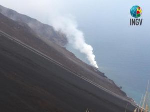
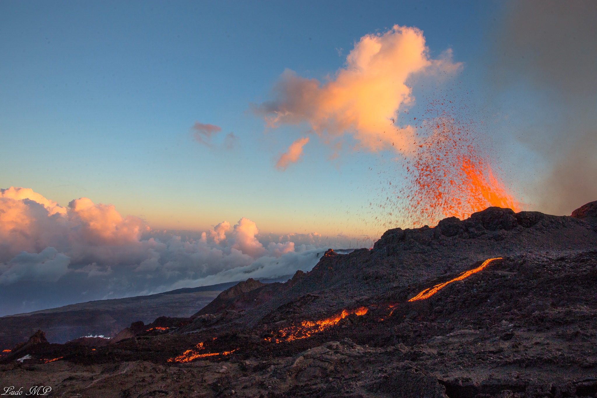
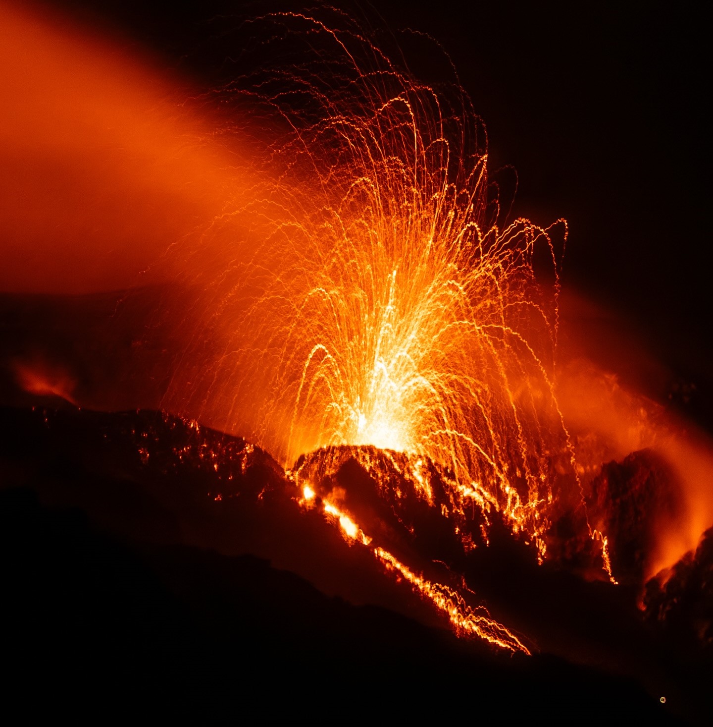
Only one eruptive site remains active on the south-southeast flank of the volcano, with fountains still visible from Piton de Bert. A cone is forming through the accumulation of lava flows.
Seismicity beneath the summit is decreasing but continues. Since February 14, 327 shallow volcano-tectonic earthquakes have been recorded beneath the summit area at depths of between 1.6 and 2.1 km.
Surface deformations since the first days of the eruption indicated deflation of the summit area due to the rapid emptying of the shallow magma reservoir (located at a depth of approximately 1.5–2 km) that feeds the eruptive site. A change in trend, with the onset of inflation, appears to be emerging on the summit GNSS stations; this parameter will need to be confirmed in the coming days. New fissure openings remain possible.
Numerous rockfalls are still being recorded. Their number is increasing both at the Dolomieu crater and at the cone forming on the eruptive site.
The intensity of the eruptive tremor (an indicator of lava and gas emissions at the surface) has remained generally stable over the last 24 hours.
Surface flow rates, estimated from satellite data via the HOTVOLC (OPGC – Clermont Auvergne University) and MIROVA (University of Turin) platforms, have shown values between 1 and 12 m³/sec over the past 24 hours. It should be noted that these estimates can change rapidly depending on cloud cover and be zero in the event of total cloud cover.
The lava flow front remains stationary in the lower part of the Grandes Pentes, approximately 2.6 km from the road and at an altitude of 660 m.
The active parts of the flow are now concentrated near the eruptive site before the Grandes Pentes fault, where the lava field widens and thickens.
Alert level 2.1
Source : OVPF/IPGP.
Photo : Ludo MP – Réunion de Paysages / FB.
Italy , Stromboli :
Stromboli Activity Update, February 20, 2026, 20:17 (19:17 UTC).
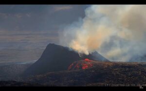
The National Institute of Geophysics and Volcanology, Etna Observatory, announces that analysis of surveillance camera images shows that, starting at approximately 18:10 UTC, effusive activity is underway due to lava overflow from vent N2 in the North Crater area. This is producing a moderate, slow-moving lava flow with fronts located in the upper part of the Sciara del Fuoco. Ordinary explosive activity continues in the North and Central-South Crater areas, with varying frequency and intensity.
From a seismic perspective, the average amplitude of volcanic tremors is currently high. No significant changes have been reported in the frequency and amplitude of explosion earthquakes. Currently, no significant changes are visible in the ground deformation monitoring network signals.
Further updates will be provided soon.
Source : INGV.
Photo : Stromboli stati d’animo / Sebastiano Cannavo.
Alaska , Katmai :
ALASKA VOLCANO OBSERVATORY INFORMATION STATEMENT , U.S. Geological Survey
Friday, February 20, 2026, 12:24 PM AKST (Friday, February 20, 2026, 21:24 UTC)
58°16’44 » N 154°57’12 » W,
Summit Elevation 6716 ft (2047 m)
Current Volcano Alert Level: NORMAL
Current Aviation Color Code: GREEN
Strong northwesterly winds in the vicinity of Katmai and the Valley of Ten Thousand Smokes have picked up loose volcanic ash erupted during the 1912 Novarupta-Katmai eruption and are carrying it to the southeast. The National Weather Service has issued a SIGMET for this low-level event and suggests that the maximum cloud height is 6,000 ft (1.8 km) above sea level.
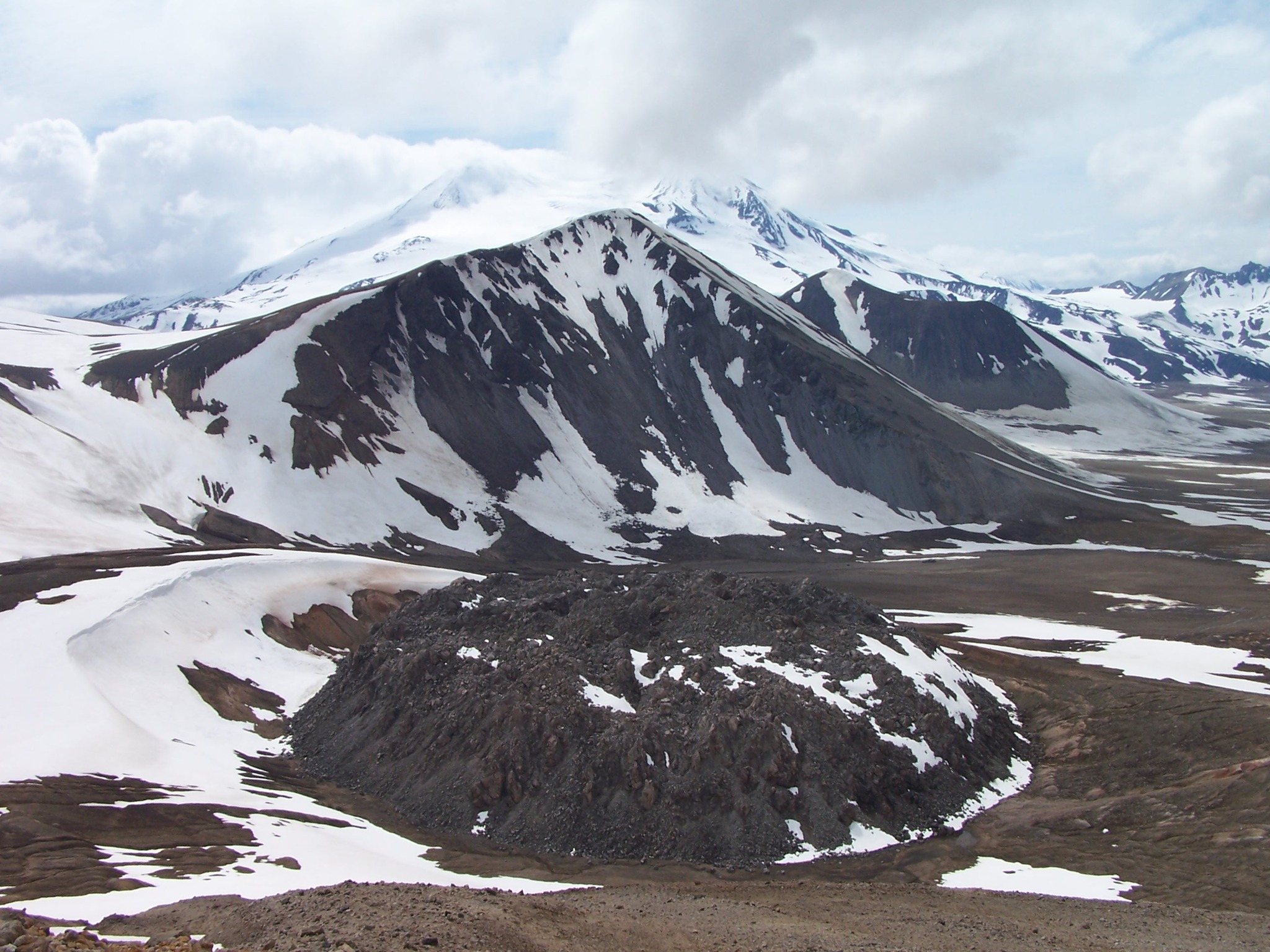
This phenomenon is not the result of recent volcanic activity and occurs during times of high winds and dry snow-free conditions in the Katmai area and other young volcanic areas of Alaska. No eruption is in progress. All of the volcanoes of the Katmai area (Griggs, Katmai, Novarupta, Mageik, Martin, Snowy and Trident) remain at Aviation Color Code GREEN and Alert Level NORMAL. Resuspended volcanic ash should be considered hazardous and could be damaging to aircraft and health.
Source : AVO.
Photo : P. Izbekov, AVO/UAF-GI. USGS, DGGS .
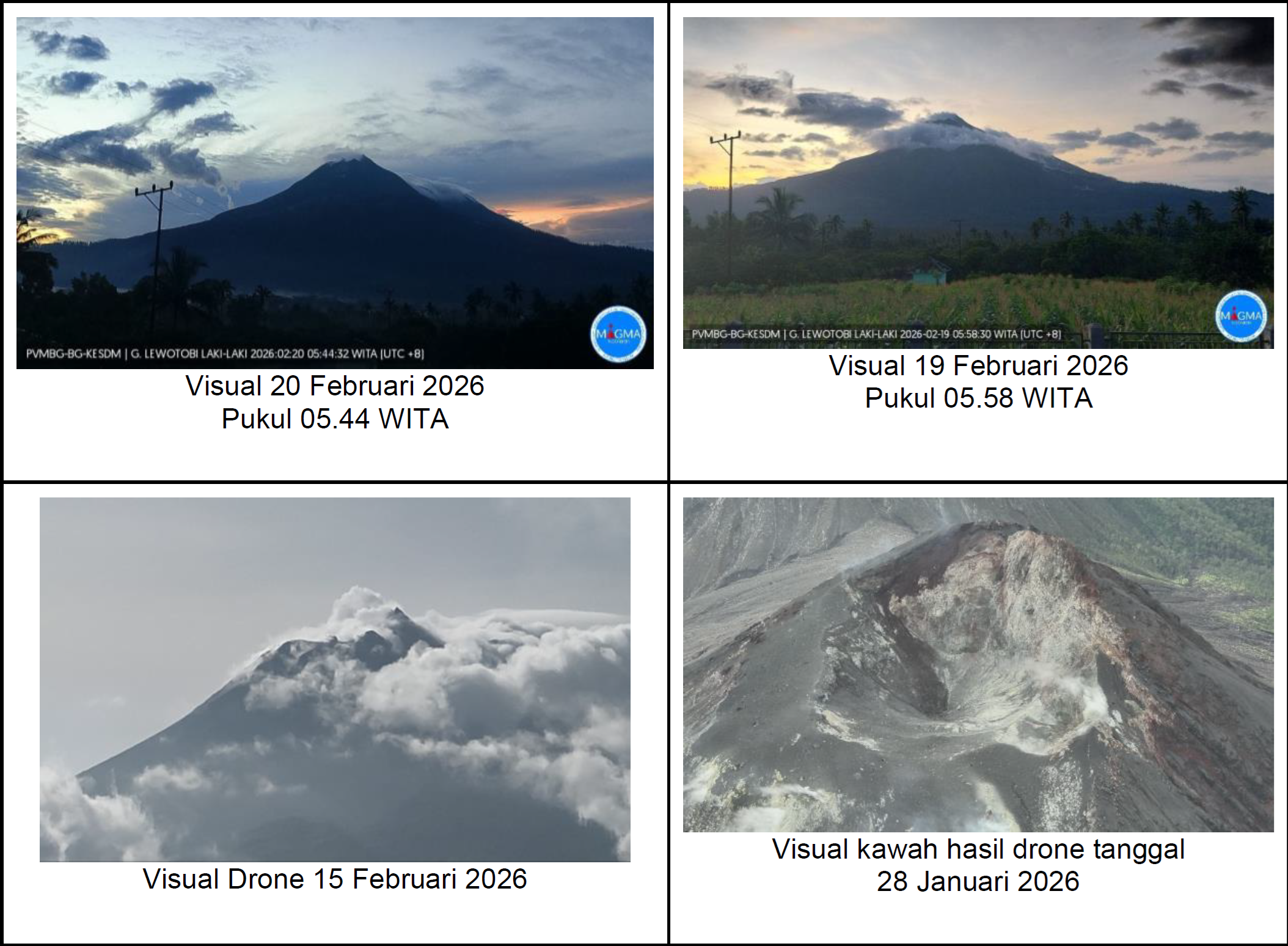
Indonesia , Lewotobi Laki Laki :
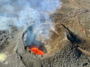
Visual monitoring over the past week has shown that the volcano is clearly visible, though sometimes obscured by fog. White smoke is escaping from the main crater, forming thin, medium, or thick plumes rising 50 to 200 meters from the summit. Avalanches have occurred, but their distance and direction could not be visually observed.
Seismic data recorded from February 13 to 19, 2026, include 5 avalanche earthquakes, 11 emission earthquakes, 114 non-harmonic tremors, 1 tornillo-type earthquake, 90 low-frequency earthquakes, 22 deep volcanic earthquakes, 7 local tectonic earthquakes, 28 distant tectonic earthquakes, and 3 flood/lahar tremors.
From January to February 2026, volcanic activity at Mount Lewotobi Laki-laki showed a marked decrease. Seismic parameters also showed a gradual decline over the past month.
From January to mid-February 2026, seismic activity at Mount Lewotobi Laki-laki was dominated by non-harmonic tremors and low-frequency (LF) earthquakes, with daily fluctuations. An increase in LF earthquakes was recorded at several stations, with some events reaching high amplitudes (overamplitude). However, this increase in LF earthquakes was not accompanied by an increase in volcanic intensity or deformation inflation. Given the rainy conditions of the previous week, the increase in LF earthquakes is more consistent with a shallow hydrothermal response due to water infiltration. Additionally, a Tornillo-type earthquake was recorded on February 13, 2026.
The last eruption occurred on October 18, 2025, and no further eruptions have occurred since. The observed plume heights were generally low to moderate and did not show a consistent increase.
Based on this visual and instrumental analysis, the activity level of Mount Lewotobi Laki-Laki has been downgraded from Level III (Siaga) to Level II (Waspada).
Source et photo: PVMBG.
Colombia , Galeras :
San Juan de Pasto, February 17, 2026, 4:20 PM
Regarding the monitoring of activity at the Galeras volcano, the Colombian Geological Survey (SGC), an agency under the Ministry of Mines and Energy, reports the following:
For the period from February 10 to 16, 2026, the main variations in monitored parameters compared to the previous week were as follows:
● Despite low volcanic activity, stability was observed in both seismic frequency and energy release. Seismicity associated with rock fracturing processes within the volcanic edifice remains predominant.
● Most earthquakes occurred near the main crater, and some to the northeast, at distances of less than 17 km. Depths were less than 15 km from the summit of the Galeras volcano (4,200 m altitude), with magnitudes less than 1.4.
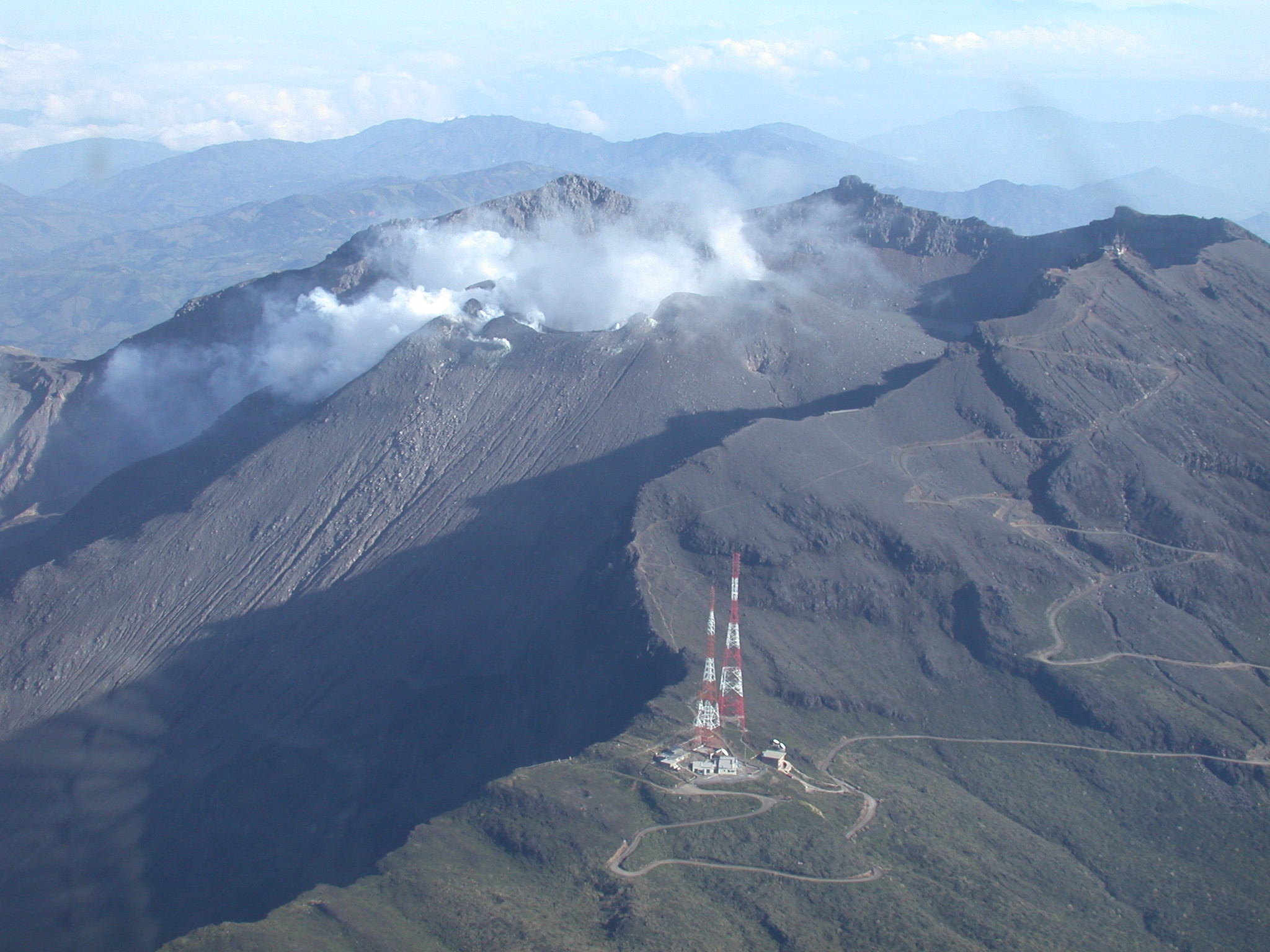
● During the week, low-altitude plumes of white gas were observed, with varying dispersion depending on wind direction. These plumes originated primarily from the fumarole fields of El Paisita to the north, Las Chavas to the west, and the main crater.
● Other volcanic monitoring parameters remained stable.
Given the above, the Geological Survey of Colombia (SGC) recommends closely monitoring developments through weekly bulletins and other information published by its official channels, as well as instructions from local and departmental authorities and the National Unit for Disaster Risk Management (UNGRD).
● Volcanic activity remains at the yellow alert level: Active volcano with changes in the baseline behavior of monitored parameters and other manifestations.
Source et photo : SGC.