November 13 , 2025.
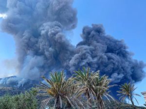
Italy , Campi Flegrei :
Weekly Bulletin, November 3-9, 2025. (Publication date: November 11, 2025)
SUMMARY OF ACTIVITIES
Based on monitoring data, the following points should be noted:
1) SEISMOLOGY: From November 3 to 9, 2025, 165 earthquakes of magnitude Md ≥ 0.0 (Mdmax = 2.5 ± 0.3) were located in the Phlegraean Fields region.
2) DEFORMATION: As of October 10, 2025, the average monthly uplift rate in the area of maximum deformation is approximately 25 ± 3 mm/month.
3) GEOCHEMISTRY: During the reference week, the monitored geochemical parameters confirmed the long-term warming trend of the hydrothermal system and the increase in flow rates already observed.
SEISMOLOGY
From November 3 to 9, 2025, 165 earthquakes of magnitude Md ≥ 0.0 (Mdmax = 2.5 ± 0.3) were located in the Phlegraean Fields region.
61 earthquakes were recorded during three seismic swarms:
1. Starting at 18:26 UTC on November 4, 2025, 29 earthquakes of magnitude 0.0 ≤ Md ≤ 2.4 (± 0.3) occurred in the Pozzuoli-Cigliano region;
2. Starting at 12:40 UTC on November 7, 2025, 6 earthquakes of magnitude 0.0 ≤ Md ≤ 2.2 (± 0.3) occurred in the Pozzuoli-Solfatara region;
3. From 05:03 UTC on 09/11/2025, 26 earthquakes with 0.0≤Md≤2.5(±0.3) occurred in the Pozzuoli-Pisciarelli region.
GROUND DEFORMATIONS
GNSS. The permanent GNSS network of the Phlegraean Fields comprises 39 land and sea stations. The SOLO GNSS station (Solfatara) was taken out of service due to the demolition of the building that housed it (the « A. Trincone » school complex).
Data collected after the series of earthquakes from February 15 to 19, 2025, showed an increase in the rate of ground uplift, with a monthly average of approximately 30 ± 3 mm/month until the end of March. Since the beginning of April, ground uplift has continued, with a monthly average of approximately 15 ± 3 mm/month. From October 10, 2025, an increase in the rate of ground uplift is observed, with a monthly average of approximately 25 ± 3 mm/month.
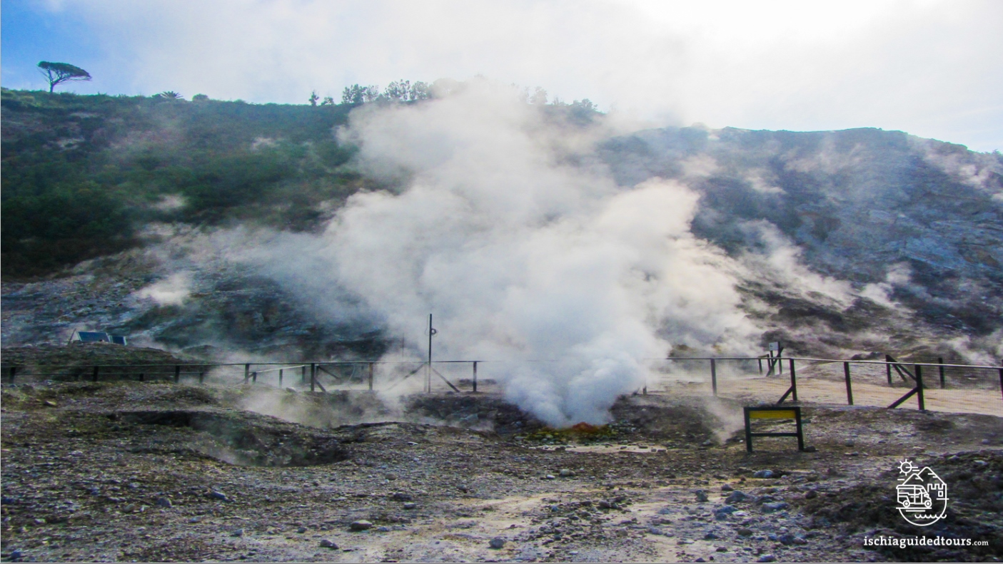
Source : INGV Vulcani
Photo : Ischia guide tours . com
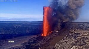
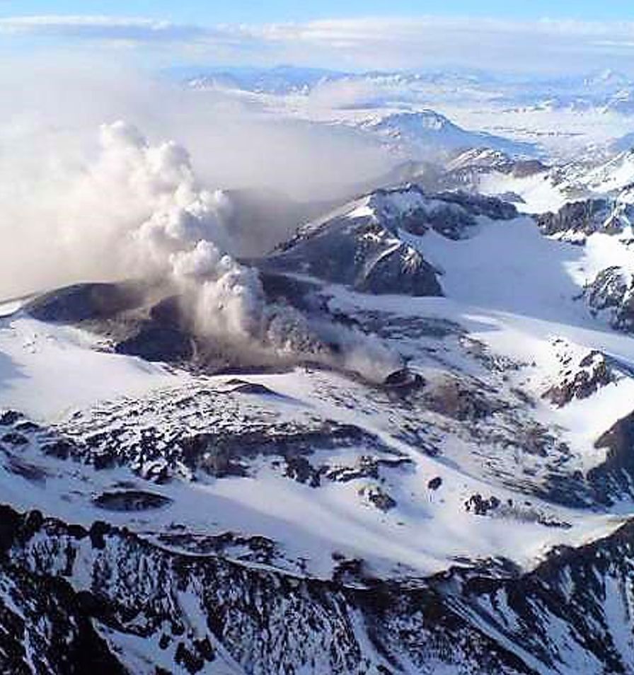
Colombia , Nevado del Ruiz :
Manizales, November 11, 2025, 2:30 PM
Regarding the monitoring of activity at the Nevado del Ruiz volcano, the Colombian Geological Survey (SGC), an agency under the Ministry of Mines and Energy, reports the following:
During the week of November 4-10, 2025, the volcano continued to exhibit unstable behavior. Compared to the previous week, the main variations in monitored parameters were as follows:
– Seismic activity associated with rock fracturing processes within the volcanic edifice decreased, both in the number of recorded earthquakes and in the seismic energy released. Seismicity was primarily located on the southeast flank, 3 km from the Arenas crater, and within the crater itself. To a lesser extent and in a more diffuse manner, seismicity also occurred on the other flanks of the volcano. The depth of the earthquakes was less than 3 km within the crater, between 2 and 4 km on the south-southeast flank, and up to 7 km on the other flanks of the volcanic structure. The largest earthquake of the week, with a magnitude of 2.1, was recorded on November 9 at 9:43 PM, 2 km south-southeast and at a depth of 3 km. This event occurred during a period of increased seismic activity in the aforementioned area.
Seismicity related to fluid dynamics in the volcanic conduits remained stable in terms of the number of recorded earthquakes, while the seismic energy released increased. This week, a predominance of seismic signals associated with ash emissions was observed. The energy of these events was low. Thanks to the cameras (conventional and thermal) used to monitor the volcano, several pulsed ash emissions and slight variations in the apparent temperature of the emitted materials were confirmed.
The volcano continued to emit water vapor and volcanic gases, primarily sulfur dioxide (SO₂), into the atmosphere from the Arenas crater. The estimated SO₂ flux, associated with degassing processes, was variable and remained at values similar to those recorded the previous week.
The column of gas, water vapor, or ash reached a height of 800 m above the summit of the volcano. On November 7, during the ash emission recorded at 1:46 a.m., it reached this height. Regarding the direction of dispersion, the plume showed a preferential tendency toward the western flank (from northwest to southwest), with a predominance on the southwest and northwest flanks of the volcanic structure.
Monitoring of thermal anomalies at the bottom of the Arenas crater, using satellite platforms, continued to be limited by the thick cloud cover in the volcanic area. However, some low-energy anomalies were detected.
Source et photo : SGC.
Photo : via Vulcaniya / FB.
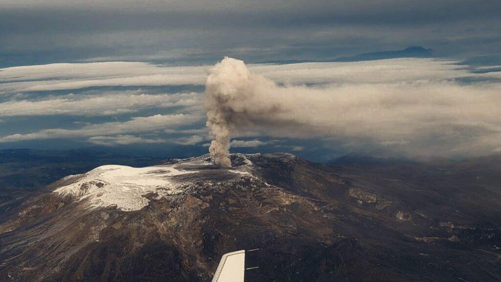
Chile , Planchón-Peteroa :
Special Report on Volcanic Activity (REAV)
Maule Region, Planchón-Peteroa Volcanic Complex, November 12, 2025, 10:20 a.m. local time (Mainland Chile)
The Chilean National Geology and Mining Service (Sernageomin) is publishing the following PRELIMINARY information, obtained through monitoring equipment from the National Volcanic Monitoring Network (RNVV), processed and analyzed at the Southern Andes Volcanological Observatory (OVDAS):
Today, Wednesday, November 12, monitoring stations located near the Planchón-Peteroa Volcanic Complex recorded a long-period (LP) earthquake associated with internal fluid dynamics.
The earthquake’s characteristics, after analysis, are as follows:
TIME OF ORIGIN: 08:41, local time (11:41 UTC)
DISPLACEMENT: 43.7 cm
The volcanic alert level remains unchanged.
Yellow Technical Alert.
Furthermore, the energy of the continuous tremor signal recorded by the RSAM, associated with sustained fluid dynamics within the volcano, fluctuated throughout the period, primarily due to variations in surface activity. These values remain above the reference level for this volcano.
November 12, 2025, 10:20 a.m. local time (Mainland Chile)
The Chilean National Geological and Mining Service (Sernageomin) is publishing the following PRELIMINARY information, obtained through monitoring equipment from the National Volcanic Monitoring Network (RNVV), processed and analyzed at the Southern Andes Volcanological Observatory (OVDAS):
Today, Wednesday, November 12, monitoring stations located near the Planchón-Peteroa volcanic complex recorded a long-period (LP) earthquake associated with internal fluid dynamics.
The earthquake’s characteristics after analysis are as follows:
ORIGINAL TIME: 8:41 a.m. local time (11:41 UTC)
REDUCED DISPLACEMENT: 43.7 cm
Sources : Sernageomin , Cegemar .
Photo : Cegemar
Indonesia , Ibu :
Mount Ibu erupted on Wednesday, November 12, 2025, at 1:07 PM (local time). An ash column was observed approximately 500 meters above the summit (at an altitude of about 1,825 meters). This ash column was gray and dense, drifting southeast. The eruption was recorded by a seismograph with a maximum amplitude of 28 mm and a duration of 61 seconds.
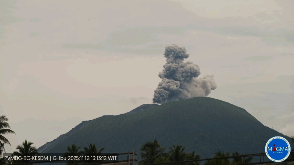
VOLCANO OBSERVATORY NOTICE FOR AVIATION – VONA
Issued : November 12 , 2025
Volcano : Ibu (268030)
Current Aviation Colour Code : ORANGE
Previous Aviation Colour Code : orange
Source : Ibu Volcano Observatory
Notice Number : 2025IBU1121
Volcano Location : N 01 deg 29 min 17 sec E 127 deg 37 min 48 sec
Area : North Maluku, Indonesia
Summit Elevation : 4240 FT (1325 M)
Volcanic Activity Summary :
Eruption with volcanic ash cloud at 04h07 UTC (13h07 local).
Volcanic Cloud Height :
Best estimate of ash-cloud top is around 5840 FT (1825 M) above sea level or 1600 FT (500 M) above summit. May be higher than what can be observed clearly. Source of height data: ground observer.
Other Volcanic Cloud Information :
Ash cloud moving to southeast. Volcanic ash is observed to be gray. The intensity of volcanic ash is observed to be thick.
Remarks :
Eruption recorded on seismogram with maximum amplitude 28 mm and maximum duration 61 second
Source et photo : Magma Indonésie.
Guatemala , Santiaguito :
Atmospheric conditions: Clear skies
Wind: Northeast
Rainfall: 0 mm
Activity:
Activity is being recorded at the Caliente dome of the Santa María-Santiaguito volcanic complex. Weak white degassing fumaroles are visible 500 meters above the crater, along with weak to moderate explosions at a rate of 2 to 4 per hour. These explosions are ejecting columns of gas and ash up to an altitude of 3,400 meters (11,155 feet), which are drifting west and southwest with the wind.
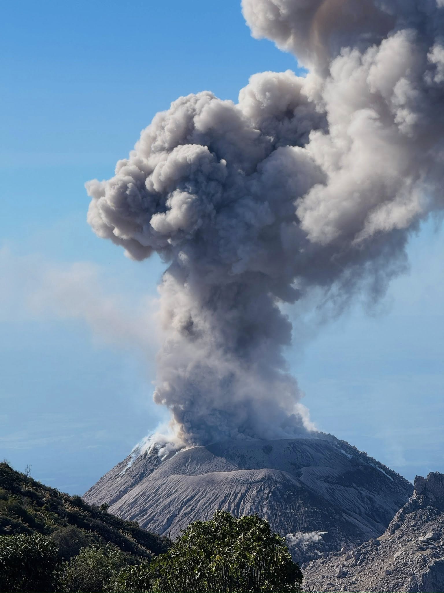
Incandescent blocks of rock are breaking off and falling down the volcano’s flanks. Due to the wind direction, light ashfall is possible in and around San Marcos Palajunoj. Given the significant accumulation of rock material on the Caliente dome and the promontory overlooking the lava flow on its southwest flank, the formation of long-distance pyroclastic flows in all directions cannot be ruled out. Therefore, it is recommended to follow the guidelines in Special Bulletin BESAN-063-2025.
Source : Insivumeh.
Photo : ELEVA ixcan / FB .