September 16 , 2026.
Hawaii , Kilauea :
HAWAIIAN VOLCANO OBSERVATORY STATUS REPORT , U.S. Geological Survey
Tuesday, September 15, 2026, 2:11 PM HST (Wednesday, September 16, 2026, 00:11 UTC)
19°25’16 » N 155°17’13 » W,
Summit Elevation 4091 ft (1247 m)
Current Volcano Alert Level: WATCH
Current Aviation Color Code: ORANGE
Summary:
New vents opened at Kīlauea summit eruption site last night. Kīlauea summit region is pressurized above the level required to start a fountaining episode. Additional changes to the type of activity/eruption location could potentially occur.
Eruption History:
There have been 54 episodes of lava fountaining since the Halemaʻumaʻu eruption began in late December 2024 at the summit of Kīlauea. Each episode was preceded by a period of summit inflation as magma accumulated in the shallow chamber beneath Halemaʻumaʻu followed by rapid summit deflation during lava fountaining. New fountaining episodes usually occur when inflation recovers the amount lost in the previous fountaining episode indicating the system has repressurized. This repeating pattern coupled with uniform inflation as measured on summit tiltmeters has allowed the USGS Hawaiian Volcano Observatory to track the pressurization required to initiate fountaining episodes and issue forecast windows of several days for the onset of fountaining for about 50 of the episodes.
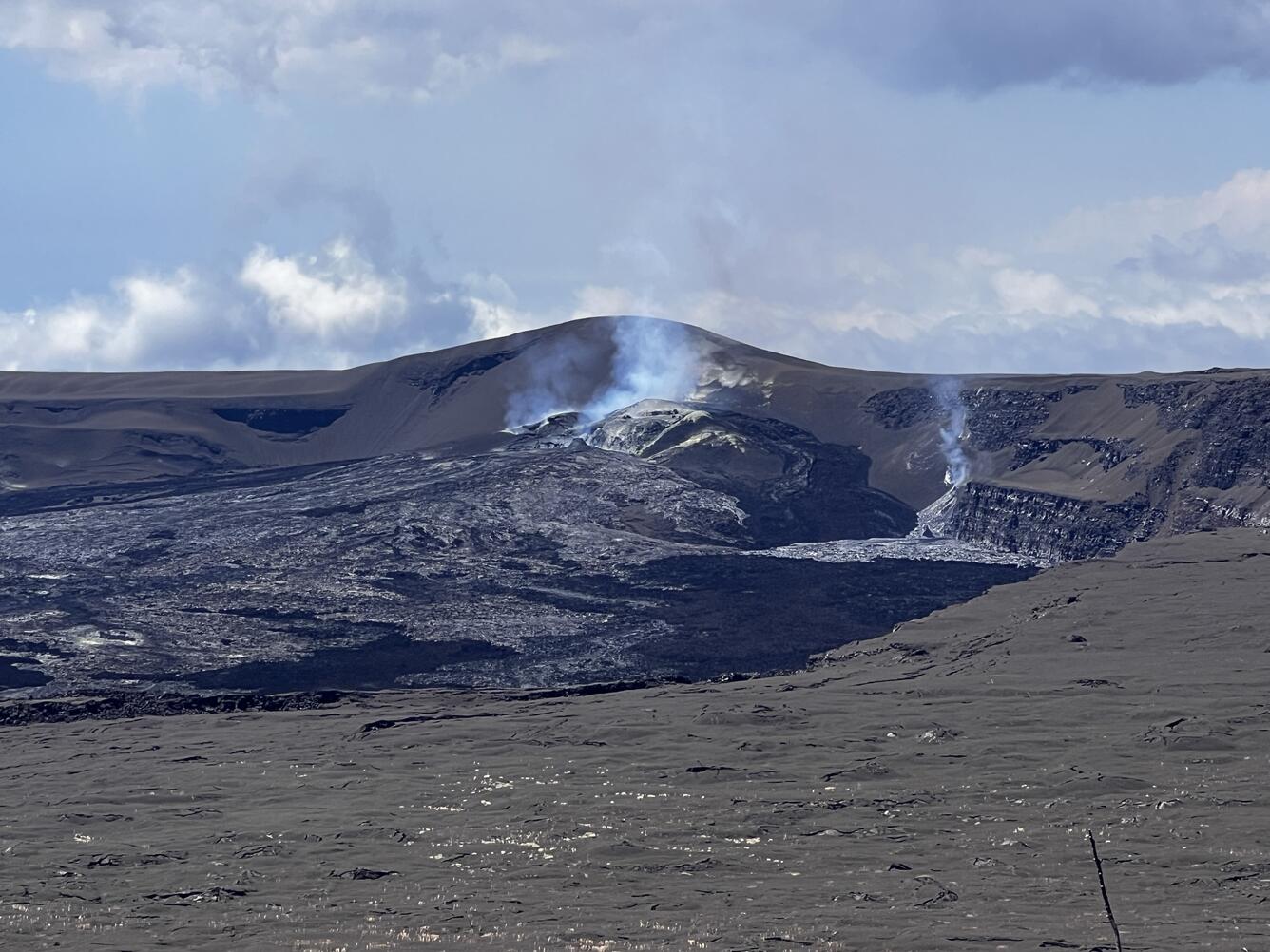
This view of the eruptive vent complex in Halemaʻumaʻu, taken on the morning of September 15, shows the new fissures that opened the night of September 14, 2026. The main vent complex in the center of the photo includes the north, south, and west vents, which are visibly degassing from a shield-shaped structure on the crater floor. To the right of the main vent complex, the new fissures are marked by another degassing area visible on the northwest wall of Halemaʻumaʻu crater. The new fissures are about 150 feet (45 meters) below the level of the north vent and fed the lighter-grey-colored lava flows on the crater floor
Description of Current Activity:
Data from summit tiltmeters and Global Positioning Satellite (GPS) instruments indicate that the summit region is highly pressurized. This pressurization may be due to the increased height, about 500 feet (150 meters), of the north-south-west vent complex since the start of the eruption on December 23, 2024. The opening of new vents last night and this morning north of the established vent complex in Halemaʻumaʻu appears to be a response to this pressurization. The new vents are about 150 feet (45 meters) below the level of the north vent. The new vents opened without significant seismicity, although they are in the region where a short-lived swarm of shallow earthquakes took place from about 9:15 to 9:25 p.m. HST on the night of September 13.
Current summit reinflation leading up to this change in activity has been very irregular since lava fountaining episode 54 on August 25 and difficult to model due to repeated deflations and periods of no inflation. On September 7, summit tiltmeters indicated that the Halemaʻumaʻu magma chamber surpassed the amount of pressurization typically observed to start a fountaining episode. Since September 7, the number of small magnitude earthquakes began to increase in the Kīlauea summit region, likely related to the general increase in pressure in the Halemaʻumaʻu magma chamber. Nearly 100 earthquakes have been located since September 7, in three general areas: about 1.5 km (0.9 miles) below Halemaʻumaʻu including the northwest side where the new vents occurred, about 3 km (1.8 miles) deep just south of Halemaʻumaʻu, and 1.5 km (0.9 miles) deep beneath Keanakākoʻi crater on the southeast side of the caldera. Most earthquakes have been smaller than magnitude-2, though the largest event was M2.6 on September 11.
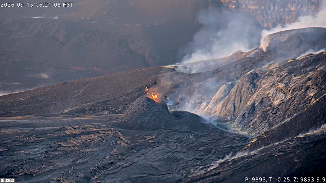
Lava has not yet erupted as high fountains, but smaller, precursory lava flows have erupted from the north vent over 104 times between September 7–12. Since then, intermittent spatter bursts on September 13–15 have built a small spatter cone around the north vent that was measured as 36-39 feet (11-12 meters) tall September 14 afternoon. Last night, September 14, cracks on and near the base of the northwest wall of Halemaʻumaʻu crater erupted lava just north of the vent complex beginning just before 9:00 p.m. HST. No fountaining was associated with the new vents, which continue to feed a small flow today in the northwest corner of the crater floor. Precursory flows have been ongoing for 8 days now, the longest period recorded during this eruption.
No unusual activity has been detected in the Southwest or East Rift Zones of Kīlauea. All activity has been confined to the summit region of Kīlauea in Hawaiʻi Volcanoes National Park.
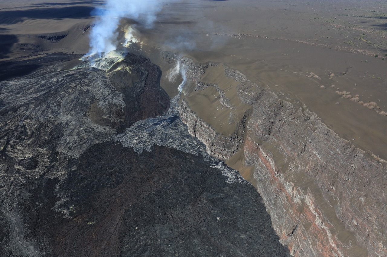
September 14, new fissures began breaking out along the base of the northwest wall of Halema‘uma‘u crater, north of the episodic lava fountaining vents that have persisted since December 23, 2024, at the summit of Kīlauea. These fissures have effused pāhoehoe lava flows onto the crater floor, seen here with a silvery color, as observed during a USGS Hawaiian Volcano Observatory overflight this morning, September 15. The lava fountaining vents can be seen in the upper left of the frame, still emitting a volcanic gas plume.
Interpretation:
The magma plumbing system connecting the eruptive vents in Halemaʻumaʻu to the shallow magma chamber below has been remarkably stable throughout most of this eruption. During the start of episode 30 lava fountaining on August 6, 2025, earthquakes and ground deformation in an area on the south rim of Halemaʻumaʻu crater were associated with the opening of a new fissure on the south side of the crater, which erupted briefly only during episode 30. Earthquakes occurred minutes to hours before the new fissure began erupting in this area. That vent opened about 10 minutes prior to the onset of fountaining and stopped erupting about 2 hours into the fountaining episode. Kīlauea summit rapidly deflated during lava fountaining episode 30, and the fissure on the south side Halemaʻumaʻu did not erupt again.
Overnight glow and spatter visible in the north/south/west vents indicate that the conduits remain intact and connected to the underlying chamber despite the opening of new vents nearby last night. Volcanic tremor, which has been the major seismic signal during this eruption, has also continued. While many lava fountaining episodes are preceded by lava flows or visible spatter, this period of precursory activity is now the longest since high fountains began after episode 4 from January 15–18, 2025. The rate of earthquakes has decreased slightly in the past day but the summit region of Kīlauea summit remains at a high level of pressurization despite the opening of new vents last night. The new vents are at a lower elevation than the main eruptive vent complex in Halemaʻumaʻu, which could sustain prolonged continuous eruption of lava. However, the continued high level of pressurization could also potentially result in additional changes outlined below.
Possible Outcomes
The impact of Kīlauea summit increased pressurization and earthquakes on the next episode of lava fountaining, if any, is unknown at this time. It is not possible to forecast an exact outcome of this activity. However, some potential scenarios are described below based on past episodic eruptions of Kīlauea (1983 Puʻuʻōʻō and the 1969 Maunaulu eruptions). These past eruptions both continued after lava fountaining episodes ended, with fissures opening nearby that erupted more continuous lava flows.
Eruption becomes continuous at the new vents:
Lava could continue to erupt from the vents in Halemaʻumaʻu, as lava flows or spatter bursts, for an unforeseeable amount of time. The prolonged nature of low-level activity since September 7 and opening of new vents could be signs of a transition to lava erupting more continuously within Halemaʻumaʻu from existing vents. The only similar scenario is the onset of episode 48 during the Puʻuʻōʻō eruption where pressure built up to a new fountaining episode, but instead of fountaining a new fissure opened up down rift of Puʻuʻōʻō and began erupting continuously.
Eruption returns to fountaining:
Alternatively, a fountaining episode from an existing vent in Halemaʻumaʻu could begin at any point during this period of increased pressurization. Prior to episode 35 of the Puʻuʻōʻō eruption, a fissure erupted uprift of the vent before fountaining began and continued for 2 weeks after the end of the fountain episode. Normal fountain episodes resumed after the end of this extended excursion.
Formation of new vent(s) in summit region:
Magma could form a new shallow pathway toward the surface, potentially resulting in other new vents erupting lava within the summit caldera. In this scenario, we would expect earthquakes, potentially with tightly clustered locations, along with changes in the patterns of ground deformation indicative of shallow crack formation, similar to what occurred in the new vent formation during episode 30 on August 6, 2025, when a crack in the southwest wall of Halemaʻumaʻu briefly erupted.
Intrusion into the upper parts of the Southwest Rift Zone or East Rift Zone:
Magma could migrate into the upper portion of the Southwest Rift Zone or the East Rift Zone in Hawaiʻi Volcanoes National Park. In this scenario, we would expect an extended period of increased rates of earthquakes migrating from the summit towards a rift zone, along with ground deformation indicative of summit magma chamber deflation.
Source : HVO.
Photos : USGS / C. Gansecki. USGS / M. Zoeller. USGS.
Italy / Sicily , Etna :
WEEKLY BULLETIN, September 7, 2026 – September 13, 2026 (issue date: September 15, 2026)
SUMMARY OF ACTIVITY STATUS
Based on monitoring data, the following is noted:
1) VOLCANOLOGICAL OBSERVATIONS: Variable degassing activity at the summit craters, associated with near-continuous ash emissions from the Northeast Crater; weak, intermittent Strombolian activity and sporadic ash emissions from the Bocca Nuova crater.
2) SEISMOLOGY: Low-level fracturing seismic activity: a single event reached the ML ≥ 2.0 threshold. Tremor amplitude ranged between low and medium levels.
3) INFRASOUND: Low-energy infrasonic activity with occurrence rates ranging from low to very high.
4) GROUND DEFORMATION: Signals from ground deformation monitoring networks showed no significant variation.
5) GEOCHEMISTRY: SO2 flux at a medium level.
Soil CO2 flux (Etnagas): average values.
Partial pressure of dissolved CO2 in groundwater (EtnaAcque network): no update.
Helium isotope ratio at peripheral sites: no update; the latest data indicated high values (August 26, 2026).
6) SATELLITE OBSERVATIONS: Satellite-observed thermal activity in the summit area remained generally low.
7) OTHER OBSERVATIONS: Data from the RADONETNA network during September 2026 revealed anomalies at sites on the southern flank, preceding those observed at northern flank sites by a few days.
VOLCANOLOGICAL OBSERVATIONS
Throughout the week, monitoring of Etna’s volcanic activity was conducted via the analysis of images from INGV–Osservatorio Etneo (INGV-OE) surveillance cameras. Between September 12 and 13, observations were severely limited by dense cloud cover.
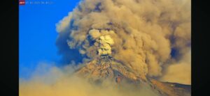
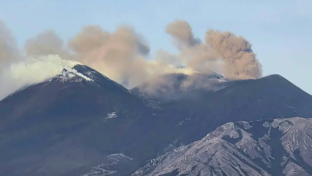
Overall, the observation period was characterized by near-continuous ash emissions from the Northeast Crater (CNE), with intensity varying over the course of the week. Ash from the CNE was emitted in pulses, reaching an altitude of approximately 4,000 m and dispersing beyond the summit area toward the eastern and southern sectors.
On September 7 and 8, the Bocca Nuova (BN) crater was also active, producing ash emissions from the BN1 vent that likewise dispersed beyond the summit area. Activity at the Southeast Crater (CSE) and Voragine Crater (VOR) consisted primarily of fumarolic degassing.
Source : INGV
Photo : INGV
Italy , Stromboli :
WEEKLY BULLETIN, September 7, 2026 – September 13, 2026 (issue date: September 15, 2026)
SUMMARY OF ACTIVITY STATUS
Based on monitoring data, the following is noted:
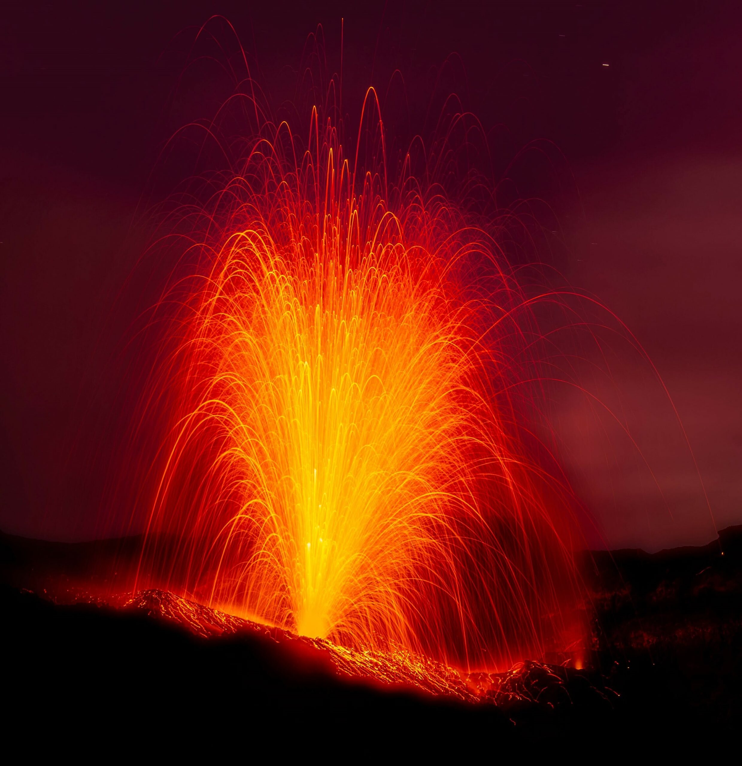
1) VOLCANOLOGICAL OBSERVATIONS: Ordinary Strombolian eruptive activity across both crater zones. The frequency of total explosive activity—including the North Crater zone and the Central-South Crater zone—is at a low-to-moderate level, with low explosion intensity in both zones.
2) SEISMOLOGY: Monitored seismic parameters show no significant variations.
3) GROUND DEFORMATION: Signals from ground deformation monitoring networks showed no significant variations.
4) GEOCHEMISTRY: SO2 flux at a moderate level.
Soil CO2 flux (Pizzo zone – STR02): no update.
C/S ratio in the plume: no update.
Helium isotope ratio (R/Ra): increasing, reaching very high values.
Soil CO2 flux in the San Bartolo zone: high values.
Soil CO2 flux in the Scari zone: no update.
5) SATELLITE OBSERVATIONS: Satellite-observed thermal activity in the summit area remained generally low, with a few isolated moderate- and high-level anomalies.
.
VOLCANOLOGICAL OBSERVATIONS
Observations of explosive activity captured by surveillance cameras
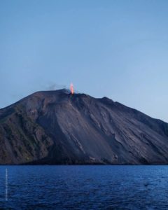
During the observation week, Stromboli’s eruptive activity was characterized through the analysis of images recorded by INGV-OE surveillance cameras located at 190 m above sea level and at Punta dei Corvi (SCT-SCV and SPCT, respectively). Explosions in the North and Central-South crater areas primarily produced fine material mixed with coarse material (lapilli and bombs; Zone N and Zone CS).
The average explosion frequency in Zone N was within the normal range, and intensity remained predominantly low. In Zone CS, the average explosion frequency was low, and the intensity of explosive activity remained generally weak. The total daily hourly average frequency of explosions (Zone N + Zone CS) was at a low-to-moderate level.
Source : INGV
Photo : Stromboli stati d’animo / Sebastiano Cannavo.
Colombia , Chiles / Cerro Negro :
San Juan de Pasto, September 15, 2026, 6:30 PM.
As part of the monitoring of activity at the Chiles-Cerro Negro volcanic complex (CVCCN), the Colombian Geological Service (SGC)—an agency under the Ministry of Mines and Energy—
reports the following:
For the period from September 8 to 14, 2026, the main changes in monitored parameters compared to the previous week were as follows:
● Amidst the volcanic complex’s fluctuating behavior, seismic activity showed a slight increase in earthquake frequency; the most common events during the week were those associated with rock-fracturing processes, followed by events linked to fluid dynamics from a persistent source. Energy levels remained comparable to those of the previous week.
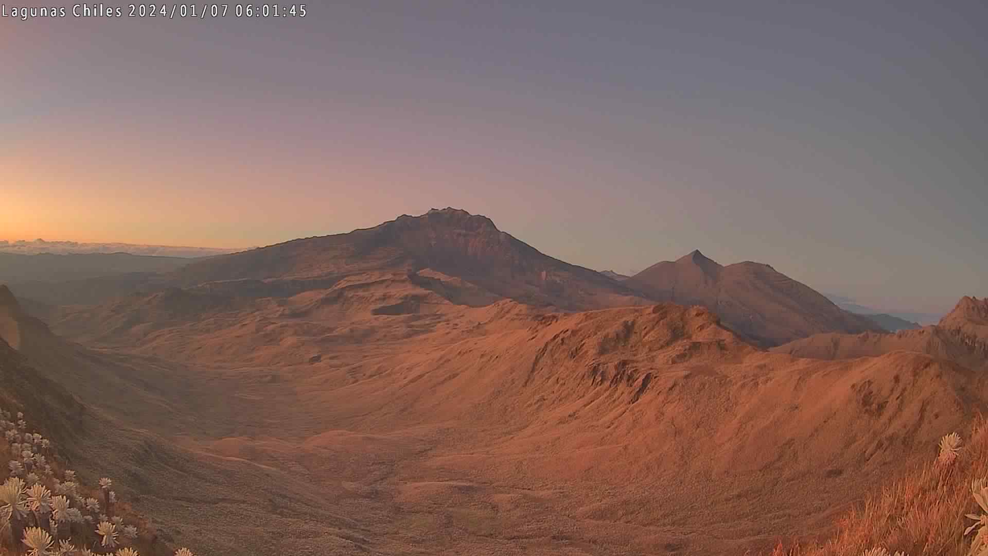
● Overall, seismicity was concentrated in the western, southern, and southeastern sectors of the Chiles volcanic edifice, at distances of up to 5.6 km and depths reaching 8.6 km below the summit (4,700 m above sea level), with a maximum magnitude of 1.7. A few events were located further away—up to 10.5 km east and 19.8 km southeast of the Chiles volcano, respectively—with maximum depths of 8 km below the summit and a maximum magnitude of 1.9. No earthquakes were felt by residents in the area surrounding the volcano.
● Analysis of data collected by satellite sensors and ground stations continued to show variations associated with deformation processes in the volcanic zone.
Based on the assessment and correlation of monitored parameters, the SGC recommends closely tracking their evolution via weekly bulletins and other information released through our official channels, as well as adhering to instructions from local and departmental authorities and the National Unit for Disaster Risk Management (UNGRD).
Volcanic activity remains at the yellow alert level: an active volcano showing behavioral changes relative to the baseline of monitored parameters, along with other manifestations.
Source et photo : SGC.
Indonesia , Lewotobi Laki-laki :
Decrease in activity level of the Lewotobi Laki-laki volcano (NTT), moving from Level III (Alert/Siaga) to Level II (Vigilance/Waspada) effective September 16, 2026, at 08:00 WITA.
Following an intensification of activity observed since May 2026, the Lewotobi Laki-laki volcano has shown an overall downward trend as of mid-September 2026. This decline in volcanic activity is evidenced by a reduction in surface eruptions, the absence of recorded eruptive earthquakes since the beginning of September, a decrease in certain types of shallow seismicity, and a lack of signs of inflation in deformation data collected via GNSS and tiltmeter. Nevertheless, internal volcanic activity persists, and the risk of eruption remains, albeit on a smaller scale.
Visually, eruptive activity has decreased compared to the previous period. An eruption producing an ash plume rising approximately 2,500 meters above the summit occurred on August 27, 2026, at 08:30 WITA, while the most recent eruption—on August 31, 2026, at 12:53 WITA—produced a plume rising about 300 meters above the summit. No further eruptive activity was observed between that event and the mid-September assessment period. In early September, surface activity was dominated by white emissions escaping from the main crater rim; these ranged from weak to moderate in intensity and rose approximately 50 to 200 meters above the summit.
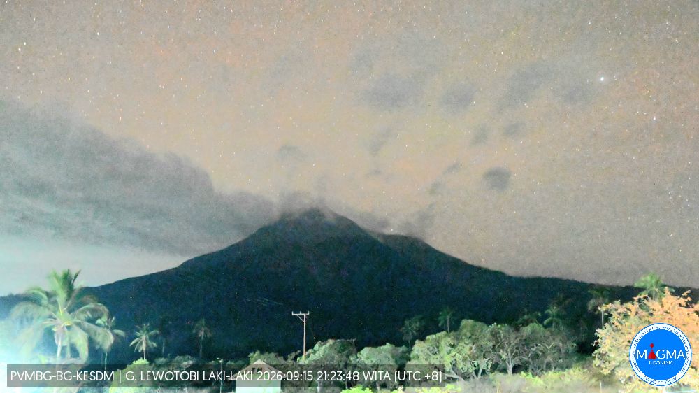
Drone surveillance conducted on September 10, 2026, provided a clear view of the crater’s condition. Aerial imagery revealed no signs of a lava plug within the summit crater of Lewotobi Laki-laki. This indicates that the crater remains relatively open, with no evidence of lava plug formation that could lead to a significant buildup of pressure at the top of the conduit. Seismic data show that no eruptive earthquakes have been recorded since September 1, 2026; emission earthquakes and low-frequency (LF) events are trending downward, while non-harmonic tremors have shown no significant increase.
In-depth analysis and assessment indicate that activity at the Lewotobi Laki-laki volcano is declining. Eruptive activity has decreased, and drone surveillance shows no signs of lava plug formation in the crater. Seismic data indicate no significant increase in seismic energy, and GNSS deformation data show no inflation suggesting a rise in the volcano’s internal pressure.
Based on the analysis of visual and instrumental observations, activity at Mount Lewotobi Laki-laki is considered to be declining compared to the previous situation. In light of this development, the activity level of Mount Lewotobi Laki-laki has been lowered from Level III (Alert/Siaga) to Level II (Vigilance/Waspada).
At activity Level II (Vigilance/Waspada), local residents, visitors, and tourists must not conduct any activities within a 4 km radius of the eruption center.
Source et photo : PVMBG.