September 1 , 2026.
Indonesia , Sinabung :
Mount Sinabung’s activity level was raised from Level II (Waspada) to Level III (Siaga) on August 31, 2026, at 12:00 WIB.
Mount Sinabung is an active volcano located in the Karo Regency of North Sumatra Province. It had been classified at Level II (Waspada) since May 17, 2023, with recommendations prohibiting any activity within a 3 km radius of the summit and within a 4.5 km sectoral radius to the southeast of the volcano. Mount Sinabung has been monitored visually and instrumentally from the volcano observation post (PGA) located in the village of Ndokum Siroga.
Visual observations made between August 1 and August 30, 2026, showed that Mount Sinabung was clearly visible before being obscured by fog. Emissions of white and gray smoke escaping from the main crater were observed; their density varied from thin to thick, and they rose between 50 and 1,000 meters above the summit. Weather conditions alternated between sunny and rainy, with winds ranging from light to strong. Additionally, yellowing and drying of vegetation were noted on the eastern slopes. Seismic activity recorded during this same period included: 1 avalanche earthquake, 14 « emission » (gust) earthquakes, 2 « tornillo » earthquakes, 29 low-frequency earthquakes, 8 hybrid/multiphase earthquakes, 1 shallow volcanic earthquake, 141 deep volcanic earthquakes, 26 local tectonic earthquakes, 1 felt earthquake, 93 distant tectonic earthquakes, and 1 « flood tremor » earthquake.
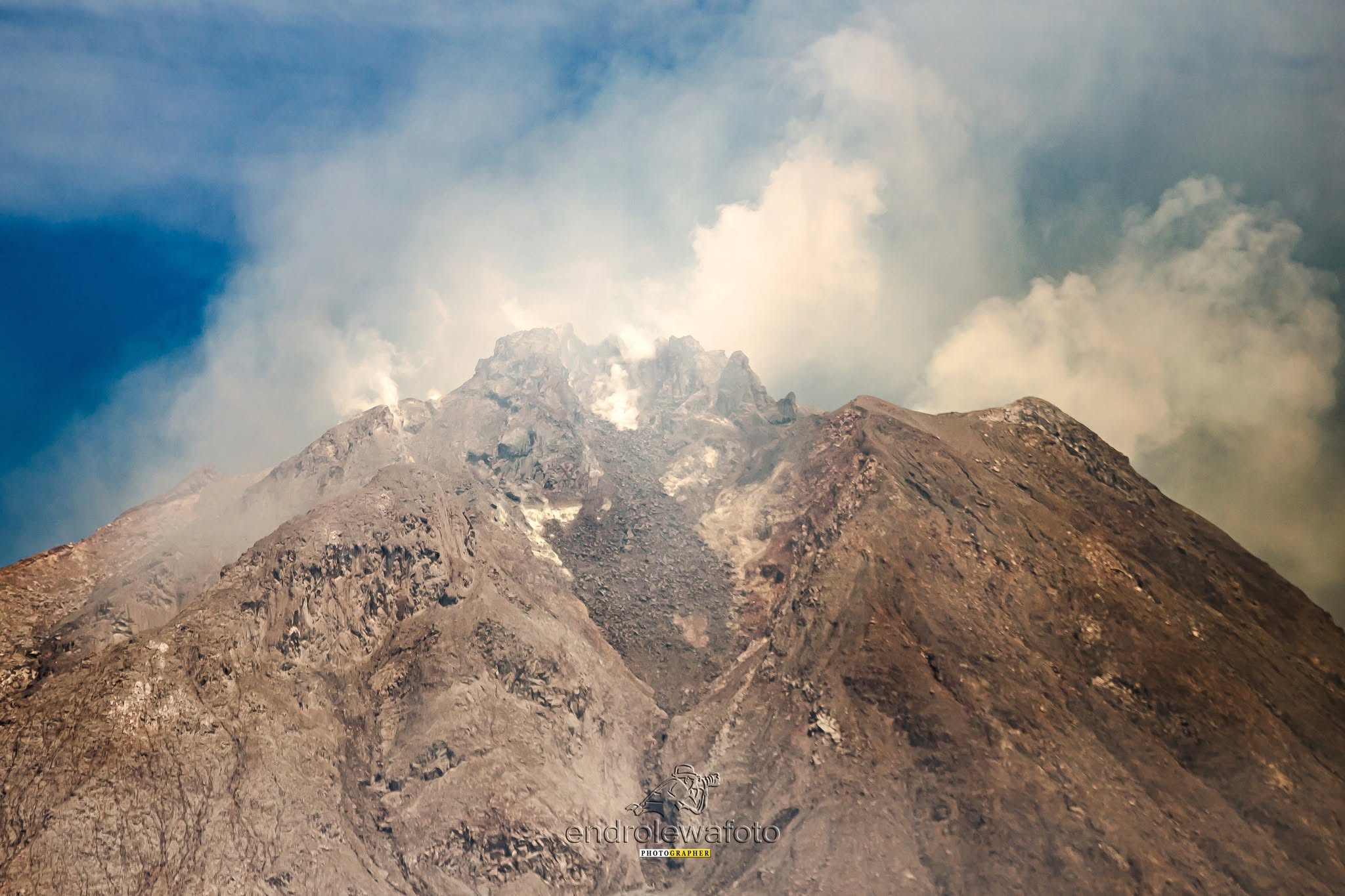
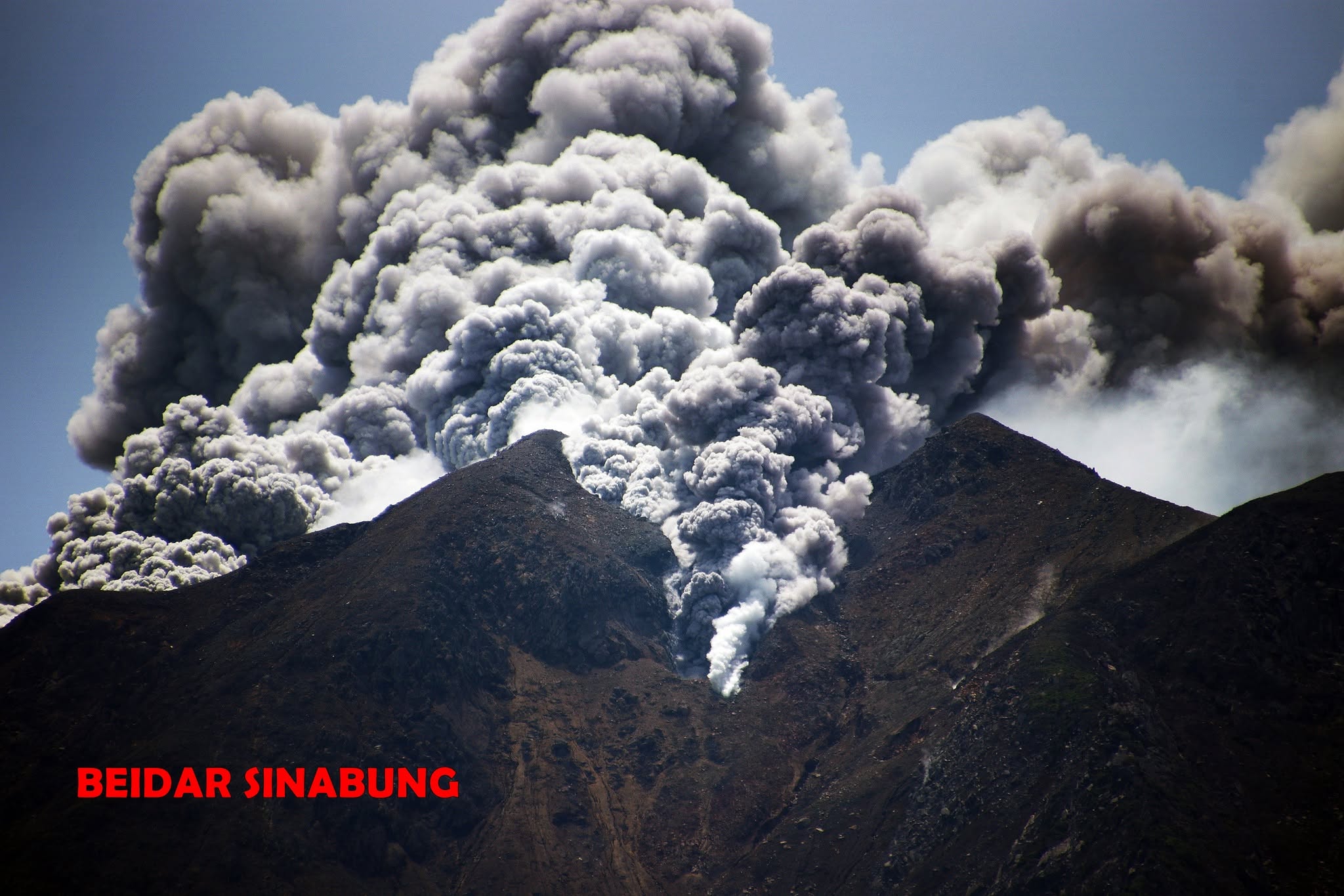
Prior to the eruption that occurred on August 31, 2026, at 10:17 WIB, a series of earthquakes was recorded: 85 volcanic earthquakes, 1 « emission-type » earthquake, and 1 harmonic tremor. On August 31, 2026, at 10:17 (Western Indonesia Time – WIB), an eruption took place, generating an eruption column rising approximately 3,500 m above the summit (or about 5,960 m above sea level). The ash column, observed to be black and dense, drifted towards the east and southeast. This eruption was recorded on a seismogram with a maximum amplitude of 120 mm and was ongoing at the time this special report was written.
This is an initial eruption; a larger eruption is possible.
Visual and instrumental monitoring results indicate an intensification of volcanic activity at Mount Sinabung; consequently, the volcano’s activity level has been raised from Level II (Waspada) to Level III (Siaga) effective August 31, 2026, at 00:30 (Western Indonesia Time – WIB).
At activity level III (Siaga), the following recommendations apply regarding Mount Sinabung:
The public, visitors, and tourists are advised to avoid all activities in relocated villages, within a 3 km radius of the Mount Sinabung summit, and within a 6 km radius in the southeast sector.
Residents living near watercourses originating from Mount Sinabung are advised to remain vigilant regarding the risk of lahar flows.
Residents in the vicinity of Mount Sinabung are advised to remain calm and not be swayed by rumors concerning the eruption. They are urged to follow the directives of the Regional Disaster Management Agency (BPBD) of North Sumatra Province and Karo Regency.
Mount Sinabung’s activity level will be assessed periodically or at any time should significant changes occur. The public is urged to remain calm and vigilant, and to follow official instructions to ensure everyone’s safety.
Source : PVMBG.
Photo : Endro Lewa , Firdaus Surbakti / Beidar Sinabung .
Colombia , Cumbal :
San Juan de Pasto, August 25, 2026, 2:20 PM.
Based on monitoring of the Cumbal Volcanic Complex (CVC) activity, the Colombian Geological Service (SGC)—an agency attached to the Ministry of Mines and Energy—reports the following information:
During the week of August 18 to 24, 2026, the main variations in monitored parameters compared to the previous week were as follows:
● Consistent with the fluctuating behavior characteristic of this volcanic complex, seismic activity showed a slight decrease in both the number of events and the energy released. Seismicity was primarily associated with rock-fracturing processes, followed by events linked to fluid dynamics.
● Rock-fracturing seismicity was concentrated mainly within a 5 km radius of the summit, at depths of less than 10 km relative to the La Plazuela crater (4,700 m elevation). The event with the highest local magnitude (1.0) occurred on August 23; it was located 9.5 km northeast of the volcanic edifice at a depth of 7 km.
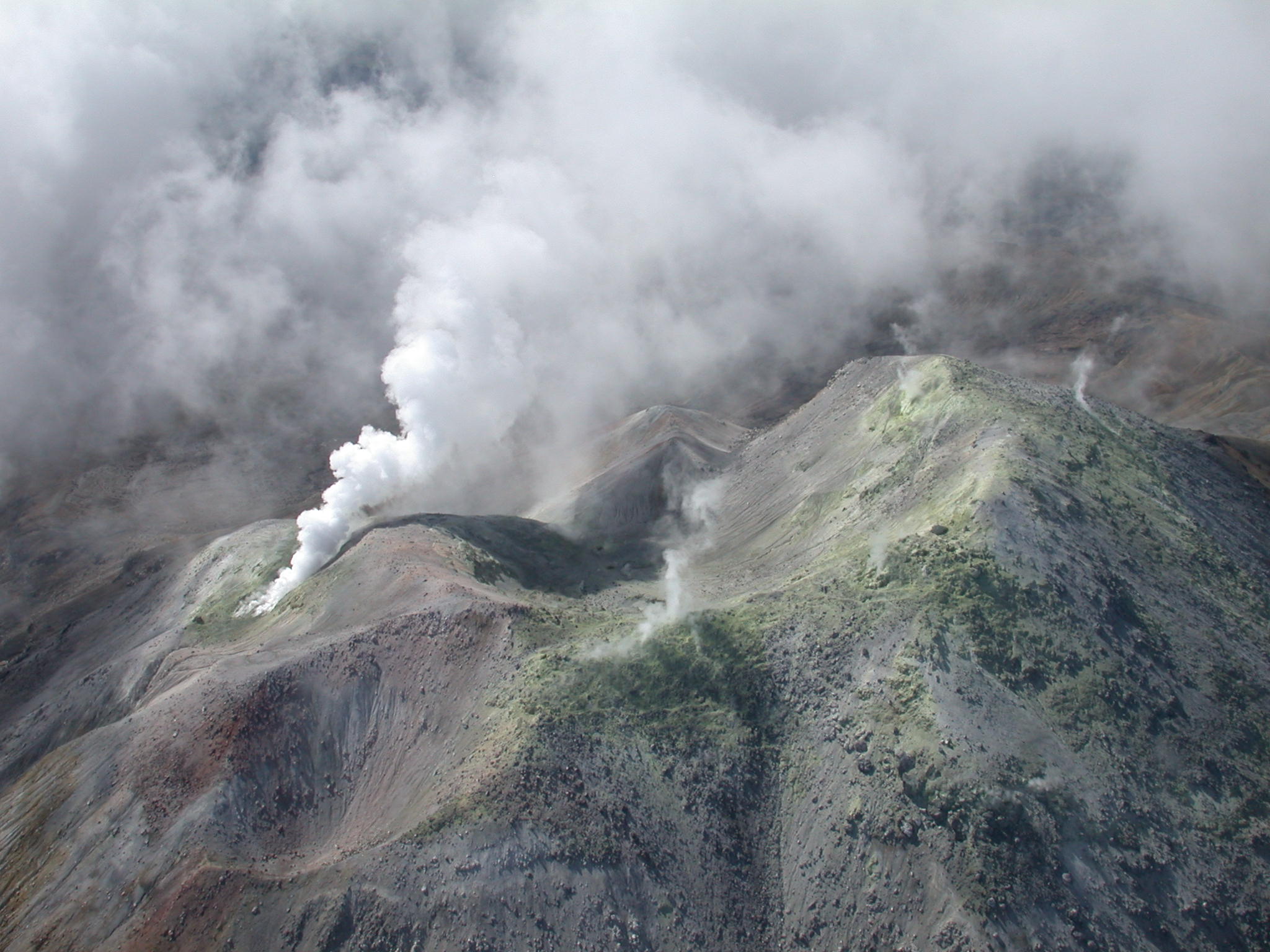
● Low-altitude emissions of white gas were observed at the El Verde (northeast flank) and Rastrojos (southwest flank of the CVC) fumarole fields. The dispersion of these plumes varied depending on wind direction.
● Other volcanic monitoring parameters remained stable.
In light of the above, the SGC recommends closely monitoring the situation via weekly bulletins and other information released through our official channels, as well as adhering to the instructions of local and departmental authorities and the National Unit for Disaster Risk Management (UNGRD). Volcanic activity remains at the yellow alert level: an active volcano showing changes in the baseline behavior of monitored parameters and other manifestations.
Source et photo : SGC.
Peru , Sabancaya :
Local date and time: August 31, 2026 – 12:10 PM
Bulletin analysis period: August 24–30, 2026
Volcanic alert level
Orange alert level: The volcano is showing a significant increase in eruptive activity. Increased seismic activity, frequent explosions, and emissions of ash and ballistic blocks have been observed.
Conclusions
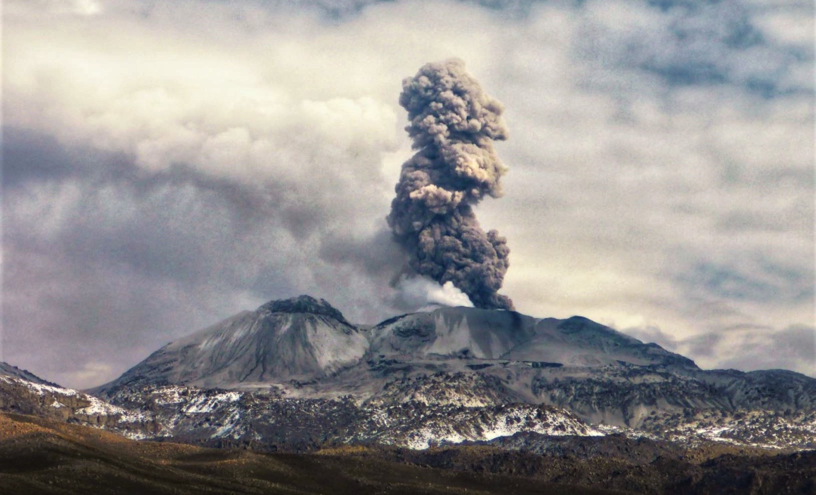
The IGP reports that the eruptive process at Sabancaya volcano is ongoing. No volcanic explosions occurred during this period; activity was limited to emissions of water vapor, ash, and gas reaching up to 900 m above the summit, accompanied by seismic activity linked to the movement of magmatic fluids and internal fracturing. Consequently, the volcanic alert level remains at orange.
Recommendations
Adopt prevention and preparedness measures consistent with the current orange volcanic alert level.
Do not approach within 12 km of the crater. In the event of ashfall, cover your nose and mouth with damp cloths or masks. Keep doors and windows of homes closed.
Stay constantly informed about Sabancaya’s volcanic activity through reports and bulletins published by the IGP.
Outlook
Volcanic explosions generating eruption columns exceeding 2 km in height are considered likely. These could affect districts in the Colca Valley and surrounding areas through the dispersal of volcanic ash; the volcanic alert level therefore remains at orange.
Source et photo : Cenvul.
Guatemala , Santiaguito :
Weather conditions: Clear skies
Wind: Northeasterly
Precipitation: 8.1 mm
Volcanic activity
White degassing is observed above the Caliente dome; fumaroles rise up to 600 meters and disperse towards the west and southwest. Low- to moderate-intensity explosions are occurring at a rate of 1 to 3 per hour, propelling gas and ash columns up to 800 meters above the dome in the same direction. Incandescence was observed in the crater during the night and early morning, accompanied by collapses and the descent of incandescent blocks along the flanks.
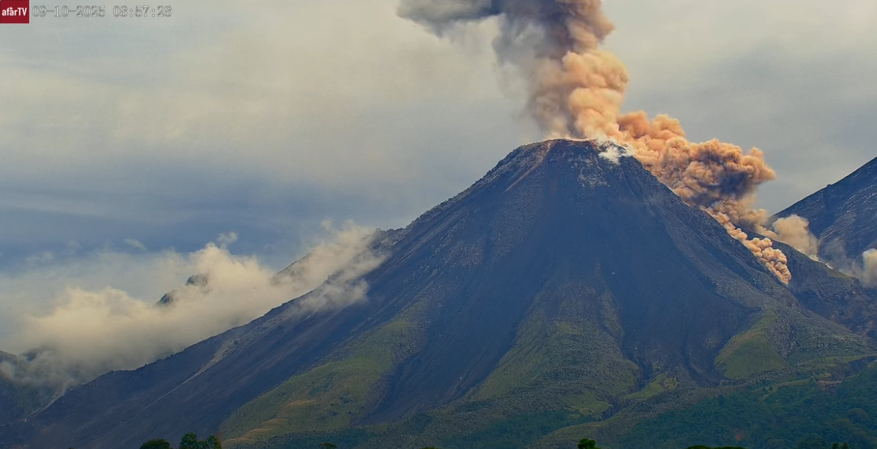
Given the high level of activity and the risk of major collapses, the formation of long-range pyroclastic density currents in any direction cannot be ruled out; therefore, it is recommended to adhere to the instructions in special bulletin BESAN-002-2026.
Furthermore, precipitation could mobilize material accumulated in ravines and riverbeds, potentially triggering lahars during the afternoon and evening. It is recommended to avoid ravines and riverbeds and to strictly follow the instructions in special bulletin BESAN-016-2026.
Source : Insivumeh .
Photo : Afar TV.
Alaska , Katmai :
AVO/USGS Volcanic Activity Notice
Current Volcano Alert Level: NORMAL
Current Aviation Color Code: GREEN
Issued: Monday, August 31, 2026, 4:04 PM AKDT
Source: Alaska Volcano Observatory
Notice Number: 2026/A673
Location: N 58 deg 16 min W 154 deg 57 min
Elevation: 6716 ft (2047 m)
Area: Alaska Peninsula
Summary:
Resuspended ash observed from 1912 eruption. Aviation color code and alert level remain at GREEN/NORMAL.
Volcanic Activity:
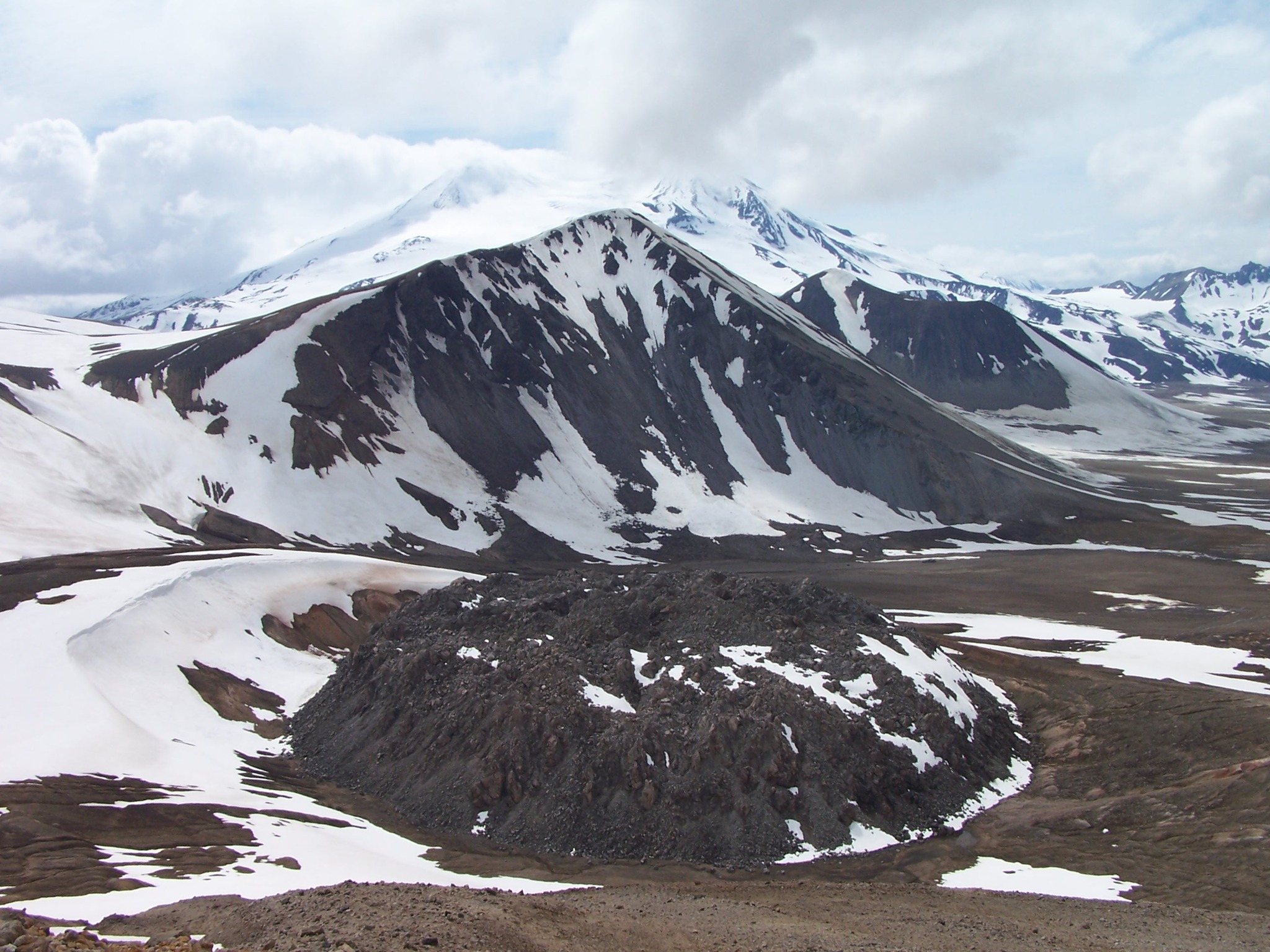
Strong northwesterly winds in the vicinity of Katmai and the Valley of Ten Thousand Smokes have picked up loose volcanic ash erupted during the 1912 Novarupta-Katmai eruption and are carrying it to the southeast. The National Weather Service has issued a SIGMET for this low-level event and suggests that the maximum cloud height is 6,000 ft (1.83km) above sea level.
This phenomenon is not the result of recent volcanic activity and occurs during times of high winds and dry snow-free conditions in the Katmai area and other young volcanic areas of Alaska. No eruption is in progress. All of the volcanoes of the Katmai area (Griggs, Katmai, Novarupta, Mageik, Martin, Snowy and Trident) remain at Aviation Color Code GREEN and Alert Level NORMAL. Resuspended volcanic ash should be considered hazardous and could be damaging to aircraft and health.
Source : AVO.
Photo : P. Izbekov, AVO/UAF-GI. USGS, DGGS .