November 21 , 2026.
Hawaii , Kilauea :
HAWAIIAN VOLCANO OBSERVATORY DAILY UPDATE , U.S. Geological Survey
Friday, November 20, 2026, 8:45 AM HST (Friday, November 20, 2026, 18:45 UTC)
19°25’16 » N 155°17’13 » W,
Summit Elevation 4091 ft (1247 m)
Current Volcano Alert Level: ADVISORY
Current Aviation Color Code: YELLOW
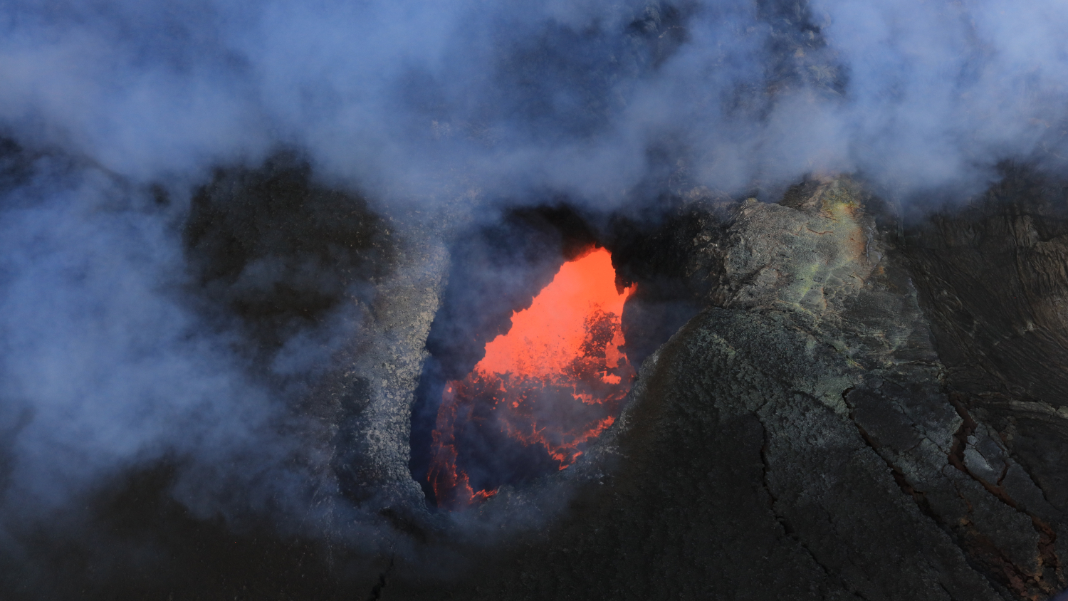
USGS photo of a roiling lava lake within the southwest vent of Halemaʻumaʻu at the summit of Kīlauea, taken November 18, 2026,
Summit Observations:
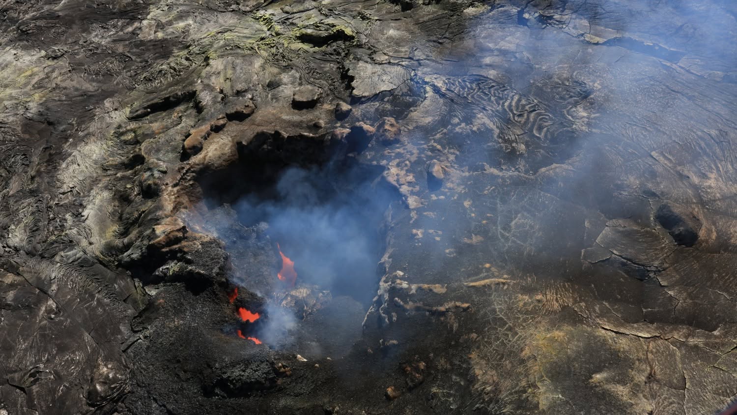
Summit webcams recorded strong to moderate glow from both the north and southwest vents overnight. Variable periods of strong glow from the south vent were related to tremor bursts early in the evening. Views from the V1cam livestream webcam overnight showed nearly continuous flames and occasional spattering from the north and southwest vents. A helicopter overflight on November 18 confirmed the presence of a large lava pond within the southwest vent that occasionally was spattering and overturning. The north vent was largely crusted over but had two pukas (holes) that are the source of the flames and spatter visible at night.
Seismic tremor changed from periods of low tremor followed by tremor bursts every 5-10 minutes to more continuous tremor just before midnight. One earthquake were located beneath the summit in the past day.
The Uēkahuna tiltmeter (UWD) has recorded nearly continuous summit inflation since the end of episode 56 lava fountaining. Tilt began slowly deflating around midnight on November 18, but started to inflate again on the afternoon of November 19. This morning, UWD had regained about 0.6 microradians of tilt during the past day resulting in a total of about 14.2 microradians of inflationary tilt since the end of episode 56.
The average sulfur dioxide (SO2) emission rate recorded by the summit gas monitoring array yesterday, November 19, was about 2,400 tonnes per day. Trade winds this morning are carrying volcanic gases to the southwest.
Rift Zone Observations:
Rates of seismicity and ground deformation remain low in the East Rift Zone and Southwest Rift Zone. SO2 emissions from the East Rift Zone remain below the detection limit.
Source : USGS.
Photos : USGS / D. Downs , USGS.
Indonesia , Dukono :
An eruption of Mount Dukono occurred on Friday, November 20, 2026, at 15:50 WIT; an ash column was observed, reaching approximately 1,500 meters above the summit (about 2,587 meters above sea level). This ash column, which appeared dense and ranged in color from white to gray, drifted toward the west. The eruption was recorded by a seismograph, showing a maximum amplitude of 34 mm and a duration of 33.02 seconds.

Seismic Observations
1 eruption-related earthquake, with an amplitude of 34 mm and a duration of 33.02 seconds.
1 local tectonic earthquake, with an amplitude of 15 mm and a duration of 34.34 seconds.
1 distant tectonic earthquake, with an amplitude of 34 mm and a duration of 59.01 seconds.
1 continuous tremor, with an amplitude ranging between 1 and 3 mm (predominantly 1 mm).
Recommendations
(1) Communities living near Mount Dukono, as well as visitors and tourists, are advised against engaging in any activities, hiking, or approaching the Malupang Warirang crater within a 4 km radius.
(2) Given that eruptions producing volcanic ash occur periodically—and that the dispersion of this ash depends on wind direction and speed, meaning the affected areas may vary—individuals living in the vicinity of Mount Dukono are advised to keep masks (or nose and mouth coverings) on hand, to be used if necessary to protect against respiratory health risks associated with volcanic ash.
Source et photo : PVMBG.
Martinique , Mount Pelée :
Weekly Report, Institut de Physique du Globe de Paris / Martinique Volcanological and Seismological Observatory (OVSM)
Saint-Pierre, November 20, 2026, at 15:00 local time (GMT-4)
Volcanic seismic activity:
Between November 13, 2026, at 16:00 (UTC) and November 20, 2026, at 16:00 (UTC), the OVSM recorded 284 earthquakes of volcanic origin:
– 284 volcano-tectonic earthquakes. 12 of these earthquakes had a magnitude (local magnitude Mlv or duration magnitude Md) greater than 1, and 2 had a magnitude (Mlv or Md) greater than 2. The largest event had a magnitude of Mlv = 2.23. The others were of lower energy. These earthquakes were located at depths ranging from 0.6 to 1.3 km below the volcano’s summit.
No earthquakes were reported as felt by the population.
During the previous week, the OVSM recorded 479 earthquakes of volcanic origin. As of November 20, 2026, and over the past 4 weeks, the OVSM has observed a total of 1,217 volcanic earthquakes, representing an average of 304 to 305 earthquakes per week.
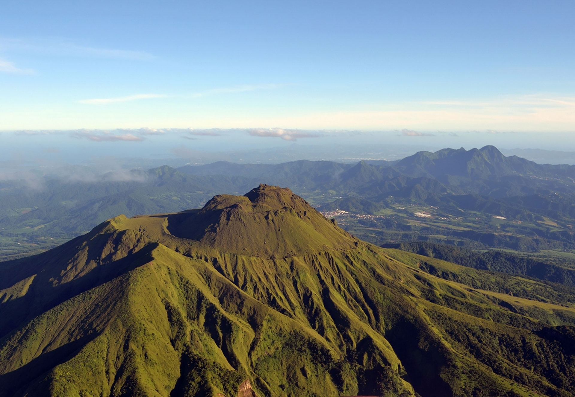
Deformations of Mount Pelée
The ground displacements of several centimeters that had been observed in the summit area of Mount Pelée over the last few months have decreased significantly. In the deformation zones near the summit, the maximum elongation recorded over the past four weeks is 0.6 cm (along a 610-meter-long profile). These displacements remain consistent with a deformation of the volcanic edifice caused by an inflating pressure source, though this source can no longer be precisely localized.
The probability of eruptive activity in the short term remains low. However, based on observations gathered over the last few months and years, an evolution of the situation in the medium term (weeks to months) cannot be ruled out.
The volcanic alert level, in accordance with the provisions established by the authorities, is currently YELLOW: vigilance..
Source : OVSM-IPGP.
Photo : BRGM.
Colombia , Nevado del Ruiz :
Manizales, November 18, 2026, 3:30 PM
As part of the ongoing monitoring of the Nevado del Ruiz volcano, the Colombian Geological Service (SGC)—an agency affiliated with the Ministry of Mines and Energy—reports the following:
During the week of November 10 to 16, 2026, the volcano continued to exhibit unstable behavior. Compared to the previous week, the primary variations in the monitored parameters were as follows:
– Seismic activity associated with rock fracturing within the volcanic edifice decreased, in terms of both the number of recorded earthquakes and the total seismic energy released. The earthquakes were located in the vicinity of the Arenas crater and, primarily, along the northeast and north-northeast flanks, at distances of up to 11 km from the crater. The depth of these events ranged from less than 1 km to 8 km below the volcano’s summit. The highest magnitude recorded during the week was 1.8, associated with an earthquake on November 14 at 10:32 PM, which was located 10 km northeast of the crater at a depth of 3 km.

– Seismicity associated with fluid dynamics within the volcanic conduits has decreased, in terms of both the number of recorded earthquakes and the seismic energy released. The events were short-lived and exhibited low energy levels.
– The volcano continued to emit water vapor and volcanic gases—primarily sulfur dioxide (SO₂)—into the atmosphere via the Arenas crater. The estimated flux of this gas decreased compared to the previous week; this trend was also confirmed by satellite monitoring.
– The vertical height of the gas and water vapor plume ranged from 100 m to 500 m above the volcano’s summit, with a predominant height of 300 m. A maximum height of 500 m was recorded on November 14. The plume dispersed primarily toward the northwest, with some variability also observed toward the west-northwest, north-northwest, and southwest of the volcano.
– Satellite-based monitoring of thermal anomalies at the bottom of the Arenas crater detected anomalies characterized by low energy levels.
Source et photo : SGC.
Chile , Villarica :
Research has determined that a large portion of the volcano was formed over the last 181,000 years and that it exhibits the highest long-term growth rate in the Southern Andes.
A scientific discovery has altered our previous understanding of the history of the Villarrica volcano. An international investigation, which included specialists from the National Geology and Mining Service (Sernageomin), has revealed that a significant part of the volcano’s structure was formed within the last 181,000 years—an age nearly three times younger than previously thought. The study also established that Villarrica has the highest long-term growth rate in the Southern Volcanic Zone of the Andes; these findings provide a better understanding of its evolution and help strengthen the assessment of hazards associated with its activity.
The work, led by researcher Pablo Moreno-Yaeger from the University of Wisconsin–Madison (USA), involved geologists Franco Vera and Felipe Flores from Sernageomin’s National Volcanic Monitoring Network (RNVV), in collaboration with scientists from various Chilean and American institutions.
To reconstruct the volcano’s evolution, the team analyzed 130 samples collected between 2019 and 2025 and determined the ages of 41 lava and deposit samples using four complementary dating methods. These results have enabled the establishment of a much more precise chronology of the volcano’s formation—a process previously thought to have begun more than 500,000 years ago.
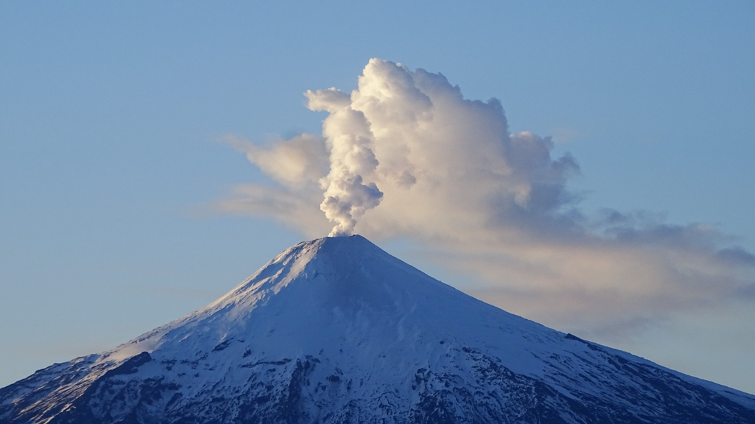
Among the key findings, it emerges that Villarrica—also known by its ancestral names, Rukapillán or Quitralpillán—has accumulated nearly 300 cubic kilometers of lava and pyroclastic material, with a growth rate of up to 1.7 cubic kilometers every thousand years. This figure represents the highest long-term growth rate identified in the Southern Volcanic Zone of the Andes and is comparable to that of some of the most active volcanoes in South America.
The investigation also determined that the Pichillancahue caldera, which surrounds the volcanic edifice, formed approximately 16,800 years ago as the result of a single collapse associated with the eruption of the Licán Ignimbrite—the largest such event in the volcano’s history.
Furthermore, scientists suggest that a magmatic system in an early stage of maturation exists beneath Villarrica. This helps explain the prevalence of relatively fluid andesitic-basaltic magmas, which distinguishes it from other volcanoes in the region.
In this context, Sernageomin maintains continuous monitoring of the volcano through the Southern Andes Volcanological Observatory (OVDAS), supplementing instrumental surveillance with research designed to deepen scientific understanding and strengthen the tools available for disaster prevention and decision-making.
Source et photo : Sernageomin.