October 29 , 2026.
New Zealand , Ruapehu :
Since the last Volcanic Activity Bulletin on 11 August, volcanic tremor at Ruapehu has fluctuated at low-to-moderate levels, with a gradual upward trend in recent weeks. There has been minimal change in measured gas emissions as well as the temperature of Te Wai ā-moe (Ruapehu Crater Lake). Volcanic activity remains within the range typical for minor unrest, therefore the Volcanic Alert Level remains at 1.
Since early August 2026, seismic tremor at Ruapehu has fluctuated in intensity with a gradual increase to moderate levels since early October. In the same period, we have occasionally detected small numbers of low-magnitude earthquakes beneath the volcano.
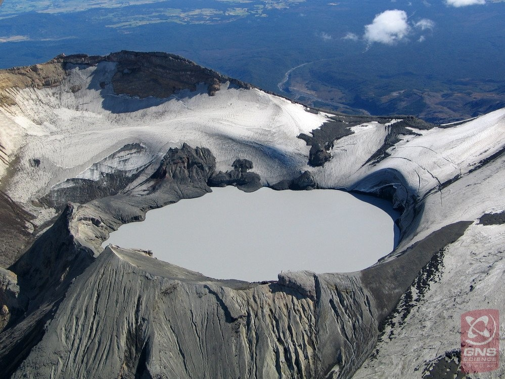
Te Wai ā-moe / Crater Lake temperatures have remained in the range 19 – 22 ᵒC, and the output of volcanic sulphur dioxide (SO₂) gas has been low-to-moderate compared to long-term ranges. During recent sampling visits, persistent upwelling was observed at several locations in the lake, with sulphur slicks visible across the water surface and around the lake shores. Analysis of the lake chemistry have indicated a slight change in chemical content in 2026, but values remain well within range typical for minor unrest at Ruapehu.
Altogether, our observations are consistent with a dynamic volcano hydrothermal system experiencing intermittent but slightly elevated input of volcanic gas and heat. Current activity at Ruapehu is within the range expected during minor volcanic unrest. Therefore, the Volcanic Alert Level remains at 1 and the Aviation Colour Code at Green.
The Earth Sciences New Zealand Volcano Monitoring Group and National Geohazards Monitoring Centre will continue to closely monitor Ruapehu 24/7 for any changes in activity. We will provide further updates when information becomes available or the status changes.
Source : Geonet / Oliver Lamb / Duty Volcanologist .
Photo : Bradd Scott / GNS science.
Kamchatka , Chikurachki :
KVERT VOLCANIC ACTIVITY NOTICE (VAN)
Issued: October 28 , 2026
Volcano: Chikurachki (CAVW #290360)
Current aviation colour code: YELLOW
Previous aviation colour code: orange
Source: KVERT
Notice Number: 2026-108
Volcano Location: N 50 deg 19 min E 155 deg 28 min
Area: Northern Kuriles, Russia
Summit Elevation: 1816 m (5956.48 ft)
Volcanic Activity Summary:
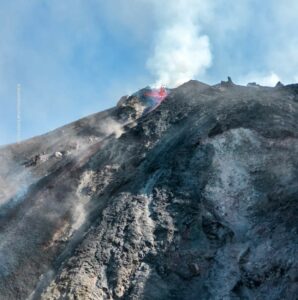
Weak explosive eruption occurred on October 26. No more explosions were observed since this day.
An activity of the volcano continues. Ongoing activity could affect low-flying aircraft.
Volcanic cloud height: NO ASH CLOUD PRODUCED
Other volcanic cloud information: NO ASH CLOUD PRODUCED
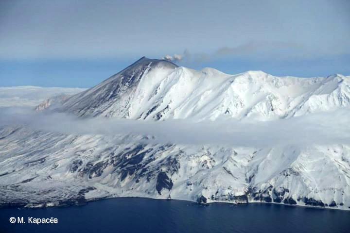
Chikurachki, the highest volcano on Paramushir Island in the northern Kuriles, is a relatively small cone constructed on a high Pleistocene edifice. Oxidized basaltic-to-andesitic scoria deposits covering the upper part of the cone give it a distinctive red color. Frequent basaltic Plinian eruptions have occurred during the Holocene. Lava flows have reached the sea and formed capes on the NW coast; several young lava flows are also present on the E flank beneath a scoria deposit. The Tatarinov group of six volcanic centers is located immediately to the south, and the Lomonosov cinder cone group, the source of an early Holocene lava flow that reached the saddle between it and Fuss Peak to the west, lies at the southern end of the N-S-trending Chikurachki-Tatarinov complex. The Tatarinov centers are extensively modified by erosion and have a more complex structure. Tephrochronology gives evidence of an eruption around 1690 CE from Tatarinov, although its southern cone contains a sulfur-encrusted crater with fumaroles that were active along the margin of a crater lake until 1959.
Sources : KVERT , GVP.
Photo : M. Karasev
Indonesia , Anak Krakatau :
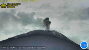
An eruption of Mount Anak Krakatau, in Lampung Province, occurred on Wednesday, October 28, 2026, at 11:29 p.m. WIB. The eruption was not observed visually; it was recorded on a seismogram, with a maximum amplitude of 48.0 mm and a duration of approximately 573.0 seconds.
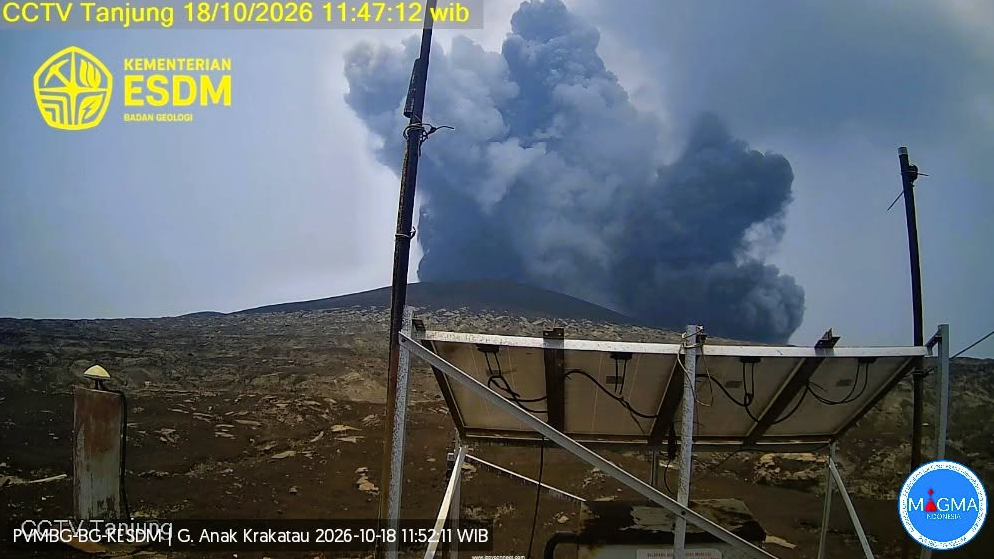
Seismic data
1 episode of continuous tremor, with an amplitude ranging between 5.0 and 35.0 mm (predominantly 10.0 mm).
1 low-frequency earthquake, with an amplitude of 48.0 mm and a duration of 8.0 seconds.
1 emission-related earthquake, with an amplitude of 44.0 mm and a duration of 38.0 seconds.
1 hybrid/polyphase earthquake, with an amplitude of 39.0 mm and a duration of 16.0 seconds.
Recommendations
1. Populations living near Mount Anak Krakatau, as well as visitors, tourists, and hikers, are prohibited from entering or conducting any activities within a 5 km radius of the Anak Krakatau eruptive center.
2. Populations living near Mount Anak Krakatau, as well as visitors and tourists, are prohibited from entering or conducting any activities within a 1 km radius of the new islands located in the northwest and southeast sectors of Mount Anak Krakatau.
Source et photo : PVMBG .
La Réunion , Piton de la Fournaise :
Press release from the Institut de Physique du Globe de Paris / Piton de la Fournaise Volcanological Observatory, October 26, 2026 – 08:30 local time – 04:30 UTC
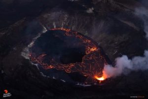
Since the magmatic intrusion on October 24, 2026, beneath the southern edge of the Dolomieu crater, no significant change in activity has been observed.
Shallow volcano-tectonic seismicity beneath the summit is at a level slightly lower than that recorded during the month preceding the intrusion (7 earthquakes detected on October 25, Figure 1). However, inflation of the summit area continues at a rate comparable to that observed prior to the intrusion.
These observations suggest that the pressurization of the shallow magmatic reservoir is ongoing.
In the past, such intrusions have occasionally preceded an eruption by a few days to a few weeks, as was the case before the eruptions in January and February–April 2026.
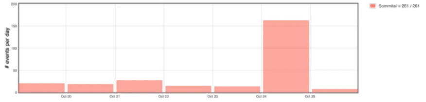
Number of shallow volcano-tectonic earthquakes detected per day beneath the summit area of Piton de la Fournaise since October 19, 2026. Following the intrusion on October 24—which was associated with ~150 earthquakes—the rate of seismicity has returned to a level slightly lower than that observed prior to the intrusion. (© OVPF-IPGP)
Current alert level: Alert 1
Source et photo : direction de l’OVPF-IPGP.
Colombia , Puracé – Los Coconucos volcanic chain:
Popayán, October 27, 2026, 3:00 PM
As part of the ongoing monitoring of the Puracé volcano—part of the Los Coconucos volcanic chain (CVLC)—the Colombian Geological Service (SGC), an agency under the Ministry of Mines and Energy, reports the following:
During the week of October 20 to 26, 2026, seismicity associated with fluid movement (gases and liquids originating from magma and their interaction with the hydrothermal system) remained at levels comparable to those of the previous week. These events continued to be localized beneath the Puracé and Piocollo volcanoes, at depths of less than 3 km.
Seismicity associated with rock fracturing (VT events) remained at levels similar to those recorded the previous week in terms of the number of events, and was concentrated in two areas: one to the northeast of the Puracé volcano, at a distance of 12 to 18 km and at depths between 7 and 14 km (notably, one event reached a local magnitude of 2.0); and another in the area between the Puracé and Piocollo volcanoes, with events occurring at depths between 1 and 4 km, all of which were of low magnitude.
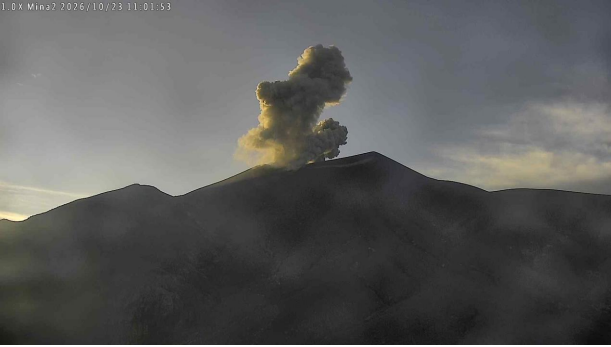
Eruption event at the Puracé volcano, October 23, 2026, at 06:01. Recording from the « Mina » camera, located 2.2 km north of the Puracé volcano.
A process of slow ground deformation continues in the area encompassing the Puracé, Piocollo, and Curiquinga volcanoes. Significant levels of sulfur dioxide (SO₂) and carbon dioxide (CO₂) emissions into the atmosphere are also still being recorded. During this period, satellite observations have identified low-energy thermal anomalies within the crater of the Puracé volcano.
Continuous degassing, as well as 31 ash emission events, have been recorded; some of these emissions reached heights of up to 2.1 km above the summit of the Puracé volcano, with dispersion primarily toward the west and northwest. Residents of Coconuco, Puracé, and Paletará (in the municipality of Puracé, Cauca Department) have reported some of these events.
In conclusion, the variations observed at the Puracé volcano indicate that the system remains unstable, as evidenced by several of the monitored parameters. Further ash emissions and fallout are possible, with their dispersion depending on the prevailing wind direction. Furthermore, the occurrence of additional changes in volcanic activity—potentially leading to more intense surface manifestations—cannot be ruled out.
The volcanic alert level remains at « Yellow, » indicating an active volcano showing deviations from the baseline behavior of monitored parameters, along with other manifestations.
Source et photo : SGC.