October 24 , 2026.
Indonesia , Semeru :
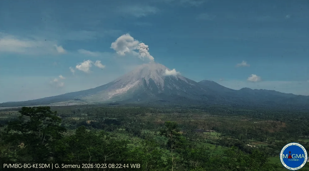
An eruption of Mount Semeru, located in East Java, occurred on Friday, October 23, 2026, at 08:20 WIB. A column of ash was observed, reaching a height of approximately 1,000 meters above the summit (about 4,676.0 meters above sea level). This dense, white-to-gray column drifted toward the southwest. The eruption was recorded on a seismogram, showing a maximum amplitude of 25.0 mm and an initial duration of approximately 85.0 seconds.
Seismic Data
20 eruption-related earthquakes, with amplitudes ranging from 12.0 to 25.0 mm and durations from 66.0 to 179.0 seconds.
5 emission-related earthquakes, with amplitudes ranging from 3.0 to 8.0 mm and durations from 41.0 to 103.0 seconds.
3 distant tectonic earthquakes, with amplitudes ranging from 1.0 to 4.0 mm and durations from 35.0 to 56.0 seconds.
1 deep volcanic earthquake, with an amplitude of 20.0 mm and a duration of 26.0 seconds.
1 harmonic tremor, with an amplitude of 2.0 mm and a duration of 169.0 seconds.
10 rockfall (avalanche) earthquakes, with amplitudes ranging from 1.0 to 8.0 mm and durations from 36.0 to 132.0 seconds.
1 local tectonic earthquake, with an amplitude of 2.0 mm and a duration of 28.0 seconds.
Recommendations
1. Do not conduct any activities in the southeastern sector, along the Besuk Kobokan riverbed, within a 13 km radius of the summit (the eruption center). Beyond this distance, the public should avoid all activities within a 500-meter-wide strip on either side of the Besuk Kobokan riverbanks, due to the risk of pyroclastic flows and lahars, which could reach a distance of 17 km from the summit.
2. Do not conduct any activities within a 5 km radius of the crater/summit of Mount Semeru, due to the danger posed by (incandescent) rock ejections.
Source et Photo : PVMBG.
Italy , Campi Flegrei :
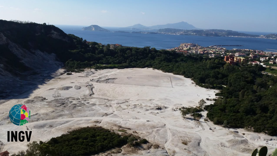
During the month of September 2026, 91 earthquakes were recorded in the Phlegraean Fields area, with a maximum magnitude of 2.0 ± 0.3. Of the recorded earthquakes, 81 events (89.31%) had a magnitude of less than 1.0—or could not be determined due to the low amplitude of the signal, which was difficult to distinguish from background noise—; 9 events (9.9%) had a magnitude between 1.0 and 1.9; and 1 event (1.1%) reached a magnitude of 2.0. 65 earthquakes (~74% of the total recorded) were localized; these were concentrated primarily between Pozzuoli, Agnano, the Solfatara-Pisciarelli area, and Bagnoli, as well as in the Gulf of Pozzuoli, at depths generally within the first 3 kilometers.
Regarding ground deformation, the phenomenon of uplift continues, although its rate has gradually decreased over the last few months. Since mid-December 2025, an uplift rate has been observed, with a monthly average of approximately 15 ± 3 mm/month. Since the beginning of February 2026, a decline in this uplift rate has been noted, with a monthly average of approximately 10 ± 3 mm/month.
In connection with the seismic event on July 31 (magnitude Md = 4.7) and the subsequent seismic swarm, certain GNSS stations located in the central area of the caldera recorded discontinuities in their time series. The most energetic events within this July 31 swarm also caused offsets at tiltmeter and dilatometer stations. The uplift recorded at the RITE GNSS station is approximately 169.5 cm since November 2005—of which about 32 cm has occurred since January 2025—following a correction for the co-seismic discontinuity recorded on July 31.
Maximum surface temperature values, derived from infrared (IR) time series in the Pisciarelli and Solfatara areas, show stable trends.
Geochemical parameters confirm long-term, multi-year trends of heating and increasing pressure within the hydrothermal system. The CO2 flux emitted from the ground, measured in the target area within the Solfatara, is among the lowest values recorded in recent months—estimated at approximately 900 tonnes per day; nevertheless, this remains a high value, comparable to those measured in the plumes of active volcanoes characterized by persistent degassing.
Source et photo : INGV Vulcani.
Hawaii , Kilauea :
HAWAIIAN VOLCANO OBSERVATORY DAILY UPDATE , U.S. Geological Survey
Friday, October 23, 2026, 9:37 AM HST (Friday, October 23, 2026, 19:37 UTC)
19°25’16 » N 155°17’13 » W,
Summit Elevation 4091 ft (1247 m)
Current Volcano Alert Level: ADVISORY
Current Aviation Color Code: YELLOW
Summary:
The Halema’uma’u eruption of Kīlauea is currently paused after episode 55 fountaining ended on October 17. Summit reinflation continues today and the preliminary forecast for episode 56 fountaining is between October 29 and November 5, 2026.
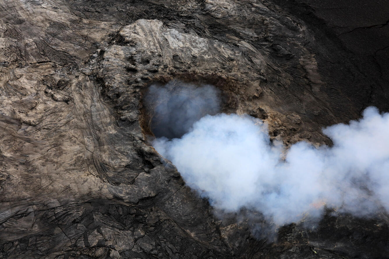
A close-up aerial view of the north vent within Halema‘uma‘u crater taken during a Hawaiian Volcano Observatory helicopter overflight on October 22, 2026. During the flight, a small area of incandescence was visible deep within the vent but can’t be seen in this image. In the ongoing episodic eruption at Kīlauea summit, lava fountains from the north vent during episode 55 reached maximum heights of about 720 feet (220 meters).
Overview:
The summit eruption of Kīlauea in Halemaʻumaʻu is paused following lava fountaining in episode 55 on October 17, 2026. Summit tiltmeter data showed re-inflation began immediately following the end of episode 55 and steady, slow inflation is continuing. Assuming magma chamber inflation has returned to the pattern established in the past, the preliminary forecast for episode 56 fountaining to occur is between October 29 and November 5, 2026.
Summit Observations:
Continuous moderate-to-strong glow was observed overnight from both the north and west vents within Halema’uma’u. No glow was visible from the south vent, which was covered in a layer of tephra during episode 55. Observations from an overflight yesterday morning showed that the north vent was crusted over and the west vent had a slowly convecting pond within it. The constant glow last night from the north vent suggests that there is now actively convecting pond within it.
Continuous, low-level seismic tremor has been present over the past day, which is typical during inter-episode pauses. One earthquake was recorded in the summit area in the past 24 hours.
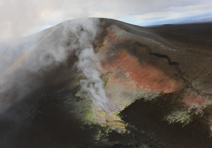
During a USGS Hawaiian Volcano Observatory helicopter overflight of Halema‘uma‘u crater, this close-up image was taken of the tephra hill on the southwest rim of Kaluapele (the Kīlauea summit caldera). This hill of tephra formed during the ongoing episodic summit eruption as tephra fallout from many high fountaining episodes accumulated here. A large crack is visible on the right side of the image where the material has slowly been slumping, along with areas of alteration that are yellow and orange in color.
Steady inflationary tilt continued over the past 24 hours. The UWD tiltmeter has recovered at total of 11.6 microradians of inflationary tilt since the end of episode 55. Deflationary tilt measured at a summit tiltmeter at Uēkahuna (UWD) totaled 21 microradians during episode 55. Post-fountaining tilt patterns have been similar to those seen prior to episode 54.
During inter-episode pauses, the sulfur dioxide (SO2) emission rate from the summit typically varies between 1,000 to 5,000 tonnes per day. Winds are forecast from the northeast, which are pushing the gas plume to the southwest over the Kaʻū Desert this morning.
Rift Zone Observations:
Rates of seismicity and ground deformation remain low in the East Rift Zone and Southwest Rift Zone. SO2 emissions from the East Rift Zone remain below the detection limit. No significant ground deformation was recorded in either rift zone.
Source : HVO
Photos : USGS/ L. DeSmither.
Guatemala , Santiaguito :
Atmospheric conditions: Clear sky
Wind: From the north
Precipitation: 2 mm
Activity
The « Caliente » dome crater exhibits a persistent fumarole. Explosions of low to moderate intensity have been observed, accompanied by ash plumes reaching 3,200 m above sea level. These plumes are dispersing toward the south and southwest over a distance of approximately 15 km, resulting in ashfall on the « El Patrocinio » and « El Faro » farms (*fincas*), the village of Loma Linda Palajunoj, as well as « Las Marías » and other nearby communities. The extrusion of volcanic material continues at the crater, triggering constant avalanches and short-range pyroclastic flows, moving toward the west and northeast.
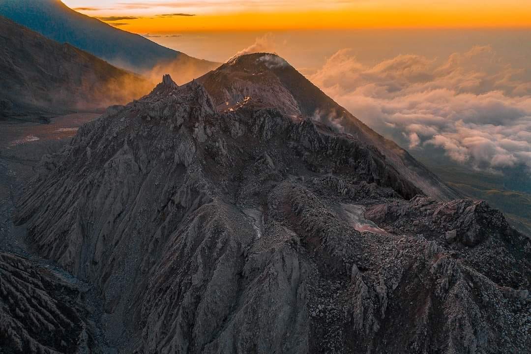
During the night and into the early morning hours, a strong incandescence was observed within the crater, indicating the presence of active magma at the surface. The instability of the dome raises concerns about potential partial collapses, which could trigger more extensive pyroclastic flows. Consequently, it is strongly advised to avoid approaching the domes, and to refrain from entering or remaining in the ravines, as these areas pose the highest level of risk.
Source : Insivumeh
Photo : Noticias Caballo Blanco.
Colombia , Chiles – Cerro Negro :
San Juan de Pasto, October 20, 2026, 4:24 PM
As part of the ongoing monitoring of the Chiles-Cerro Negro volcanic complex (CVCCN), the Colombian Geological Service (SGC)—an agency affiliated with the Ministry of Mines and Energy—
reports the following:
For the period from October 13 to October 19, 2026, the primary changes in the monitored parameters, compared to the previous week, were as follows:
● Amidst fluctuating seismic activity, an increase in the number of events was observed, while the total energy released decreased slightly. Seismicity associated with
rock fracturing remains predominant, followed by activity linked to fluid dynamics.
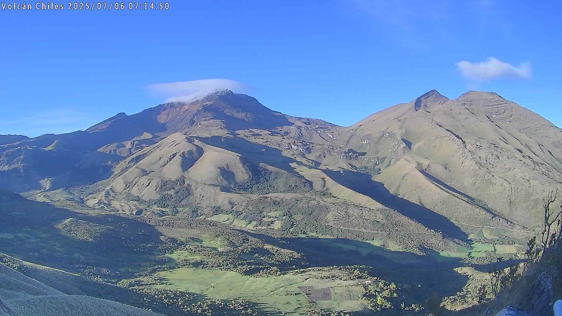
● Fracturing-related earthquakes were primarily located to the west of the Chiles volcano, at a distance of less than 3.4 km and at depths ranging from 2.6 to 4.2 km below the volcano’s summit (4,700 m above sea level), with a maximum magnitude of 1.4. None of the recorded earthquakes were felt.
● Analysis of data collected by satellite sensors and ground-based stations continued to reveal variations associated with deformation processes in the volcanic area.
Based on the assessment and correlation of the monitored parameters, the SGC recommends closely following the evolution of the situation through weekly bulletins and other information released via our official channels. It is also advised to adhere to the instructions provided by local and departmental authorities, as well as those from the National Unit for Disaster Risk Management (UNGRD).
Volcanic activity remains at the yellow alert level: an active volcano exhibiting changes in the baseline behavior of monitored parameters, along with other manifestations.
Source et photo : SGC.