November 11 , 2025.
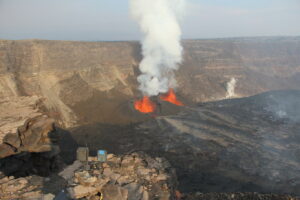
Italy , Stromboli :
STROMBOLI ACTIVITY UPDATE, November 10, 2025, 3:39 PM (2:39 PM UTC)
The National Institute of Geophysics and Volcanology, Etna Observatory, announces that surveillance camera images show that the lava flow from the North Crater area, reported in the previous update, has ceased and is cooling. Ordinary explosive activity and moderate ejection activity persist in the North Crater area, at varying intensities.
From a seismic perspective, no significant changes were observed compared to previously published data, and the average amplitude of volcanic tremor remains within the average range.
Analysis of ground deformation monitoring network data reveals no significant changes.
Further updates will be provided soon.
Source : INGV
Photo : Stromboli stati d’animo / Sebastiano Cannavo , Capture d’écran
New Zealand , White Island :
Low-level eruptive phase at Whakaari/White Island continues. Volcanic Alert Level Remains at Level 3 and Aviation Colour Code remains Orange.
Published: Tue Nov 11 2025 3:30 PM
Intermittent ash emission from the active vent at Whakaari/White Island has continued since the two small, low energy eruptions on 30 October. Ash emissions have been low level, and are unlikely to reach the mainland. The Volcanic Alert Level remains at Level 3 and the Aviation Colour Code remains Orange
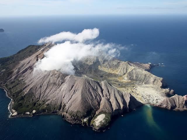
Our observations indicate that Whakaari/White Island remains in a low energy eruptive phase. This is characterised by a steam and gas plume sometimes carrying minor amounts of volcanic ash. The amount of volcanic ash present is minor and often difficult to detect, depending on cloud cover. Between 2 and 6 November, our colleagues at MetService have intermittently detected volcanic ash in satellite imagery. Ash was also observed during overflights on 3 and 4 November. Ash has not been observed since 6 November but cannot be excluded as the island was at times obscured by clouds.
We have also observed sulphur dioxide (SO2) in satellite imagery from 1-8 November. These observations are complemented by measurements of an increased amount of SO2 being emitted by the volcano measured by an overflight on 4 November. As wind directions change, the plume may at times be blown towards the Bay of Plenty coast, meaning residents may possibly smell sulphur odours. However, at the current level of activity, there is a very low likelihood of ash falling to the ground (ashfall) at the coast. The level of volcanic activity would have to escalate significantly for this likelihood to increase.
Based on the recent observations, the Volcanic Alert Level remains at level 3 (minor volcanic eruption) and the Aviation Colour Code remains Orange. These levels acknowledge the predominant low level of activity but also reflect the degree of uncertainty about volcanic activity due to the current lack of real-time monitoring data from the island.
To further assess the status of the volcano we will conduct a gas or observation flight when conditions are suitable. Earth Sciences NZ Volcano Monitoring Group and National Geohazards Monitoring Centre will continue to closely monitor Whakaari/White Island for any changes in activity. Without sensors on the island, our monitoring continues to rely on remote cameras, satellite imagery, and periodic observation and gas flights to monitor Whakaari/White Island.
Source : Geonet , Paul Jarvis / Duty Volcanologist
Photos : Geonet.
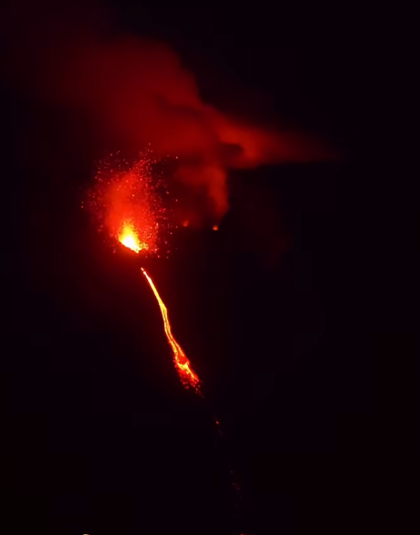
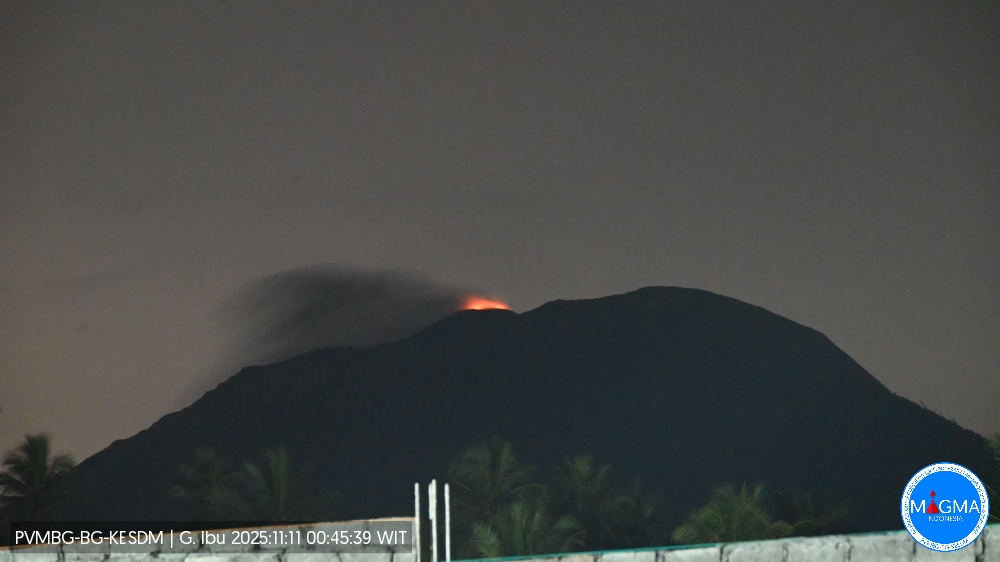
Indonesia , Ibu :
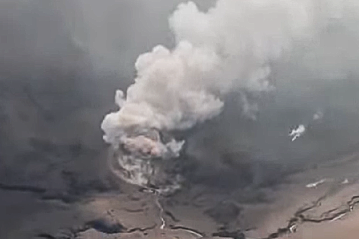
Mount Ibu erupted on Monday, November 10, 2025, at 1:22 PM UTC (10:22 PM local time). An ash column was observed approximately 600 meters above the summit (at an altitude of about 1,925 meters). This ash column was gray and dense, and drifted northeast. The eruption was recorded by a seismograph with a maximum amplitude of 28 mm and a duration of 64 seconds.
VOLCANO OBSERVATORY NOTICE FOR AVIATION – VONA
Issued : November 10 , 2025
Volcano : Ibu (268030)
Current Aviation Colour Code : ORANGE
Previous Aviation Colour Code : orange
Source : Ibu Volcano Observatory
Notice Number : 2025IBU1119
Volcano Location : N 01 deg 29 min 17 sec E 127 deg 37 min 48 sec
Area : North Maluku, Indonesia
Summit Elevation : 4240 FT (1325 M)
Volcanic Activity Summary :
Eruption with volcanic ash cloud at 13h22 UTC (22h 22 local).
Volcanic Cloud Height :
Best estimate of ash-cloud top is around 6160 FT (1925 M) above sea level or 1920 FT (600 M) above summit. May be higher than what can be observed clearly. Source of height data: ground observer.
Other Volcanic Cloud Information :
Ash cloud moving to northeast. Volcanic ash is observed to be gray. The intensity of volcanic ash is observed to be thick.
Remarks :
Eruption recorded on seismogram with maximum amplitude 28 mm and maximum duration 64 second.
Source et photo : Magma Indonésie .
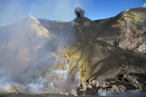
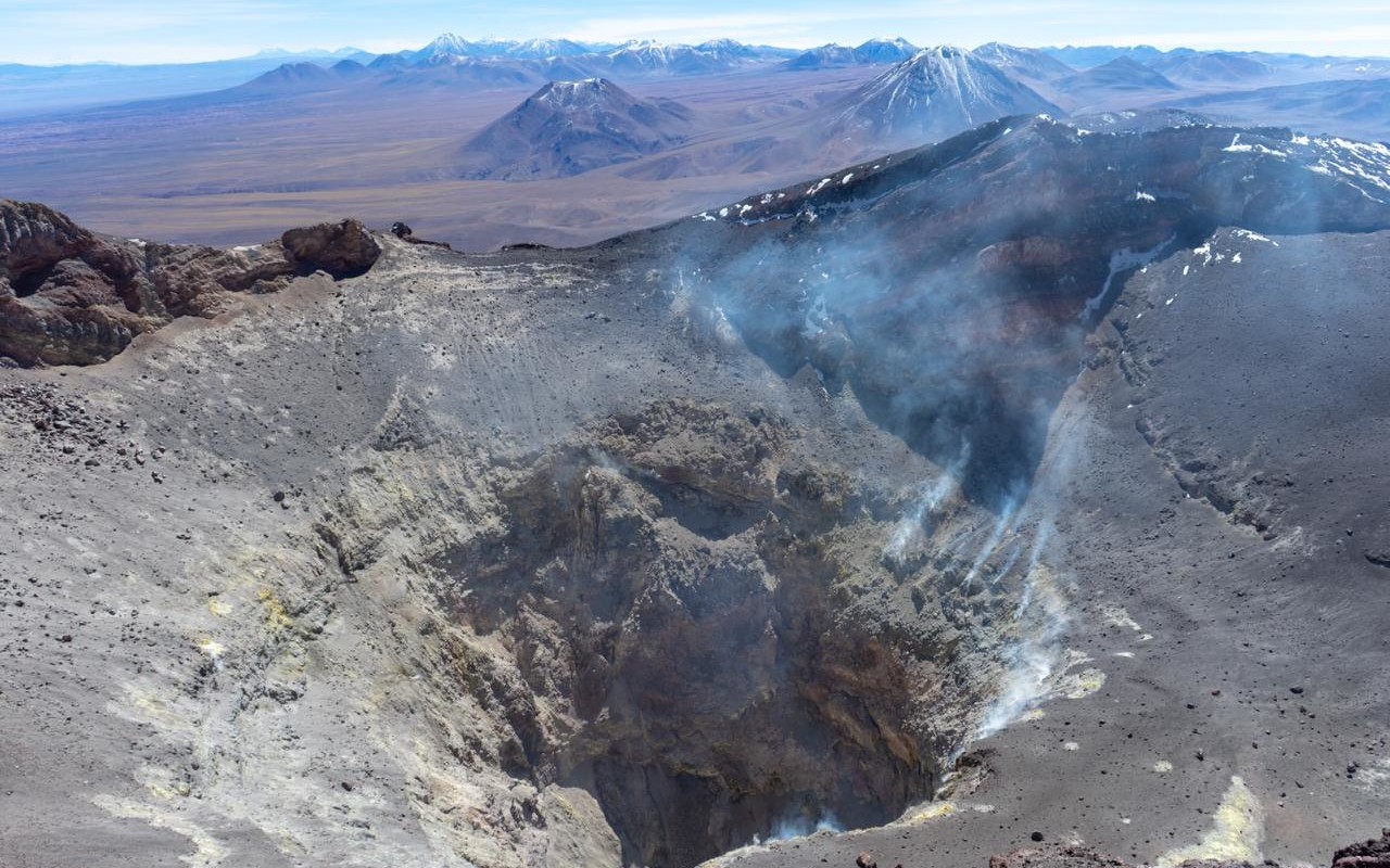
Chile , Lascar :
Seismology
The seismic activity of the period was characterized by the recording of:
11 VT-type seismic events, associated with rock fracturing (volcano-tectonics). The most powerful earthquake, with a local magnitude (ML) of 1.4, was located 1.0 km east-southeast of the volcanic edifice, at a depth of 2.0 km.
6 LP-type seismic events, associated with fluid dynamics within the volcanic system (long period). The amplitude of the largest earthquake, measured by the reduced displacement parameter (DR), was 3 cm².
Fluid Geochemistry
Sulfur dioxide (SO₂) emission data obtained by differential optical absorption spectroscopy (DOAS) at the Emu station, located 6 km east-southeast (ESE) of the active crater, revealed an average SO₂ flux of 947 t/d for the study period, with a daily peak of 2,652 t/d on October 6.
Four anomalies in sulfur dioxide (SO₂) emissions into the atmosphere were reported in the area near the volcano, according to data published by the German Aerospace Center (DLR) Earth Observation Centre (EOC). The maximum mass recorded by the mounts project is 111 tonnes of SO₂ emitted on October 3 in connection with the Láscar volcano.
Satellite Thermal Anomalies
During the study period, 104 thermal alerts were recorded on the MIROVA platform in the volcanic zone, with a maximum radiative power (PRV) of 2.2 MW (MODIS) on October 4, 3.0 MW (VIIRS750) on October 16, and 2.6 MW (VIIRS375) on October 4, a level considered low. Analysis of Sentinel-2 L2A satellite images identified six images exhibiting radiance anomalies, based on false-color combinations, on October 4, 6, 9, 14, 26, and 29. The NHI TOOLS tool did not detect any areas of intense activity within the volcanic system.
Geodesy
Geodetic monitoring, performed using data from two GNSS stations, was characterized by:
– Low rates of vertical displacement, less than 0.4 cm/month.
– Horizontal rates of displacement less than 0.6 cm/month, considered low because no significant trend was observed over time, indicating an increase in pressure at depth.
– No deformation was detected by interferometry radar (InSAR) on the Sentinel-1A images of the volcano.
Therefore, no changes related to deformation of the volcanic system were observed.
Monitoring Cameras
Images from fixed cameras installed near the volcano recorded low-intensity degassing plumes. The maximum plume height was recorded on October 31, reaching 480 m above the crater.
Satellite Geomorphological Analysis
During this period, images from the PlanetScope Scene satellite were analyzed, and no morphological changes to the volcanic system were observed.
Activity remained low, suggesting the volcano’s stability. The volcanic technical alert level remains at the following:
GREEN TECHNICAL ALERT: Active volcano with stable behavior – No immediate risk
Observation:
Given the behavior of this volcanic system observed over the past ten years, sudden, low-magnitude explosions without warning signs, potentially affecting the immediate vicinity of the active crater, cannot be ruled out. However, considering its baseline activity, this type of event is infrequent, and its probability of occurrence is therefore considered low. Risks associated with this minor activity include the ejection of ballistic pyroclastic flows, ash emissions, and volcanic gases.
Source : Sernageomin
Photo : Vulcanopro.
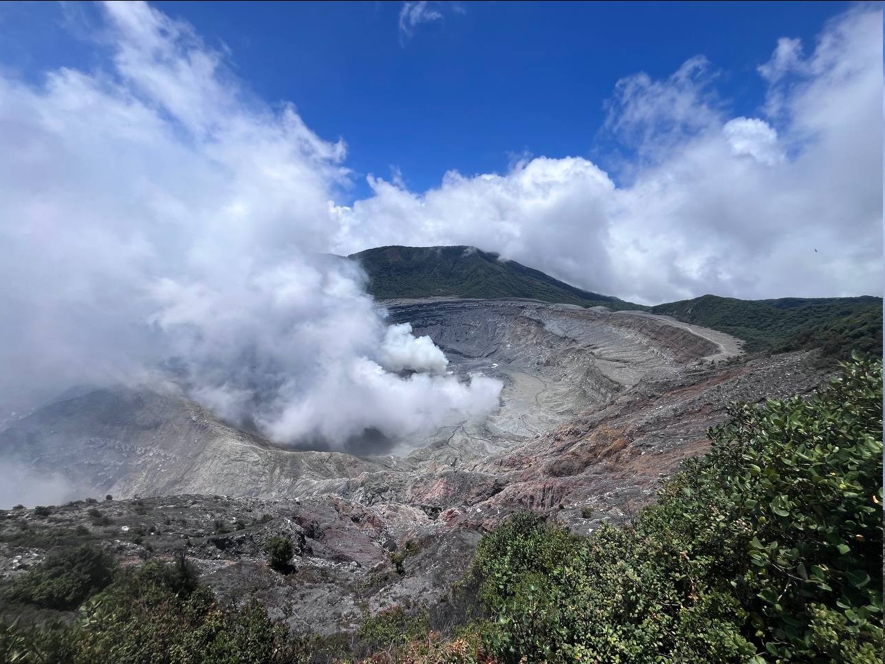
Costa Rica , Poas :
OVSICORI-UNA Volcanic Monitoring Weekly Bulletin, November 7, 2025
Latitude: 10.20°N
Longitude: 84.23°W
Altitude: 2687 m
Current Activity Level: Alert
Tremor amplitude has decreased since the 28th and has remained stable this week.
Acoustic tremor has decreased considerably this week and is now almost nonexistent. The number of long-period events continues to increase. Five proximal volcano-tectonic events and one distal event were recorded. On the night of October 31, a seismo-acoustic signal was observed, probably related to a slight detachment of material from the crater walls. However, darkness prevented confirmation by the camera. The following morning, a small detachment was observed in the western sector of the crater on webcam images, but undetectable by seismic and infrasonic signals due to its very low magnitude.
The geodetic network is not recording any significant deformation. A slight subsidence of the volcano has been detected. MultiGAS stations measured an average SO₂/CO₂ ratio of 1.6 ± 0.4 this week, a value similar to last week’s (1.3 ± 0.4). The H₂S/SO₂ ratio remained very low (< 0.1). The ExpoGAS station at the viewpoint measured a maximum of 1.2 ppm of SO₂ this week, which represents a relatively low concentration. DOAS stations detected an increase in SO₂ flux (217 ± 46 t/d) compared to the previous week (127 ± 94 t/d). Furthermore, satellite measurements of atmospheric SO₂ confirm a decrease, with a peak of 209 tonnes of SO₂ on November 2.
Due to heavy rainfall, the lake level rose 1.4 m this week, then fell about 0.4 m, ending the week at a level 1 m higher than the previous week.
Source : Ovsicori.
Photo : RSN/UCR