March 26 , 2026.
La Réunion Island , Piton de la Fournaise :
Press release from the Paris Institute of Earth Physics, Piton de la Fournaise Volcanological Observatory, March 25, 2026 – 4:00 PM local time – 12:00 PM UTC
Sudden decrease in eruptive activity
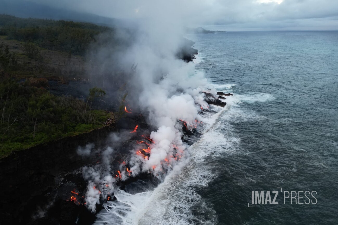
Volcanic tremor showed two successive drops on March 25 at 9:50 AM local time (5:50 AM UTC) and then at 1:45 PM local time (9:45 AM UTC), before returning to a level close to the seismic background noise around 3:00 PM local time (11:00 AM UTC). This development indicates a very sharp decrease in magma supply, suggesting a very low or even zero lava flow. Residual seismic energy remains observed between 1 and 3 Hz, which suggests that activity may not have completely stopped (degassing or residual lava flow). No hypothesis is being ruled out regarding the future course of the situation (definitive cessation, resumption of activity at the same site, or resumption of activity at another site). In the past, episodes of abrupt cessation of similar eruptions have been observed, where a sudden resumption of eruptive activity occurred after a period of inactivity (for example, during the August-October 2015 eruption).
Furthermore, degassing continues at the eruptive site, and lava flows may remain visible even if the eruption has ceased, due to the gradual emptying of the lava tubes. The plume associated with the lava flows entering the sea and the fumaroles on the flows can remain active for several days to several weeks after the end of an eruption.
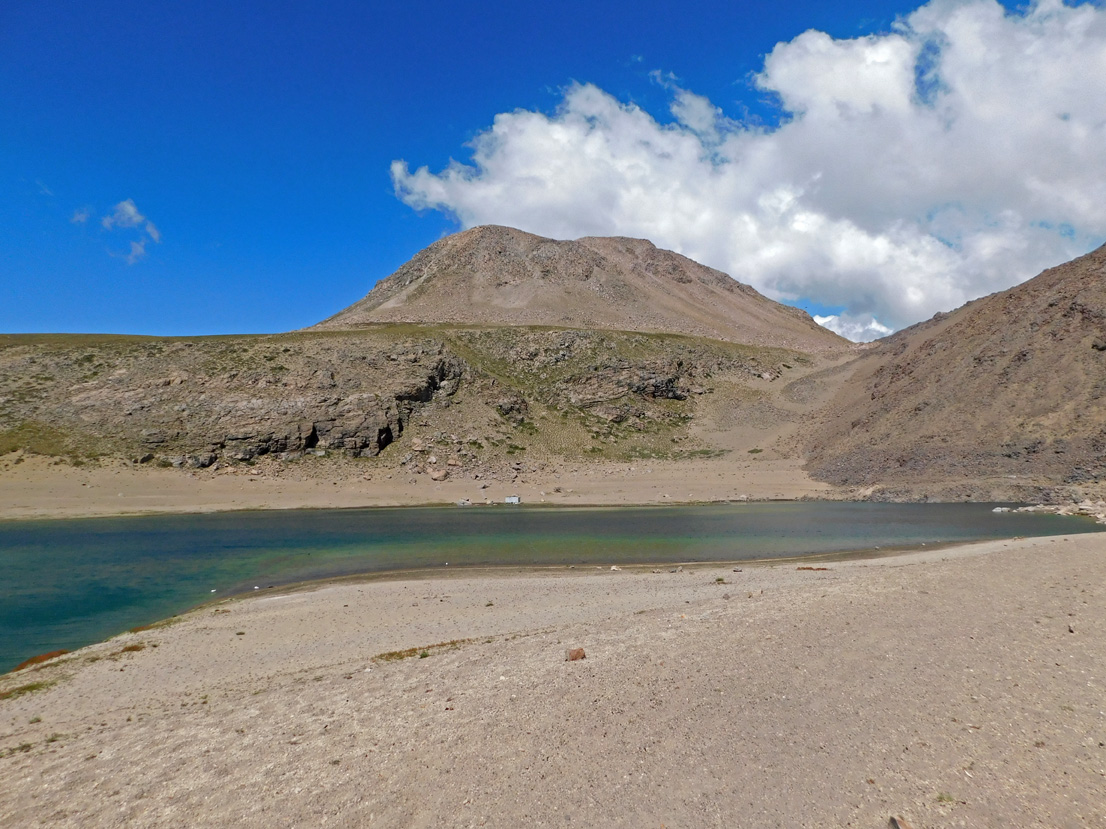
Press release from the Paris Institute of Earth Physics, Piton de la Fournaise Volcanological Observatory, March 25, 2026 – 6:30 PM local time – 2:30 PM UTC
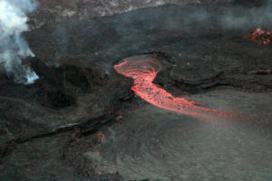
Eruption ended
The eruption that began on February 13, 2026, at 10:00 AM local time ended today, March 25, 2026, around 4:30 PM local time (1:00 PM UTC).
Volcanic tremor showed two successive drops on March 25 at 9:50 AM local time (5:50 AM UTC) and then at 1:45 PM local time (9:45 AM UTC), before returning to a level close to the seismic background noise around 3:00 PM local time (11:00 AM UTC). Residual tremor was then observed until its gradual disappearance from our recordings around 4:30 PM local time (12:30 PM UTC).
No hypothesis is being ruled out regarding the future evolution of the situation (definitive cessation, resumption of activity at the same site, or resumption of activity at another site). In the past, episodes of abrupt cessation of similar eruptions have been observed, where a sudden resumption of eruptive activity occurred after a period of inactivity (for example, during the August-October 2015 eruption).
Furthermore, degassing continues at the eruptive site, and lava flows may remain visible despite the cessation of the eruption, due to the gradual emptying of the lava tubes. The plume associated with the lava flows entering the sea and the fumaroles on the flows can remain active for several days to several weeks after the end of an eruption.
Source : OVPF / IPGP.
Photo : Imaz Press
Italy , Stromboli :
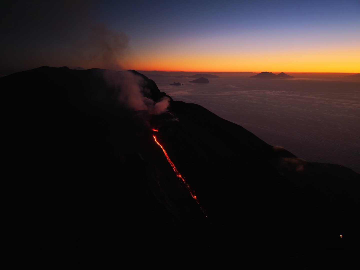
Stromboli Activity Update, March 25, 2026, 8:41 PM (7:41 PM UTC).
The National Institute of Geophysics and Volcanology, Etna Observatory, reports that analysis of surveillance camera images reveals ongoing lava flow activity
in the northern area of the crater, producing a modest lava flow whose front is located in the upper part of the Sciara del Fuoco.
From a seismic perspective, the temporal evolution of the average amplitude of volcanic tremor shows no significant variations, and the values remain, with slight
oscillations, within the average range.
.
No significant changes were observed in the frequency and magnitude of explosion earthquakes.
Analysis of high-frequency GNSS data shows no significant changes.
Further information will be released soon.
Source : INGV.
Photo : Stromboli stati d’animo / Sebastiano Cannavo.
Indonesia , Marapi :
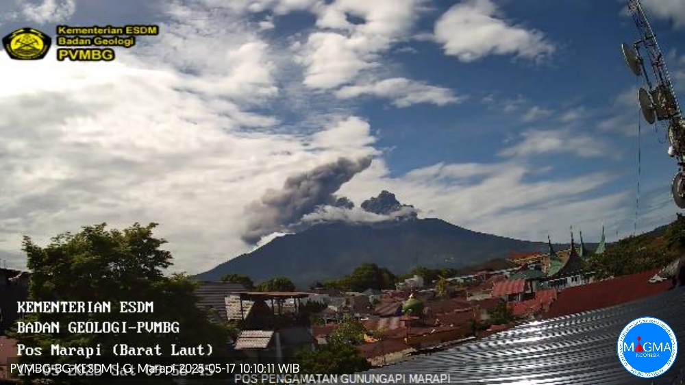
Mount Marapi experienced an eruption on Thursday, March 26, 2026, at 9:56 AM West Indonesian Time (WIB). No visual observations were made. The eruption was recorded by a seismograph with a maximum amplitude of 10 mm and a duration of 22 seconds.
VOLCANO OBSERVATORY NOTICE FOR AVIATION – VONA
Issued : March 26 , 2026.
Volcano : Marapi (261140)
Current Aviation Colour Code : ORANGE
Previous Aviation Colour Code : orange
Source : Marapi Volcano Observatory
Notice Number : 2026MAR040
Volcano Location : S 0 deg 22 min 52 sec E 100 deg 28 min 23 sec
Area : West Sumatra, Indonesia
Summit Elevation : 9251 FT (2891 M)
Volcanic Activity Summary :
Eruption at 02h56 UTC (09h56 local).
Volcanic Cloud Height :
Ash-cloud is not observed.
Other Volcanic Cloud Information :
Ash-cloud is not observed.
Remarks :
Eruption recorded on seismogram with maximum amplitude 10 mm and maximum duration 22 second.
Source et photo : PVMBG.
Chile , Laguna del Maule :
For the evaluated period, volcano-tectonic (VT) seismic activity, associated with rock fracturing within the volcano, increased slightly in the number of recorded events, although the energy released was similar, compared to the previous period.
The most energetic VT event recorded had a local magnitude (ML) of 3.3 and was located 5.1 km west-southwest (WSW) and at a depth of 5.3 km from the center of the lagoon (CDL). Seismic activity associated with fluid movements within the volcano, represented by long-period (LP) events, recorded a similar number to that of the previous period, although with an increase in associated energy.
The most energetic event, measured by its reduced displacement (DR), recorded a value of 25 cm².
The occurrence of four (4) tremor events (TR), associated with sustained fluid dynamics within the volcanic system, is noteworthy. The most energetic event, measured by its reduced displacement (DR), recorded a value of 4 cm².
Furthermore, the occurrence of one (1) hybrid seismic event (HB), associated with both rock fracturing and fluid dynamics within the volcanic system, is also noteworthy. Its energy, measured by its reduced displacement (DR), was 5 cm². The use of interferometric radar (InSAR) with Sentinel-1 images revealed that the uplift process continues with vertical deformation rates similar to those of previous periods, still high relative to the baseline value. Images from monitoring cameras installed near the volcanic complex showed no surface activity. Moreover, processing of the satellite images detected no thermal anomalies associated with the volcanic complex.
Source : Segemar.
Photo : Álvaro Vivanco , Photo taken southwest of the Maule lagoon.
Guatemala , Fuego :
Atmospheric conditions: Clear skies
Wind: West
Rainfall: 0 mm
Activity:
Weak degassing is observed above the crater, reaching an altitude of 600 meters and dispersing to the west and southwest. Strombolian explosions of low, moderate, and high intensity are recorded at a rate of 5 to 7 per hour, generating columns of gas and ash that rise up to 4,800 meters above sea level. Ash is dispersed over a distance of 10 to 20 km to the east and southeast. Streamfall of fine ash is reported in localities on the eastern and southeastern flanks. Ballistic ejecta and fallout of incandescent volcanic material from the explosions are also observed on the western, southern, and southwestern flanks, reaching vegetation.

The explosive activity also generates rumbling, shockwaves, and noises similar to those of an aircraft turbine due to the continuous expulsion of gas. Moderate to strong explosions can generate audible rumbling in Antigua, Alotenango, Amatitlán, San Vicente Pacaya, Escuintla, El Rodeo, Siquinalá, Santa Lucía Cotzumalguapa, Yepocapa, and other locations. During the night and early morning, incandescence is visible in the crater, also manifesting as incandescent pulses reaching heights of 100 to 300 meters.
Source : Insivumeh
Photo : @davidrojasgtfoto