March 24 , 2026.
La Réunion Island , Piton de la Fournaise :
Press release from the Paris Institute of Earth Physics / Piton de la Fournaise Volcanological Observatory, March 24, 2026 – 9:40 a.m. local time – 5:40 a.m. UTC
Eruption in progress
Summary
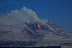
The eruption that began on February 13, 2026, continues. Only one eruptive site remains active on the south-southeast flank. Surface activity is decreasing, with few ejections but ongoing degassing. Only the main southern flow is still being fed and continues to supply a platform to the ocean, whose activity is now primarily tunnel-like. Seismicity and surface deflation show a marked slowdown. Deflation at the base of the cone and on either side of the Enclos Fouqué caldera continues. Eruptive tremor (an indicator of lava and gas flow) showed a sharp decrease between 5:00 a.m. and 7:00 a.m. (local time), but has been stable since. All of these observations suggest a decrease in eruptive activity, which will be confirmed in the coming days.
The lava field forms two main arms, each branching into secondary arms. New Sentinel-1 and PlanetScope satellite images have allowed for a new, detailed mapping of the lava flows as of March 23, 2026.
Over the past 24 hours, only the southern main arm was active. The fronts of the two northern arms remained stationary, located at approximately 660 meters altitude for the northern main arm and 690 meters for the northern secondary arm.
The southern arm, after dividing into several secondary arms, crossed the RN2 highway on March 13 and reached the ocean on March 16.
Several secondary arms also formed downstream of the RN2 before the lava flow reached the ocean. One of these arms eventually reached the sea a few days after the main arm.
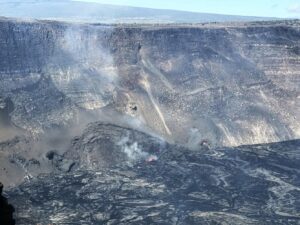
At the point of contact between the lava and the ocean, a platform continues to form and expand, resulting from the accumulation of lava flow and fine particles from lava fragmentation. In recent days, the lava supply to the platform has been lower, and numerous lava tubes have developed within it; the lava is now emerging primarily at the point of contact with the ocean. Small collapses have been observed along the edge of the platform due to wave action.
At this point of contact with the ocean, a gas plume is still present. This plume is mainly composed of water vapor, hydrochloric acid (HCl), and fine particles. When the lava, at a temperature of approximately 1130°C, comes into contact with the sodium chloride-rich ocean water, it generates an acidic aerosol in the form of fine suspended droplets. This plume also contains particles of pulverized lava and fragments of volcanic glass, which can be carried hundreds of meters to kilometers by the wind.
This plume, sometimes called « lava haze, » can be irritating and corrosive to the respiratory tract, skin, and eyes. Its dispersal is highly dependent on local weather conditions. Furthermore, the sudden contact between the lava and the water can generate localized explosions, projecting molten material and jets of high-temperature steam in the immediate vicinity of the point of entry into the sea.
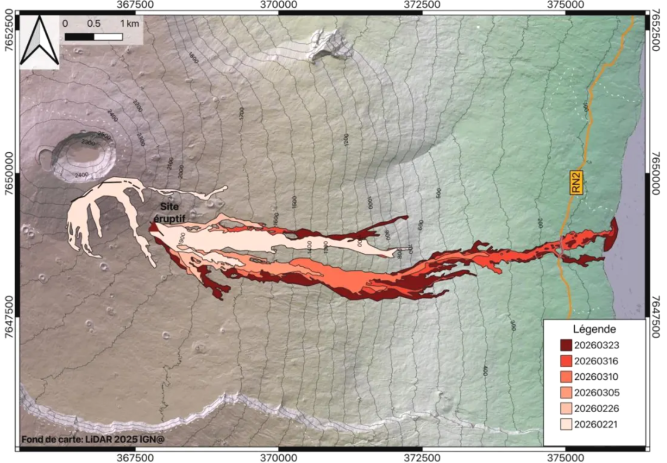
Evolution of the lava field. The outlines were estimated from Sentinel-1, Sentinel-2, and Planet images up to March 23. Eruptive fissures are shown in black, and the current eruptive site is represented by a triangle (© OI²/ISDeform – OSUL, OPGP-LMV, University of Reunion Island, OVPF-IPGP).
Explosions could also occur if the platform becomes destabilized. This platform, composed of an accumulation of lava flows and rock fragments, remains highly unstable and fragile. In the event of sudden destabilization, explosions of varying intensity could occur.
The decrease in seismicity that began on Sunday, March 22, is confirmed, with fewer than 20 earthquakes recorded on March 23.
Deflation observed at the summit GNSS stations shows a marked slowdown. Conversely, baselines located in the more distal field, particularly at the base of the terminal cone and outside the Enclos, indicate the persistence of a deflation signal. This trend will need to be confirmed in the coming days.
Eruptive tremor (an indicator of lava and gas emissions at the surface) showed a significant decrease this morning starting at 5:00 AM (local time, 1:00 AM UTC). The tremor is now stable and has maintained a relatively constant level since 7:00 AM (local time, 3:00 AM UTC), at a level comparable to the lowest point of eruptive activity around February 19, 2026 (2 μm/s at the FOR station).
No reliable satellite measurements of lava flow rates could be taken in the last 24 hours due to inclement weather.
Alert Level 2.2
Source : OVPF / IPGP.
Photos : Ludovic Leduc , OVPF.
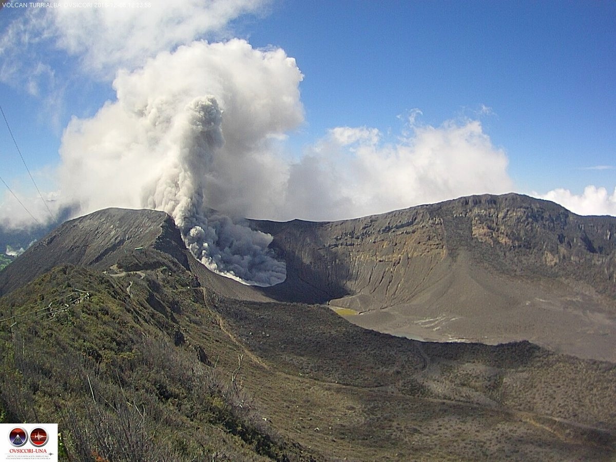
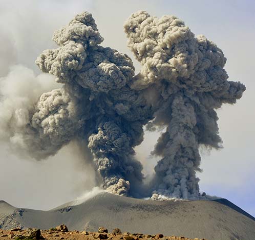
Costa Rica , Turrialba :
ERUPTION REPORT – OVSICORI-UNA
Coordinates: N10.02 W83.76
Mountain Altitude: 3325 m
Date: 22/03/2026 Time: 12:03
Plume Height: Unknown
Source of Plume Observation: Seismograph recordings, infrasonic acoustic sensors, and initial report from Turrialba Volcano National Park officials.
Observed Activity:
Today at 12:03 PM, seismographs and infrasonic sonic sensors detected a volcano-tectonic signal at Turrialba Volcano, followed one minute later by a signal associated with a landslide in the area of the active crater. Officials from Turrialba Volcano National Park informed OVSICORI-UNA at 12:04 PM that they had heard a loud explosion and smelled sulfur at the summit. No ashfall was reported, only a sulfur odor detected near the active crater.
The prevailing wind is blowing from the north.
Activity Level: Alert
Source et photo : Ovsicori .
New Zealand , White Island :
Small eruption at Whakaari/White Island. Volcanic Alert Level raised to 3 and Aviation Colour Code to Orange. Published: Tue Mar 24 2026 7:00 PM
A small volcanic eruption occurred at Whakaari/White Island at 5:35 PM this evening. The Volcanic Alert Level is raised to 3 and the Aviation Colour Code to Orange.
A small volcanic eruption occurred at Whakaari/White Island at 5:35 PM this evening. The eruption was observed from our mainland cameras (Whakatāne and Te Kaha ) as single slug of dark grey volcanic ash that rose to about 1300m elevation over 2 minutes (see image below). An ash plume then drifted to the west. No further activity has been observed.
The eruption plume was also observed on satellite data by Metservice.
In recent weeks, Whakaari/White Island has had minor eruptive activity interspersed with quiet steam emission.
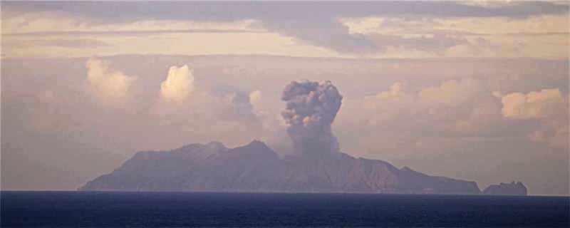
Still image from the video from our Whakatāne camera, about one minute after the eruption occurred.
Due to the small eruption we have increased the Volcanic Alert Level to 3 (minor volcanic activity) and Aviation Colour Code to Orange. While eruptive activity has ceased for now, volcanic activity could re-escalate with little or no warning. Further sudden, more explosive events could therefore affect the crater floor and immediate vicinity of the island, although ashfall affecting the mainland remains unlikely.
The Earth Sciences New Zealand’s Volcano Monitoring Group and National Geohazards Monitoring Centre will continue to closely monitor Whakaari/White Island for any changes in activity. Without sensors on the island, our monitoring continues to rely on remote cameras, satellite imagery, and periodic observation and gas flights to monitor Whakaari/White Island. We will provide further updates when information becomes available.
Source : Geonet / Steve Sherburn / Duty Volcanologist
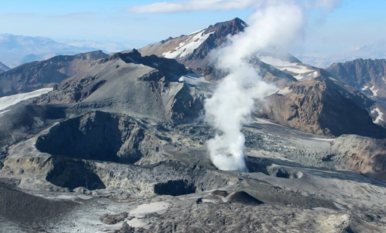
Chile , Planchón-Peteroa :
For the period under review, volcano-tectonic (VT) seismic activity, associated with rock fracturing within the volcano, showed similar values, both in terms of the number of recorded events and energy release levels, compared to the previous period.
The most energetic recorded VT event had a local magnitude (ML) of 2.3 and was located 2.0 km north-northwest (NNW) of the volcanic edifice, at a depth of 6.2 km from the active crater.
Seismic activity associated with fluid movement within the volcano, represented by long-period (LP) earthquakes and tremors (TR), remained stable, both in terms of the number of recorded events and energy release levels, compared to the previous period. The maximum energy released during LP events, recorded via reduced displacement (DR), was 8 cm². For TR events, the maximum DR value was 9 cm².
Notably, during the evaluated period, a very long period (TLP) event was recorded, associated with fluid dynamics within the deep volcanic system. This event exhibited a DR value of 2 cm². Furthermore, the energy of the continuous tremor signal, recorded from the RSAM value and associated with sustained fluid dynamics within the volcano, continues to show a downward trend, although the values remain significantly above their baseline levels.
Future changes cannot be ruled out. During this two-week period, low-altitude, whitish degassing columns were repeatedly recorded at the summit of the volcano. The maximum recorded column height was 340 m above the crater on March 11. Notably, no nighttime incandescence or pyroclastic material (volcanic ash) emissions were recorded during this period.
During the evaluated period, satellite data processing revealed no anomalies in sulfur dioxide (SO₂) emissions near the volcanic edifice. Satellite image analysis during this period detected six (6) low-magnitude thermal anomalies using the VIIRS375 satellite, with a maximum radiative power (MRP) of 0.5 MW on March 12. Geodetic monitoring did not record any significant changes related to volcanic activity during this period. Morphological analysis, based on PlanetScope and Sentinel-2 L2A satellite imagery, revealed that the emission of gas and water vapor from the Southwest Crater is continuous. Furthermore, no emissions or deposition of pyroclastic material were recorded during this two-week period.
Source : Segemar .
Photo : Sernageomin.
Peru , Sabancaya :
Local date and time: March 23, 2026 – 11:28 AM
Bulletin analysis period: March 16-22, 2026
Volcanic alert level
Orange alert level: The volcano’s eruptive activity has increased significantly. Increased seismic activity, frequent explosions, and emissions of ash and ballistic fragments have been observed.
Conclusions:
The IGP (Geophysical Institute of Peru) reports that the eruptive process of the Sabancaya volcano continues. During this period, two volcanic explosions were detected, generating columns of ash and gas up to 2,000 meters above the volcano’s summit, in addition to seismic activity associated with the movement of magmatic fluids and internal fracturing. Therefore, the volcanic alert level remains orange.
Recommendations:
Take preventative measures in accordance with the current orange volcanic alert level.
Do not approach within 12 km of the crater. In case of ashfall, cover your nose and mouth with damp cloths or a mask. Keep doors and windows closed.
Stay informed about Sabancaya’s volcanic activity through reports and bulletins published by the IGP (Geneva Institute of Public Health).
Outlook:
The occurrence of future volcanic explosions generating eruptive columns over 2 km high is considered likely, with a risk of impact on districts in the Colca Valley and surrounding areas due to the dispersal of volcanic ash. Therefore, the volcanic alert level remains orange.
Source : Cenvul .
Photo : IGP.