July 21 , 2026.
Indonesia , Lewotobi Laki-laki :
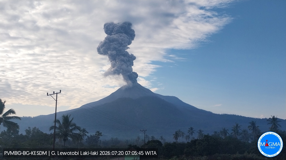
An eruption of Mount Lewotobi Laki-laki occurred on Monday, July 20, 2026, at 07:03 WITA, with an ash column reaching a height of approximately 1,600 m above the summit (or about 3,184 m above sea level). The observed ash column was gray and dense, drifting towards the north and northeast. The eruption was recorded by the seismograph with a maximum amplitude of 29.5 mm and a duration of 165 seconds.
Seismic observations
3 eruption earthquakes with amplitudes of 11.8–47.3 mm and durations of 46–147 seconds.
2 emission earthquakes with amplitudes of 3.7–4.4 mm and durations of 33–38 seconds.
6 episodes of non-harmonic tremor with amplitudes of 2.9–7.4 mm and durations of 70–152 seconds.
2 low-frequency earthquakes with an amplitude of 7.4 mm and durations of 24–25 seconds.
Recommendations
1. Communities located near Mount Lewotobi Laki-laki, as well as visitors and tourists, must not conduct any activities within a 5 km radius of the Mount Lewotobi Laki-laki eruption center.
2. The public is advised to remain calm, follow the instructions of local authorities, and disregard information from unverified sources.
Source et photo : PVMBG.
Costa Rica , Poas :
OVSICORI-UNA Weekly Volcanic Monitoring Bulletin, July 17, 2026
Latitude: 10.20°N;
Longitude: 84.23°W;
Elevation: 2,687 m above sea level.
Current activity level: Advisory
A very small eruption (infrasonic magnitude of 1) was recorded this week, on July 15 at 19:00. It could not be observed due to darkness. Tremor amplitude had gradually decreased over the previous week and increased following the eruption. Tremor amplitude remains high. The number of long-period events had increased last week following the July 4 eruption but has decreased again in recent days. No volcano-tectonic earthquakes were recorded this week. The geodetic network indicates subsidence of the volcano, as well as slight contraction around the crater.
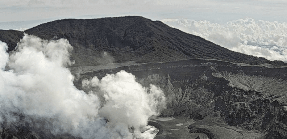
No significant change in the SO2/CO2 ratio is reported; values were close to 1.4 last week and close to 1.7 this week, with both figures falling within the margin of error of one another. The H2S/SO2 ratio continues to show values below 0.1. NOVAC stations recorded 211 ± 60 metric tons of SO2 per day,
a flux comparable to that of the previous week (215 ± 49 t/d).
Source et photo : Ovsicori
Peru , Sabancaya :
Local date and time: July 20, 2026 – 12:42 PM
Bulletin analysis period: July 13 to 19, 2026
Volcanic alert level
Orange alert level: The volcano is showing a significant increase in eruptive activity. Heightened seismic activity, frequent explosions, and emissions of ash and ballistic blocks have been observed.
Conclusions
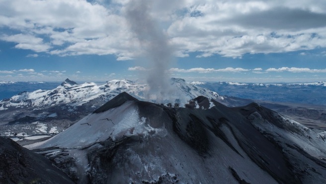
The IGP reports that the eruptive process at Sabancaya volcano is ongoing. No volcanic explosions were detected during this period; however, emissions of water vapor, ash, and gas reaching up to 1,000 m above the summit were observed, alongside seismic activity linked to the movement of magmatic fluids and internal fracturing. Consequently, the volcanic alert level remains at orange.
Recommendations
Adopt prevention and preparedness measures consistent with the current orange volcanic alert level.
Do not approach within 12 km of the crater. In the event of ashfall, cover your nose and mouth with damp cloths or masks. Keep doors and windows of homes closed.
Stay constantly informed about Sabancaya’s volcanic activity through reports and bulletins published by the IGP.
Outlook
Volcanic explosions generating eruption columns exceeding 2 km in height are considered likely. These could affect districts in the Colca Valley and surrounding areas through the dispersal of volcanic ash; the volcanic alert level is therefore maintained at orange.
Source : Cenvul
Photo : IGP.
Alaska , Shishaldin :
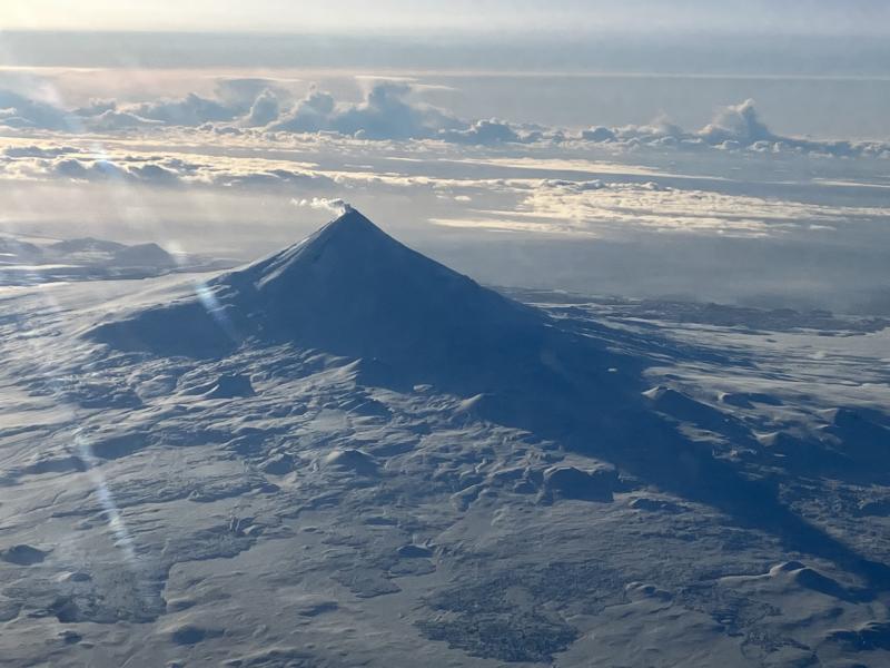
Minor seismicity and infrasound were detected at the volcano over the past day. A sulfur dioxide gas plume was observed southeast of the volcano in satellite data. A few clear web cam images from yesterday showed steaming at the summit. Cloudy conditions obscured other satellite and webcam observations.
Local seismic and infrasound sensors, web cameras, and a geodetic network are used to monitor Shishaldin Volcano. In addition to the local monitoring network, AVO uses nearby geophysical networks, regional infrasound and lightning data, and satellite images to detect eruptions.
Source : AVO
Photo : Beesley, Nick.
Guatemala , Santiaguito :
Weather conditions: Clear skies
Wind: Northeasterly
Precipitation: 5.3 mm
Volcanic activity
White degassing is observed above the Caliente dome; fumaroles are rising to an altitude of 600 meters and dispersing towards the west and southwest. Low- to moderate-intensity explosions are occurring at a rate of 1 to 3 per hour, propelling gas and ash columns up to 800 meters above the dome in the same direction. Incandescence was recorded in the crater during the night and early morning, accompanied by collapses and the descent of incandescent blocks along the flanks.
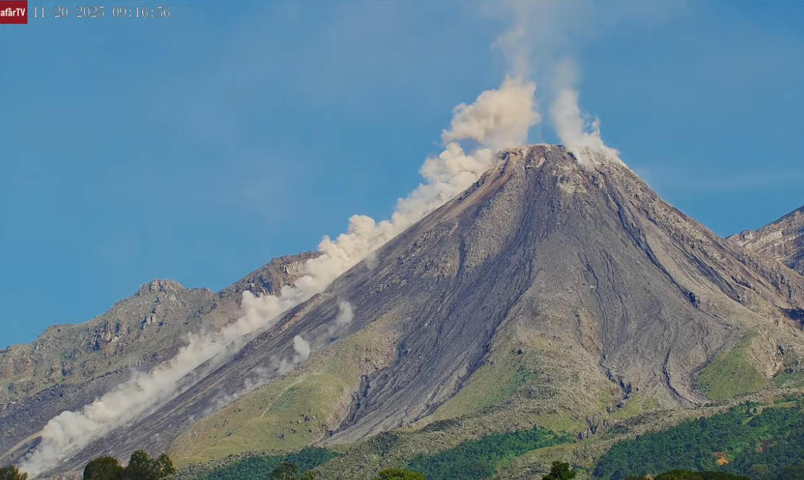
Given the high level of activity and the risk of major collapses, the formation of long-range pyroclastic density currents in any direction cannot be ruled out; it is therefore recommended to follow the guidelines in special bulletin BESAN-002-2026. Furthermore, rainfall could mobilize material accumulated in ravines and riverbeds, triggering lahars during the afternoon and evening. It is advised to avoid ravines and riverbeds and to strictly adhere to the instructions in special bulletin BESAN-016-2026.
Source : Insivumeh
Photo : Afar TV.