July 12 , 2026.
Hawaii , Kilauea :
HAWAIIAN VOLCANO OBSERVATORY DAILY UPDATE , U.S. Geological Survey
Saturday, July 11, 2026, 9:09 AM HST (Saturday, July 11, 2026, 19:09 UTC)
19°25’16 » N 155°17’13 » W,
Summit Elevation 4091 ft (1247 m)
Current Volcano Alert Level: ADVISORY
Current Aviation Color Code: YELLOW
Summary:
Kīlauea volcano is erupting small precursory spatter bursts. Forecasts based on summit inflation indicate another lava fountaining episode is likely between now and July 13.
Overview:
The Kīlauea summit eruption within Halemaʻumaʻu crater is erupting small bursts of precursory spatter. Overnight webcam views showed strong glow and spatter from the north vent, and variable glow from the south vent. The summit recorded inflationary tilt over the past day but flattened around 4:00 a.m. HST this morning and then shifted to deflation in the past few hours. Current forecast models suggest that lava fountaining episode 51 is likely to start between now and July 13, but most likely today or tomorrow. However, if the current deflation is sustained, then Monday, July 13 is more likely.
No significant activity has been noted along Kīlauea’s East Rift Zone or Southwest Rift Zone.
Summit Observations:
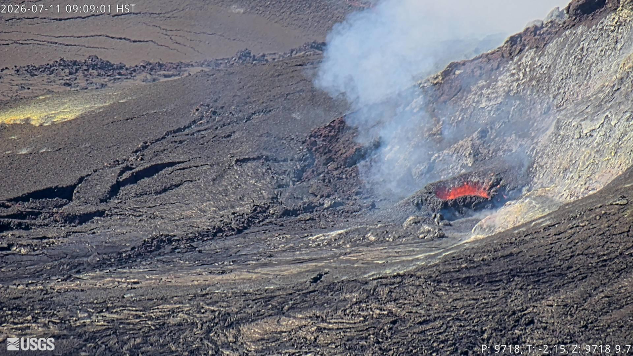
Strong glow was visible from the north vent overnight, with nearly continuous spatter starting around midnight. The north vent spattering has become less vigorous this morning following the start of slow summit deflation. The accumulation of spatter landing around the north vent rim has built up a small cone around the vent. Glow from the south vent was dim most of the night but was punctuated by periods of bright glow after 3:00 a.m. HST. The bright glow correlated with spikes in tremor and appears to mark the onset of gas piston activity in the south vent. One of these periods produced visible spatter early this morning.
Continuous, low-level seismic tremor transitioned to cyclic tremor bursts every 5-10 minutes around 3:00 a.m. HST. These spikes appear to mark drainback events associated with gas piston cycles in the south vent. Earthquake activity beneath Kaluapele (Kīlauea caldera) remains low.
Kīlauea summit has recorded inflationary tilt over much of the past few days, however, starting around 4:00 a.m. HST this morning the tilt flattened followed by slight deflation over the past few hours. Several deflationary trends have interrupted the overall inflationary pattern following episode 50, and the current deflation may push back the eruption forecast window if it continues. Tilt recovery since the end of episode 50 presently stands at about 15.3 microradians on the Uēkahuna (UWD) tiltmeter, an increase of 1.2 microradians since yesterday morning. Summit deflation totaled 15.3 microradians on UWD during episode 50.
The sulfur dioxide (SO2) emission rate from the summit is likely now varying within a typical range of 1,000 to 5,000 tonnes per day.
Rift Zone Observations:
Rates of seismicity and ground deformation remain low in the East Rift Zone and Southwest Rift Zone. SO2 emissions from the East Rift Zone remain below the detection limit.
Source : HVO
Kamchatka , Krasheninnikov :
KVERT VOLCANIC ACTIVITY NOTICE (VAN)
Issued: July 12 , 2026
Volcano: Krasheninnikov (CAVW #300190)
Current aviation colour code: YELLOW
Previous aviation colour code: yellow
Source: KVERT
Notice Number: 2026-72
Volcano Location: N 54 deg 36 min E 160 deg 16 min
Area: Kamchatka, Russia
Summit Elevation: 1856 m (6087.68 ft)
Volcanic Activity Summary:
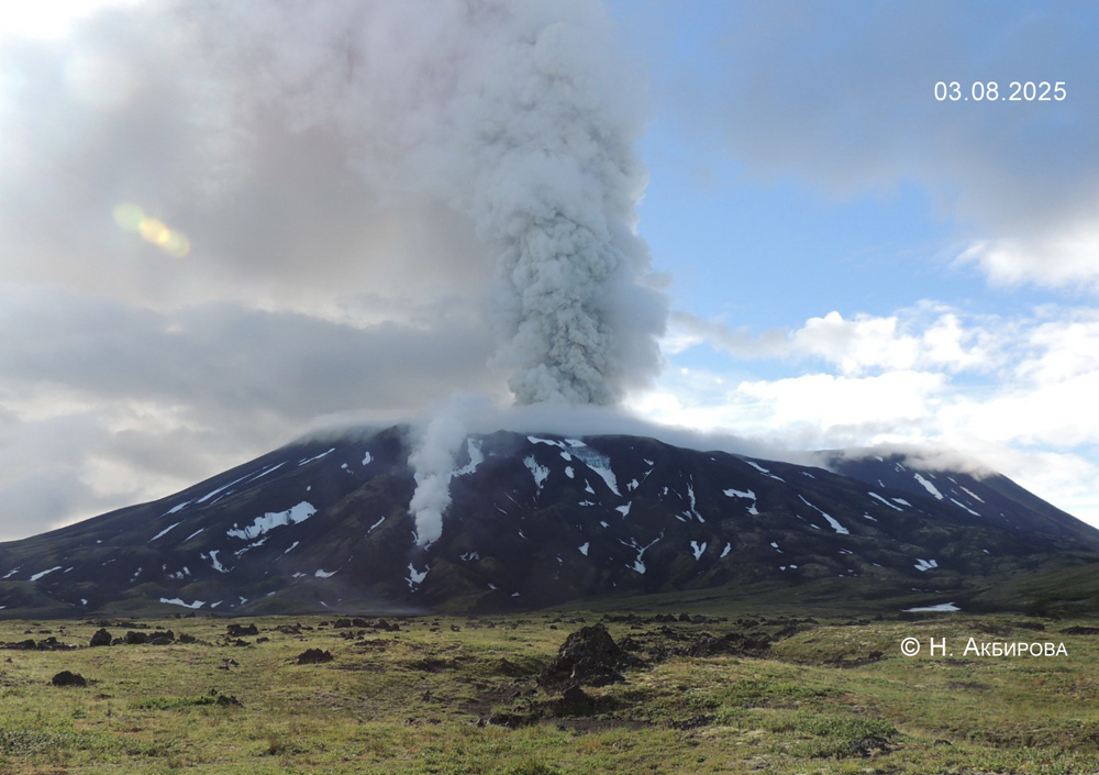
The effusive eruption of the volcano continues: lava flows are effusing to the eastern slope of the Northern Cone of the volcano, and a gas-steam emission from this Cone is observing. Satellite data by KVERT showed a large thermal anomaly on the volcano all week. A plume of resuspended ash on 11-12 July extended 60 km to the south-southeast of the volcano. A height of a plume is unknown.
The effusive eruption of the volcano continues. The danger of ash explosions up to 6 km (19,700 ft) a.s.l. remains. Ongoing activity could affect low-flying aircraft.
Volcanic cloud height: NO ASH CLOUD PRODUCED
Other volcanic cloud information: NO ASH CLOUD PRODUCED
Source : Kvert.
Photo : N. Akbirova , 3/8/2025.
Indonesia , Lewotobi Laki-laki :
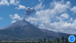
An eruption of Mount Lewotobi Laki-laki occurred on Saturday, July 11, 2026, at 08:12 WITA, with an ash column reaching a height of approximately 1,000 meters above the summit (or about 2,584 meters above sea level). The observed ash column was gray and dense, drifting towards the north and northeast. The eruption was recorded by the seismograph with a maximum amplitude of 44.4 mm and a duration of 94 seconds.
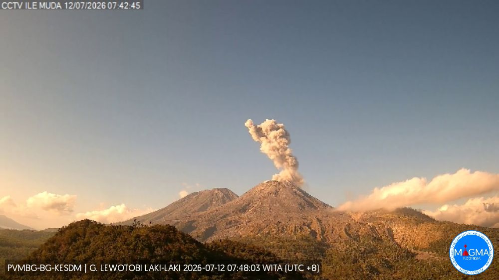
Seismic observations
3 eruption earthquakes with amplitudes of 11–22.2 mm and durations of 37–143 seconds.
2 emission earthquakes with amplitudes of 5.1–5.9 mm and durations of 37–50 seconds.
1 non-harmonic tremor with an amplitude of 5.9 mm and a duration of 92 seconds.
1 low-frequency earthquake with an amplitude of 4.4 mm and a duration of 22 seconds.
1 distant tectonic earthquake with an amplitude of 7.4 mm and a duration of 72 seconds.
Recommendations
1. Communities living near Mount Lewotobi Laki-laki, as well as visitors and tourists, must not engage in any activities within a 5 km radius of the Mount Lewotobi Laki-laki eruption center.
2. The public is advised to remain calm, follow instructions from local authorities, and disregard rumors from unverified sources.
Source et photo : PVMBG.
Colombia , Chiles / Cerro Negro :
San Juan de Pasto, July 7, 2026, 6:20 PM
Based on monitoring of the Chiles-Cerro Negro volcanic complex (CVCCN), the Colombian Geological Service (SGC)—an agency under the Ministry of Mines and Energy—
reports the following information:
For the period from June 30 to July 6, 2026, the main changes in monitored parameters compared to the previous week were as follows:
● Amidst fluctuating seismic activity, a slight increase in the number of events was recorded, while the energy released decreased. Seismicity associated with rock fracturing processes remains predominant, followed by activity linked to fluid dynamics.
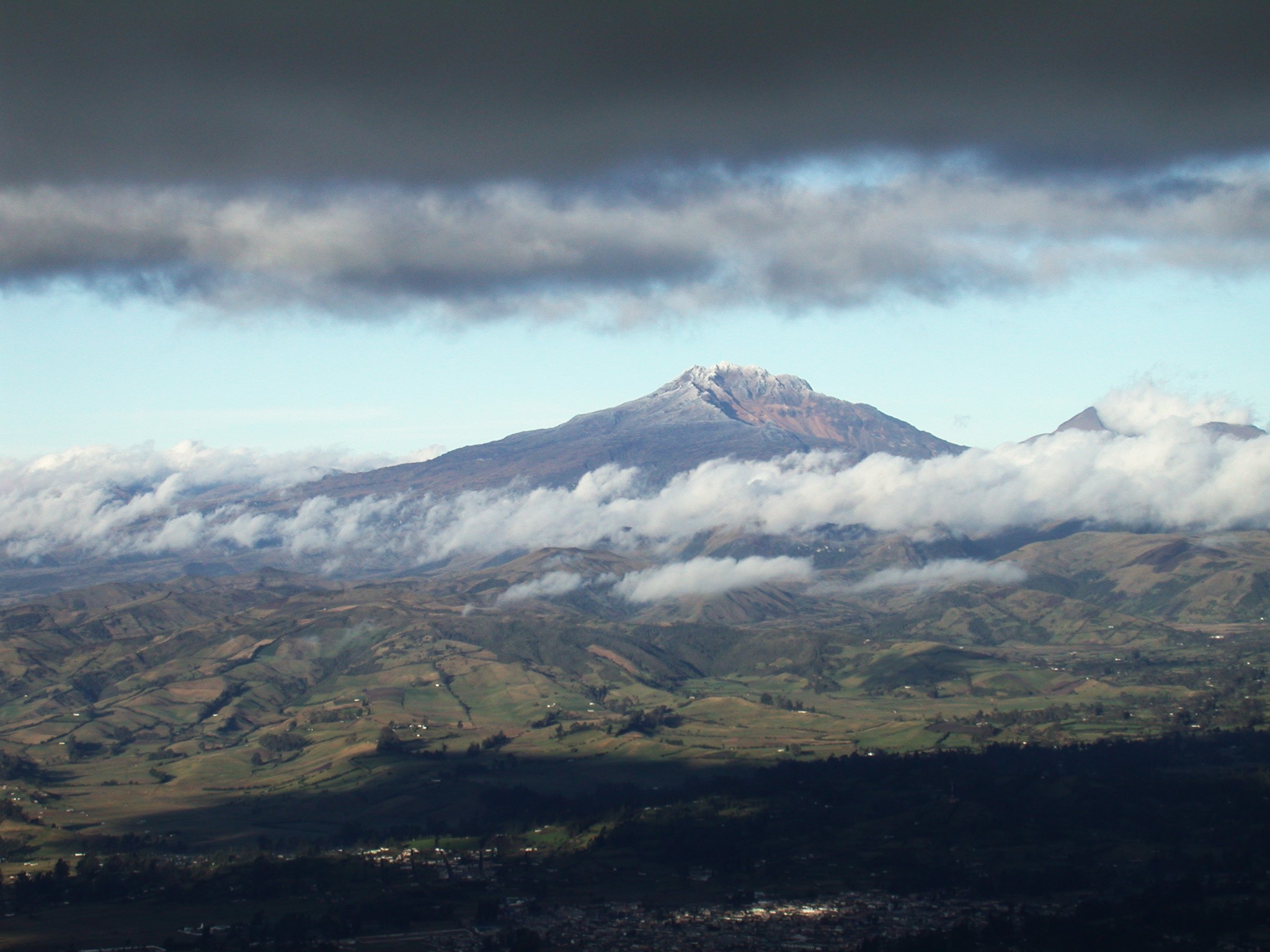
● The earthquakes were distributed around the volcanic edifice at depths ranging from 2 to 10 km below the summit of Chiles Volcano (4,700 meters above sea level), at distances of up to 9 km, and with a maximum magnitude of 1.8. None of the recorded earthquakes were felt by local populations.
● Analysis of data from satellite sensors and ground-based stations continued to show variations associated with deformation processes in the volcanic area.
Based on the assessment and correlation of monitored parameters, the SGC recommends closely following the situation’s evolution via weekly bulletins and other information published through our official channels, as well as adhering to the guidelines issued by local and departmental authorities and the National Unit for Disaster Risk Management (UNGRD).
Volcanic activity remains at the yellow alert level: an active volcano showing changes in the baseline behavior of monitored parameters and other manifestations.
Source et photo : SGC.
Costa Rica , Rincon de la Vieja :
Latitude: 10.83° N;
Longitude: 85.34° W;
Elevation: 1,916 m above sea level.
Current activity level: Alert.
Twenty-three small phreatic eruptions were recorded this week. The event with the greatest amplitude occurred on July 6 at 8:23 PM. The number of events decreased after July 6, and the last eruption was recorded on July 8 at 5:47 PM. None of these events triggered lahars. Background tremor showed a shift in frequency range: low frequencies (1–3 Hz) disappeared starting July 2, and high-frequency tremor (3–5 Hz) predominated up to the time of writing this report. The
eruptions began simultaneously with the disappearance of the low-frequency tremor. A distal volcano-tectonic earthquake was detected, along with sporadic long-period and « tornillo »-type signals.
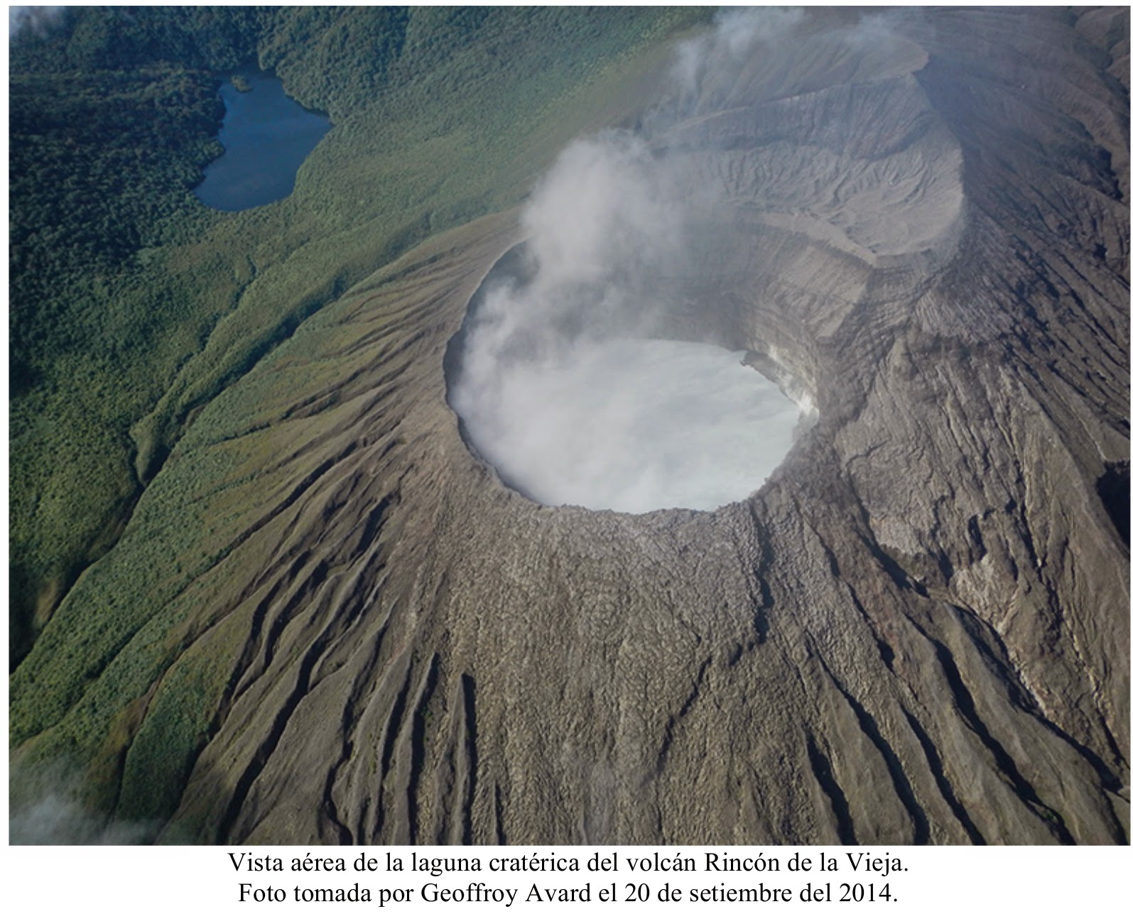
The geodetic network detected no clear deformation pattern, aside from slight extension and summit uplift. The MultiGAS station continues to record low volcanic gas concentrations. This week, NOVAC stations recorded an SO2 flux (293 ± 158 t/d) very similar to that of the previous week (292 ± 115 t/d). The most recent detection of atmospheric SO2 from Rincón de la Vieja volcano by the Sentinel satellite occurred on September 7, 2025. The Santuarium-Sensoria thermal spring, located approximately 4 km north of Rincón’s active crater, recorded a temperature of 34.8°C on July 7, 2026—a value similar to the average temperature of 31.9°C observed since 1989.
On July 8, the boiling water and mud pool (P1), located in the Las Pailas sector of Rincón de la Vieja National Park (PNVRV) southwest of the volcano, recorded a temperature above the boiling point of water: 101°C.
Source et photo : Ovsicori .