July 11 , 2026.
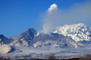
Kamchatka , Sheveluch :
KVERT VOLCANIC ACTIVITY NOTICE (VAN)
Issued: July 10 , 2026
Volcano: Sheveluch (CAVW #300270)
Current aviation colour code: ORANGE
Previous aviation colour code: red
Source: KVERT
Notice Number: 2026-71
Volcano Location: N 56 deg 38 min E 161 deg 19 min
Area: Kamchatka, Russia
Summit Elevation: 3283 m (10768.24 ft), the dome elevation ~2500 m (8200 ft)
Volcanic Activity Summary:
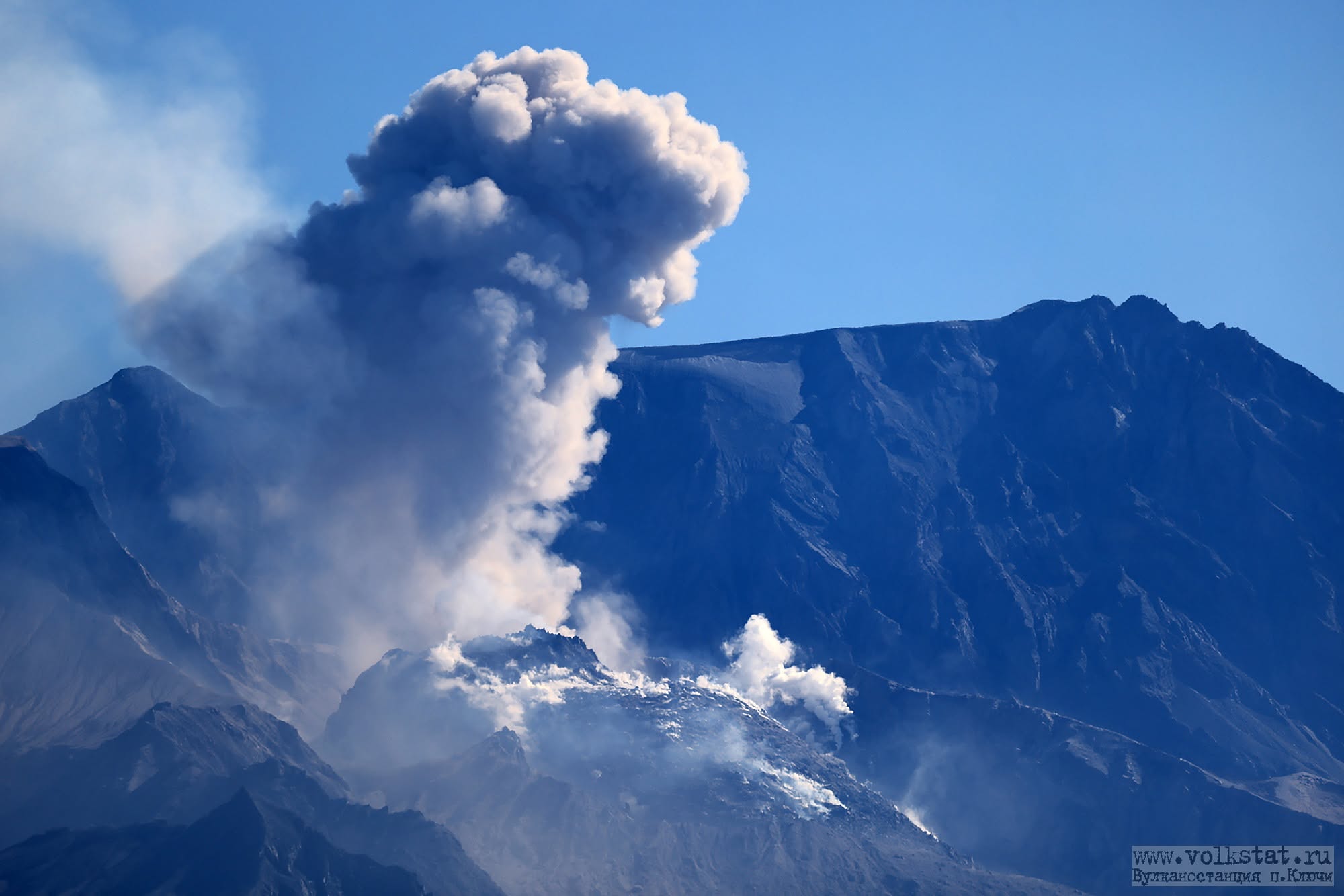
The explosive-extrusive eruption of the volcano continues, accompanied by powerful gas-steam activity; a new block of lava continues to grow in the northern part of the lava dome. No new ash explosions have been observing on the volcano at now, but ash cloud 440×62 in size (from ash explosions up to 10.5-11 km a.s.l., start 21:43 UTC on 09 July) was observing from 885 km to the southwest (azm 218 degrees) of the volcano.
The explosive-extrusive eruption of the volcano continues. Ash explosions up to 12 km (39,400 ft) a.s.l. could occur at any time. Ongoing activity could affect international and low-flying aircraft.
Volcanic cloud height: NO ASH CLOUD PRODUCED
Other volcanic cloud information: NO ASH CLOUD PRODUCED
Source : Kvert.
Photo : volkstat ru.
Indonesia , Anak Krakatau :
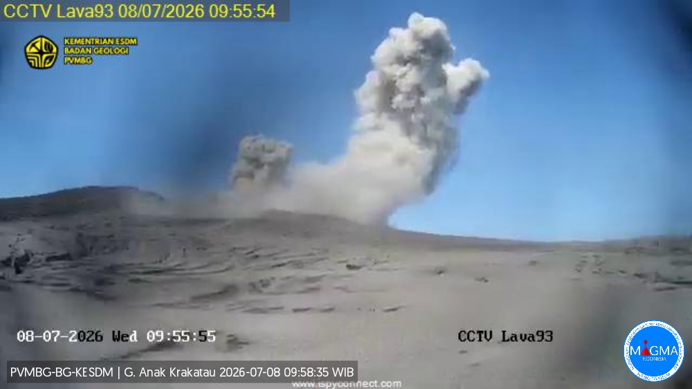
An eruption of Mount Anak Krakatau occurred on Friday, July 10, 2026, at 4:57 p.m. (Western Indonesia Time), with an ash column reaching a height of approximately 200 m above the summit (or about 357 m above sea level). The observed ash column was black and dense, drifting towards the north, northeast, and northwest. The eruption was recorded by the seismograph with a maximum amplitude of 44.3 mm and a duration of 40 seconds.
Seismic observations
4 emission earthquakes with amplitudes of 13–22 mm and durations of 22–75 seconds.
4 low-frequency earthquakes with amplitudes of 11–21 mm and durations of 5–7 seconds.
5 hybrid/multiphase earthquakes with amplitudes of 10–24 mm and durations of 7–22 seconds.
1 episode of continuous tremor with an amplitude of 2–15 mm (dominant amplitude of 3 mm).
Recommendations
The public, visitors, tourists, and hikers must not approach Mount Anak Krakatau or engage in activities within a 3 km radius of the active crater.
Source et photo : PVMBG.
Colombia , Puracé – Los Coconucos volcanic chain :
Popayán, July 7, 2026, 1:00 PM
Based on monitoring of the activity of the Puracé volcano and the Los Coconucos volcanic chain, the Colombian Geological Service (SGC)—an entity attached to the Ministry of Mines and Energy—reports the following information:
During the week of June 30 to July 6, 2026, behavior similar to that recorded in previous weeks was observed. Seismic activity associated with fluid movements (gases and liquids derived from magma and their interaction with the hydrothermal system) persists beneath the Puracé volcano crater, at depths of less than 3 km. The number of daily ash emissions decreased, and the associated plumes dispersed toward the northwest, reaching a maximum height of 600 m above the volcano’s summit.
On July 4, reports of ashfall were received from the rural locality of Cristales, in the municipality of Puracé.
Meanwhile, seismicity associated with rock fracturing (VT) remained comparable to that of the previous week, in terms of both frequency and released seismic energy. These earthquakes were primarily located between the Puracé and Piocollo volcanoes, at depths ranging from 1 to 3 km, with magnitudes below 1.
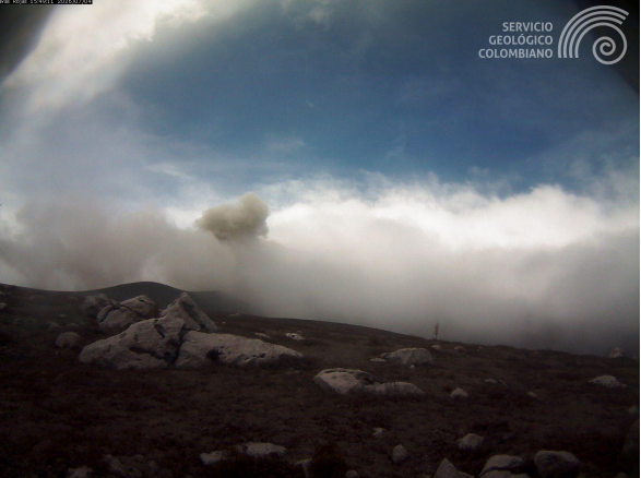
Image from the Lavas Rojas camera, located 2 km west of Puracé volcano, showing an ash emission on July 4, 2026, at 10:49 AM.
Images captured by webcams (visible and infrared spectra) have continued to show thermal anomalies at the fumarole field located on the outer rim of the Puracé volcano crater, as well as degassing phenomena at the craters of the Puracé and Curiquinga volcanoes. Sulfur dioxide (SO2) emissions into the atmosphere are also continuing. The slow deformation process previously recorded in the area between the Puracé, Piocollo, and Curiquinga volcanoes persists.
In conclusion, the variations observed at Puracé volcano—part of the Los Coconucos volcanic chain—indicate that the system continues to evolve; further ash emissions and fallout are possible, with their dispersion determined by prevailing wind directions.
Furthermore, a change in volcanic activity that could lead to more energetic surface manifestations cannot be ruled out. The public is advised not to visit the upper reaches of the volcanic chain and to stay informed through official SGC reports.
The volcanic alert level remains at « Yellow »: an active volcano showing changes in the baseline behavior of monitored parameters, as well as other manifestations.
Source et photo : SGC.
Hawaii , Kilauea :
HAWAIIAN VOLCANO OBSERVATORY DAILY UPDATE , U.S. Geological Survey
Friday, July 10, 2026, 9:01 AM HST (Friday, July 10, 2026, 19:01 UTC)
19°25’16 » N 155°17’13 » W,
Summit Elevation 4091 ft (1247 m)
Current Volcano Alert Level: ADVISORY
Current Aviation Color Code: YELLOW
Summary:
Kīlauea volcano is not erupting. Forecasts based on summit inflation indicate another lava fountaining episode is likely between July 11 and 13.
Overview:
The Kīlauea summit eruption within Halemaʻumaʻu crater is paused. Overnight webcam views showed strong glow at both the north and south eruptive vents, and rare spatter from the north vent. The summit continued to record inflationary tilt over the past day. Current forecast models suggest that lava fountaining episode 51 is likely to start between July 11 and 13.
No significant activity has been noted along Kīlauea’s East Rift Zone or Southwest Rift Zone.
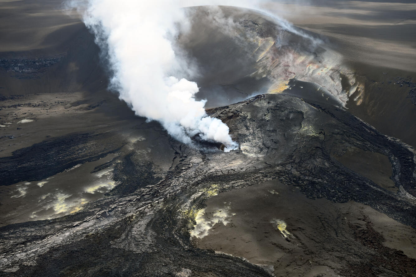
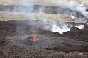
On Tuesday, July 7, USGS Hawaiian Volcano Observatory geologists completed a brief monitoring helicopter overflight of Halema‘uma‘u crater at the summit of Kīlauea. They captured photos to construct a three-dimensional digital elevation model of the crater, and they overflew the eruptive vents to check for lava; an active lava pond deep was visible deep within the south vent, but no lava was visible within the north vent. This overview photo of the vent complex was captured looking to the south-southwest, with the north vent apparent near the center of the frame and the south vent obscured by the plume behind.
Summit Observations:
Strong glow was continuously visible from both the north and south vents overnight, along with rare spatter from the north vent, indicating the magma column is relatively high in both vents.
Low-level seismic tremor continues during the current pause with occasional bursts, likely in association with gas piston cycles in the eruptive vents. Earthquake activity beneath Kaluapele (Kīlauea caldera) remains low.
Kīlauea summit has recorded inflationary tilt over the past two days, but deflationary trends have interrupted the overall inflationary pattern following episode 50. Tilt recovery since the episode presently stands at about 14.1 microradians on the Uēkahuna (UWD) tiltmeter, an increase of 2 microradians since yesterday morning. Summit deflation totaled 15.3 microradians on UWD during episode 50.
The sulfur dioxide (SO2) emission rate from the summit is likely now varying within a typical range of 1,000 to 5,000 tonnes per day.
Rift Zone Observations:
Rates of seismicity and ground deformation remain low in the East Rift Zone and Southwest Rift Zone. SO2 emissions from the East Rift Zone remain below the detection limit.
Source : HVO.
Photo : USGS / E. Gallant.
Costa Rica , Poas :
OVSICORI-UNA Weekly Volcanic Monitoring Bulletin, July 10, 2026
Latitude: 10.20° N;
Longitude: 84.23° W;
Elevation: 2,687 m above sea level.
Current activity level: Alert
A small-scale eruption (infrasonic magnitude of 2) was recorded this week, on July 4 at 05:00. It could not be visually observed due to cloud cover. Tremor amplitude had increased significantly over the preceding week before dropping sharply two days prior to the eruption. This suggests a process of conduit obstruction and pressure buildup, leading to the observed eruption. Tremor amplitude remains high, although it has decreased compared to last week. Following the eruption, the spectral content of the tremor gradually shifted toward higher frequencies (~2 Hz). The number of long-period events increased in the 12 hours leading up to the eruption and continued to rise thereafter. Similarly, the number of high-frequency events increased this week following the eruption.
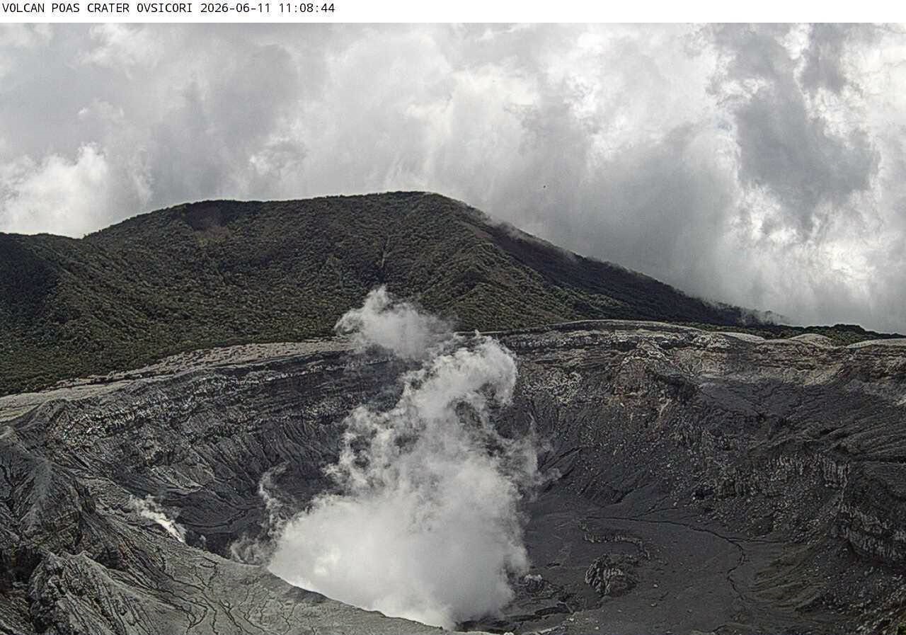
Two distal volcano-tectonic earthquakes were recorded this week on the southern flank at depths of 2.5 and 8.5 km below sea level, with local magnitudes of 1.9 and 1.6, respectively. The geodetic network indicates volcanic subsidence and slight contraction around the crater. A slight increase in the SO2/CO2 ratio was recorded, rising from values near 1.2 the previous week to values near 1.4 this week. The H2S/SO2 ratio continues to show values below 0.1. NOVAC stations recorded a daily SO2 flux of 216 ± 49 tonnes, a level comparable to that of the previous week (221 ± 45 t/d). The Sentinel satellite detected the SO2 plume on several occasions, with a peak exceeding 64.7 tonnes of SO2 on July 5.
The level of the hyperacidic lake continues to fluctuate, rising in response to rainfall; it ended the week with a slight drop. The lake temperature remains very high, with a direct measurement of 74°C.
Source et photo : Ovsicori .