July 10 , 2026.
Italy / Sicily , Etna :
WEEKLY BULLETIN, June 29, 2026 – July 5, 2026 (issue date: July 7, 2026)
ACTIVITY STATUS SUMMARY
Based on monitoring data, the following observations were recorded:
1) VOLCANOLOGICAL OBSERVATIONS: Effusive activity at the eruptive vent located at an elevation of 3,030 m above sea level; effusive activity from a vent located at an elevation of approximately 3,200 m, between the Voragine and North-East craters; Strombolian activity with volcanic ash emissions from the Voragine crater; Strombolian activity with volcanic ash emissions and effusive activity from an active eruptive fissure trending north-northeast, located between the eastern rim of the Voragine crater and the North-East crater.
2) SEISMOLOGY: Seismic activity related to fracturing was very low; no event exceeded the Ml ≥ 2.0 threshold.
The average amplitude of volcanic tremor remained at high levels.
3) INFRASOUND: Infrasonic activity ranged from low to very high levels.
4) GROUND DEFORMATION: During the week in question, deformation monitoring networks detected no significant variations, with the exception of high-precision signals from the ECP station (borehole tiltmeter in the summit area) and the DRUV station (deep borehole dilatometer), which showed slight variations on July 5.
5) GEOCHEMISTRY: SO2 flux at a moderate and increasing level.
Soil CO2 flux (Etnagas): moderate levels.
Partial pressure of dissolved CO2 in groundwater (EtnaAcque network): no update. Helium isotope ratio at peripheral sites: within average ranges (latest data from July 6, 2026).
6) SATELLITE OBSERVATIONS: Over the past week, satellite-observed thermal activity in the summit area was moderate, with high to very high levels associated with effusive activity (which began on June 26, 2026, and ended on July 4, 2026) and eruptive activity that started on July 5, 2026.
7) OTHER OBSERVATIONS: Preliminary data from ash samples—emitted on July 5 by explosive vents active between the Voragine and Northeast craters—indicate a predominance of a very fine grain-size fraction and a lithic component.
VOLCANOLOGICAL OBSERVATIONS
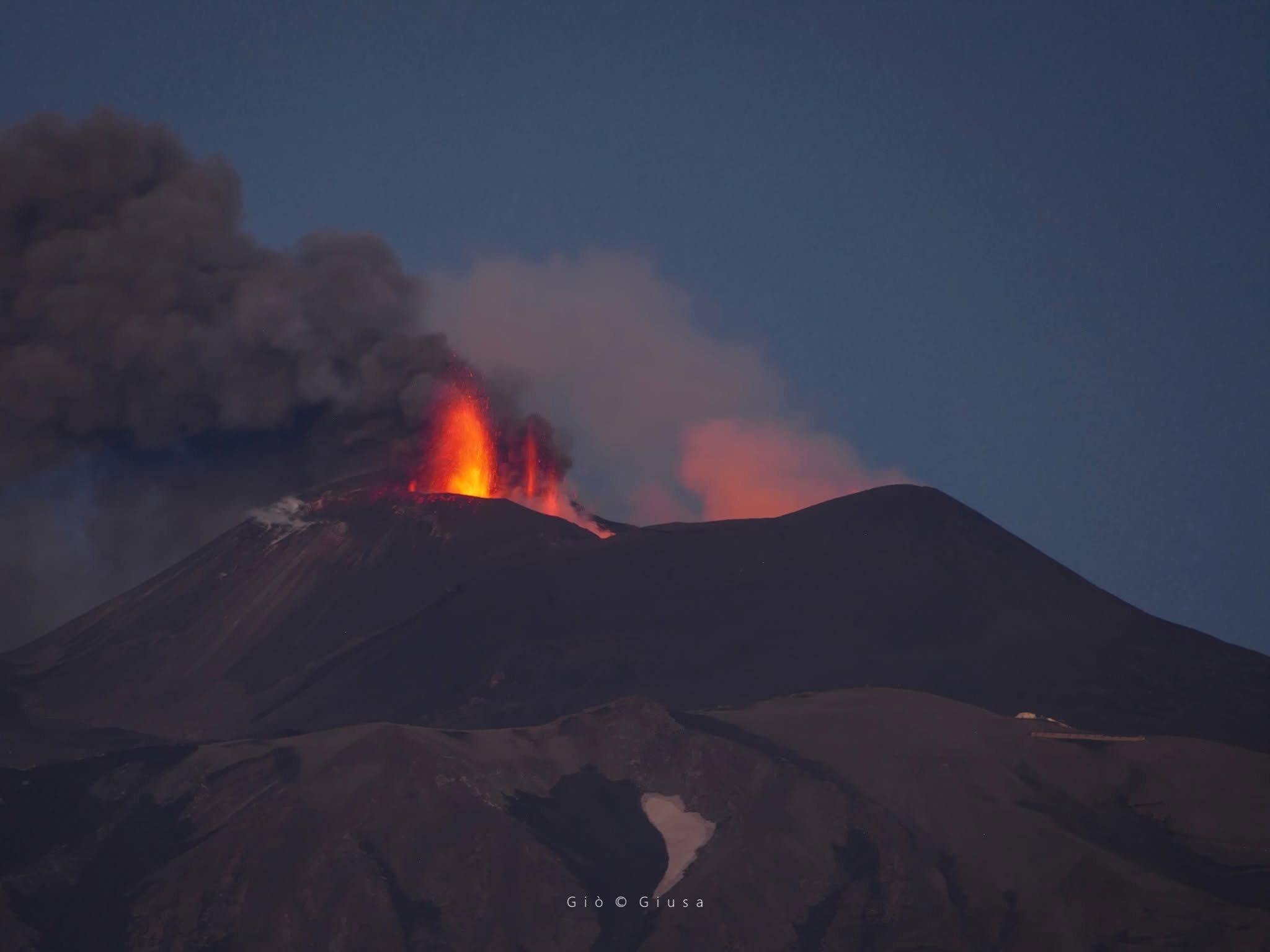
Throughout the week, monitoring of Etna’s volcanic activity was conducted via the analysis of images from Osservatorio Etneo (INGV-OE) surveillance cameras and through direct observations by INGV-OE personnel. Effusive activity continued at the vent located at an elevation of 3,030 m above sea level. A small lava flow was also detected; it originated from a vent that opened on July 2 at an elevation of approximately 3,200 m, between the Voragine and Northeast craters. Another lava flow was fed by a fissure that opened on July 5, extending towards the north-northeast from the rim of the Voragine crater. Weak volcanic ash emissions persisted from the depression located on the upper eastern flank of the Voragine crater (the vent that appeared on December 12, 2025). Volcanic ash was also emitted from a fissure that opened on July 5. Additionally, degassing activity of varying intensity was observed at the other summit craters.
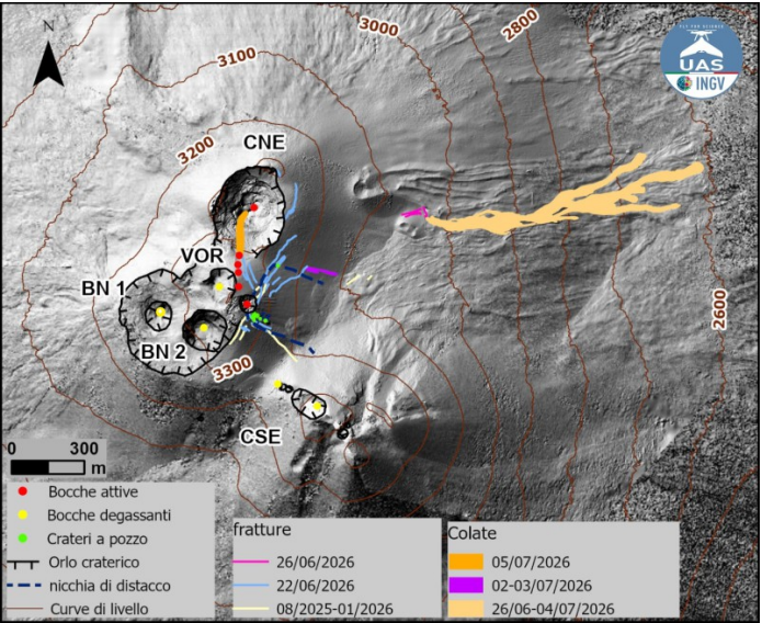
Map of lava flows, updated as of June 5, superimposed on the shaded relief of Mount Etna’s summit area; the map is derived from processing images acquired by drone in June and October 2025, as well as June and July 2026. Contour lines are plotted at 100-meter intervals. CSE = Southeast Crater, CNE = Northeast Crater, VOR = Voragine, BN = Bocca Nuova.
During the observation period, effusive activity continued from the vent located at an elevation of 3,030 m in the upper part of the Valle del Bove. INGV-OE personnel present in the field on June 29 observed that the lava field remained active and well-fed, with its front situated between 2,750 and 2,700 m elevation. Observations made on July 2 revealed a complex lava field characterized by superimposed flows, ephemeral vents, and small lava tubes. Mapping of the lava field was carried out by analyzing photogrammetric data from a drone overflight on July 2, 2026, and a Sentinel-2 satellite image from July 5, 2026. The lava field reached a maximum length of approximately 1.2 km, with a front descending to an elevation of about 2,605 m; it covered an area of approximately 0.87 × 10⁵ m² and represented a volume of about 2.6 × 10⁵ m³ (with a 40% uncertainty regarding the volume).
During observations conducted on July 2, INGV-OE personnel noted persistent Strombolian activity at the depression located on the upper flank of the Voragine crater. Additionally, on the evening of July 2, a second small lava flow emerged from a vent located at an elevation of approximately 3,200 m, between the Voragine and Northeast craters; this flow traveled just over a hundred meters before coming to a halt on the morning of July 3. The flow reached a length of 150 m, and its front descended to an elevation of 3,115 m. On July 4, effusive activity from the vent at an elevation of 3,030 m gradually declined and eventually ceased during the day, while Strombolian activity within the Voragine depression continued.
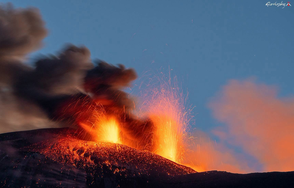
Finally, on Sunday, July 5, intense explosive activity began, driven by an eruptive fissure extending from the Voragine crater toward the Northeast Crater along a north-northeast trend. INGV-OE personnel observed that the vents at higher elevations were continuously emitting volcanic ash, while those at lower elevations exhibited Strombolian activity. The explosive activity produced a volcanic plume reaching approximately 4.5 km above sea level, which dispersed toward the south. During field surveys conducted on July 5, INGV-OE personnel also detected volcanic ash deposits in several municipalities on the southern flank, in the area between Rifugio Sapienza and the city of Catania. Finally, the north-northeast end of the eruptive fissure was observed feeding a lava flow—approximately 180 m long—that was spilling into the Northeast Crater. It should be noted that the outlines of the lava flows from July 2–3 and July 5 were mapped using a Sentinel-2 satellite image from July 5, 2026, and should therefore be considered preliminary.
Source : INGV.
Photos : Gio Giusa , INGV , Giovinsky Aetnensis .
Indonesia , Awu :
REDUCTION OF AWU VOLCANO’S (NORTH SULAWESI) ACTIVITY LEVEL FROM LEVEL III (SIAGA) TO LEVEL II (WASPADA), EFFECTIVE JULY 8, 2026, AT 13:00 WITA.
Awu Volcano is an active volcano located in the Sangihe Islands, North Sulawesi Province. Seismic activity at Awu Volcano had shown an upward trend since April 2024, particularly regarding shallow volcanic earthquakes. A peak in volcanic earthquakes was recorded on August 24 and 25, 2024, with 364 shallow volcanic earthquakes registered. The most recent increase in seismicity occurred on May 19, 2026, when 104 shallow volcanic earthquakes were recorded. Awu Volcano had been classified at Level III (Siaga) since May 19, 2026.
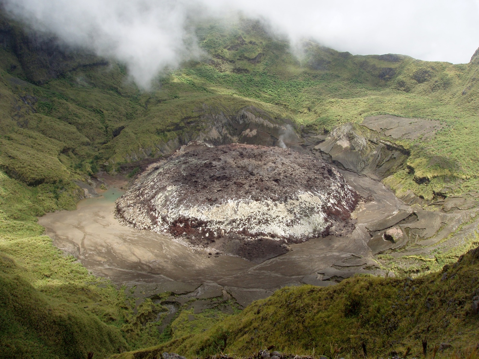
Seismic monitoring conducted from July 1 to July 7, 2026, recorded 116 shallow volcanic earthquakes (VB)—an average of 16 events per day—as well as 17 deep volcanic earthquakes (VA), 445 distant tectonic earthquakes (TJ), and one felt earthquake (intensity I on the MMI scale). No surface earthquakes associated with fluid activity have been recorded to date. This level of seismicity is significantly lower than the activity observed at Awu Volcano in May 2026. Crater emissions remain stable; no plume rising above the summit was observed, and no increase was noted compared to the previous period. Deformation data from tiltmeters indicate a reduction in shallow pressure buildup.
These data indicate that the previously observed peaks in seismic activity at Awu Volcano did not lead to an intensification of activity at the surface or in the crater area. Nevertheless, a sudden increase in seismicity—particularly volcanic earthquake swarms—remains a future concern, given that volcanic and tectonic activity levels remain relatively high. Potential hazards to monitor include both magmatic and phreatic eruptions. There is also a risk of lava dome destabilization should internal pressure within the magmatic system increase significantly. Given the decline in volcanic seismic activity, the activity level of Mount Awu was downgraded from Level III (Alert/Siaga) to Level II (Waspada), effective July 8.
Source et photo : PVMBG.
Kamchatka , Sheveluch / Mutnovsky :
KVERT VOLCANIC ACTIVITY NOTICE (VAN)
Issued: July 9 , 2026
Volcano: Sheveluch (CAVW #300270)
Current aviation colour code: RED
Previous aviation colour code: orange
Source: KVERT
Notice Number: 2026-70
Volcano Location: N 56 deg 38 min E 161 deg 19 min
Area: Kamchatka, Russia
Summit Elevation: 3283 m (10768.24 ft), the dome elevation ~2500 m (8200 ft)
Volcanic Activity Summary:
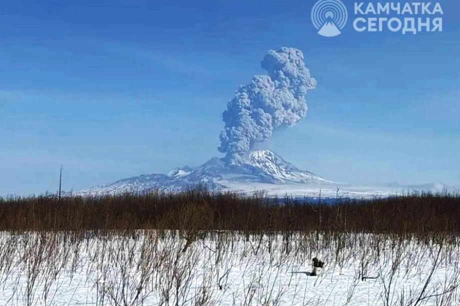
The explosive-extrusive eruption of the volcano continues, accompanied by powerful gas-steam activity; a new block of lava continues to grow in the northern part of the lava dome. Explosions sent ash up to 10 km a.s.l. (start 21:43 UTC according to video data), ash plume is extending for 30 km to the east-northeast of the volcano.
The explosive-extrusive eruption of the volcano continues. Ash explosions up to 12 km (39,400 ft) a.s.l. could occur at any time. Ongoing activity could affect international and low-flying aircraft.
Volcanic cloud height:
10000 m (32800 ft) AMSL Time and method of ash plume/cloud height determination: 20260709/2150Z – Himawari-9 14m15
Other volcanic cloud information:
Distance of ash plume/cloud of the volcano: 30 km (19 mi)
Direction of drift of ash plume/cloud of the volcano: ENE / azimuth 61 deg
Time and method of ash plume/cloud determination: 20260709/2150Z – Himawari-9 14m15
Start time of explosion and how determined: 20260709/2143Z – Video data
Remarks:
Сlarification of data based on satellite information.
Volcan Mutnovsky
The Kamchatkan Volcanic Eruption Response Team (KVERT) reported that an explosion at Mutnovsky occurred at 0819 on 1 July, lasted around three minutes, and generated an ash plume that rose 3.5 km above the summit and drifted several kilometers W. The Aviation Color Code (ACC) was raised to Orange (the second highest level on a four-color scale) at 2146. No additional explosions were detected; at 0420 on 2 July the ACC was lowered to Yellow. Weather clouds obscured satellite views during 2-5 July. A thermal anomaly was identified in satellite images during 6-7 July, but with decreasing temperatures. At 0316 on 9 July the ACC was lowered to Green. Dates are based on UTC; specific events are in local time where noted.
Sources : KVERT , GVP.
Photo : ИА Камчатка
Philippines , Kanlaon :
The Philippine Institute of Volcanology and Seismology (PHIVOLCS) reported continuing eruptive activity at Kanlaon during 2-7 July. The seismic network recorded 3-10 daily volcanic earthquakes. Sulfur dioxide emissions ranged from 1,234 to 2,531 tonnes per day. Volcanic emissions generally rose as high as 1.3 km above the summit and drifted NW, W, and SW. There were 2-3 periods of ash emissions on 2, 4, and 6 July, each lasting five minutes to nearly three hours.
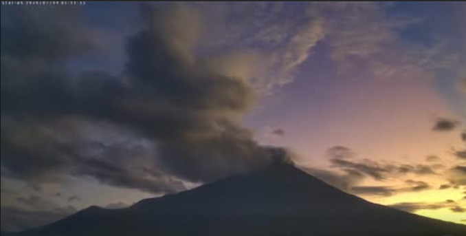
Two of the events on 4 July were recorded by webcams; at 05h02 a grayish ash plume rose 300 m above the crater rim and drifted SW and during 13h39-14h04 grayish ash plumes rose as high as 200 m above the crater rim and drifted SW. At 13h43 on 6 July a grayish ash plume rose 900 m above the crater rim and drifted SW.
The Alert Level remained at 2 (on a scale of 0-5); the public was warned to stay out of the 4-km-radius Permanent Danger Zone (PDZ) and pilots were advised to avoid flying close to the summit.
Sources : Philippine Institute of Volcanology and Seismology (PHIVOLCS) , GVP.
Japan , Sakurajima :
The Japan Meteorological Agency (JMA) reported ongoing eruptive activity at Minamidake Crater (Aira Caldera’s Sakurajima volcano) during 29 June-6 July. A very small eruptive event was detected on 29 June, and crater incandescence was visible in nighttime webcam images during 29 June-3 July. The Alert Level remained at 3 (on a 5-level scale), and the public was warned to be cautious within 2 km of both the Minimadake and Showa craters.
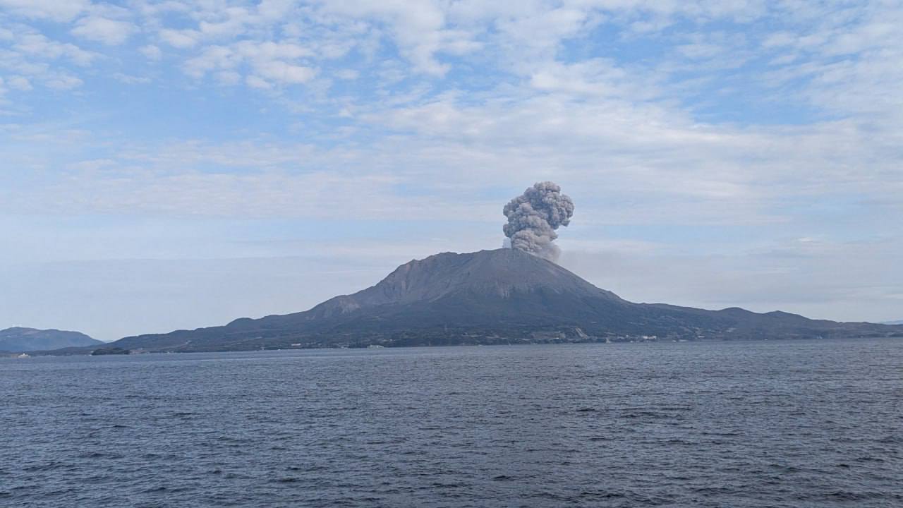
The Aira caldera in the northern half of Kagoshima Bay contains the post-caldera Sakurajima volcano, one of Japan’s most active. Eruption of the voluminous Ito pyroclastic flow accompanied formation of the 17 x 23 km caldera about 22,000 years ago. The smaller Wakamiko caldera was formed during the early Holocene in the NE corner of the caldera, along with several post-caldera cones. The construction of Sakurajima began about 13,000 years ago on the southern rim and built an island that was joined to the Osumi Peninsula during the major explosive and effusive eruption of 1914. Activity at the Kitadake summit cone ended about 4,850 years ago, after which eruptions took place at Minamidake. Frequent eruptions since the 8th century have deposited ash on the city of Kagoshima, located across Kagoshima Bay only 8 km from the summit. The largest recorded eruption took place during 1471-76.
Sources and photo : Japan Meteorological Agency (JMA) , GVP.