February 22 , 2026.
La Réunion Island , Piton de la Fournaise :
Press release from the Paris Institute of Earth Physics / Piton de la Fournaise Volcanological Observatory. February 22, 2026 – 9:15 a.m. local time – 5:15 a.m. UTC.
Eruption in progress
The eruption that began on February 13, 2026, shortly after 10:00 a.m. (local time), at Piton de la Fournaise continues.
Only one eruptive site remains active on the south-southeast flank of the volcano, with fountains still visible from Piton de Bert. A cone is forming due to the accumulation of lava flows.
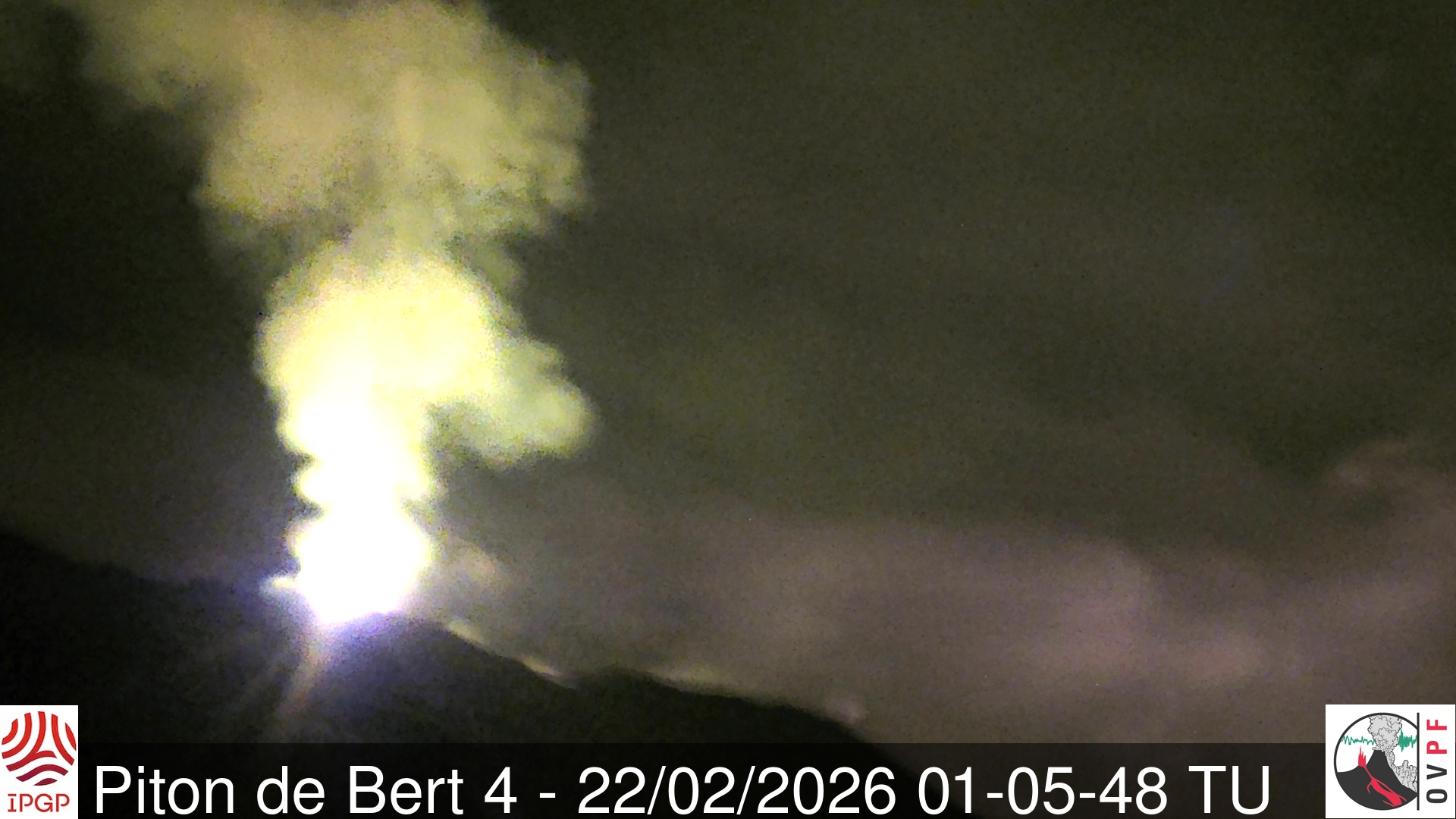
Image taken at the eruptive site from the IRT webcam located at Piton Bert (UTC: local time -4 hours) (©OVPF-IPGP).
Seismicity beneath the summit is decreasing but remains constant. Since February 14, 338 shallow volcano-tectonic earthquakes have been recorded beneath the summit area at depths of between 1.6 and 2.1 km.
Surface deformations since the first days of the eruption indicated deflation of the summit area due to the rapid emptying of the shallow magma reservoir (located at approximately 1.5-2 km depth) that supplies magma to the eruptive site. A change in trend, with the onset of inflation, appears to be emerging at the summit GNSS stations; this parameter will need to be confirmed in the coming days. New fissure openings remain possible.
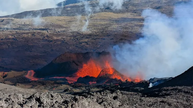
Numerous rockfalls are still being recorded. Their number is increasing both at the Dolomieu crater and at the cone forming on the eruptive site.
The intensity of the eruptive tremor (an indicator of lava and gas emissions at the surface) decreased slightly yesterday (February 21, 2026) around 1:00 PM local time (9:00 AM UTC).
Surface flow rates, estimated from satellite data via the HOTVOLC (OPGC – Clermont Auvergne University) and MIROVA (University of Turin) platforms, have shown values over the past 24 hours ranging from 1 to 12 m³/sec. It should be noted that depending on cloud cover, these estimates can change rapidly and be zero in the event of total cloud cover.
The lava flow front remains stationary in the lower part of the Grandes Pentes, approximately 2.6 km from the road and at an altitude of 660 m. The active parts of the lava flow are now concentrated near the eruptive site before the Grandes Pentes fault, where the lava field widens and thickens.
Alert Level 2.1
Source : OVPF/IPGP.
Photos : OVPF/IPGP , François Martel-Asselin/ zinfos974.
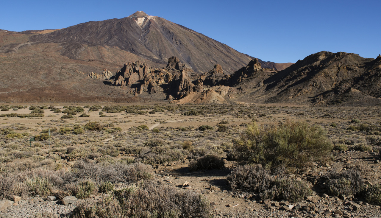
Canaries Islands , Pico del Teide :
The National Geographic Institute (IGN) confirmed on Friday that the Las Cañadas del Teide seismic swarm remains active. This is the third such swarm in just a few days, coinciding with increased volcanic activity on the island, and has been ongoing for more than 31 hours.
This is the ninth seismic swarm of this type recorded on the island since 2016 by scientists, as specified on Thursday by the IGN’s regional director, Ithaiza Domínguez, during a press conference following the latest meeting of the PEVOLCA scientific committee in Santa Cruz de Tenerife.
According to the IGN report, this still-active swarm began on Wednesday at 11:00 PM, but is currently continuing « with less energy and intensity. »
However, despite its duration, this seismic episode has maintained the same characteristics since its onset. In other words, the seismic activity continues at very low magnitudes, always below 0.7 mbLg, meaning that these earthquakes are not felt by the population but only detected by the sensors of the national seismological network.
The combined analysis of this series confirms its location in the western part of Las Cañadas del Teide, between 7 and 8 kilometers below sea level, an area where similar seismic swarms had already been recorded in October 2016, June 2019, June and July 2022, November 2024, August 2024, and on February 12, 16, and 17, 2026.
In total, the institution specifies, the number of recorded hybrid events exceeds 2,500, a figure that could increase after further analysis. “Many of these events exhibit very weak signals, making them difficult to identify in the recordings,” notes the IGN (National Geographic Institute).
The IGN also specifies that these types of hybrid seismic swarms do not increase the short-term risk of eruption in Tenerife.
The IGN indicates that it has deployed a network of more than 100 fixed stations, equipment, and sampling points across the island to monitor all possible parameters and thus ensure comprehensive, real-time tracking of any developments that could indicate a change in the short-, medium-, and long-term risk of volcanic eruption.
Source : elidealgallego
Photo : EFE.
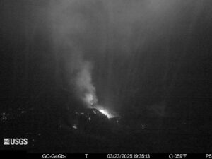
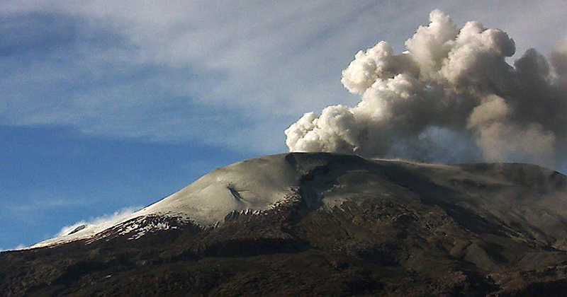
Colombia , Nevado del Ruiz :
Manizales, February 17, 2026, 4:20 PM
Regarding the monitoring of activity at the Nevado del Ruiz volcano, the Colombian Geological Survey (SGC), an agency under the Ministry of Mines and Energy, reports the following:
During the week of February 10-16, 2026, the volcano continued to exhibit unstable behavior. Compared to the previous week, the main variations in some monitored parameters were as follows:
– Seismic activity associated with rock fracturing processes within the volcanic edifice increased in the number of recorded earthquakes, while the seismic energy released remained at a similar level. The recorded earthquakes were of low energy (magnitude less than 1) and occurred in the Arenas crater and in various sectors of the volcano, primarily on the north and southwest flanks. The distance of the earthquakes from the crater reached 12 km, and their depth varied from less than 1 km to 9 km.
Seismicity associated with fluid dynamics within volcanic conduits decreased, both in the number of recorded earthquakes and in the seismic energy released. Both short- and long-duration signals showed low energy levels, lower than those recorded the previous week. Ash emissions were not confirmed during the week due to heavy cloud cover in the region and the low number of signals associated with this phenomenon.
The emission of water vapor and volcanic gases, primarily sulfur dioxide (SO₂), into the atmosphere from the Arenas crater was variable and remained low. The estimated SO₂ flux, associated with degassing processes, remained at levels similar to those recorded the previous week. These low values are due, in part, to the high variability in wind direction, which was unfavorable to the monitoring stations. Further monitoring, using satellite data, confirms the persistence of low levels of SO₂ emissions.
The vertical height of the column of gas, vapor, or ash was variable, with values predominantly between 200 and 400 m and between 700 and 800 m above the volcano’s summit, reaching a maximum height of 900 m. The direction of dispersion of the column varied along the flanks of the volcano, with a tendency towards the southwest, west-southwest, and south-southeast flanks. Monitoring of thermal anomalies at the bottom of the Arenas crater, using satellite platforms, showed that energy levels remained low.
Source et photo : SGC.
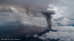
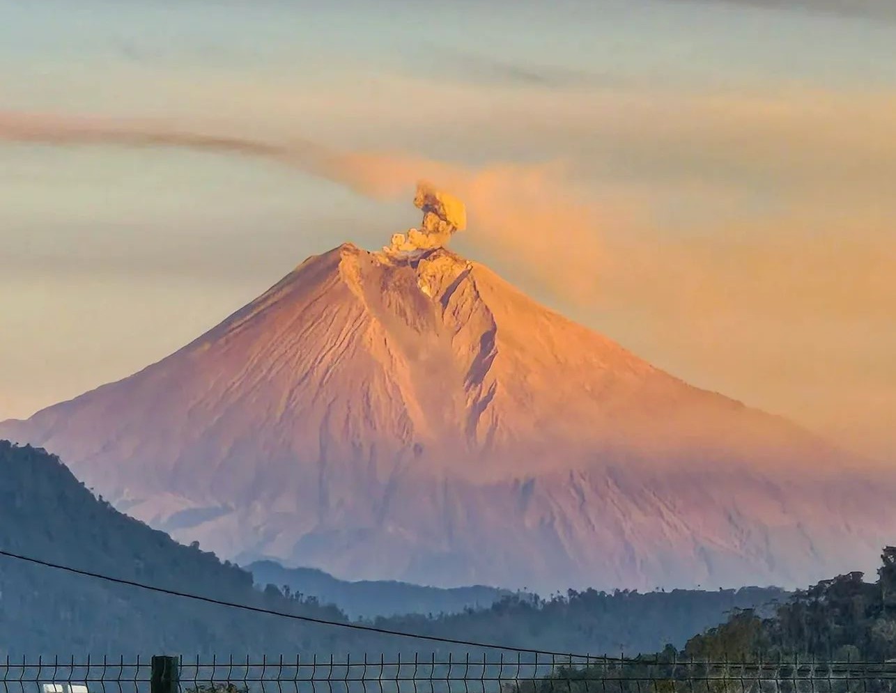
Ecuador , Sangay :
DAILY REPORT ON THE STATE OF SANGAY VOLCANO, Saturday, February 21, 2026.
Geophysical Information Institute – EPN.
Surface Activity Level: High, Surface Trend: No Change
Internal Activity Level: Moderate, Internal Trend: No Change
Seismicity: From February 20, 2026, 11:00 AM to February 21, 2026, 11:00 AM:
Seismicity:
Due to technical problems at the monitoring stations, no seismic events related to the volcano could be recorded.
Rainfall/Lahars:
Since yesterday afternoon, no rain has been recorded in the volcano area. Heavy rainfall could remobilize accumulated material, generating mudflows and debris flows that would cascade down the volcano’s flanks and flow into nearby waterways.
Emissions/Ash Column:
Due to cloud cover in the volcano’s vicinity, only gas and ash emissions could be observed by surveillance cameras to the west, at an altitude of 400 meters above the crater. Additionally, the GOES-19 satellite system detected two westward-oriented gas and ash plumes at altitudes of 700 and 1,000 meters. Related to this activity, the Washington VAAC issued three reports of ash clouds drifting westward at altitudes between 600 and 1,800 meters.
The MOUNTS satellite system detected no traces of sulfur dioxide (SO2) in the last 24 hours.
Other monitoring parameters: The MIROVA-MODIS satellite system recorded one thermal anomaly, as did the MIROVA-VIIRS 750 system, and the FIRMS satellite system recorded five in the last 24 hours.
Observation: Due to cloud cover in the area, it was not possible to observe the volcano’s incandescence using monitoring cameras. At the time of writing, the volcano remains obscured by clouds.
Alert level: Yellow
Source : IGEPN
Photo : Cristopher Cardenas / volcan Sangay / FB.
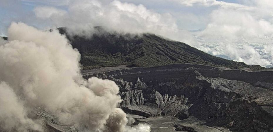
Costa Rica , Poas :
Latitude: 10.20°N
Longitude: 84.23°W
Altitude: 2,687 m
Current Activity Level: Alert
This week, the amplitude of seismic activity decreased compared to last week. The number of long-period events also decreased. High-frequency events continue to be recorded, although their number and amplitude have decreased this week. The geodetic network is not recording any significant deformation. DOAS stations detected a sulfur dioxide (SO₂) flux of 121 ± 43 t/d, slightly higher than the previous week’s 83 ± 42 t/d. SO₂ was detected in the atmosphere by satellite, with a peak mass of 32.3 tonnes on February 16. The lake level remained stable at a high level this week, and its temperature remained warm (> 65 °C).
Lake Río Cuarto Maar in Alajuela exhibited a moderate change in water color, shifting from blue-green to brown-green, along with fish mortality, on February 12, 2026. A field inspection determined that there were no significant geochemical changes in the composition of the lake’s surface waters. Furthermore, bathymetric sampling of the lake’s waters, conducted on February 14 at depths of 1 to 61 meters, revealed no significant chemical changes or imbalances in the lake’s limnological layers. Therefore, the hypothesis of a « water reversal » caused by a sudden release of magmatic or biogenic gases trapped at the bottom of the lake is ruled out. We believe the most likely cause of the color change and fish mortality is the circulation of surface water layers due to the influx of heavy rainfall in the days preceding the color change, a period during which torrential rains were observed for several days. This color change and fish death have been observed repeatedly in the lakes of the Río Cuarto Maars and Laguna Hule between December and February 2014 and 2024.
Source et photo : Ovsicori.