February 12 , 2026.
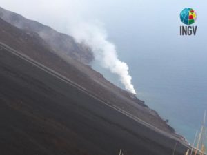
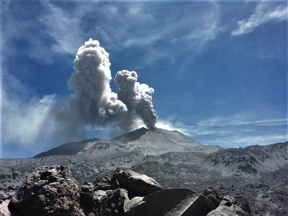
Italy , Vulcano :
MONTHLY BULLETIN, JANUARY 2026 (Publication date: February 3, 2026)
ACTIVITY STATUS SUMMARY
Based on monitoring data, the following points should be noted:
1) Crater fumarole temperature: Values recorded in January are gradually decreasing.
2) CO₂ flux in the crater area: The CO₂ flux in the crater area is approximately 10,000 g/m²/day.
3) SO₂ flux in the crater area: The SO₂ flux is moderately elevated and decreasing.
4) Fumarole gas geochemistry: No update is available for January. The last sample was taken on December 18, 2025, with CO₂ concentrations in the fumarolic gases ranging from 13 to 16 molar percent.
5) CO₂ flux at the base of the La Fossa cone and in the Vulcano Porto area: Monitoring stations at the base of the cone indicate a slight decrease in CO₂ flux values.
6) Geochemistry of thermal aquifers: In the Camping Sicilia and Bambara wells, the physicochemical parameters are stable or decreasing.
7) Local seismicity: The occurrence rate of local microseismicity remained low.
 8) Regional Seismicity: Seismic activity associated with limiting magnitude (LM) earthquakes greater than or equal to 1 was very low.
9) Deformation – GNSS: Signals from Vulcano’s permanent GNSS network did not show significant variations during the last month.
10) Deformation – Inclinometry: Data from the clinometry network did not show significant variations during the last month.
11) Gravimetry: Updated data are not available for January due to malfunctions in the power supply system.
PREDICTABLE SCENARIOS
Dormant volcano with no eruptive activity, with gas emissions from crater fumaroles and areas outside the crater, possibly accompanied by the spread of toxic gases in the fumarole emission zones; Accumulations of gases (particularly CO₂ and H₂S) near the seaward emission zones, in leward areas, topographically low-lying areas, or in enclosed spaces; mud and debris flows or flooding triggered by intense rainfall on the slopes of the La Fossa cone.
TEMPERATURE OF THE CRATER’S FUMAROLES:
The values recorded in January gradually decreased, with the maximum recorded temperature dropping from 267 to 227 °C.
Source et photo : INGV.
Indonesia , Ili Werung :
The activity level of Mount Ili Werung, in East Nusa Tenggara province, was reduced from Level II (Waspada) to Level I (Normal) on February 11, 2026.
Mount Ile Werung is a stratovolcano with a summit of 1,486 meters. It is located at 8° 32′ 24″ South latitude and 123° 35′ 24″ East longitude. Administratively, it lies within the Lembata Regency, East Nusa Tenggara province.
From January 1 to February 10, 2026, no volcanic activity was observed at the crater of Mount Ili Werung, nor were there any submarine eruptions, particularly around Mounts Hobal and Wetitar. No significant changes were observed following the eruption of November 29, 2021. Therefore, crater activity remains relatively low. However, eruptions can occur at any time, even without obvious warning signs. Therefore, the public is advised to remain vigilant and cautious.
Seismic monitoring of Mount Ili Werung reveals an increase in deep volcanic earthquakes over several periods: 21 events on January 1, 2025, 11 on September 6, 2025, and a significant increase to 47 events on September 14, 2025. Following the earthquake felt on November 29, 2025, at 9:11 PM (Central Indonesian Time), 18 other deep volcanic earthquakes were recorded. This indicates an increase in pressure inside the volcano, due to increased magmatic activity or the migration of magma from deep within the volcano to the surface.
Although increased seismicity was observed, particularly after the earthquake felt on November 29, 2025, subsequent developments have shown a downward trend in seismic activity, with no visible increase at the surface. This indicates that the increased pressure within Mount Ile Werung has not yet translated into surface seismic activity likely to increase the risk of eruption.
The activity of Mount Ile Werung continues to be monitored. The number of recorded, felt, and distant local tectonic earthquakes requires heightened vigilance, as increased regional tectonic activity could affect the activity of Mount Ile Werung. The risk of eruption of Mount Ile Werung is explosive, with threats including pyroclastic flows, lava flows, incandescent rocks, and toxic gas emissions at the summit. Furthermore, increased vigilance is also necessary due to potential hazards such as lava flows and underwater ejections of material, particularly around Mounts Hobal and Wetitar. Volcanic activity can also cause sea level rise around the eruption’s epicenter. Exposure to toxic volcanic gases such as CO₂, CO, and SO₂ poses another potential danger, especially in the Bualan area.
Following visual and instrumental observations, the activity level of Mount Ile Werung has been downgraded from Level II (Waspada) to Level I (Normal) effective February 11, 2026, at 2:00 PM (West Indonesian time). The public and visitors/climbers of Mount Ile Werung are advised to avoid approaching the crater and to exercise caution in the Bualan area.
Source et photo : PVMBG.
Colombia , Nevado del Ruiz :
Manizales, February 10, 2026, 6:30 PM
Regarding the monitoring of activity at the Nevado del Ruiz volcano, the Colombian Geological Survey (SGC), an agency under the Ministry of Mines and Energy, reports the following:
During the week of February 3-9, 2026, the volcano continued to exhibit unstable behavior. Compared to the previous week, the main variations in some monitored parameters were as follows:
– Seismicity associated with fluid dynamics in the volcanic conduits was characterized primarily by long-duration, low-energy signals, similar to those recorded the previous week. In contrast, seismicity related to short-duration signals showed a decrease in the number of earthquakes and the seismic energy released. During the week, only one ash emission associated with one of these recent signals could be confirmed, thanks to the use of conventional and thermal cameras for monitoring the volcano and according to a report received from officials of the Los Nevados National Natural Park, located in the volcanic area.

Seismic activity associated with rock fracturing processes within the volcanic edifice decreased, both in the number of recorded earthquakes and in the seismic energy released. The events occurred primarily in the Arenas crater and on the north-northeast flank of the volcano, up to 9 km from the crater. Less frequent and more dispersed earthquakes were observed on the other flanks, up to 13 km from the crater. The depth of the earthquakes ranged from less than 2 km to 7 km. The highest recorded magnitude was 1.2, corresponding to the earthquake recorded on February 8 at 8:53 a.m., located 9 km northeast of the crater, at a depth of 4 km.
The emission of water vapor and volcanic gases, primarily sulfur dioxide (SO₂), from the Arenas crater into the atmosphere was variable. Estimates of daily SO₂ fluxes increased slightly compared to the previous week. However, the daily average remained similar. This increase was partly due to favorable wind direction at the monitoring stations. Additional satellite monitoring continues to show low levels of SO₂ release.
– The vertical height of the column of gas, water vapor, or ash generally remained below 500 m above the volcano’s summit, reaching a maximum of 800 m. The column’s dispersion direction was variable, primarily toward the west-northwest, south-southwest, and southwest flanks of the volcano, and to a lesser extent toward the northwest and west-southwest flanks.
Monitoring of thermal anomalies at the floor of Arenas Crater, using satellite platforms, showed that energy levels remained low.
Source et photo : SGC.
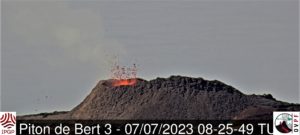
Peru , Sabancaya :
Local date and time: February 9, 2026 – 12:04 PM
Bulletin analysis period: February 2-8, 2026
Volcanic alert level
Orange alert level: The volcano’s eruptive activity has increased significantly. Increased seismic activity, frequent explosions, and emissions of ash and ballistic fragments have been observed.
Conclusions
During this period, three moderate volcanic explosions were detected, generating columns of ash and gas up to 2,300 meters above the volcano’s summit, in addition to seismic activity associated with the movement of magmatic fluids and internal fracturing. Therefore, the volcanic alert level remains orange.
Recommendations
Adopt the current preventative measures due to the orange volcanic alert level.
Do not approach within 12 km of the crater. In case of ashfall, cover your nose and mouth with damp cloths or a mask. Keep doors and windows closed.
Outlook
The occurrence of future volcanic explosions generating eruptive columns more than 2 km high is considered likely, with a risk of impact on districts in the Colca Valley and surrounding areas due to the dispersal of volcanic ash. Therefore, the volcanic alert level remains orange.
Between February 9 and 11, if ash emissions occur, they will disperse to the west of the volcano. From February 12 to 15, the dispersal will be towards the southwest of Sabancaya, with winds of 50 km/h.
Source : Cenvul.
Photo : IGEPN.
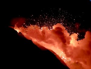
Guatemala , Fuego :
Atmospheric conditions: Clear skies
Wind: Northeast
Precipitation: 0.0 mm
Activity
During the night and early morning, weak to moderate degassing was recorded, with fumaroles reaching approximately 200 meters above the crater and dispersing to the southwest.
Explosive activity continued with 8 to 12 weak to moderate explosions per hour, generating ash columns rising to between 4,300 and 4,700 meters in altitude, drifting west and southwest. This activity caused fine ashfall on Panimache 1 and 2, Morelia, Santa Sofía, and surrounding areas.
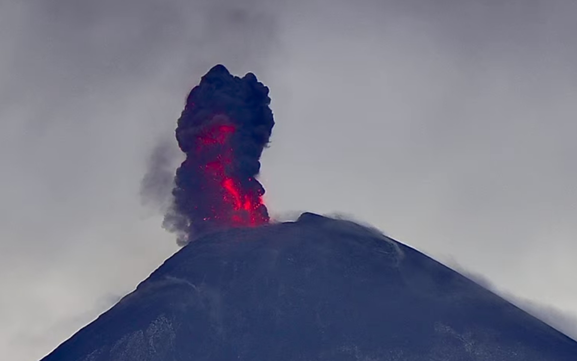
Some explosions were accompanied by rumbling sounds, shock waves, and brief noises similar to those of locomotives, associated with the continuous expulsion of gas. Incandescent glows were also observed rising up to 200 meters above the crater, accompanied by small avalanches. Incandescent material fell back around the crater, flowing into the ravines of Ceniza, Taniluyá, Seca, Santa Teresa, Trinidad, and Las Lajas, sometimes reaching the tree line.
Source : Insivumeh
Photo : Afar TV , 07/06/2025