August 8 , 2026.
Italy / Sicily , Etna :
Statement on Mount Etna activity, August 7, 2026, 10:38 (08:38 UTC).
The National Institute of Geophysics and Volcanology (INGV) – Etna Observatory – reports that, following the statement issued on the 6th at 21:11 UTC, lava fountaining activity at the Voragine crater is continuing. Video surveillance footage shows that these fountains intensified significantly, reaching a high level starting at 23:00 yesterday and maintaining this intensity until 02:00 UTC today, before gradually subsiding. Strong Strombolian activity is currently underway at the Voragine crater, generating an eruption plume drifting towards the south/south-southwest; ashfall has been reported in Ragalna and Adrano. Lava flows are also present in the Valle del Leone. Additionally, a new eruptive vent opened in the Valle del Bove around 07:30 UTC, at an elevation of approximately 2,750 m.
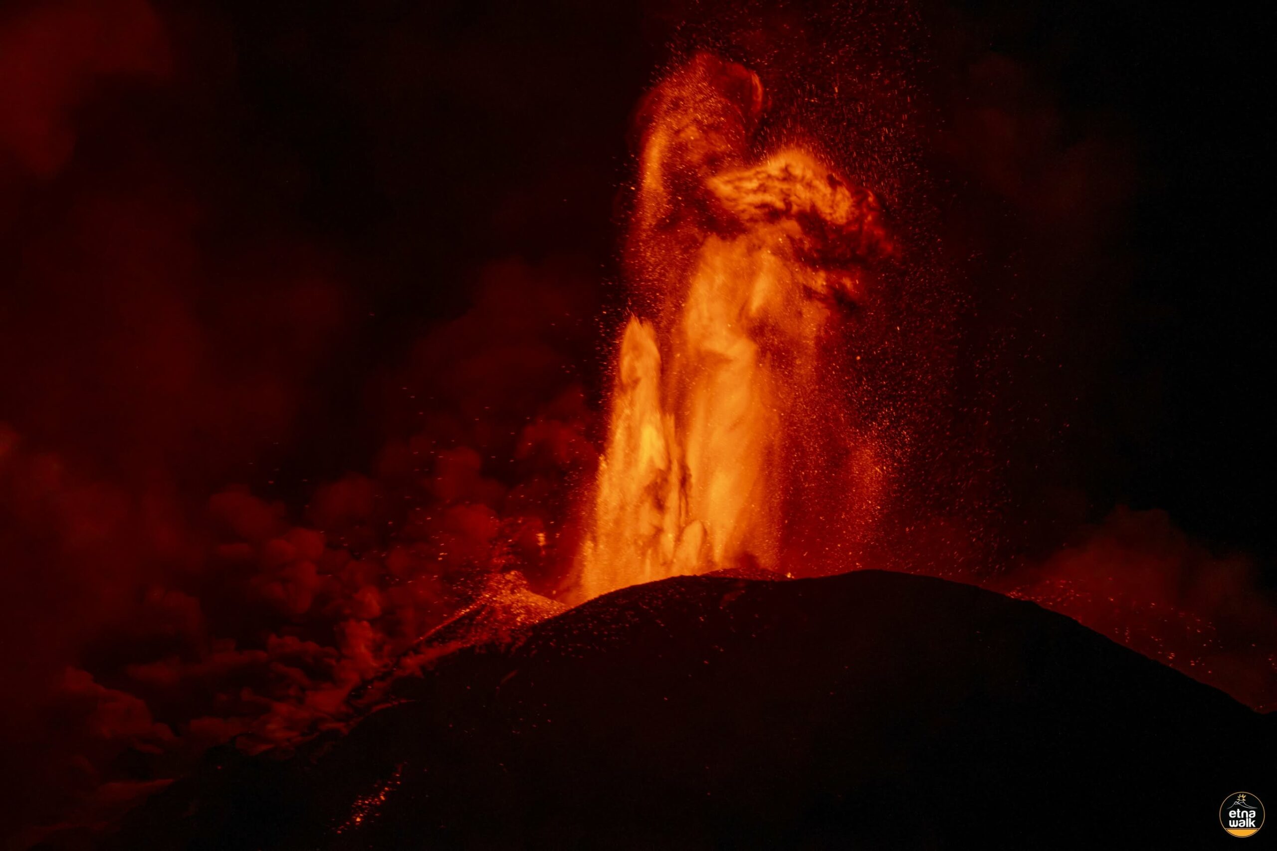
Field surveys are underway, and results will be released as soon as they become available. Seismically, the amplitude of the volcanic tremor peaked around 21:30 UTC before decreasing, though it remains at a high level. The tremor source remains located beneath the Voragine crater, at an elevation of approximately 3,000 meters above sea level.
Infrasonic activity—in terms of both event count and energy—was high at the Voragine crater until 23:00 UTC, at which point both parameters dropped sharply. Infrasonic tremor persists, likely associated with ash emission from the same crater. GNSS monitoring networks show no significant variation. However, summit stations in the tiltmeter network indicate a change in trend starting at 20:28 UTC on August 6, recording maximum variations of approximately 2.5 microradians at the Cratere del Piano (ECP) station.
Statement on Etna activity, August 7, 2026, 15:58 (13:58 UTC).
The National Institute of Geophysics and Volcanology (INGV), Etna Observatory, reports that field inspections by INGV personnel and analysis of video surveillance images indicate that the modest lava flow moving from the Voragine crater toward the Northeast Crater continues to be fed (see the statement from August 6, 18:36 UTC).
The eruptive vent that appeared around 07:30 UTC in the Valle del Leone, at an elevation of approximately 2,750 m (statement from earlier today, 08:38 UTC), remains active; It is feeding lava flows whose fronts—around 13:00 UTC—had moved past Monte Simone in the Valle del Bove, reaching an elevation of approximately 2,000 m. Observations of the other lava flows
described in today’s bulletin (08:38 UTC) suggest that they are cooling or are being fed at a low rate.
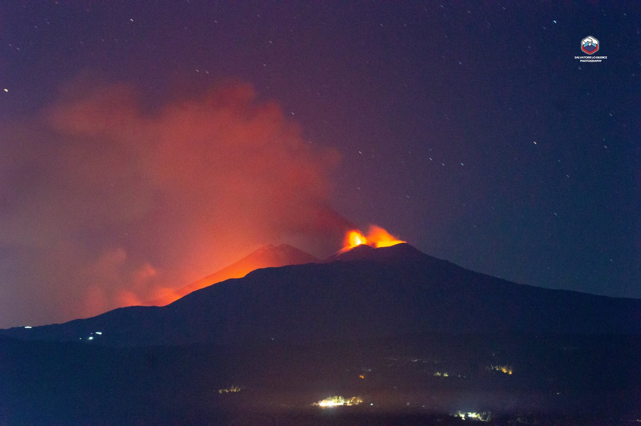
The lava fountaining activity mentioned in today’s earlier update (08:38 UTC) has resulted in ashfall reported in Adrano, Ragalna, Piano Vetore, and Nicolosi.
Over the past few hours, explosive activity at the Voragine crater has intensified, generating an eruption plume that is drifting southward.
Seismically, the amplitude of volcanic tremor has decreased slightly compared to the previous update but remains at a high level. The source location remains centered on the Voragine crater at an elevation of 3,000 meters above sea level.
Infrasonic tremor persists, though no discrete infrasonic events have been detected. The trend observed at summit tiltmeter stations—as reported in the previous bulletin—continues, with a maximum variation of 3.2 microradians recorded at the Cratere del Piano station. GNSS monitoring networks indicate variations within the instrumental margin of error, with the exception of the Crisimo (CRI) station, which shows an eastward displacement of 4 cm recorded at 10:40 UTC.
Further information will be provided as soon as possible.
Source : INGV.
Photos : Etna Walk / Giuseppe Distefano / Marco Restivo , Salvatore Lo Giudice .
Italy , Stromboli :
Statement on Stromboli activity, August 8, 2026, 02:48 (00:48 UTC).
The National Institute of Geophysics and Volcanology (INGV) – Osservatorio Etneo – reports that analysis of images from the surveillance camera network reveals that, since approximately 22:45 UTC on August 7, lava has begun to overflow from the North crater area; this activity is generating a modest lava flow that is accumulating in the upper part of the Sciara del Fuoco. Ordinary Strombolian activity continues in the North and Central-South crater areas, accompanied by lava spattering from the North crater area, with varying intensity.
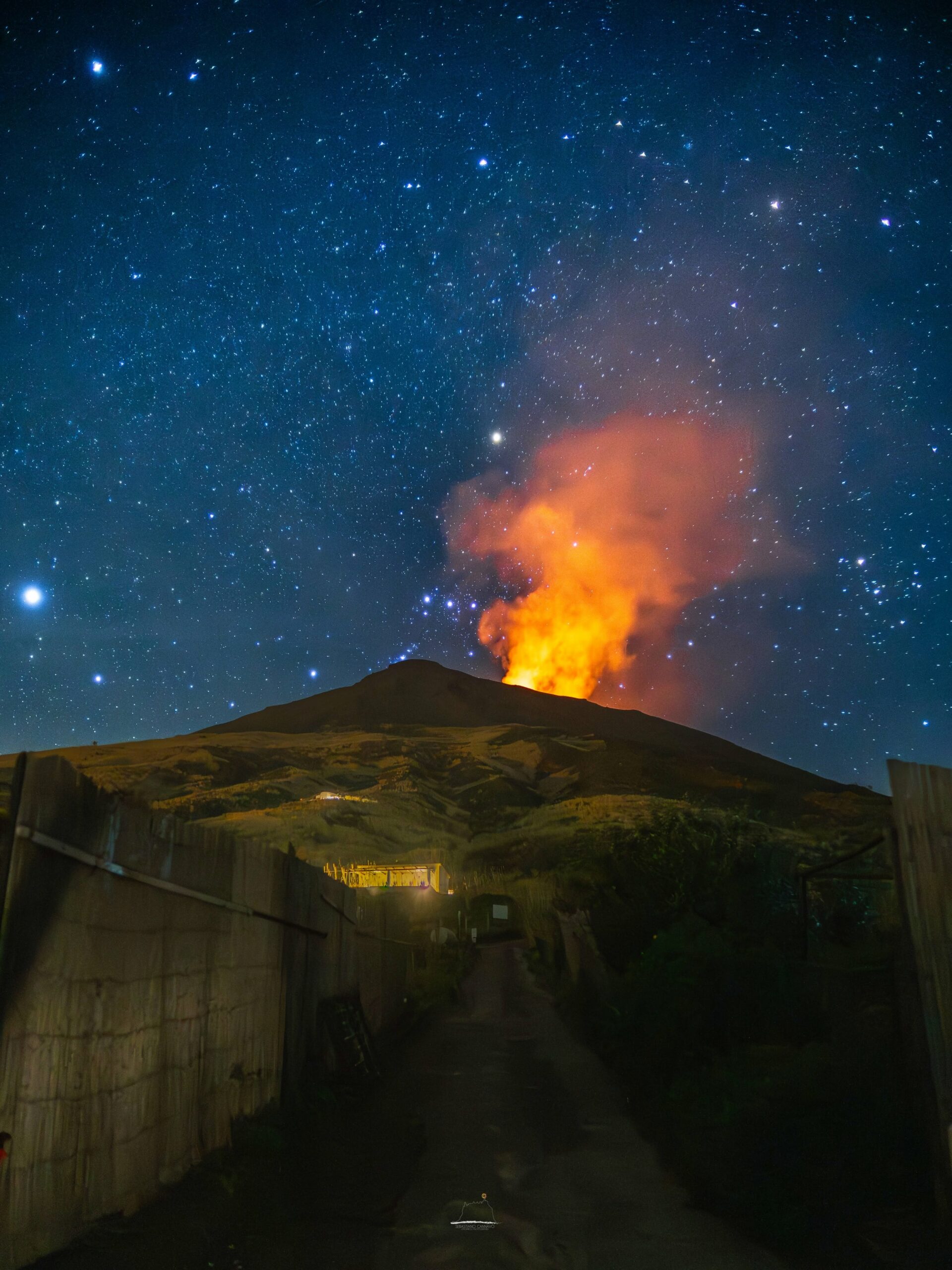
Seismically, the average amplitude of volcanic tremor remains within a moderate range. No significant changes have been reported regarding the frequency or amplitude of explosion earthquakes. No notable variations have been detected in the time series from ground deformation monitoring stations.
Further updates will be provided in due course.
Source : INGV.
Photos : Stromboli stati d’animo / Sebastiano Cannavo.
Indonesia , Ili Lewotolok :
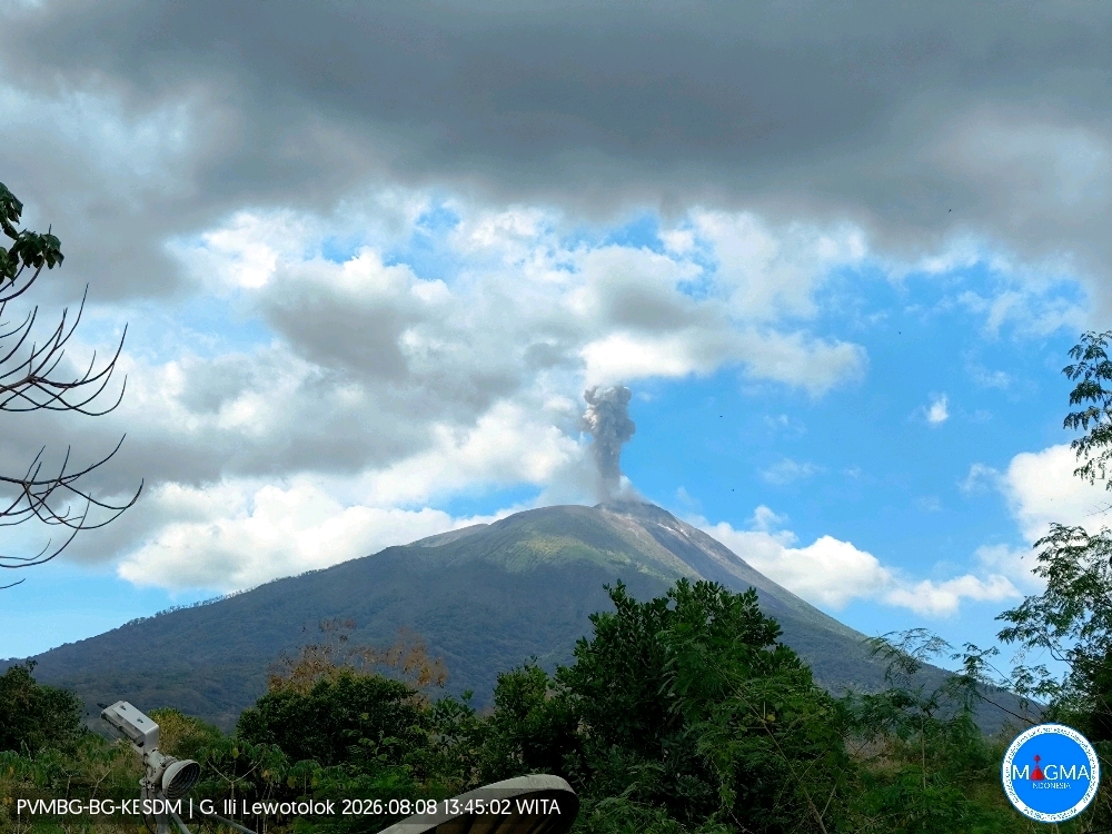
An eruption of Mount Ili Lewotolok occurred on Saturday, August 8, 2026, at 13:44 WITA, with an observed ash column rising approximately 600 m above the summit (2,023 m above sea level). The dense, gray ash column drifted towards the southwest and west. The eruption was recorded by the seismograph with a maximum amplitude of 40 mm and a duration of 38 seconds.
Seismic observations
206 eruption earthquakes, with amplitudes of 11.1–40 mm and durations of 30–123 seconds.
135 emission earthquakes, with amplitudes of 2.2–33.2 mm and durations of 22–55 seconds.
5 harmonic earthquakes, with amplitudes of 3.9–13 mm and durations of 121–188 seconds.
2 episodes of non-harmonic tremor, with amplitudes of 4.4–13.8 mm and durations of 90–137 seconds.
1 hybrid/multiphase earthquake, with an amplitude of 3.3 mm and a duration of 18 seconds.
1 shallow volcanic earthquake, with an amplitude of 6.6 mm and a duration of 18 seconds.
1 deep volcanic earthquake, with an amplitude of 24.4 mm and a duration of 17 seconds.
1 distant tectonic earthquake, with an amplitude of 6.6 mm and a duration of 61 seconds.
Recommendations
1. Communities living near Mount Ili Lewotolok, as well as visitors, climbers, and tourists, must not enter or conduct activities within a 2 km radius of the Mount Ili Lewotolok activity center.
2. Remain vigilant regarding potential hazards associated with lava avalanches/rockfalls and pyroclastic flows in the South, Southeast, West, and Northeast sectors of Mount Ili Lewotolok.
Source et photo : PVMBG.
Colombia , Puracé – Los Coconucos volcanic chain :
Popayán, August 7, 2026, 2:00 PM.
Based on monitoring of the Los Coconucos volcanic chain’s activity, the Colombian Geological Service (SGC)—an agency under the Ministry of Mines and Energy—reports the following information:
Since the last bulletin, long-period (LP) seismicity and continuous tremor (TR) signals at Puracé Volcano have persisted; these phenomena are primarily linked to fluid dynamics within internal conduits and originate beneath the volcano’s crater, at a depth of less than 1 km.
Seismicity associated with rock fracturing has remained at a very low level—in terms of both frequency and magnitude—and has been localized between 1 and 2 km beneath the crater.
Although a decrease in the number of earthquakes and atmospheric ash emissions has been recorded, gas monitoring indicates that sulfur dioxide (SO₂) flux values remain above the established average for the volcano, and elevated soil carbon dioxide (CO₂) concentrations persist.
Measurements of atmospheric sulfur dioxide (SO₂) emissions indicate a value of 1,900 tonnes per day, with the plume dispersing toward the northwest of the volcano. No thermal anomalies associated with the crater floor have been detected, according to data published on the MIROVA satellite platform.
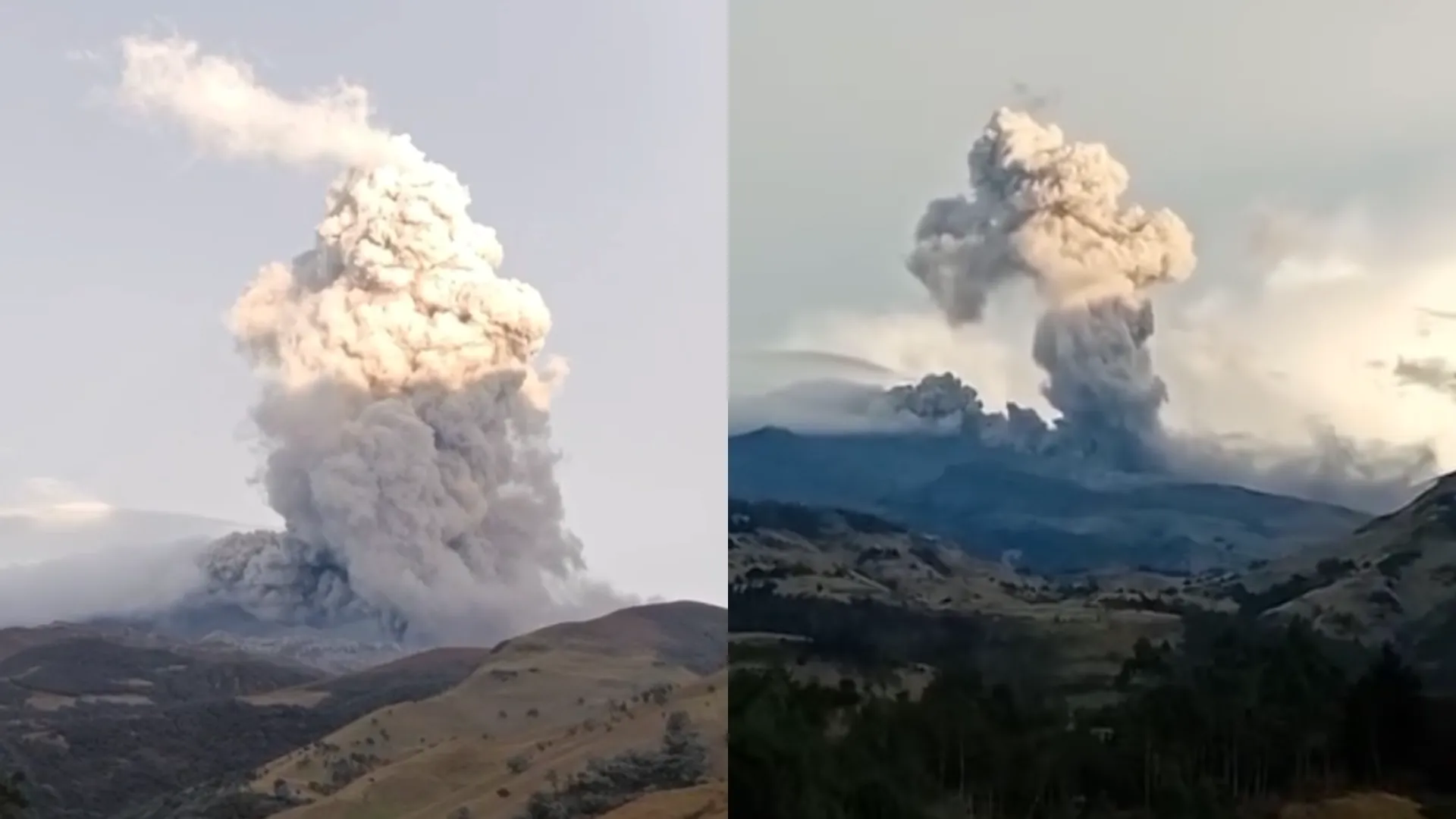
On August 7 at 10:14 a.m., an ash emission was recorded but could not be visually confirmed by webcams due to adverse weather conditions limiting visibility in the area. At the same time, residents of the rural locality of Cristales, in the municipality of Coconuco, reported loud noises associated with this event. The values recorded by instruments on the volcano in recent days are the highest observed to date, significantly exceeding usual baseline levels. They therefore indicate a significant change in the volcano’s dynamics; the volcano remains at the orange alert level.
As long as the orange alert remains in effect, the volcano’s activity levels are likely to fluctuate; for example, activity could temporarily decrease compared to previous days or weeks without implying that the volcano has returned to a stable state. A shift to the yellow alert level requires sufficient time to evaluate all monitored parameters and identify trends indicating reliable stability.
The public is advised not to approach the crater areas of the Puracé, Piocollo, and Curiquinga volcanoes, as sudden ash or gas emissions—posing a significant risk to people—could occur.
In light of the above, the SGC recommends closely monitoring the situation via daily bulletins and other information released through our official channels, as well as adhering to instructions from local and departmental authorities and the National Unit for Disaster Risk Management (UNGRD).
The volcanic alert level remains orange: Volcano showing significant changes in monitored parameters.
Source et photo : SGC.
Costa Rica , Rincon de la Vieja :
Latitude: 10.83° N;
Longitude: 85.34° W;
Elevation: 1,916 m above sea level.
Current activity level: Alert.
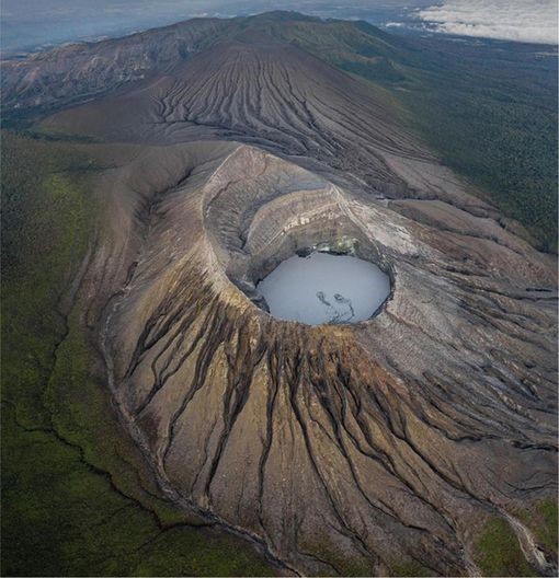
Fourteen eruptions were recorded this week. None of them triggered lahars. Most of these eruptions were of low magnitude and occurred between July 31 and August 1. However, a moderate-magnitude eruption took place on August 3 at 10:45 PM. No further eruptions have been recorded since that event, and background tremor has subsequently decreased. The amplitude of the background tremor remains low, with a predominance of high frequencies (4 to 6 Hz). Short-duration tremor pulses, with frequencies ranging from 0.5 to 6 Hz, were also observed. Sporadic long-period earthquakes and volcano-tectonic events—located both near and far from the crater—were recorded. The dominant frequency of « tornillo »-type signals decreased over the course of the week. Since mid-June, the geodetic network has recorded crustal extension at the volcano’s summit; however, a weakening of this signal was observed over the past week.
No significant crustal uplift was detected in these areas. No increase in this signal was observed over the past week, and variations remain within the measurement margin of error. NOVAC stations recorded a slight decrease in SO2 flux (299 ± 156 t/d) compared to the previous week (394 ± 300 t/d). The Multi-GAS station recorded a CO2/SO2 ratio of 10 and an H2S/SO2 ratio of 0.13; these values were unique for the week.
Source : Ovsicori .
Photo : Soy Tico.