August 5 , 2026.
Guatemala , Fuego :
Guatemala, August 3, 2026, 11:00 PM (local time): PAROXYSM: INTENSE PHASE OF THE ERUPTION.
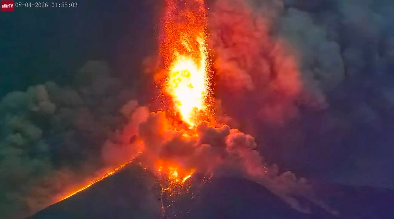
Following the eruptive activity of Volcán de Fuego described in special bulletin BEFGO-059-2026, INSIVUMEH is maintaining constant monitoring of the situation. Fourteen and a half hours have passed since the event began (8:30 AM local time); a new eruptive pulse recorded at 11:05 PM confirms an intensification of the eruption’s explosivity, which could generate larger and more far-reaching pyroclastic density currents. A lava fountain reaching 200 to 300 meters above the crater has formed, ejecting material toward the upper reaches of all ravines and causing incandescent blocks to break off and reach the edge of the vegetation. Furthermore, the eruption column could rise above 7,000 meters above sea level, increasing the amount of ash suspended in the atmosphere. The ravines most likely to be affected remain the Seca, Taniluyá, and Ceniza, located on the volcano’s southwest flank. However, given the increased explosivity, the possibility of pyroclastic density currents descending through other ravines to the south and southeast cannot be ruled out.
Satellite monitoring continues to confirm the dispersal of volcanic ash from this eruption at altitudes between 5,000 and 6,000 m (14,604–19,685 ft) and over distances of up to 130 km to the west, reaching the Pacific coast off the coast of the Retalhuleu department.
Ashfall continues in the localities of San Pedro Yepocapa, Chimaltenango.
INSIVUMEH maintains visual and instrumental monitoring of volcanic activity using field observers, seismic and infrasound sensors, webcams, and satellite imagery products. Should any of the previously mentioned conditions change—indicating increased activity—new special volcanic bulletins would be issued.
ERUPTION UPDATE, Guatemala, August 4, 2026, 4:00 PM (local time)
Following the eruption of the Fuego volcano—which began on August 3 at 8:30 AM and reached its most intense phase starting at 11:00 PM (as detailed in bulletins BEFGO-060, 061, and 062)—activity continues today.
Acoustic tremor continues to be recorded uninterrupted, indicating the abundant and continuous emission of gas, ash, and lava from the crater.
Webcams also continue to show pyroclastic density currents descending the western flank, which remains shrouded in thick, suspended ashfall.
Field observers have confirmed the movement of these pyroclastic density currents toward the Ceniza and Seca ravines. This activity is also causing ashfall in the municipalities of San Pedro Yepocapa and Acatenango, located to the west of the volcano.
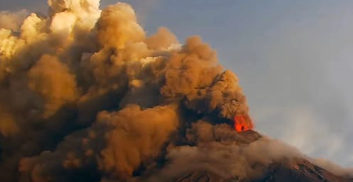
The eruption column continues to inject ash into the atmosphere; consequently, material may disperse up to an altitude of 22,966 feet (approximately 7,000 meters) and spread westward and northwestward over distances of up to 120 kilometers.
There remains a risk that pyroclastic density currents could continue to descend through any of the volcano’s ravines, traveling distances of 5 to 7 kilometers; this poses the greatest threat to communities located near these ravines, particularly those on the southwest flank (Seca, Taniluyá, and Ceniza).
Rainfall forecast for today, associated with the passage of an easterly wave, could trigger lahars in the ravines of Fuego Volcano—specifically the Seca and Ceniza ravines—where low to moderate impacts are anticipated.
Source : Insivumeh.
Photo : Afar tv.
Italy / Sicily , Etna :
WEEKLY BULLETIN, July 27, 2026 – August 2, 2026 (issue date: August 4, 2026)
SUMMARY OF ACTIVITY STATUS
Based on monitoring data, the observations are as follows:
1) VOLCANOLOGICAL OBSERVATIONS: Eruptive activity at the Voragine crater (VOR): very sustained Strombolian activity culminating in lava fountaining, and effusive activity in the upper part of the Valle del Leone. Intra-crater explosive activity at the North-East Crater (CNE) and the Bocca Nuova crater (BN). Variable degassing at the South-East Crater (CSE).
2) SEISMOLOGY: Absence of seismic activity linked to fracturing with a local magnitude (Ml) ≥ 2.0. High volcanic tremor on July 30. During the rest of the week, tremor amplitude fluctuated between moderate and low levels.
3) INFRASOUND: High infrasonic activity between July 30 and 31. Low infrasonic activity for the rest of the week.
4) GROUND DEFORMATION: Volcanic activity on July 30 and 31 was accompanied by variations in ground deformation.
5) GEOCHEMISTRY: SO2 flux at a moderate level.
Soil CO2 flux (Etnagas network): moderate values.
Partial pressure of dissolved CO2 in groundwater (EtnaAcque network): no update.
Helium (He) isotopic ratio at peripheral sites: no update; the last recorded data showed high values (July 9, 2026). 6) SATELLITE OBSERVATIONS: Over the past week, satellite-observed thermal activity in the summit area was moderate, with values ranging from high to very high associated with the lava fountain of July 30, 2026, and the effusive activity that began on July 30, 2026, and ended on August 2, 2026.
VOLCANOLOGICAL OBSERVATIONS
During the week in question, monitoring of Etna’s volcanic activity was conducted through the analysis of images from INGV-OE (Osservatorio Etneo) surveillance cameras, satellite imagery, and direct field observations by INGV-OE personnel.
Throughout the observation period, activity at Etna was characterized by degassing and intra-crater explosive activity at Bocca Nuova (BN) and the Northeast Crater (CNE)—the latter showing occasional nighttime incandescence—as well as variable degassing at the Southeast Crater (CSE) and eruptive activity at the Voragine Crater (VOR), which produced sustained Strombolian activity (evolving into lava fountaining) and effusive activity in the upper Valle del Leone.
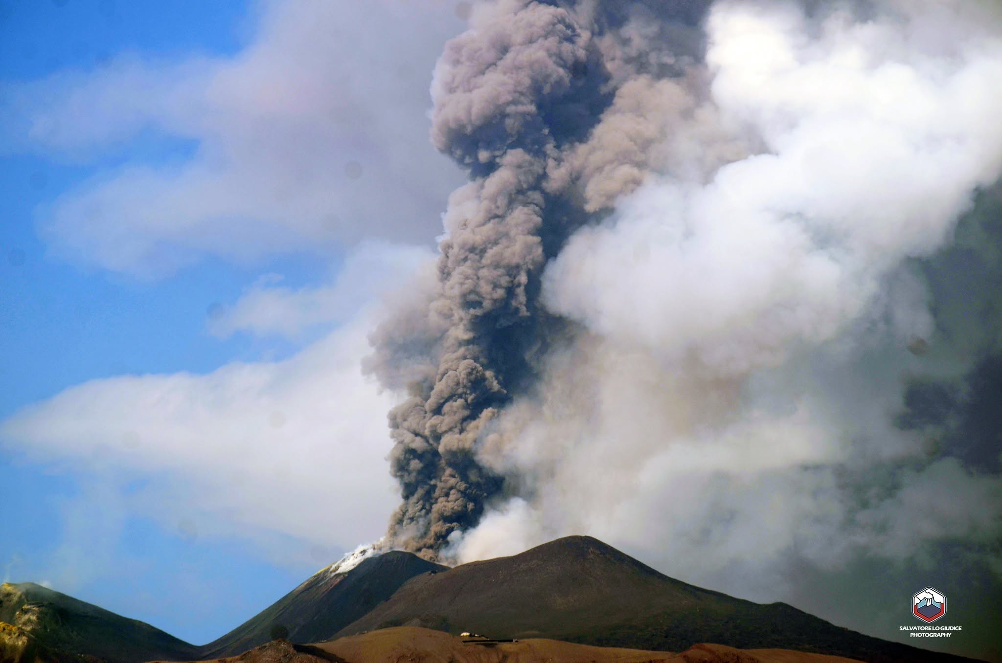
Specifically, starting around 01:30 UTC on July 30, a resumption of Strombolian activity was observed at the Voragine Crater; this activity intensified progressively over the following hours, producing ash emissions that dispersed toward the northwest. During the morning, this intensification led to an evolution in activity from sustained Strombolian activity to lava fountaining.
From 07:00 UTC onwards, ash emissions increased significantly, feeding an eruption plume that reached an altitude of approximately 7 kilometers above sea level and drifted toward the western sector of the volcano. INGV field personnel reported light ashfall over the town of Bronte. At 07:58 UTC, a small pyroclastic flow occurred on the flank of the Voragine crater, traveling about a hundred meters toward the upper section of the Valle del Bove.
From approximately 08:30 UTC, Strombolian activity gradually declined to very low levels of intensity and frequency, ceasing temporarily around 11:00 UTC, although intense ash emissions persisted.
Strombolian activity at the Voragine crater resumed around 16:50 UTC and gradually intensified, reaching a very sustained level around 19:55 UTC. This vigorous activity continued until approximately 23:40 UTC before stopping abruptly around midnight on July 31. The explosive activity generated an ash plume reaching an altitude of about 7,000 m above sea level; the plume drifted southwest, causing fine material to fall in the Monte Denza area. In addition to the explosive activity, this intense Strombolian activity fed a lava flow that spilled into the Northeast Crater.
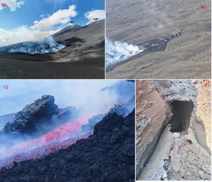
Overview of the Valle del Leone taken on the morning of July 31, showing the eruptive fissure—which opened on July 30—in full activity. In the background are the Southeast Crater (SEC) and the Voragine (VOR) (Photo: S. Giammanco). b) Detail of the effusive vents along the eruptive fissure (Photo: S. Giammanco). c) Detail of the main lava channel, observed on the morning of July 31 (Photo: S. Giammanco). d) The main effusive vent, by then inactive, as it appeared on the morning of August 2 (Photo: F. Ciancitto).
At 18:49 UTC, effusive activity began following the opening of an eruptive fissure at an elevation of approximately 2,700 m. The lava flows, fed by two aligned vents, formed a lava field that spread into the Valle del Leone (the upper part of the Valle del Bove). Continuing through the night, the effusive activity reached Monte Simone and split into three branches; the smallest flowed toward the cone itself, while the other two skirted it on either side, stopping just downslope of the cone at elevations of 1,990 m (northernmost branch) and 1,950 m (southern branch), respectively.
On the morning of July 31, lava emission at the vent was ongoing, while the flow fronts appeared to have a limited supply and were beginning to cool gradually. By the morning of August 1, the flow remained active, albeit with a reduced supply. The most distal part of the lava field, as well as the flow fronts, appeared inactive and were cooling. Finally, effusive activity ceased during the night of August 1–2. The lava flows were no longer active and showed signs of significant cooling. A preliminary analysis of data from drone surveys conducted on August 3 revealed that the flow had traveled a distance of approximately 2.9 km, covering an area of 1.5 × 10⁵ m². The estimated average thickness was about 2 m, and the volume was 5 × 10⁵ m³, with a margin of error of 40%.
Source : INGV.
Photos : INGV. Salvatore Lo Giudice.
Italy , Stromboli :
WEEKLY BULLETIN, July 27, 2026 – August 2, 2026 (issue date: August 4, 2026)
SUMMARY OF ACTIVITY STATUS
Based on monitoring data, the observations are as follows:
1) VOLCANOLOGICAL OBSERVATIONS: Ordinary Strombolian eruptive activity in both crater zones, occasionally accompanied by lava spattering in the North Crater zone. The frequency of overall explosive activity—encompassing both the North Crater zone and the Central-South Crater zone—remains at a moderate level.
2) SEISMOLOGY: Monitored seismic parameters show no significant variation.
3) GROUND DEFORMATION: Data from the GNSS network and tilt measurements at the Punta Labronzo and Elipista stations revealed no significant variation during the week.
4) GEOCHEMISTRY: SO2 flux: moderate level.
Soil CO2 flux (Pizzo zone – STR02): high values.
Plume C/S ratio: moderate values.
Helium isotope ratio (R/Ra): decreasing from high values.
Soil CO2 flux in the San Bartolo zone: stable at high values.
5) SATELLITE OBSERVATIONS: Satellite-observed thermal activity in the summit area remained generally low, with a few isolated anomalies of moderate intensity.
.
VOLCANOLOGICAL OBSERVATIONS
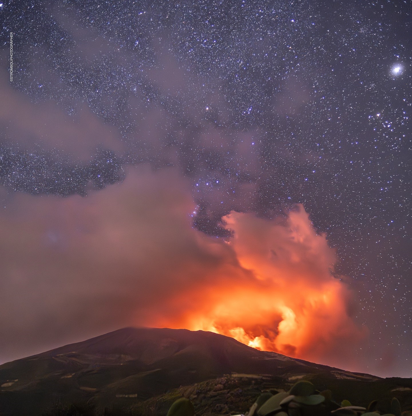
During the observation week, Stromboli’s eruptive activity was characterized through the analysis of images recorded by INGV-OE surveillance cameras located at an elevation of 190 m above sea level and at Punta dei Corvi (SCT-SCV and SPCT, respectively). Explosions in the North crater area (Zone N) primarily produced coarse material (bombs and lapilli); in the Central-South crater area (Zone CS), explosions produced predominantly fine material mixed with coarse material. The average explosion frequency for Zone N fell within a medium range. In Zone CS, the average explosion frequency also remained at a medium level. The total average hourly explosion frequency (Zone N + Zone CS) remained at a medium level.
Source : INGV.
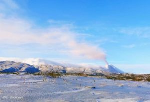
Photo : Stromboli stati d’animo / Sebastiano Cannavo.
Colombia , Puracé – Los Coconucos volcanic chain :
Popayán, August 4, 2026, 1:30 PM.
Based on monitoring of activity in the Los Coconucos volcanic chain, the Colombian Geological Service (SGC)—an agency attached to the Ministry of Mines and Energy—reports the following information:
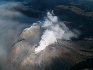
Over the past 24 hours, long-period (LP) seismicity and spasmodic tremor (TR) signals associated with the Puracé volcano have continued. These signals are primarily linked to fluid dynamics within internal conduits and originate from zones beneath the volcano’s crater, at a depth of less than 1 km.
Although a decrease in the number of earthquakes and atmospheric ash emissions has been recorded, gas monitoring indicates that sulfur dioxide (SO₂) flux values remain above the volcano’s usual average and that elevated soil carbon dioxide (CO₂) concentrations persist.
Measurements of atmospheric sulfur dioxide (SO₂) emissions indicate a value of 1,965 tonnes per day, with the plume dispersing toward the northwest of the volcano. No thermal anomalies associated with the crater floor have been detected, according to data published on the MIROVA satellite platform, managed by the Department of Earth Sciences at the University of Turin.
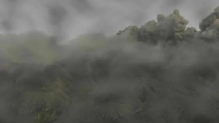
Over the past 24 hours, two ash emissions reaching a maximum height of 600 m were recorded; these dispersed westward, following the prevailing winds. Residents in the rural areas of Alto Anambío, Loma Linda – Cristales, and 20 de Julio reported loud noises associated with the ash emission that occurred at 7:25 PM. Instrument readings from the volcano in recent days are the highest observed to date, significantly exceeding established baseline levels; they therefore indicate a significant shift in the volcano’s dynamics, which remains at the orange alert level.
While the orange alert remains in effect, temporary fluctuations in the volcano’s activity level may occur—with activity sometimes decreasing compared to previous days or weeks—without implying that the volcano has returned to a stable state. A downgrade to the yellow alert level requires a sufficient period to evaluate all monitored parameters and identify trends indicating reliable stability.
The public is advised not to approach the crater areas of the Puracé, Piocollo, and Curiquinga volcanoes, as sudden ash or gas emissions posing a significant risk to people could occur.
In light of the above, the SGC recommends closely monitoring the evolution of this phenomenon via daily bulletins and other information released through our official channels, as well as adhering to instructions from local and departmental authorities and the National Unit for Disaster Risk Management (UNGRD).
The volcanic alert level remains at orange: Volcano showing significant changes in monitored parameters.
Source et photo : SGC.
Indonesia , Semeru :
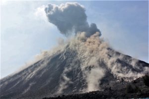
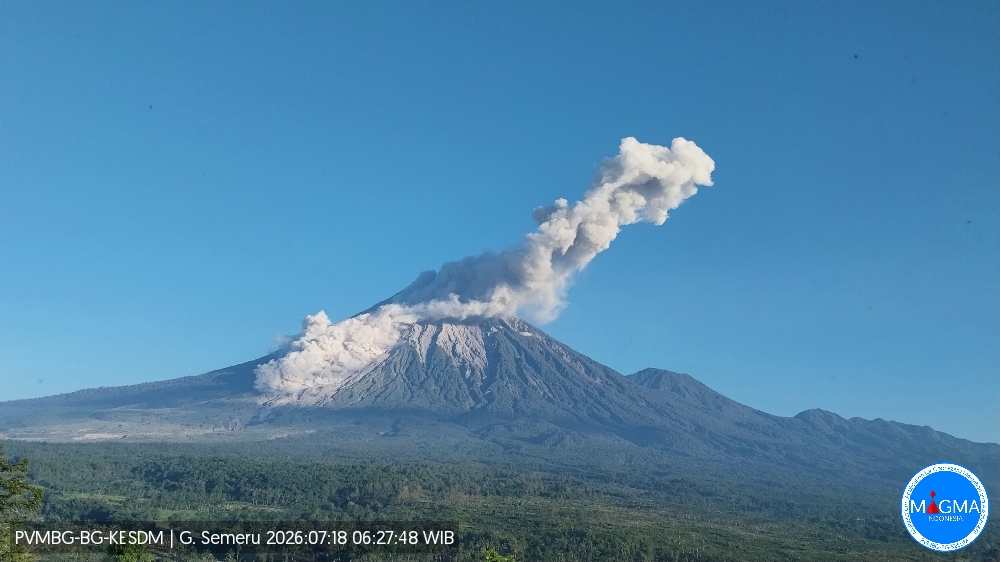
An eruption of Mount Semeru occurred on Tuesday, August 4, 2026, at 5:02 p.m. (Western Indonesia Time), producing an ash column estimated to rise approximately 800 m above the summit (or about 4,476 m above sea level). The dense, white-to-gray ash column drifted northeast. The eruption was recorded by a seismograph with a maximum amplitude of 21 mm and a duration of 100 seconds.
Seismic observations
16 eruption earthquakes, with amplitudes of 10–22 mm and durations of 61–113 seconds.
1 avalanche earthquake, with an amplitude of 5 mm and a duration of 72 seconds.
2 emission earthquakes, with amplitudes of 2–7 mm and durations of 29–56 seconds.
3 distant tectonic earthquakes, with amplitudes of 10–29 mm and durations of 44–236 seconds.
Recommendations
Do not conduct any activities in the southeast sector along the Besuk Kobokan River within a 13 km radius of the summit (eruption center). Beyond this distance, the public must not conduct activities within 500 meters of the banks of the Besuk Kobokan, due to the risk of pyroclastic flows and lahars spreading up to 17 km from the summit.
Source et photo : PVMBG