August 26 , 2026.
Hawaii , Kilauea :
HVO/USGS Volcanic Activity Notice
Current Volcano Alert Level: WATCH
Previous Volcano Alert Level: ADVISORY
Current Aviation Color Code: ORANGE
Previous Aviation Color Code: YELLOW
Issued: Tuesday, August 25, 2026, 6:38 AM HST
Source: Hawaiian Volcano Observatory
Notice Number: 2026/H402
Location: N 19 deg 25 min W 155 deg 17 min
Elevation: 4091 ft (1247 m)
Area: Hawaii
Summary:
Precursory low-level eruptive activity before episode 54 of the ongoing Halemaʻumaʻu eruption began around 6:16 a.m. HST on August 25.
Volcanic Activity:
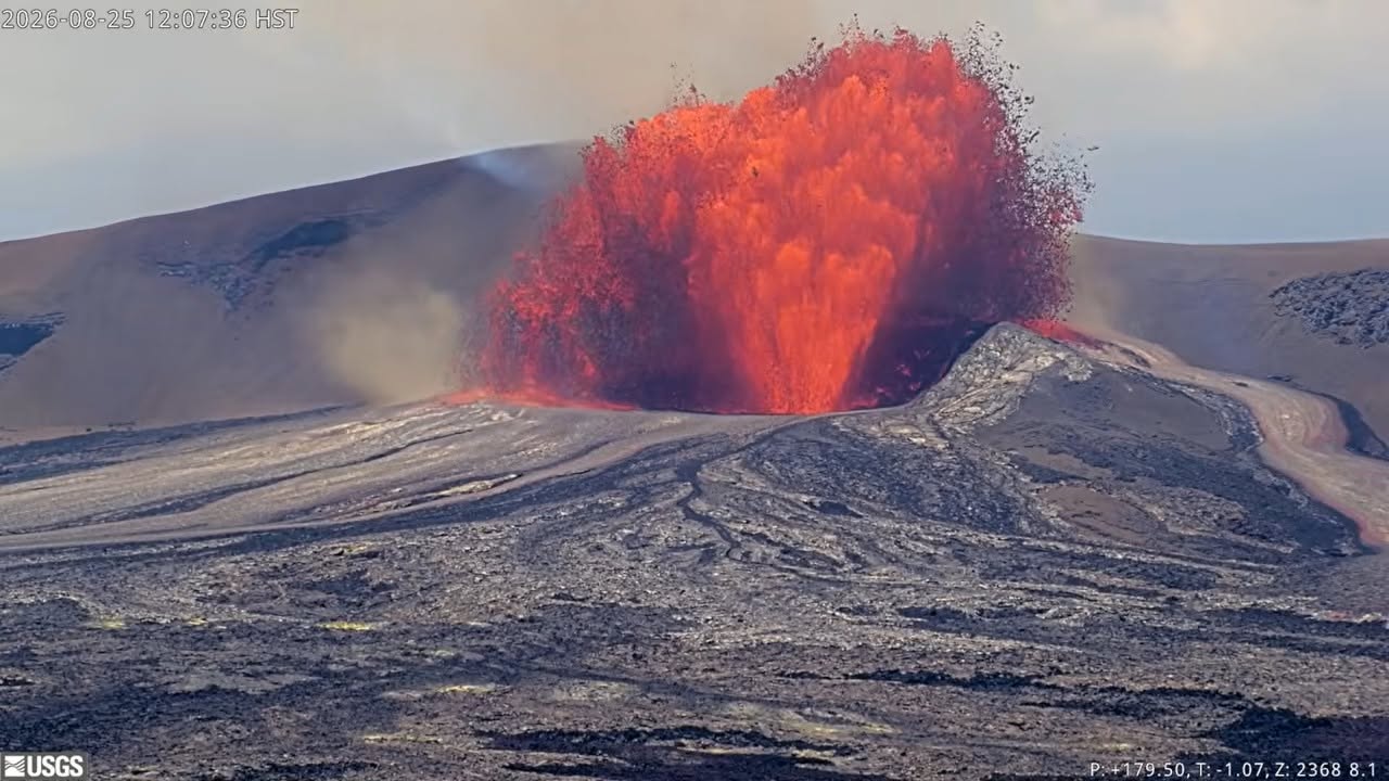
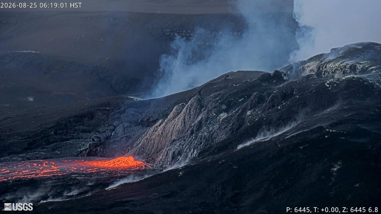
Precursory low-level activity for episode 54 of the ongoing Halemaʻumaʻu eruption at the summit of Kīlauea began around 6:16 a.m. HST on August 25 with overflows from the north vent that are continuing at this time. This activity was preceded by the onset of weak spattering from the north vent around 7:30 p.m. HST yesterday evening, August 24. This was marked by the onset of strong, rhythmic gas pistoning spikes in tremor recorded every 5-10 minutes. Glow from the vents continued to increase until after midnight, spattering from the north vent become nearly continuous. Bright glow and flames from the west vent correlate with the tremor spikes and appear to be related to the drainback cycle of gas pistoning.
Accordingly, HVO is raising the Alert Level for Kīlauea from ADVISORY to WATCH and the Aviation Color Code from YELLOW to ORANGE.
This low-level precursory activity can continue for hours to days before the lava fountaining episode beings. Inflationary tilt on the UWD tiltmeter continues and has exceed the deflation recorded during episode 53 by over one microradian. The forecast for episode 54 of lava fountaining to start is between August 25-26, with the onset most likely in the next 12 hours. Another VAN will be published when lava fountaining episode 54 begins.
HVO/USGS Volcanic Activity Notice
Issued: Tuesday, August 25, 2026, 7:47 PM HST
Summary:
Lava fountaining episode 54 of the ongoing Halemaʻumaʻu eruption ended abruptly at 7:33 p.m. HST on August 25. USGS is dropping the Volcano Alert Level from WATCH to ADVISORY and the Aviation Color Code from ORANGE to YELLOW.
Volcanic Activity:
Episode 54 of the ongoing Halemaʻumaʻu eruption at the summit of Kīlauea ended abruptly at 7:33 p.m. HST on August 25 after 9 hours of continuous lava fountaining from the north vent. Due to reduced ground and aviation hazards, the USGS is dropping the Volcano Alert Level from WATCH to ADVISORY and the Aviation Color Code from ORANGE to YELLOW. Additional details on this eruptive episode will be provided in the next official report.
All eruptive vents and lava flows are confined to Halemaʻumaʻu crater within Hawaiʻi Volcanoes National Park. Tephra fall from volcanic ash clouds is greatest within 3 miles (5 km) of the vents, lighter ash and Pele’s Hair may stay suspended for large distances from the vents.
Source et photos : HVO
Italy / Sicily , Etna :
WEEKLY BULLETIN, August 17, 2026 – August 23, 2026 (Date of issue: August 25, 2026)
ACTIVITY STATUS SUMMARY
Based on monitoring data, the following observations have been noted:
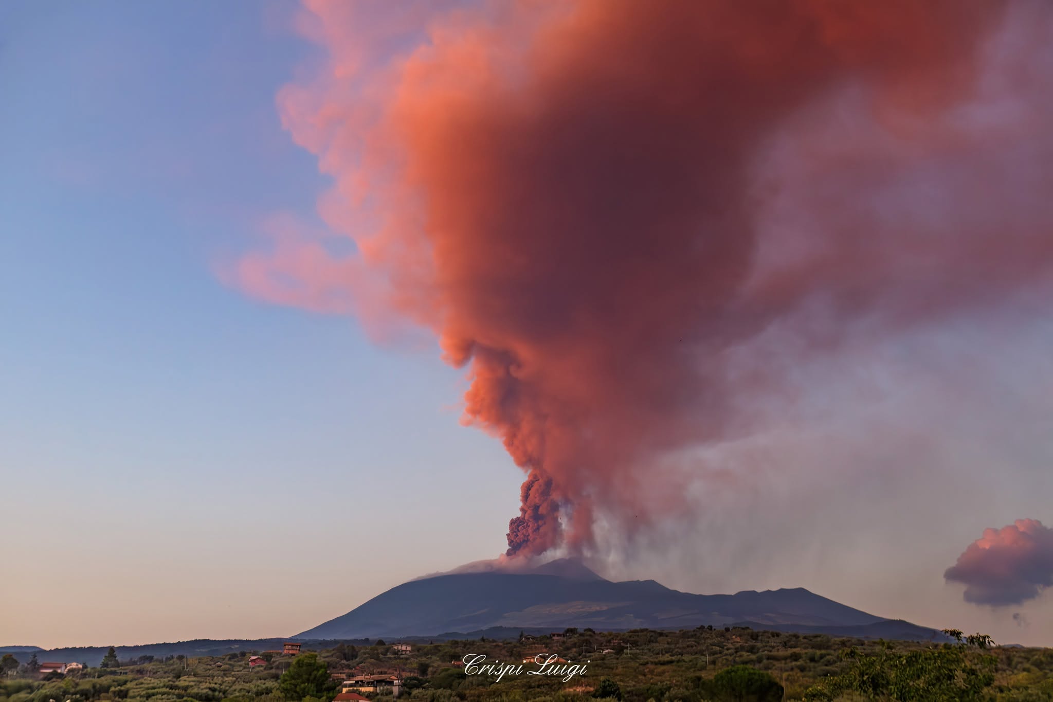
1) VOLCANOLOGICAL OBSERVATIONS: Explosive activity of varying intensity with ash emission from the Voragine and Bocca Nuova craters and the Northeast Crater. Effusive activity in the Valle del Bove fed by eruptive vents located at elevations of 3,060 m and 1,900 m. Intense degassing activity at the Southeast Crater and Northeast Crater.
2) SEISMOLOGY: Higher-energy seismicity due to fracturing along the Provenzana-Pernicana fault. The average amplitude of volcanic tremor shows highly variable values, ranging from low to high; source centroids are primarily located in the Northeast Crater area.
3) INFRASOUND: Low to moderate infrasonic activity.
4) GROUND DEFORMATION: Signals from ground deformation monitoring networks showed variations correlated with eruptive activity.
5) GEOCHEMISTRY: SO2 flux at a medium-high level, with daily values ranging from high to very high.
Soil CO2 flux (Etnagas network): average levels.
Partial pressure of dissolved CO2 in groundwater (EtnaAcque network): no update.
Helium (He) isotope ratio at peripheral sites: no update; the last recorded data showed high values (July 9, 2026).
6) SATELLITE OBSERVATIONS: Satellite-observed thermal activity in the summit area ranged from high to very high during the effusive activity that began on August 6, 2026, and subsequently from moderate to low after that activity ceased.
7) OTHER OBSERVATIONS: Two volcanic ash samples were collected and analyzed approximately 13 km from the Voragine crater, on the southeastern flank of Etna; these samples were characterized by fine grain size and higher ground-deposition levels compared to previous days.
VOLCANOLOGICAL OBSERVATIONS
Monitoring of Etna’s volcanic activity was conducted through the analysis of images from the INGV-Etna Observatory (INGV-OE) camera network and field observations by INGV-OE personnel.
Overall, activity during the period in question was characterized by:
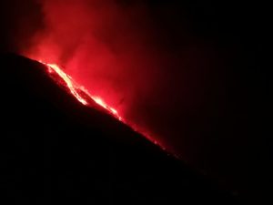
low-level explosive activity at the Voragine crater (VOR) and—with lower intensity—at the Northeast (CNE) and Bocca Nuova (BN) craters; as well as effusive activity in the Valle del Bove, fed by the vent located at an elevation of 1,900 m (described in previous bulletins) and by a new vent that appeared at an elevation of 3,060 m.
Specifically, on the 18th, a new effusive vent formed at an elevation of 3,060 m, feeding a flow that traveled approximately 600 m; by the 19th, it was no longer active. At the same time, the effusive vent located at an elevation of 1,900 m fed a lava flow—the front of which reached an elevation of approximately 1,315 m—as well as several superimposed flows that did not descend below 1,500 m; all of this activity occurred near Rocca Musarra. On the 20th, these flows were cooling and advancing via rolling motion. By the 23rd, the vent at 1,900 m elevation was no longer active.
Finally, the lava flow that had been pouring from the VOR toward the CNE ceased to be fed as of August 19.
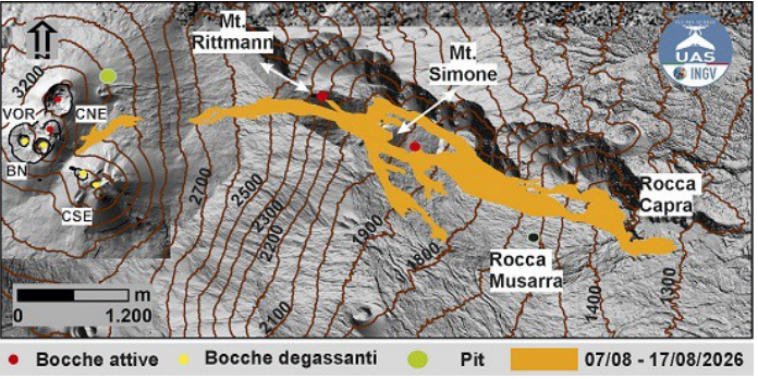
Map of the lava field updated as of August 20, 2026, created by combining drone (UAS) surveys and field observations. The lava field is superimposed on a shaded-relief model of the surface, generated from integrated drone and satellite data.
Regarding explosive activity, it was intermittent and weak at the Voragine (VOR) crater for most of the week, with dilute ash emissions dispersing mainly within the summit area. Surveillance cameras also recorded weak, continuous emissions from the Bocca Nuova (BN) crater and the NEC.
On August 24, strong degassing at the CNE was observed by cameras and by INGV personnel in the field.
The Southeast Crater (CSE) exhibited only variable-intensity degassing.
The lava field that formed on the eastern flank of Mount Etna was initially fed by the effusive vent located at an elevation of 2,750 m, and subsequently by vents at elevations of 2,350 m, 2,100 m, and 1,900 m. During the week in question, the active flow—fed by the vent at 1,900 m—reached an elevation of 1,500 m on August 20. The entire lava field has a maximum planimetric length of approximately 5.5 km, measured from the 2,750 m vent down to the 1,309 m elevation—where the furthest flow fronts are located, downstream of Rocca Capra. The lava field covered an area of 2 × 10⁶ m², and its total volume is estimated at between 8 and 11 × 10⁶ m³. The lava flow erupted on August 18, 2026, from a vent located at an elevation of 3,060 m reached a maximum planimetric length of approximately 0.6 km, with its leading edge reaching an elevation of 2,820 m.
Source : INGV
Photos : Luigi Crispi , INGV.
Italy , Stromboli :
WEEKLY BULLETIN, August 17, 2026 – August 23, 2026 (Date of issue: August 25, 2026)
ACTIVITY STATUS SUMMARY
Based on monitoring data, the following observations have been noted:
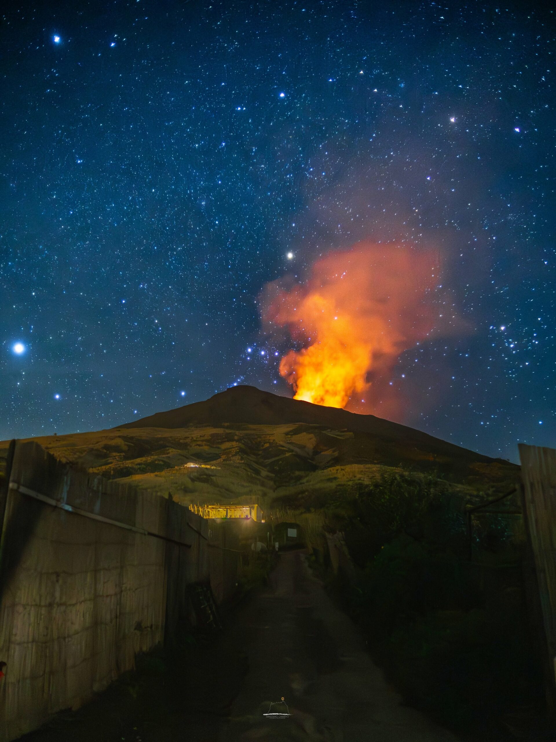
1) VOLCANOLOGICAL OBSERVATIONS: Typical Strombolian eruptive activity across both crater zones. The frequency of overall explosive activity—encompassing both the North Crater zone and the Central-South Crater zone—is at a medium-high level, with medium explosion intensity in both zones.
2) SEISMOLOGY: Monitored seismic parameters show no significant variations.
3) GROUND DEFORMATION: Signals from ground deformation monitoring networks show no significant variations.
4) GEOCHEMISTRY: SO2 flux at a medium-low level.
Soil CO2 flux (Pizzo zone – STR02): no recent data available.
Plume C/S ratio: average values.
Helium isotope ratio (R/Ra): decreasing from high values.
Soil CO2 flux in the San Bartolo zone: high values, though decreasing.
Soil CO2 flux in the Scari zone: average values.
5) SATELLITE OBSERVATIONS: Satellite-observed thermal activity in the summit area remained generally at a low to moderate level.
VOLCANOLOGICAL OBSERVATIONS
Observations of explosive activity captured by surveillance cameras
During the observation week, Stromboli’s eruptive activity was characterized through the analysis of images recorded by INGV-OE surveillance cameras located at an elevation of 190 m above sea level and at Punta dei Corvi (SCT-SCV and SPCT, respectively). Explosions in the North crater area (Zone N) primarily produced coarse material (bombs and lapilli); in the Central-South crater area (Zone CS), explosions produced predominantly fine material mixed with coarse material. The average explosion frequency in Zone N was at a medium level, and the intensity remained mostly at a medium-to-high level. In Zone CS, the average explosion frequency was at a medium level, and the intensity of explosive activity generally ranged from medium to high. The total average hourly explosion frequency (Zone N + Zone CS) was at a medium-to-high level.
Source : INGV
Photo : Stromboli stati d’animo / Sebastiano Cannavo .
Indonesia , Anak Krakatau :
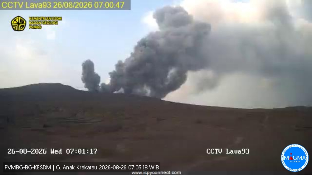
An eruption of Mount Anak Krakatau occurred on Wednesday, August 26, 2026, at 07:00 WIB; the observed ash column reached a height of approximately 250 m above the summit (or about 407 m above sea level). This dense, gray-to-black column drifted towards the west and northwest. The eruption was recorded by the seismograph with a maximum amplitude of 52 mm and a duration of 22 seconds.
Seismic observations
11 eruption earthquakes with amplitudes of 39–56 mm and durations of 14–70 seconds.
19 emission earthquakes with amplitudes of 28–51 mm and durations of 20–51 seconds.
5 harmonic tremors with amplitudes of 22–38 mm and durations of 39–418 seconds.
1 episode of continuous tremor with an amplitude of 2–65 mm (dominant amplitude: 20 mm).
Recommendations
The public, visitors, tourists, and hikers must not approach Mount Anak Krakatau or engage in activities within a 3 km radius of the active crater.
Source et photo : PVMBG.
Colombia , Chiles /Cerro Negro :
San Juan de Pasto, August 25, 2026, 2:20 PM
Based on monitoring of the Chiles-Cerro Negro volcanic complex (CVCCN) activity, the Colombian Geological Service (SGC)—an agency attached to the Ministry of Mines and Energy—reports the following information:
For the period from August 18 to August 24, 2026, the main variations in monitored parameters compared to the previous week were as follows:
● Despite the fluctuating behavior of this volcanic complex, seismic activity showed a decrease in the number of events, although a slight increase in energy levels was observed. It is worth noting an even distribution of events between earthquakes associated with rock fracturing and those linked to fluid dynamics.
● During this period, seismicity was distributed across areas both near and far from the volcanic edifices, primarily in the vicinity of the Chiles volcano collapse zone.
The event with the highest local magnitude was 0.8; it was located 0.5 km southeast of the Chiles volcano, at a depth of 3.9 km below its summit (4,700 meters above sea level). The other earthquakes occurred at distances ranging from 2 to 10 km and at depths of less than 5 km.

● Analysis of data collected by satellite sensors and ground stations has continued to reveal variations associated with deformation processes in the volcanic zone.
Based on the assessment and correlation of monitored parameters, the SGC recommends closely monitoring the situation’s evolution via weekly bulletins and other information published on our official channels, as well as adhering to the directives of local and departmental authorities and the National Unit for Disaster Risk Management (UNGRD).
Volcanic activity remains at the yellow alert level: an active volcano exhibiting changes in the baseline behavior of monitored parameters and other manifestations.
Source et photo : SGC.