August 25 , 2026.
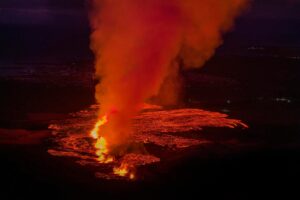
Hawaii , Kilauea :
HAWAIIAN VOLCANO OBSERVATORY DAILY UPDATE , U.S. Geological Survey
Monday, August 24, 2026, 10:00 AM HST (Monday, August 24, 2026, 20:00 UTC)
19°25’16 » N 155°17’13 » W,
Summit Elevation 4091 ft (1247 m)
Current Volcano Alert Level: ADVISORY
Current Aviation Color Code: YELLOW
Summary:
Kīlauea volcano is not erupting; the summit eruption in Halemaʻumaʻu is paused. Models indicate the onset of the next fountaining episode is likely between August 25 and August 28 with Tuesday to Wednesday most likely if rapid inflation persists.
Overview:
The summit eruption of Kīlauea in Halemaʻumaʻu is paused. Data from summit tiltmeters shows inflation resumed over the past day, increasing in rate last night and continuing into this morning. Glow was observed on webcams from the north and west vents overnight. Inflation models suggest that another episode is likely between Tuesday August 25 and Friday August 28 with Tuesday to Wednesday most likely if current inflation rates are sustained.
WARNING: NWS forecasts the nearby tropical storm system may cause potential torrential rains today. Overlap with an eruption may create extreme conditions not suitable for viewing.
CLOSURES: Hawaiʻi Volcanoes National Park is closed this morning, check the park website for updates.
No significant activity has been noted along Kīlauea’s East Rift Zone or Southwest Rift Zone.
Summit Observations:
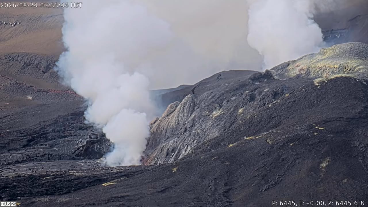
Continuous moderate to strong glow from the north vent was present overnight. Weak, intermittent glow was present at the west vent overnight in the V1 and V3 cameras. The south vent remained dark.
Continuous low-level seismic tremor occurred over the past day. There were no earthquakes recorded in the summit area in the past 24 hours.
The Uēkahuna tiltmeter (UWD) showed the resumption of inflationary tilt over the past day, increasing in rate this morning. UWD has recorded about 11.6 microradians of inflation since the end of episode 53. Deflationary tilt measured by UWD during episode 53 was approximately 13.9 microradians.
During inter-episode pauses, the sulfur dioxide (SO2) emission rate from the summit typically varies between 1,000 to 5,000 tonnes per day. Winds are currently from the northeast blowing the gas plume to the southwest.
Rift Zone Observations:
Rates of seismicity and ground deformation remain low in the East Rift Zone and Southwest Rift Zone. SO2 emissions from the East Rift Zone remain below the detection limit.
Source et photo : HVO.
Indonesia , Lewotobi Laki-laki :
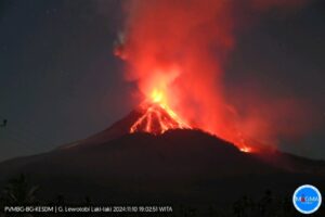
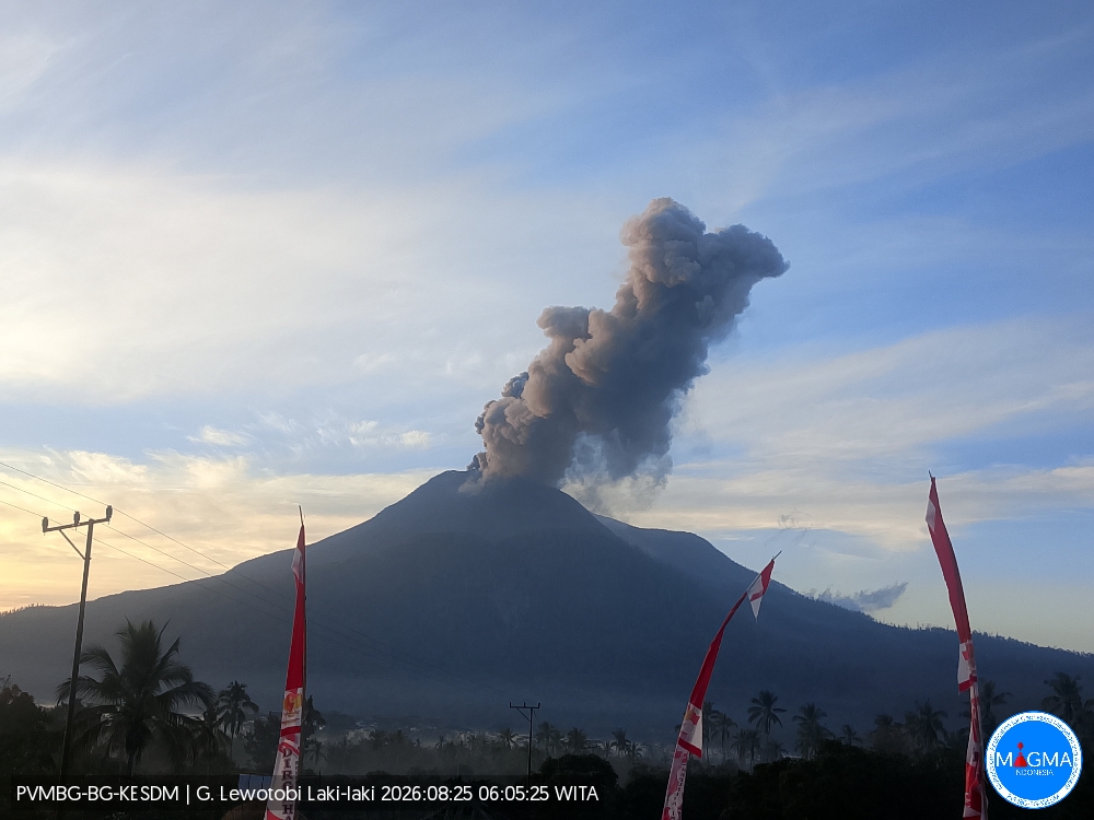
An eruption of Mount Lewotobi Laki-laki occurred on Tuesday, August 25, 2026, at 06:03 WITA, with an ash column reaching a height of approximately 1,000 m above the summit (or about 2,584 m above sea level). The observed ash column was gray and dense, drifting towards the west and northwest. The eruption was recorded by the seismograph with a maximum amplitude of 44.4 mm and a duration of 162 seconds.
Seismic observations
2 eruption earthquakes, with amplitudes of 29.6 to 44.4 mm and durations of 160 to 162 seconds.
9 distant tectonic earthquakes, with amplitudes of 4.4 to 47.3 mm and durations of 40 to 114 seconds.
Recommendations
1. Communities located near Mount Lewotobi Laki-laki, as well as visitors and tourists, must not conduct any activities within a 5 km radius of the Mount Lewotobi Laki-laki eruption center.
2. The public is advised to remain calm, follow the instructions of local authorities, and disregard information from unverified sources.
Source et photo : PVMBG.
Colombia , Puracé – Los Coconucos volcanic chain :
Popayán, August 24, 2026, 2:30 PM
Based on monitoring of activity in the Los Coconucos volcanic chain, the Colombian Geological Service (SGC)—an agency attached to the Ministry of Mines and Energy—
reports the following:
Since the last bulletin, seismic signals associated with fluid dynamics within the volcanic conduits—specifically « tremor » (TR) signals—have remained predominant; these continue to be located beneath the Puracé volcano crater at depths of less than 1 km. Seismicity linked to rock fracturing has remained at very low levels in terms of both frequency and magnitude, and has been localized within 5 km beneath the volcanic edifice. Slow ground deformation persists in the area between the Puracé, Piocollo, and Curiquinga volcanoes.
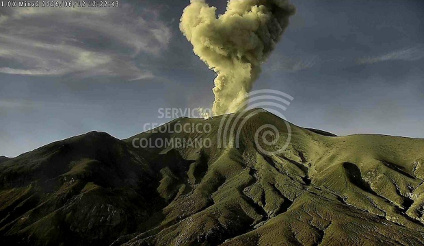
Between 2:00 PM yesterday and the time of this bulletin’s release, two ash emissions were recorded. The emission observed on August 24, 2026, at 9:39 AM was confirmed by monitoring
webcams; it produced a plume rising less than 200 m above the summit of the Puracé volcano, dispersing towards the west-northwest.
Gas monitoring indicates that sulfur dioxide (SO2) emissions are continuing and that the upward trend in soil carbon dioxide (CO2) concentrations persists. The values recorded by instruments on the volcano in recent days are the highest observed to date, far exceeding typical baseline levels; they therefore reflect a significant shift in the volcano’s dynamics, which remains at an orange alert level.
The public is advised to stay away from the crater areas of the Puracé, Piocollo, and Curiquinga volcanoes, as sudden ash or gas emissions—posing a serious risk to individuals—could occur.
In light of the above, the SGC recommends closely monitoring the situation via daily bulletins and other information released through our official channels, as well as adhering to instructions from local and departmental authorities and the National Unit for Disaster Risk Management (UNGRD). The volcanic alert level remains at orange: Volcano showing significant changes in monitored parameters.
Source et photo : SGC.
Guatemala , Fuego :
Weather conditions: Clear skies
Wind: From the east
Precipitation: 0.6 mm
Activity
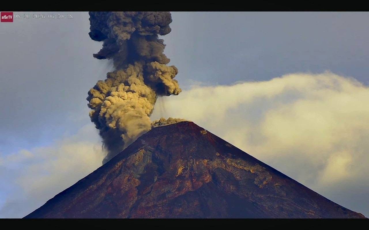
The Fuego Volcano Observatory (OVFGO) reports between 6 and 9 explosions per hour, ranging from moderate to strong intensity, accompanied by gas and ash plumes reaching altitudes of 4,200 to 4,700 meters above sea level. These plumes are dispersing towards the west and southwest, extending approximately 30 km. The explosions generate rumbling sounds and shockwaves audible at a distance of more than 15 kilometers, causing vibrations in homes located on the southwest and west flanks. They are accompanied by avalanches on the south, west, and southwest flanks. Sounds resembling aircraft turbines are also being emitted.
Ashfall has been reported in Panimaché, Morelia, Santa Sofía, El Porvenir, San Pedro Yepocapa, Sangre de Cristo, and other localities. The accumulation of deposits from pyroclastic density currents (PDCs) during the recent eruption maintains a risk of lahar formation in the Seca, Ceniza, and Lajas ravines, among others. Extreme caution is advised—particularly during afternoon and evening rains—when crossing these channels. Furthermore, it is recommended to avoid parking on the plateau or in areas near the crater.
Source : Insivumeh .
Photo : Afar TV
Kamchatka , Sheveluch :
KVERT VOLCANIC ACTIVITY NOTICE (VAN)
Issued: August 24 , 2026
Volcano: Klyuchevskoy (CAVW #300260)
Current aviation colour code: ORANGE
Previous aviation colour code: orange
Source: KVERT
Notice Number: 2026-94
Volcano Location: N 56 deg 03 min E 160 deg 39 min
Area: Kamchatka, Russia
Summit Elevation: 4750 m (15580 ft)
Volcanic Activity Summary:
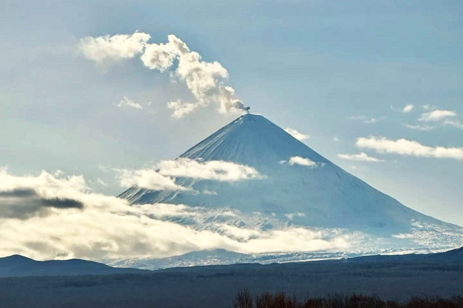
The explosive eruption of the volcano continues. According to video data, an ash rose up to 6 km a.s.l. Satellite data by KVERT showed an ash plume is extending for 130 km to the east of the volcano.
The moderate explosive eruption of the volcano continues. Ongoing activity could affect low-flying aircraft.
Volcanic cloud height:
6000 m (19680 ft) AMSL Time and method of ash plume/cloud height determination: 20260824/2055Z – Video data
Other volcanic cloud information:
Distance of ash plume/cloud of the volcano: 130 km (81 mi)
Direction of drift of ash plume/cloud of the volcano: E / azimuth 100 deg
Time and method of ash plume/cloud determination: 20260824/2020Z – Himawari-9 14m15
Source : Kvert
Photo : Kamtoday.