August 24 , 2026.
Italy / Sicily , Etna :
Statement on Etna’s activity, August 23, 2026, 09:48 (07:48 UTC).
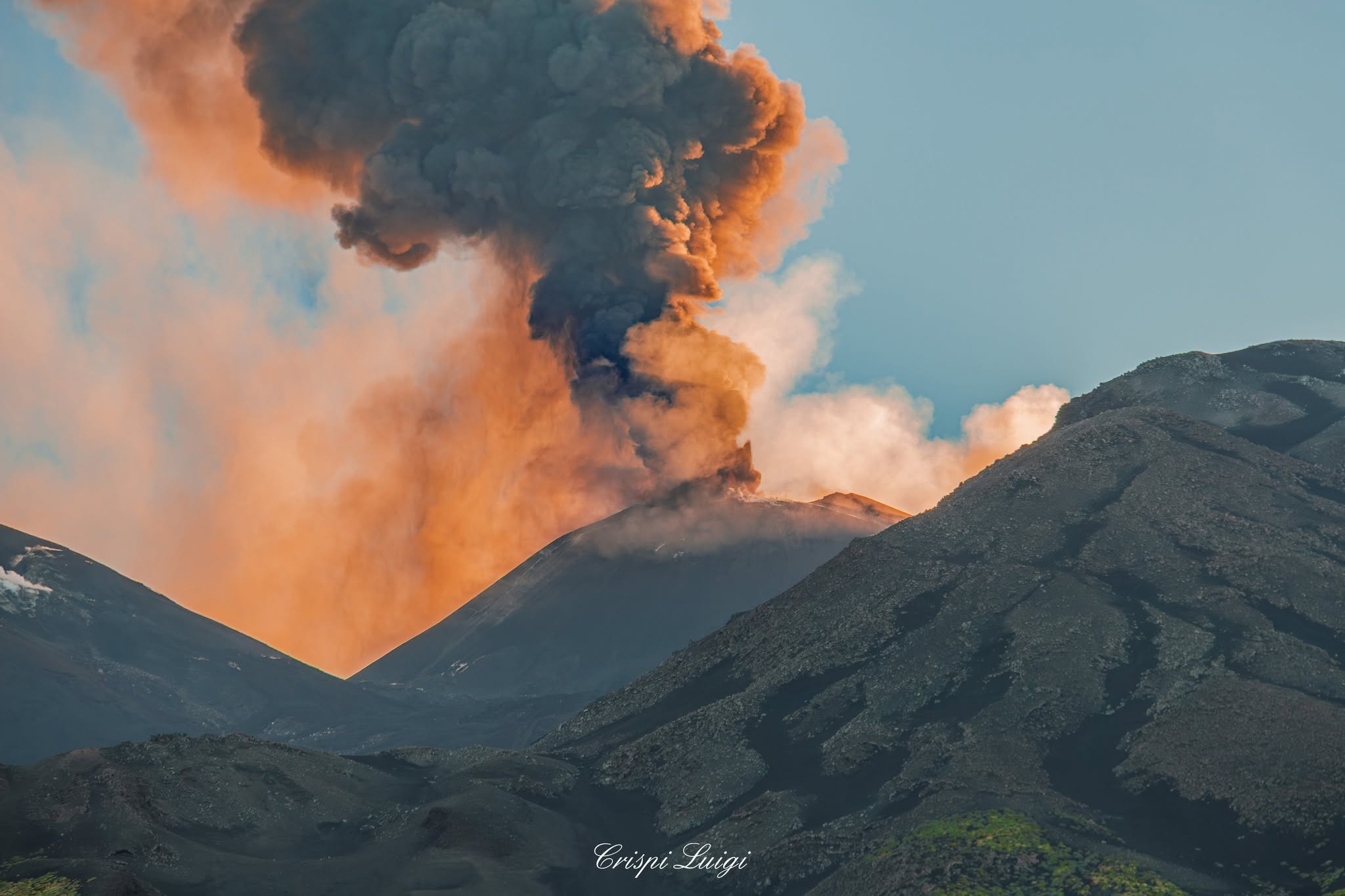
The National Institute of Geophysics and Volcanology (INGV) – Etna Observatory – reports that the frequency of ash emissions has gradually decreased since yesterday. Currently, weak and sporadic ash emissions are being observed, dispersing rapidly over the summit area.
Regarding effusive activity, as noted in the previous bulletin, all lava flows are inactive (cooled), and the vent located at an altitude of 1,900 meters is no longer active.
Seismically, the average amplitude of volcanic tremor has shown slight fluctuations within a moderate range over the past 24 hours; tremor levels currently remain moderate.
Tremor source centroids are located near the Northeast Crater, at elevations between 2,000 and 2,500 meters above sea level.
Infrasonic activity remains low; infrasonic events are localized in the Northeast Crater area, with amplitudes primarily in the moderate range.
Since the last bulletin, GNSS and tiltmeter networks have recorded no further significant changes.
Further information will be provided as soon as possible.
Source : INGV.
Photo : Luigi Crispi .
Kamchatka , Sheveluch :
KVERT VOLCANIC ACTIVITY NOTICE (VAN)
Issued: August 23 , 2026
Volcano: Klyuchevskoy (CAVW #300260)
Current aviation colour code: ORANGE
Previous aviation colour code: orange
Source: KVERT
Notice Number: 2026-93
Volcano Location: N 56 deg 03 min E 160 deg 39 min
Area: Kamchatka, Russia
Summit Elevation: 4750 m (15580 ft)

Volcanic Activity Summary:
The explosive eruption of the volcano continues. According to video data, an ash rose up to 6 km a.s.l. Satellite data by KVERT showed an ash plume is extending for 70 km to the north-east of the volcano.
The moderate explosive eruption of the volcano continues. Ongoing activity could affect low-flying aircraft.
Volcanic cloud height:
6000 m (19680 ft) AMSL Time and method of ash plume/cloud height determination: 20260823/0835Z – Video data
Other volcanic cloud information:
Distance of ash plume/cloud of the volcano: 70 km (43 mi)
Direction of drift of ash plume/cloud of the volcano: ENE / azimuth 62 deg
Time and method of ash plume/cloud determination: 20260823/0920Z – Himawari-9 14m15
Source : Kvert.
Photo : Yu. Demyanchuck. ( archive) .
Indonesia , Anak Krakatau :
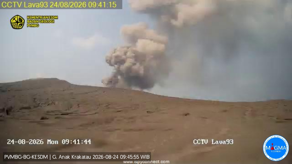
An eruption of Mount Anak Krakatau occurred on Monday, August 24, 2026, at 11:54 a.m. (Western Indonesia Time), with an ash column reaching a height of approximately 350 m above the summit (or about 507 m above sea level). The dense, gray-to-black ash column drifted towards the north and northwest. The eruption was recorded by the seismograph with a maximum amplitude of 68 mm and a duration of 29 seconds.
Seismic observations
7 eruption earthquakes with amplitudes of 49–68 mm and durations of 20–77 seconds.
49 emission earthquakes with amplitudes of 22–56 mm and durations of 14–94 seconds.
6 hybrid/multiphase earthquakes with amplitudes of 22–49 mm and durations of 11–20 seconds.
1 episode of continuous tremor with an amplitude of 2–57 mm (dominant amplitude of 20 mm).
Recommendations
The public, visitors, tourists, and hikers must not approach Mount Anak Krakatau or engage in activities within a 3 km radius of the active crater.
Source et photo : PVMBG.
Ecuador , El Reventador :
DAILY STATUS REPORT FOR REVENTADOR VOLCANO, Sunday, August 23, 2026.
Information from the Geophysical Institute – EPN.
Surface activity level: High; Surface trend: Unchanged
Internal activity level: Moderate; Internal trend: Unchanged
From August 14, 2026, 11:00 AM to August 15, 2026, 11:00 AM:
Seismicity:
Explosion (EXP): 60
Long-period (LP): 7
Emission tremor (TREMI): 3
Harmonic tremor (TRARM): 4
Precipitation / Lahars:
No precipitation has been recorded in the area. **Heavy rains could remobilize accumulated materials and generate debris-laden mudflows (lahars) capable of descending the volcano’s flanks and flowing into adjacent rivers.**
Emissions / Ash plumes:
Over the past 24 hours, the surveillance camera network and satellite imagery detected several gas and ash emissions; the resulting plumes reached heights of 500 to 1,000 meters above the crater rim, drifting toward the west, west-northwest, and northwest.
In connection with this activity, the Washington VAAC issued three reports regarding these emissions, noting plume heights ranging from 700 to 1,000 meters above the crater rim, with drift toward the west and northwest.
Observations:
Conditions remained predominantly cloudy from yesterday afternoon until the time of writing this report.
However, during the night and early morning, the surveillance camera system detected incandescence at the crater, as well as the descent of material to an elevation 800 meters below the crater rim.
Alert Level – SGR: Orange
Source : IGEPN.
Photo : Afar TV.
Costa Rica , Rincon de la Vieja :
Latitude: 10.83° N;
Longitude: 85.34° W;
Elevation: 1,916 m above sea level.
Current activity level: Alert.
Fifteen eruptions were recorded this week, five of which reached an acoustic magnitude greater than 4. The eruption on August 17 at 13:13 UTC was the second largest recorded so far this year. Residents of communities north of the volcano reported secondary lahars flowing down the Río Azul today, August 21. An increase in the number of long-period events was observed compared to the previous week, while the number of « tornillo » (screw-shaped) events remained stable.
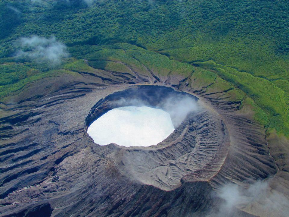
Background tremor persists, dominated by high frequencies (3.5–6.5 Hz). Following the eruptions, the tremor showed an increase in both amplitude and spectral range. Additionally, brief tremor pulses with frequencies between 0.5 and 6 Hz were detected. Three volcano-tectonic earthquakes were also recorded: two distal and one proximal to the crater. No significant deformation was observed. The average SO2 flux this week was 684 ± 361 t/d—double that of the previous week—with a maximum value of 4,524 t/d. These figures indicate an increase compared to the previous week, when the average flux was 329 ± 187 t/d with a maximum of 2,422 t/d.
Eruptive activity continues. SO2 emissions remain above baseline levels. The situation suggests the possibility of further eruptions, including events of equal or greater magnitude than those recorded so far. Consequently, the activity level of Rincón de la Vieja volcano remains at Level 3 (Alert).
Source : Ovsicori.
Photo : Raul Mora / RSN / UCR