August 23 , 2026.
Alaska , Kupreanof :
Low-level earthquake activity continued over the past day. No activity was observed in cloudy satellite images. Minor steam emissions were observed in web camera views.
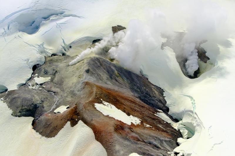
A new temporary monitoring station was installed recently near Mount Kupreanof and is providing seismic data, infrasound data, gas measurements, and web camera images on an intermittent basis. This is by design to conserve battery power, but the frequency of data acquisition can be increased if activity warrants. The closest functioning seismometers that provide continuous data are approximately 10 miles (16 km) to the northeast of the volcano as part of the Mount Veniaminof network. Mount Kupreanof is also monitored by satellite data, remote infrasound and lightning networks, and visual observations from pilots and mariners passing by the volcano.
Source : AVO.
Photo : Loewen, M. W / AVO / USGS .
Indonesia , Ibu :
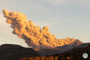
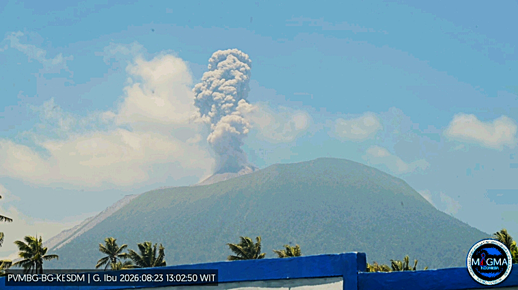
An eruption of Mount Ibu occurred on Sunday, August 23, 2026, at 1:00 PM WIT; an ash column was observed reaching approximately 600 meters above the summit (or about 1,925 meters above sea level). This dense, gray ash column drifted eastward. The eruption was recorded by the seismograph with a maximum amplitude of 28 mm and a duration of 51 seconds.
Seismic observations
110 eruption earthquakes (amplitudes: 15–28 mm; durations: 34–80 s).
1 emission earthquake (amplitude: 8 mm; duration: 35 s).
12 harmonic tremors (amplitudes: 4–28 mm; durations: 34–125 s).
96 low-frequency earthquakes (amplitudes: 2–14 mm; durations: 17–29 s).
94 shallow volcanic earthquakes (amplitudes: 2–10 mm; durations: 7–21 s).
2 local tectonic earthquakes (amplitudes: 10–15 mm; durations: 19–23 s).
7 distant tectonic earthquakes (amplitudes: 3–28 mm; durations: 39–125 s).
Recommendations
1. Communities living near Mount Ibu, as well as visitors and tourists, are advised not to conduct any activities within a 2 km radius, nor within the 3.5 km sectoral extension zone stretching toward the opening located north of Mount Ibu’s active crater.
2. In the event of ashfall, individuals outdoors are advised to protect their nose and mouth (using masks) and their eyes (using protective eyewear).
Source et photo : PVMBG.
Martinique , Mount Pelée :
Weekly Report, Institut de physique du globe de Paris / Martinique Volcanological and Seismological Observatory (OVSM)
Saint-Pierre, August 21, 2026, at 3:00 PM local time (GMT-4)
Volcano-tectonic seismic activity:
Between August 14, 2026, at 4:00 PM (UTC) and August 21, 2026, at 4:00 PM (UTC), the OVSM recorded 117 volcano-tectonic earthquakes:
• 115 volcano-tectonic earthquakes. Two earthquakes had a magnitude (local magnitude Mlv or duration magnitude Md) greater than 1, including one with a magnitude greater than 2 (Mlv = 2.3). The vast majority of these earthquakes were located at depths between 1.0 and 1.5 km below the volcano’s summit. However, two low-energy volcano-tectonic earthquakes were located at depths between 4 and 5 km below sea level, directly beneath Mount Pelée.
• One shallow long-period earthquake and one shallow low-energy hybrid earthquake (magnitudes Mlv=0.3 and Mlv=0.85, respectively), located at a depth of approximately 1 km below the volcano’s summit.
No earthquakes were reported felt by the population.
During the previous week, the OVSM had recorded 54 volcano-tectonic earthquakes. As of August 21, 2026, and over the past four weeks, the OVSM has thus observed a total of 404 volcanic earthquakes, representing an average of 101 earthquakes per week.
Mount Pelée Deformations:
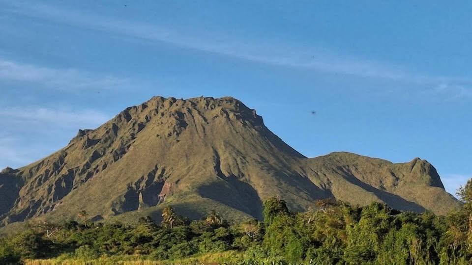
Since May 2026, the OVSM has been recording ground displacements of several centimeters in the summit area of Mount Pelée. Over the past four weeks, maximum displacement rates have been around 1.2 cm per month, a slight decrease compared to the previous month. These displacements are consistent with deformation of the volcanic edifice caused by an inflating pressure source located at a depth of approximately 1 km beneath the summit.
The probability of short-term eruptive activity remains low. However, given the observations gathered over recent months and years, a change in the situation over the medium term (weeks to months) cannot be ruled out.
The volcanic alert level, in accordance with the measures established by the authorities, is currently YELLOW: vigilance.
Source : Direction de l’OVSM-IPGP
Photo : OVSM-IPGP
Costa Rica , Poas :
OVSICORI-UNA Weekly Volcanic Monitoring Bulletin, August 21, 2026
Latitude: 10.20° N;
Longitude: 84.23° W;
Elevation: 2,687 m above sea level.
Current activity level: Advisory
No eruptions were recorded this week. On August 20, tremor amplitude increased significantly. Starting at 16:20 that day, intense seismic tremor—as well as acoustic tremor, to a lesser extent—was observed; the most intense phase occurred between 16:20 and 16:30. However, high amplitudes have persisted to the present. This increase was preceded, in the hours prior, by a slight rise in the number of high-frequency events. The number of long-period events continues to show a downward trend. Two distal volcano-tectonic earthquakes were recorded; although they could not be precisely located, they are estimated to have occurred on the eastern flank of the volcanic edifice.
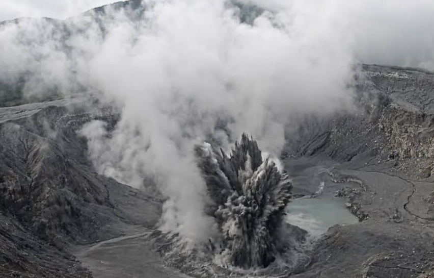
It is worth noting that last week, a sequence of harmonic tremor events was recorded, lasting several minutes (5 to 30 min) and exhibiting a large number of high-frequency harmonics. The geodetic network shows no significant deformation. Multi-GAS stations recorded an average SO2/CO2 ratio of 1.1 ± 0.4, a value similar to that of the previous week (1.4 ± 0.3). The H2S/SO2 ratio remains below 0.1. NOVAC stations recorded a daily SO2 flux of 203 ± 79 tonnes, comparable to the previous week’s figure (233 ± 43 t/d). The level of the hyperacidic lake rose by approximately 2 m over the week due to heavy rainfall, particularly on August 16. Despite the rain, a high lake temperature—exceeding 74°C—was measured.
Source et photo : Ovsicori.
Colombia , Nevado del Ruiz :
Manizales, August 18, 2026, 7:00 PM.
Based on monitoring of the Nevado del Ruiz volcano’s activity, the Colombian Geological Service (SGC)—an agency attached to the Ministry of Mines and Energy—reports the following information:
During the week of August 11 to 17, 2026, the volcano continued to exhibit unstable behavior.
Compared to the previous week, the main variations in monitored parameters were as follows:
– Seismic activity associated with rock-fracturing processes within the volcanic edifice decreased, in terms of both the number of recorded earthquakes and the seismic energy released. The earthquakes were primarily located near the Arenas crater and on the south-southeast and south-southwest flanks of the volcano, within 6 km of the crater.
To a lesser extent, isolated events were also recorded on other flanks of the volcano, up to 10 km from the crater. Earthquake depths ranged from less than 1 km to 8 km below the volcano’s summit. The maximum magnitude was 1.2, corresponding to the earthquake that occurred on August 11 at 2:41 AM, located 3 km south-southeast of the Arenas crater at a depth of 4 km.
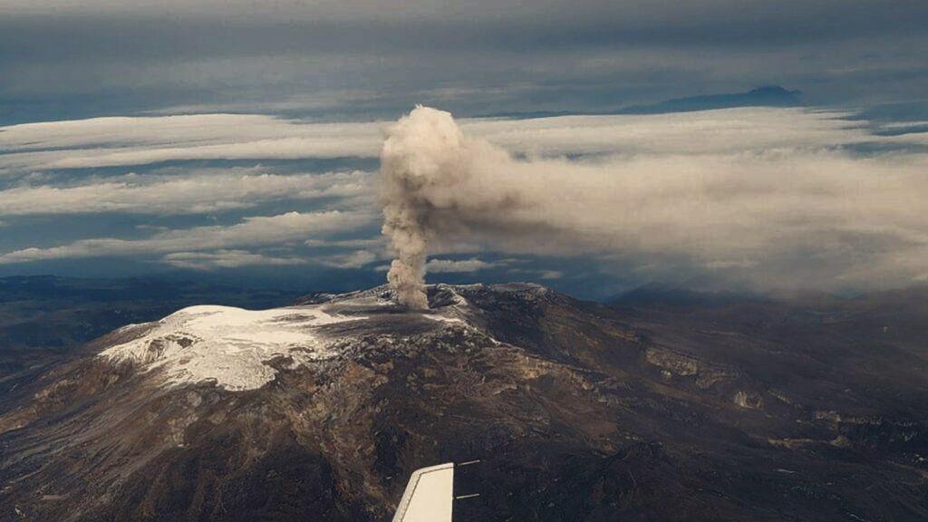
– Seismicity associated with fluid dynamics within the volcanic conduits decreased in terms of both the number of events and the seismic energy released. This seismicity was characterized by short-duration, low-energy signals. As in previous weeks, no long-duration seismic signals were recorded, and no pulsatile ash emissions or variations in the apparent temperature of the gas plume were confirmed.
– Emissions of water vapor and volcanic gases—primarily sulfur dioxide (SO₂)—into the atmosphere continued from the Arenas crater. The estimated SO₂ flux associated with degassing processes decreased slightly compared to the previous week. Supplementary monitoring via satellite data platforms continued to show low levels of SO₂ output.
The gas and water vapor plume remained below a vertical height of 300 m above the volcano’s summit, with a predominant dispersion direction toward the volcano’s northwest flank. Notably, strong winds in the volcanic area continued to remobilize previously deposited volcanic material, a phenomenon confirmed by surveillance cameras.
Monitoring of thermal anomalies at the base of the Arenas crater via satellite platforms was limited by persistent cloud cover in the area. No data were obtained for this week.
Source et photo : SGC.