August 12 , 2026.
Italy / Sicily , Etna :
Statement on Etna’s activity, August 11, 2026, 12:41 (10:41 UTC).
The National Institute of Geophysics and Volcanology (INGV), Osservatorio Etneo, announces that around 09:30 UTC, the formation of a new eruptive vent was observed at the base of the northern wall of the Valle del Bove, above Monte Simone, at an elevation of approximately 2,090 m. INGV personnel are currently conducting field surveys
to assess the activity of the eruptive vent located at 2,360 m and the characteristics of the lava fields.
Since the last update yesterday at 22:25 UTC, the average amplitude of volcanic tremor has remained high, though still within the lower end of the range. Source
centroids were located in the area of the North-East craters until approximately 05:30 UTC today, and subsequently at the Voragine crater, at an elevation between 2,800 and 3,000 m above sea level. Infrasonic activity is at moderate to high levels; events are localized at the Voragine crater and exhibit variable amplitude.
Signals from ground deformation monitoring networks indicate trends consistent with those previously reported. The GNSS stations EPDN (Pizzi
Deneri) and EINT (Intermedia) show slight shifts—westward for the former and northward for the latter.
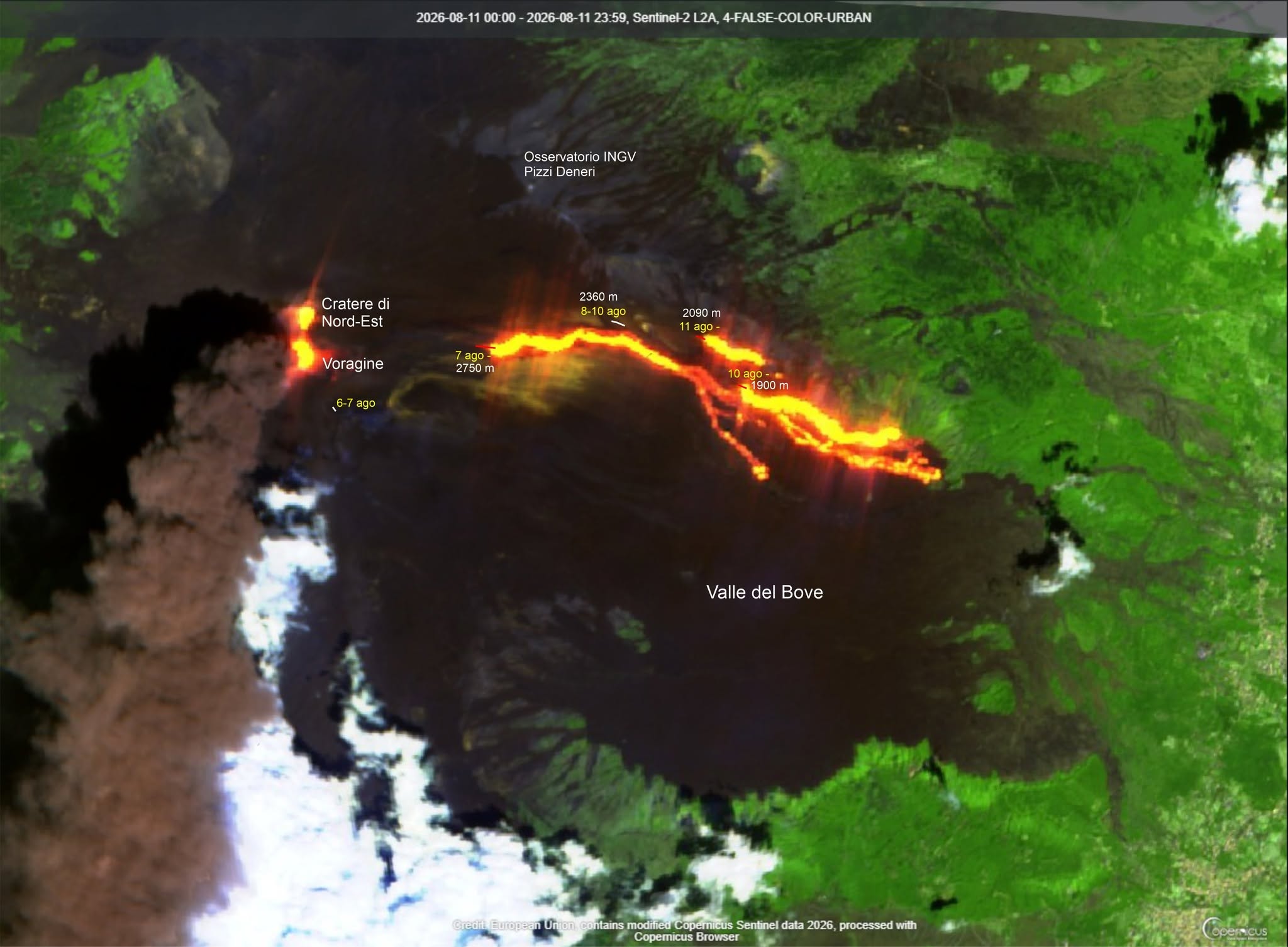
Let’s review the current eruption to avoid any unjustified speculation or alarmism.
The image I am sharing was generated using Sentinel-2 L2A data acquired today. Based on this, I have identified the active eruptive vents (red lines) and indicated their approximate elevation above sea level.
Effusive vents that are no longer active are marked with white lines.
This diagram is intended solely for educational purposes; it may be used and shared freely.
Update on Mount Etna activity, August 11, 2026, 19:54 (17:54 UTC).
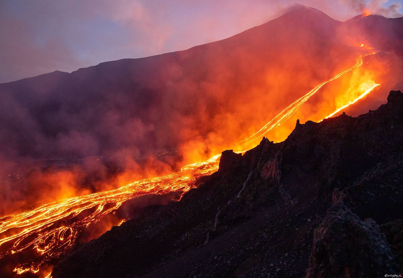
The National Institute of Geophysics and Volcanology (INGV) – Etna Observatory – reports that video surveillance images and field inspections by INGV personnel indicate ongoing effusive activity at eruptive vents located at elevations of 2,750 m, 2,090 m (see the update from August 11 at 10:41 UTC), and 1,900 m (see the update from August 10 at 22:25 UTC). Lava flow fronts fed by the vent at an elevation of 2,360 m appear to be cooling. At 16:00 UTC, the most advanced active fronts were at an elevation of 1,360 m, near Rocca Capra (Valle del Bove). At 14:10 UTC, a pulse of ash emission was observed at the Bocca Nuova crater; it interacted with products from the explosive activity at the Voragine crater, generating minor pyroclastic flows confined to the summit area. Since the last update at 10:41 UTC today, the average amplitude of the volcanic tremor has continued to fluctuate within the lower range of high values. The source centroid has been located in the Voragine crater area, at an elevation of approximately 3,000 m.
Infrasonic activity has remained at high to very high levels, particularly since approximately 13:00 UTC. Infrasonic events of moderate to high amplitude
have been localized in the Voragine crater area. Analysis of signals from ground deformation monitoring networks suggests slight deflation of Etna’s summit area. Indeed, signals from GNSS and tiltmeter networks indicate variations—already noted in previous bulletins—that point to deflation, albeit of modest magnitude. Distinct transient signals, associated with the impulsive ash emission that occurred at 14:10, are observed at the PDN and ECP tiltmeter stations.
Further updates will be provided as soon as possible.
Sources : INGV
Photos :Copernicus via Marco Neri , Giovinsky Aetnensis .
Italy , Stromboli :
WEEKLY BULLETIN, August 3, 2026 – August 9, 2026. (Date of issue: August 11, 2026)
SUMMARY OF ACTIVITY STATUS
Based on monitoring data, the observations are as follows:
1) VOLCANOLOGICAL OBSERVATIONS: Ordinary Strombolian eruptive activity accompanied by lava spattering in the North Crater area, as well as three episodes of effusive activity resulting from lava overflows from this same area. The frequency of total explosive activity—encompassing both the North Crater area and the Central-South Crater area—remained at a medium level; explosion intensity was high in the North Crater area and moderately high in the Central-South area.
2) SEISMOLOGY: Monitored seismic parameters show no significant variation.
3) GROUND DEFORMATION: Data from GNSS and tiltmeter networks showed no significant variation during the week.
4) GEOCHEMISTRY: SO2 flux at a medium level.
Soil CO2 flux (Pizzo area – STR02): high values.
C/S ratio in the plume: medium values.
Helium isotopic ratio (R/Ra): decreasing from high values.
Soil CO2 flux in the San Bartolo area: stable at high values.
5) SATELLITE OBSERVATIONS: Thermal activity observed by satellite in the summit area was generally moderate, coinciding with the effusive episodes of August 4, 6, and 7–9.
VOLCANOLOGICAL OBSERVATIONS
During the observation week, Stromboli’s eruptive activity was characterized through the analysis of images recorded by INGV-OE surveillance cameras located at an elevation of 190 m above sea level and at Punta dei Corvi (SCT-SCV and SPCT, respectively). Explosions in the North crater area (Zone N) primarily produced coarse material (bombs and lapilli); in the Central-South crater area (Zone CS), explosions produced a mixture of predominantly fine and coarse material. The average explosion frequency for Zone N fell within the usual range, while intensity remained at a predominantly high level. In Zone CS, the average explosion frequency was at a low-to-moderate level, and the intensity of explosive activity was generally moderate-to-high. The total daily average hourly explosion frequency (Zone N + Zone CS) was at a moderate level.
EFFUSIVE ACTIVITY ASSOCIATED WITH LAVA OVERFLOWS (UTC times)
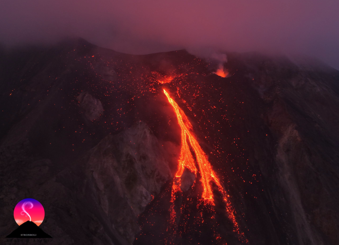
During the observation week, in addition to the usual explosive activity, the North Crater area produced effusive activity resulting from overflows on three occasions—August 4 and 6, and between August 7 and 8—coinciding with phases of intense spattering activity from the vents in the N1 sub-zone. The first episode occurred on August 4: it began around 03:30 with rheomorphic deposits, evolved into lava effusion starting around 07:30, then declined slowly and irregularly from 13:00, finally ending around 16:30.
On August 6, starting around 04:44, surveillance camera images captured the onset of a second episode of minor lava overflow, which ended at 12:00 UTC that same day.
The third overflow episode began around 22:30 on August 7 and ended the following day (August 8) around 21:00. This also involved a minor lava flow; as with the two previous episodes, the flow fronts remained confined to the upper part of the Sciara del Fuoco.
Indonesia , Karangetang :
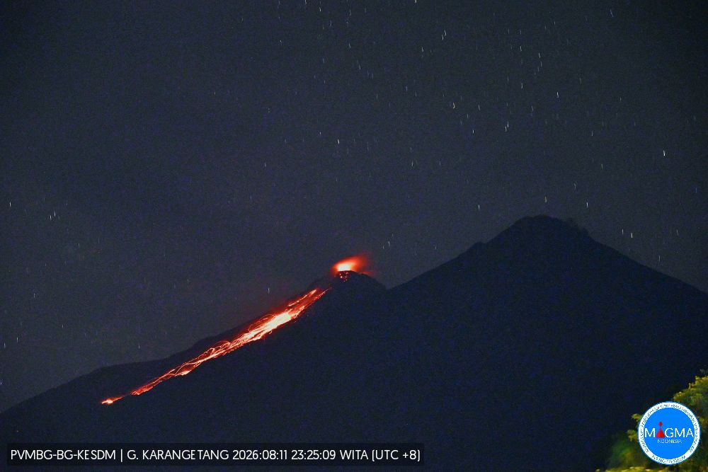
An eruption of Mount Karangetang occurred on Tuesday, August 11, 2026, at 11:43 PM (WITA), with an ash column rising approximately 350 m above the summit (or about 2,134 m above sea level). This column, ranging in color from white to gray and in intensity from moderate to dense, drifted eastward. The eruption was recorded by the seismograph with a maximum amplitude of 50 mm and a duration of 40 seconds.
Seismic observations
21 rockfall-related earthquakes, with amplitudes of 2–10 mm and durations of 28.8–85 seconds.
121 emission earthquakes, with amplitudes of 2–50 mm and durations of 13.2–71 seconds.
19 harmonic tremors, with amplitudes of 1.5–15 mm and durations of 19.5–315.2 seconds.
7 episodes of non-harmonic tremor, with amplitudes of 3–7.5 mm and durations of 36.5–74 seconds.
9 hybrid/multiphase earthquakes, with amplitudes of 3–10 mm and durations of 13.2–49.1 seconds.
6 shallow volcanic earthquakes, with amplitudes of 3–7.5 mm and durations of 5–7.6 seconds.
3 deep volcanic earthquakes, with amplitudes of 15–50 mm and durations of 9.1–22.4 seconds.
2 local tectonic earthquakes, with amplitudes of 40–50 mm and durations of 23–43.9 seconds.
4 distant tectonic earthquakes, with amplitudes of 7.5–50 mm and durations of 40.4–109.9 seconds.
Recommendations
(1) The public, as well as visitors and tourists, must not approach, climb, or conduct activities within the designated risk zone; This encompasses a 1.5 km radius around the summits of Kawah Dua (North crater) and the main crater (South), as well as a sectoral extension zone stretching 2.5 km from the North crater towards the northwest and southwest.
Source et photo : PVMBG.
Colombia , Puracé – Los Coconucos volcanic chain :
Popayán, August 11, 2026, 2:00 PM.
Based on monitoring of the Los Coconucos volcanic chain’s activity, the Colombian Geological Service (SGC)—an agency attached to the Ministry of Mines and Energy—reports the following:
Since the last bulletin, seismic activity has remained dominated by phenomena linked to fluid dynamics within the volcanic conduits—specifically continuous tremor (TR) and long-period (LP) events—located beneath the Puracé volcano’s crater at a depth of less than 1 km. Seismicity associated with rock fracturing has remained at very low levels in terms of both frequency and magnitude, occurring between 1 and 2 km below the crater.
Gas monitoring indicates that sulfur dioxide (SO₂) flux values remain above the average recorded for this volcano, and soil carbon dioxide (CO₂) concentrations continue to rise.
Satellite data regarding sulfur dioxide (SO₂) continue to show significant values, with dispersion extending northwest of the volcano. No thermal anomalies have been detected at the crater floor, according to information published on the MIROVA satellite platform.
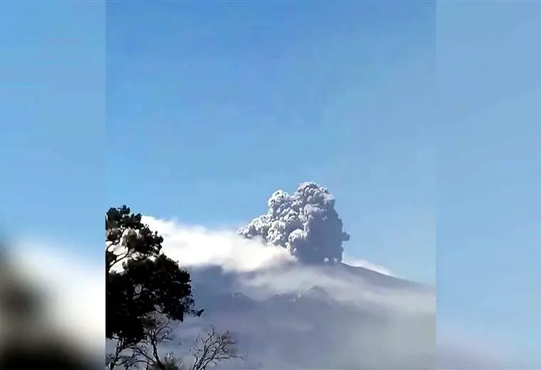
Between 2:00 PM yesterday and the time of this bulletin’s publication, three ash emissions were recorded, reaching a maximum height of 700 m. Additionally, reports of ashfall have been received from residents in rural areas such as Cristales, Loma Linda, Cobaló, Alto Anambío, and 20 de Julio, within the municipality of Puracé.
Instrument readings from the volcano over the past few days are the highest recorded to date, significantly exceeding established baseline levels; they indicate a major shift in the volcano’s dynamics, which remains at the orange alert level. Information circulating on social media suggests that the Puracé volcano has moved to the red alert level. The SGC wishes to clarify that this information is incorrect; any change in alert level or volcanic behavior will be announced immediately via our official channels. We urge the public not to share information regarding volcanic activity unless it originates from the Colombian Geological Service (SGC) or agencies within the National Disaster Risk Management System.
Although the orange alert remains in effect, temporary fluctuations in volcanic activity may occur—with activity sometimes decreasing compared to previous days or weeks—without necessarily implying that the volcano has returned to a stable state. Transitioning to the yellow alert level requires sufficient time to evaluate all monitored parameters and identify trends indicating reliable stability. The public is advised to stay away from the crater areas of the Puracé, Piocollo, and Curiquinga volcanoes, as sudden ash or gas emissions posing a significant risk to people may occur.
The volcanic alert level remains orange: the volcano is exhibiting significant changes in monitored parameters.
Source et photo : SGC.
Guatemala , Fuego :
Weather conditions: Clear skies
Wind: Easterly
Precipitation: 0 mm
Activity
During the night and early morning, low- to moderate-intensity explosions were recorded, accompanied by ash plumes reaching altitudes of 4,200 to 4,500 meters above sea level; these plumes drifted west and southwest of the volcanic complex, traveling approximately 25 kilometers. Avalanches were also observed on the western, southwestern, and southern flanks, with some blocks reaching the vegetation zone.
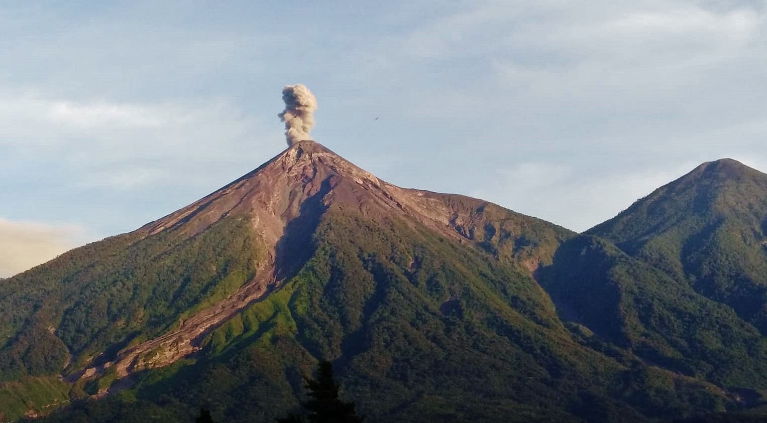
Some explosions are accompanied by rumbling, shock waves, and sounds resembling those of a locomotive.
Due to the activity described, remaining on the plateau is dangerous because of the risk of falling ballistic material.
Source : Insivumeh
Photo : Conred .