April 25 , 2026.
Hawaii , Kilauea :
HAWAIIAN VOLCANO OBSERVATORY DAILY UPDATE , U.S. Geological Survey
Friday, April 24, 2026, 8:59 AM HST (Friday, April 24, 2026, 18:59 UTC)
19°25’16 » N 155°17’13 » W,
Summit Elevation 4091 ft (1247 m)
Current Volcano Alert Level: ADVISORY
Current Aviation Color Code: YELLOW
Overview:
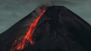
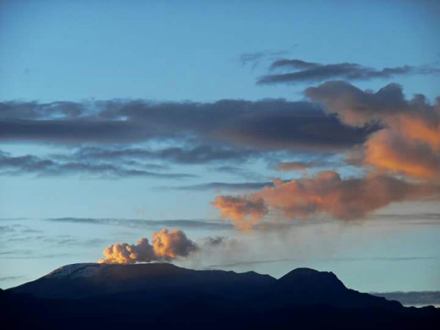
Episode 45 of lava fountaining in Halemaʻumaʻu at the summit of Kīlauea began at 1:34 a.m. HST on April 23, after two days of precursory activity, and ended at 10:01 a.m. HST the same day. The eruption is currently paused.
No significant activity has been noted along Kīlauea’s East Rift Zone or Southwest Rift Zone.
Episode 45 lava fountaining began around 1:30 a.m. HST on Thursday, April 23, and continued for 8.5 hours. Fountain heights were moderate (mostly under 300 meters, or 1000 feet), and winds carried the tephra away from populated areas, minimizing tephra impacts. The north vent had the sole fountain, with the south vent showing only weak sporadic spattering. The north fountain fed channelized lava flows that reached the northern and eastern portions of the crater floor.
Summit Observations:
Episode 45 of the ongoing Halemaʻumaʻu eruption began at 1:34 a.m. HST on April 23 and ended at 10:01 a.m. on the same day. No significant tephra fallout was reported at visitor areas of Hawai’i Volcanoes National Park or on county roads, but small particles were reported in communities farther downwind to the southwest.
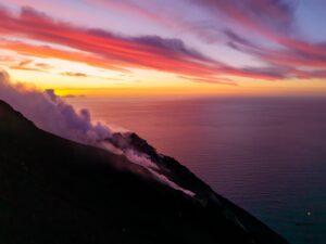
Overnight, glow was visible from both eruptive vents, with the south vent producing occasional flames. Lava flows on the Halemaʻumaʻu crater floor remained incandescent and continued to slowly spread towards the east through yesterday and slowing down overnight. Incandescence on the crater floor for several more days.
Seismic tremor continues during the current pause, with bursts of tremor every 1–10 minutes that are typical after the end of fountaining and are likely associated with gas pistoning cycles in the eruptive vents. Earthquake activity at the summit during and after episode 45 has been low; with seven small earthquakes recorded in the past day.
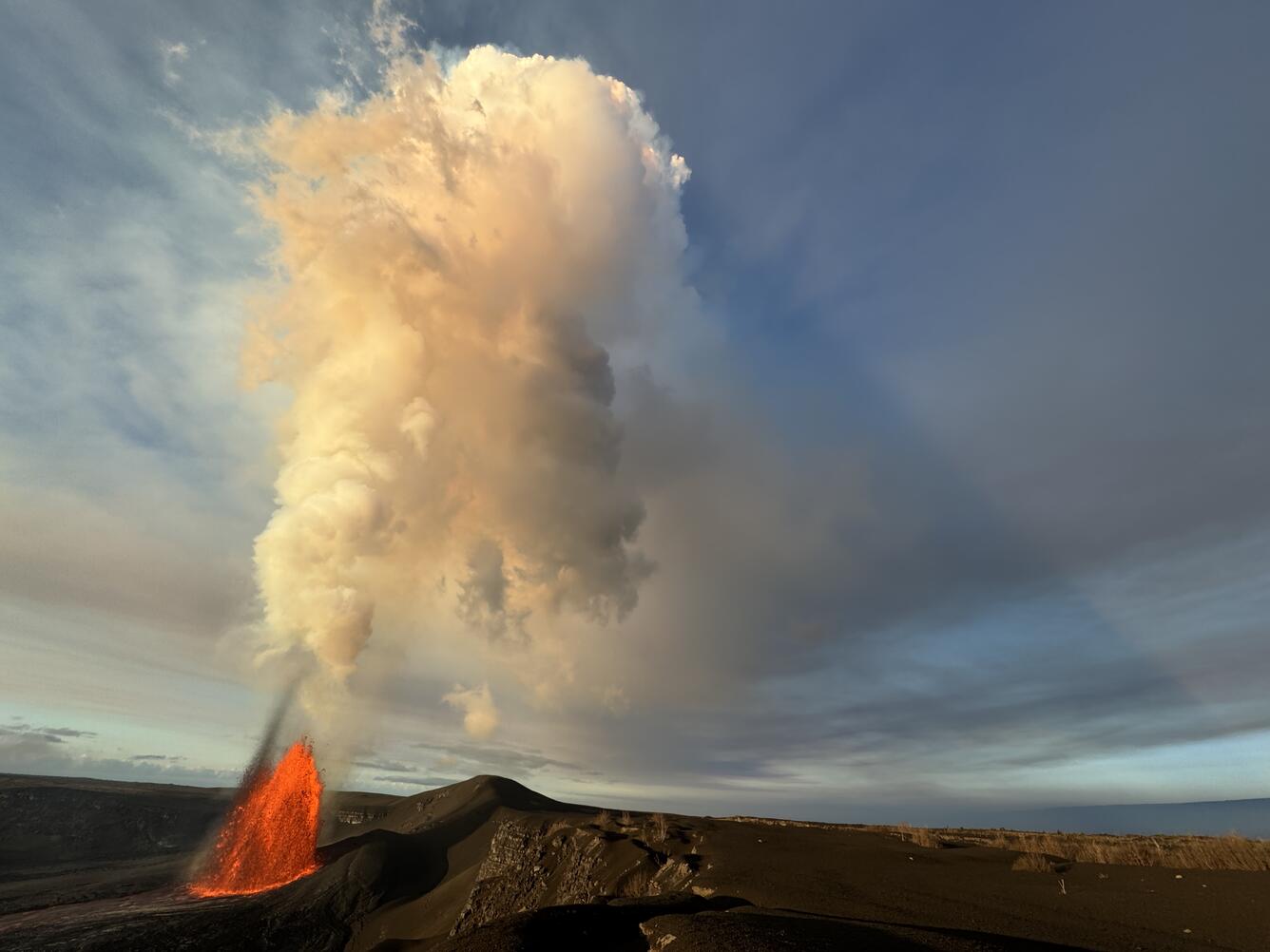
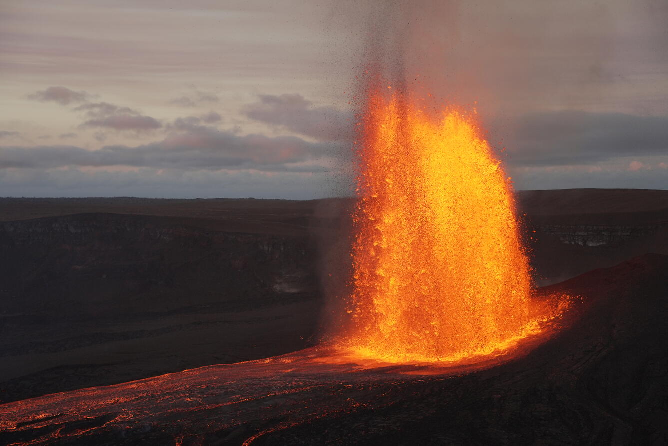
The episode 45 outgassing plume at the summit of Kīlauea rose vertically and cast a long shadow towards Mauna Loa at sunrise. The wide-angle lens used for this photograph distorts the angle of the fountain
The Uēkahuna tiltmeter (UWD) recorded about 16.0 microradians of deflationary tilt during episode 45. Since the end of fountaining, summit inflation has resumed, with the same tiltmeter recording about 3 microradians of inflationary tilt as of this morning.
Emissions during episode 45 were likely similar to those measured during episode 44, when HVO was able to measure a sulfur dioxide (SO2) emission rate of 208,000 tonnes per day during lava fountaining. With the eruption now paused, the SO2 emission rate is likely now varying within a typical range of 1,000 to 5,000 tonnes per day.
Rift Zone Observations:
Rates of seismicity and ground deformation remain low in the East Rift Zone and Southwest Rift Zone. SO2 emissions from the East Rift Zone remain below the detection limit.
Source : HVO.
Photos : USGS / M. Patrick.
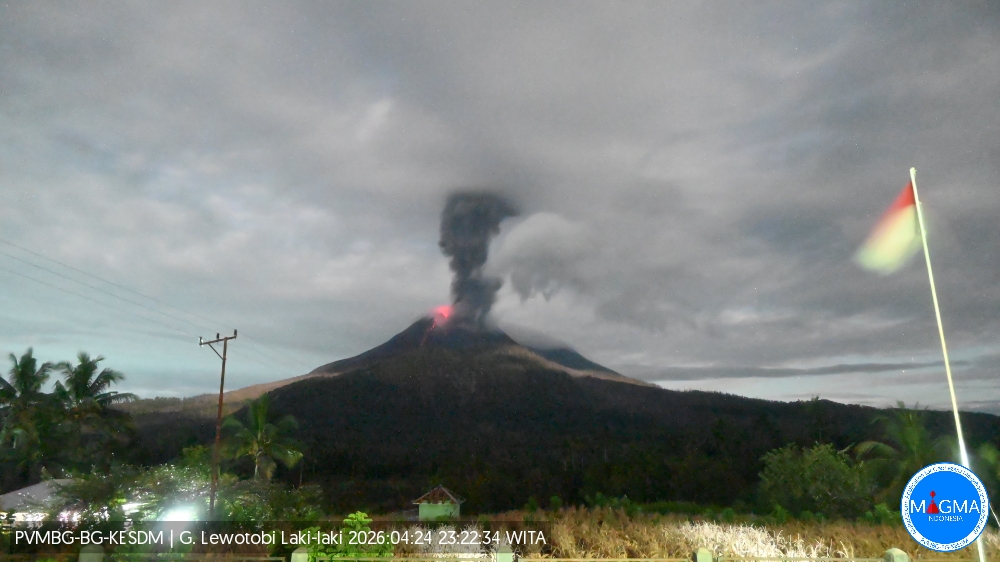
Indonesia , Lewotobi Laki-laki :
An eruption of Mount Lewotobi Laki-laki occurred on Friday, April 24, 2026, at 11:22 PM WITA. The observed ash column rose approximately 1,000 meters above the summit (approximately 2,584 meters above sea level). This gray ash column was highly intense and directed southwest. The eruption was recorded by a seismograph with a maximum amplitude of 18.5 mm and a duration of 222 seconds.
Seismic Observations
Three eruption earthquakes with amplitudes between 7.4 and 18.5 mm and durations of 110 to 222 seconds.
An avalanche earthquake with an amplitude of 5.9 mm and a duration of 34 seconds.
Three emission earthquakes with amplitudes between 5.1 and 29.6 mm and durations of 33 to 38 seconds.
Thirteen non-harmonic tremors with amplitudes between 2.9 and 10.5 mm and durations of 67 to 99 seconds.
Nine low-frequency earthquakes with amplitudes between 3.7 and 29.6 mm and durations of 24 to 30 seconds.
Two deep volcanic earthquakes with magnitudes between 2.9 and 7.4 mm and durations of 10 to 24 seconds.
Seventeen local tectonic earthquakes with magnitudes between 2.9 and 47.3 mm and durations between 24 and 60 seconds.
Four distant tectonic earthquakes with magnitudes between 2.2 and 14.8 mm and durations between 64 and 233 seconds.
Recommendations
1. Residents living around Mount Lewotobi Laki-laki and visitors/tourists are advised to refrain from any activity within a 4 km radius of the eruption center.
2. The public is advised to remain calm, follow the instructions of local authorities, and not believe rumors from unknown sources.
Source et photo : PVMBG.
Colombia , Nevado del Ruiz :
Manizales, April 21, 2026, 8:00 PM
Regarding the monitoring of activity at the Nevado del Ruiz volcano, the Colombian Geological Survey (SGC), an agency under the Ministry of Mines and Energy, reports the following:
During the week of April 14-20, 2026, the volcano continued to exhibit unstable behavior. Compared to the previous week, the main variations in monitored parameters were as follows:
– Seismic activity associated with rock fracturing processes within the volcanic edifice increased slightly in the number of recorded earthquakes, while the seismic energy released remained stable. These earthquakes were low-energy, with a magnitude of less than 1.0, and occurred primarily in the Arenas crater, at depths of up to 2 km. Smaller and scattered earthquakes were recorded in other areas of the volcano, within a radius of less than 6 km around the crater and occasionally up to 14 km. These events occurred at depths between 2 and 6 km below the reference level.
– Seismicity related to fluid dynamics in volcanic conduits remained stable in terms of the number of recorded earthquakes, while the seismic energy released decreased. These signals corresponded mainly to short-duration, low-energy events. On April 19, a moderate-energy signal was recorded, the highest value recorded so far this year and not observed since October 2015. During the week, no ash emissions or apparent temperature changes in the emitted materials, associated with this type of event, were confirmed.
– Emissions of water vapor and volcanic gases, primarily sulfur dioxide (SO₂), into the atmosphere from the Arenas crater were variable. The estimated SO₂ flux, associated with degassing processes, remained low and decreased compared to the previous week. This decrease is partly attributed to the prevailing wind direction, which shifted toward the eastern flank (from northeast to southeast) of the volcano. Additional satellite monitoring also revealed low SO₂ emissions.
– The vertical height of the gas, steam, or ash column varied from 200 to 800 m above the volcano’s summit, with values between 200 and 400 m being predominant. Regarding the dispersion direction, the column exhibited variability toward the eastern sector of the volcano, including the northeast, east-northeast, east-southeast, and southeast flanks.
– During satellite monitoring of thermal anomalies at the bottom of Arenas Crater, several low-energy anomalies were detected. However, their detection was limited by the thick cloud cover in the area.
Source et photo : SGC.
Costa Rica , Poas :
OVSICORI-UNA Volcano Monitoring Weekly Bulletin, April 24, 2026
Latitude: 10.20°N
Longitude: 84.23°W
Altitude: 2,687 m
Current Activity Level: Alert
Following the eruption of April 10, changes in seismic activity were observed this week. Brief tremors were recorded over the weekend, along with low-frequency, semi-continuous tremor. The number of long-period events remains low. Three small-magnitude (~1) distal volcano-tectonic earthquakes and seven proximal earthquakes, too weak to be located, were detected. The geodetic network indicates slight subsidence around the crater.
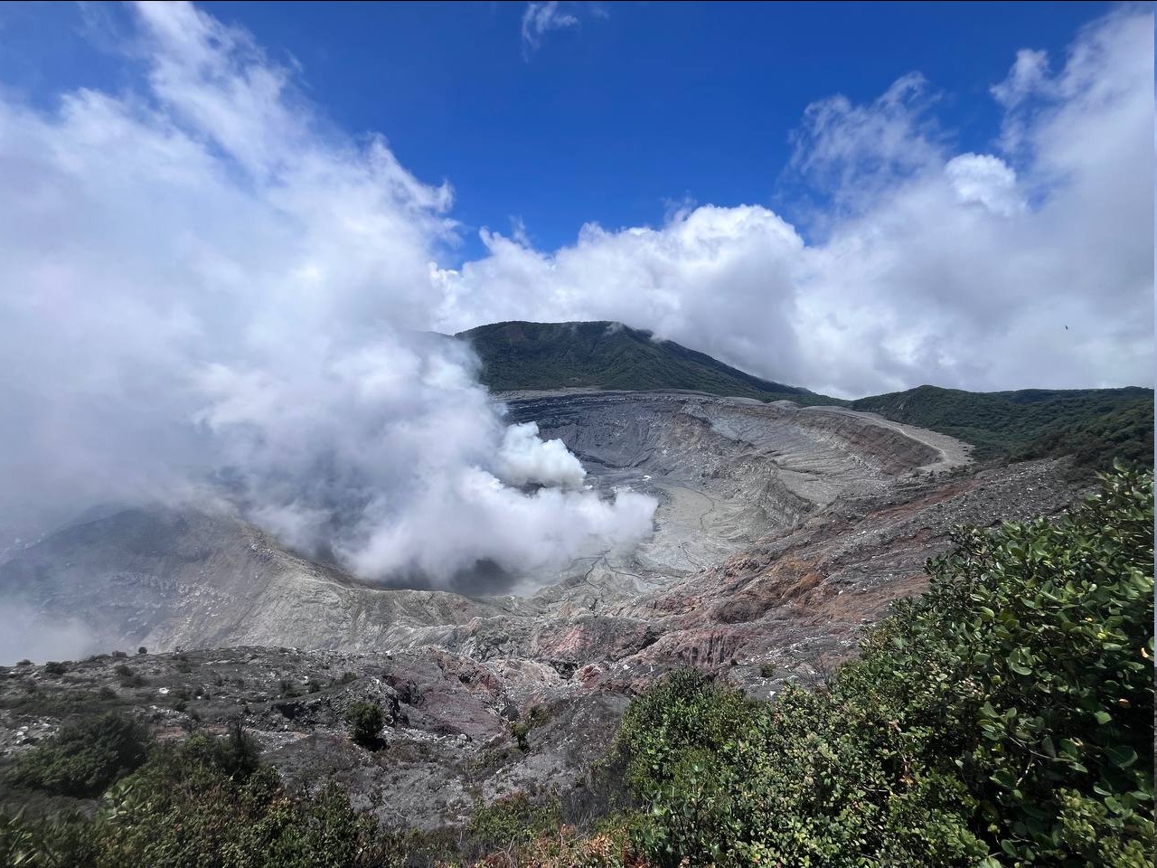
The gas composition has stabilized since the eruption on April 10. The SO₂/CO₂ ratio has averaged values close to 1.3, and the H₂S/SO₂ ratio is below 0.1. This week, DOAS stations recorded an average SO₂ flux of 128 ± 35 t/d, higher than the previous week’s (56 ± 17 t/d). The SENTINEL satellite detected the plume several times, with a peak value of 36.4 tonnes of SO₂ in the atmosphere on April 23.
The level of the hyperacidic lake has dropped by nearly one meter in one week, at a steady rate of decline throughout the week due to rainfall that began on April 22.
Source : Ovsicori .
Photo : RSN-UCR ( archive)
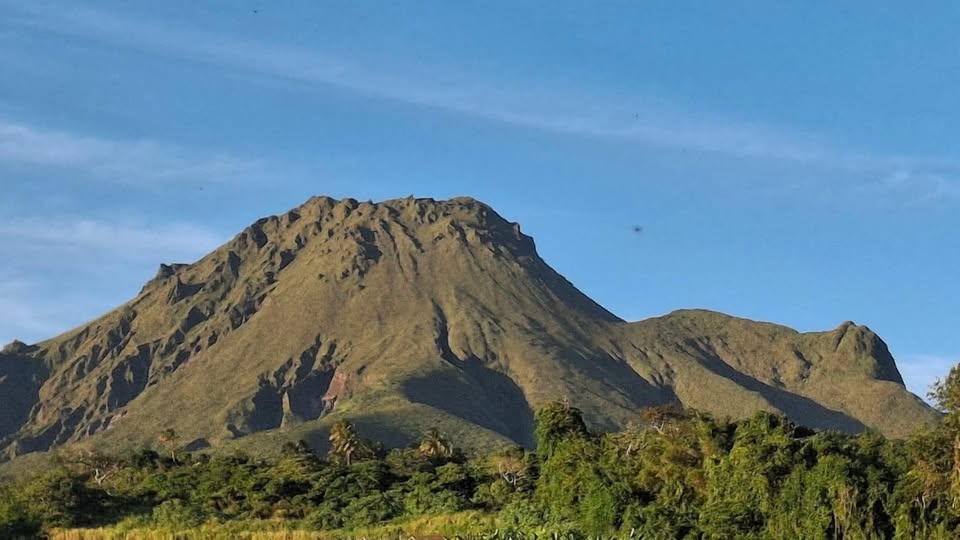
La Martinique Island , Montagne Pelée :
Weekly report, Paris Institute of Earth Physics / Martinique Volcanological and Seismological Observatory, Saint-Pierre, April 24, 2026, 3:15 PM local time (GMT-4)
Between April 17, 2026, 4:00 PM UTC and April 24, 2026, 4:00 PM UTC, the Martinique Volcanological and Seismological Observatory (OVSM) recorded 395 volcanic earthquakes:
• 391 shallow volcano-tectonic earthquakes. Among them, 33 had a magnitude (local magnitude Mlv or duration magnitude Md) greater than 0.5, and 2 had a magnitude greater than 1. The largest had a magnitude Mlv of 1.11. The others were of lower energy. These earthquakes were located at depths between 0.5 and 3.8 km below the volcano’s summit. Shallow volcano-tectonic seismicity is associated with microfracturing within the volcanic edifice, linked to the overall reactivation of the volcano observed since 2019.
• Four deep, long-period earthquakes, two of which were located at depths of 21 km and 22 km southwest of Mount Pelée, with magnitudes Mlv = 0.3 and Mlv = 0.8 respectively. Deep, long-period earthquakes are characterized by signals containing only low frequencies and are associated with the circulation of magmatic fluids deep within the Mount Pelée volcanic system.
No earthquakes were felt by the population.
The previous week, the OVSM (Mountain Safety Observatory) recorded 576 volcanic earthquakes. As of April 24, 2026, and over the past four weeks, the OVSM has observed a total of 1,113 volcanic earthquakes, an average of 278 to 279 earthquakes per week.
During phases of volcanic reactivation of volcanoes similar to Mount Pelée, seismic activity of varying intensity and frequency is common. The probability of an eruptive activity in the short term remains low. However, based on observations accumulated in recent years, and particularly in recent months, a change in the situation in the medium term (weeks to months) cannot be ruled out.
For more details on observations and interpretations of volcanic activity over the longer term, please refer to the OVSM’s monthly bulletins. The volcanic alert level, in accordance with the measures implemented by the authorities, is currently YELLOW: vigilance.
Source et photo : OVSM-IPGP.