November 1 , 2026.
Hawaii , Kilauea :
HAWAIIAN VOLCANO OBSERVATORY DAILY UPDATE , U.S. Geological Survey
Saturday, October 31, 2026, 10:36 AM HST (Saturday, October 31, 2026, 20:36 UTC)
19°25’16 » N 155°17’13 » W,
Summit Elevation 4091 ft (1247 m)
Current Volcano Alert Level: ADVISORY
Current Aviation Color Code: YELLOW
Summary:
The Halema’uma’u eruption of Kīlauea remains paused following episode 55 on October 17. The forecast for episode 56 fountaining is now Nov. 3-10, 2026.
Overview:
The summit eruption of Kīlauea in Halemaʻumaʻu remains paused following episode 55 fountaining on October 17, 2026. Slow, steady inflation continues at the summit. Based on current slow inflation trends and assuming magma chamber inflation continues to follow similar patterns to those established during episodes prior to 54, the forecast window for episode 56 fountaining is November 3-10, 2026.
Summit Observations:
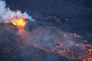
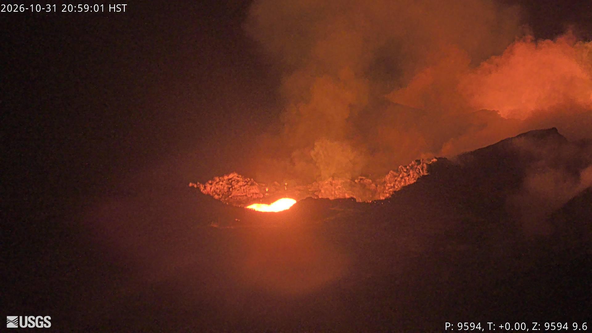
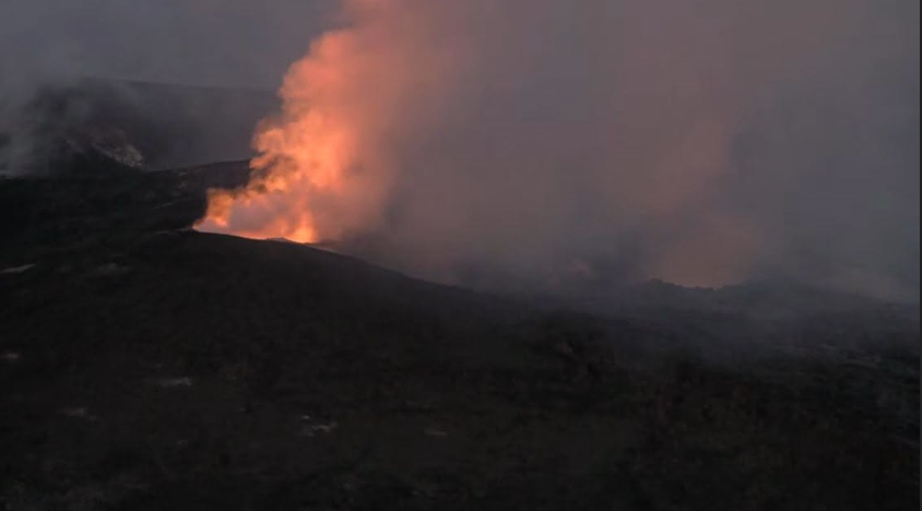
Intermittent strong glow and occasional spatter was seen from the combined southwest vent (see following explanation) overnight. Glow from the north vent, though also intermittent, was stronger than in previous nights and included semi-frequent fine spatter during the first half of the night. Glow from both vents became more continuous and strong after midnight and strengthening until about 3:00 a.m. HST when most of the tremor bursts ended. Analysis of webcam imagery suggests that the source of bright glow attributed to the west vent since episode 55 is probably located in between the original positions of the south and west vents. As such, we now consider it likely to be a merged southwest vent.
Seismic tremor continued yesterday and overnight, marked by periodic stronger pulses or bursts until midnight. Tremor pulses are typically associated with increased glow and gas emissions with dimming glow associated with periods of lower tremor in between the pulses. Tremor and associated glow became continuous after midnight. Seven earthquakes less than M1.5 were recorded at the summit in the past 24 hours, with most occurring in the southern part of Kaluapele (Kīlauea caldera).
Summit tiltmeters have recorded an overall positive trend since the end of episode 55, with several small, short-term oscillations. Though slow, the general pattern remains consistent with post-fountaining re-inflation observed during previous inter-episode pauses. The Uēkahuna tiltmeter (UWD) has recorded an increase of approximately 0.8 microradians in the past 24 hours for a total of 16.2 microradians of tilt recovered since the end of episode 55.
Sulfur dioxide (SO2) emission rates during inter-episode pauses typically range from 1,000 to 5,000 tonnes per day. Light trades are transporting volcanic gases to the southwest this morning, toward Kaʻū.
Rift Zone Observations:
Rates of seismicity and ground deformation remain low in the East Rift Zone and Southwest Rift Zone. SO2 emissions from the East Rift Zone remain below the detection limit.
Source et photos : USGS.
Indonesia , Anak Krakatau :
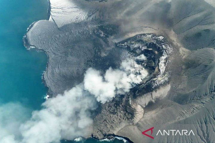
An eruption of Mount Anak Krakatau, in Lampung Province, occurred on Saturday, October 31, 2026, at 23:23 WIB (Western Indonesian Time). The eruption was not observed visually. It was recorded on a seismogram with a maximum amplitude of 0.0 mm and an estimated duration of +/- 0.0 seconds. The eruption was still ongoing at the time this report was written.
Seismic data
1 hybrid/polyphase earthquake, with an amplitude of 27.0 mm and a duration of 7.0 seconds.
3 low-frequency earthquakes, with amplitudes ranging from 25.0 to 36.0 mm and durations between 8.0 and 14.0 seconds.
1 harmonic tremor, with an amplitude of 57.0 mm and a duration of 3989.0 seconds.
1 continuous tremor, with an amplitude ranging from 10.0 to 60.0 mm (predominantly 40.0 mm).
1 eruption-related earthquake, with an amplitude of 56.0 mm and a duration of 5468.0 seconds.
Recommendations
1. Populations living near Mount Anak Krakatau, as well as visitors, tourists, and hikers, are prohibited from entering or conducting any activities within a 5 km radius of the Anak Krakatau eruptive center.
2. Populations living near Mount Anak Krakatau, as well as visitors and tourists, are prohibited from entering or conducting any activities within a 1 km radius of the new islands located in the northwest and southeast sectors of Mount Anak Krakatau.
Source : PVMBG.
Photo : Antara news.
Colombia , Nevado del Ruiz :
Manizales, October 27, 2026, 7:05 PM
As part of the ongoing monitoring of the Nevado del Ruiz volcano, the Colombian Geological Service (SGC)—an agency under the Ministry of Mines and Energy—reports the following:
During the week of October 20 to 26, 2026, the volcano continued to exhibit unstable behavior. Compared to the previous week, the primary variations in the monitored parameters were as follows:
– Seismicity associated with fluid dynamics within the volcanic conduits showed an increase in the number of recorded earthquakes, as well as a slight rise in the seismic energy released. This activity was characterized by short-duration seismic signals, with energy levels remaining low. As in previous weeks, no long-duration seismic signals were recorded; furthermore, no pulsed ash emissions or changes in the apparent temperature of the gas column were confirmed.
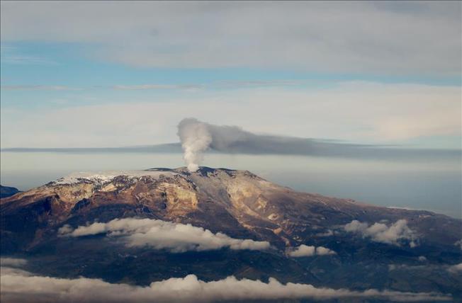
– Seismic activity linked to rock-fracturing processes within the volcanic edifice remained at levels comparable to the previous period in terms of the number of recorded earthquakes, while the total seismic energy released decreased. This seismicity was concentrated primarily around the Arenas crater and along the volcano’s northwest and south-southeast flanks, all within 15 km of the Arenas crater. The depths of these earthquakes ranged from less than 2 km (at the Arenas crater) to 9 km below the volcano’s summit. The recorded events were of low energy, with magnitudes below 1.0.
– The emission of water vapor and volcanic gases—primarily sulfur dioxide (SO₂)—into the atmosphere continued via the Arenas crater. The estimated SO₂ flux, associated with degassing processes, remained at levels similar to those of the previous week. Furthermore, additional monitoring via satellite platforms continued to show low levels of SO₂ emissions.
– The vertical height of the gas and water vapor plume generally remained between 300 m and 500 m above the volcano’s summit, reaching a maximum of 800 m on October 22. The dispersion direction of the plume varied, with a tendency toward the north-northeast, northwest, northeast, and southeast flanks of the volcano.
– Monitoring of thermal anomalies at the base of the Arenas crater via satellite platforms was limited by cloud cover in the area. Nevertheless, a few low-energy anomalies were detected.
Source et photo : SGC.
Costa Rica , Poas :
Latitude: 10.20° N;
Longitude: 84.23° W;
Elevation: 2,687 m above sea level.
Current activity level: Warning
No eruptions were recorded this week. Overall, the amplitude of the volcanic tremor remains moderate, with little variation. Six distal volcano-tectonic earthquakes were recorded northwest of San Pedro de Poás; the largest reached a local magnitude of 3. The number of long-period events remains stable. No significant deformation has been observed. MultiGAS stations measured an average SO2/CO2 ratio of 0.9 ± 0.4—a value lower than that of the previous week (1.3 ± 0.5), suggesting an apparent decrease. The H2S/SO2 ratio remains below 0.1.
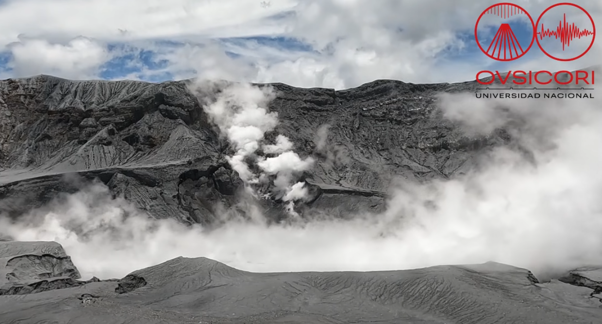
The NOVAC stations recorded 41 ± 27 tonnes of SO2 per day, with a maximum of 288 t/d. This average represents a significant decrease compared to the previous week (108 ± 88 tonnes of SO2 per day, with a maximum of 1,297 t/d). However, wind conditions this week were not favorable for these measurements. Due to low average wind speeds, high concentrations of SO2 were detected at the observation viewpoint. The SENTINEL satellite continues to frequently detect the SO2 plume, with an average quantity of approximately 87 tonnes of SO2 present in the atmosphere.
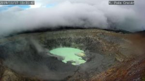
The level of the hyperacidic lake dropped this week, returning to the level observed at the end of September.
Source et photo : Ovsicori .
Ecuador , El Reventador :
DAILY STATUS REPORT FOR REVENTADOR VOLCANO, Saturday, October 31, 2026.
Information from the Geophysical Institute – EPN.
Surface activity level: High; Surface trend: Unchanged
Internal activity level: Moderate; Internal trend: Unchanged
From October 30, 2026, 11:00 AM to October 31, 2026, 11:00 AM:
Seismicity:
Explosions (EXP): 67
Long-period (LP) events: 7
Emission tremors (TREMI): 15
Harmonic tremors (TRARM): 6
Rainfall / Lahars:
At the time of writing this report, no precipitation has been recorded in the vicinity of the volcano. **In the event of heavy rainfall, accumulated materials could be remobilized, triggering mud and debris flows that would descend the volcano’s flanks and reach adjacent rivers.**
Emission Plume / Ash:
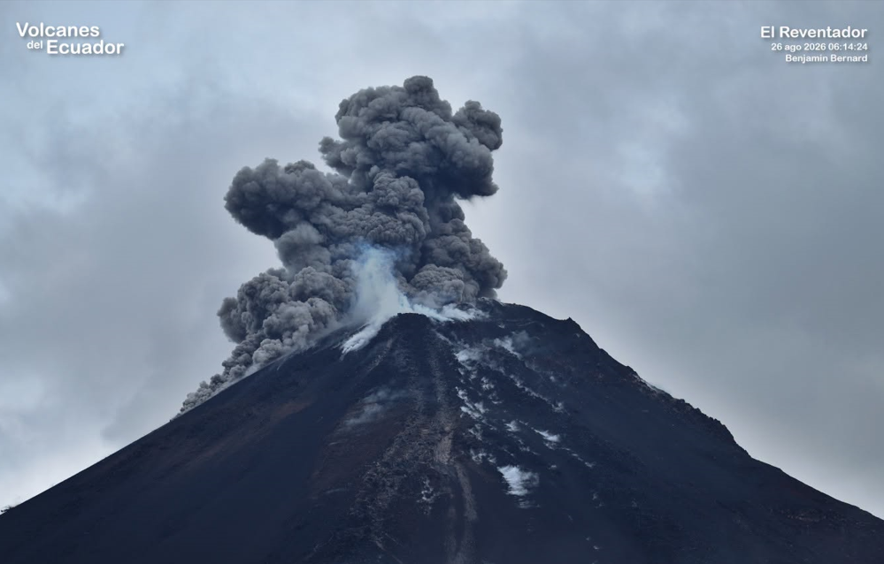
Since yesterday afternoon, the surveillance camera system has captured several gas and ash emissions, reaching heights of 500 to 1,000 meters above the crater rim and drifting toward the west and northwest. In connection with this activity, the Washington VAAC issued a report regarding an ash cloud moving westward at an altitude of 700 meters above the crater rim.
Gas:
The MOUNTS satellite system detected 12.5 tonnes of sulfur dioxide (SO2) at 14:32 (local time).
Other Monitoring Parameters:
The MIROVA VIIRS 375 and MIROVA VIIRS 750 satellite systems each recorded a thermal anomaly over the past 24 hours.
Observations:
During the night and early morning hours, incandescent material was observed descending the volcano’s flanks, reaching points between 500 and 1,150 meters below the crater rim. At the time of writing, the volcano is entirely obscured by clouds.
Alert Level – SGR: Orange
Source : IGEPN.
Photo : Benjamin Bernard / Volcanes del Ecuador