October 28 , 2026.
Italy / Sicily , Etna :
WEEKLY BULLETIN, from October 19, 2026, to October 25, 2026. (Date of issue: October 27, 2026)
SUMMARY OF ACTIVITY STATUS
Based on monitoring data, the following is observed:
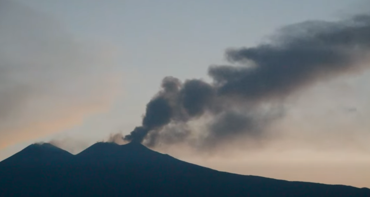
1) VOLCANOLOGICAL OBSERVATIONS: Variable degassing activity at the summit craters, with occasional ash emissions from the Northeast Crater.
2) SEISMOLOGY: Moderate seismic activity related to fracturing; the average amplitude of the volcanic tremor has shown fluctuations primarily within the range of mean values.
3) INFRASOUND: Low infrasonic activity.
4) GROUND DEFORMATION: Time series data from permanent ground deformation monitoring stations show no significant variations.
5) GEOCHEMISTRY: SO2 flux at a moderate level.
CO2 flux from the ground (Etnagas): remains at moderate values.
Partial pressure of CO2 dissolved in groundwater (EtnaAcque network): no updates available.
Helium (He) isotope ratio at peripheral sites: the latest data, from September 22, 2026, confirm high values.
6) SATELLITE OBSERVATIONS: Thermal activity in the summit area, as observed by satellite, has generally remained at a low level.
VOLCANOLOGICAL OBSERVATIONS
Monitoring of Etna’s volcanic activity was conducted through the analysis of images from the surveillance camera network of the INGV, Osservatorio Etneo (INGV-OE). However, cloud cover and strong winds in the summit area significantly limited observations of activity during part of the period in question.
Overall, throughout the period under review, Etna’s activity was characterized by degassing of varying intensity and patterns at the summit craters.
Activity at Etna’s summit craters has not changed since the previous bulletin (Report No. 43/2026 ETNA). Indeed, degassing of varying intensity and pattern has continued to be observed at the summit craters, along with occasional ash emissions from the Northeast Crater.
Source : INGV
Photo : Salvatore Lo Giudice
Italy , Stromboli :
WEEKLY BULLETIN, October 19, 2026, to October 25, 2026. (Date of issue: October 27, 2026)
SUMMARY OF ACTIVITY STATUS
Based on monitoring data, the following observations are noted:
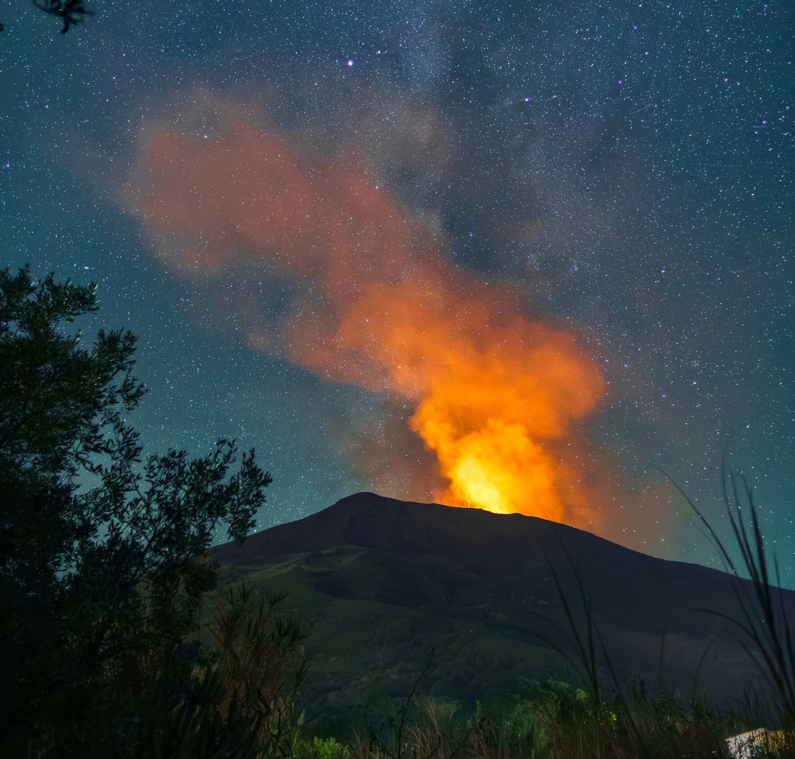
1) VOLCANOLOGICAL OBSERVATIONS: Typical Strombolian eruptive activity is occurring across both crater zones. An effusive event, characterized by an overflow from the crater, took place between October 19 and 20. The overall frequency of explosive activity—encompassing both the North crater zone and the Central-South crater zone—is at a medium level, with the intensity of explosions in both areas being predominantly low.
2) SEISMOLOGY: Monitored seismological parameters show no significant variations.
3) GROUND DEFORMATION: Deformation monitoring networks show no significant variations. The SELI inclinometer recorded a slight change during the lava overflow that occurred on October 19.
4) GEOCHEMISTRY: SO2 flux is at a medium to high level.
Soil CO2 flux (Pizzo area – STR02): preliminary data (due to technical issues).
C/S ratio in the plume: no data available.
Helium isotopic ratio (R/Ra): no data available.
Soil CO2 flux in the San Bartolo area: average values.
Soil CO2 flux in the Scari area: no data available.
5) SATELLITE OBSERVATIONS: Thermal activity observed by satellite in the summit area ranged from low to moderate, in connection with the lava overflow episode that began on October 19 and ended on October 20, 2026.
VOLCANOLOGICAL OBSERVATIONS
Observations of explosive activity captured by surveillance cameras
During the observation week, Stromboli’s eruptive activity was characterized through the analysis of images recorded by INGV-OE surveillance cameras, located at an altitude of 190 m above sea level and at Punta dei Corvi (designated SCT-SCV and SPCT, respectively). Explosions in the North crater area (Zone N) primarily produced coarse material (bombs and lapilli), while explosions in the Central-South crater area (Zone CS) generated predominantly fine material, mixed with some coarse material. The mean frequency of explosions in Zone N was at an average level, while the intensity remained generally low. In Zone CS, the mean explosion frequency remained low, and the intensity of the explosive activity was, overall, at a low level. The total daily mean hourly frequency of explosions (Zone N + Zone CS) was at an average level.
Effusive activity via lava overflow (times in GMT)
During the observation week, on October 19, starting at approximately 06:00, an episode of lava emission via overflow occurred from the North crater area. This episode, which began with a sudden initial phase, fed a small-scale lava flow; it continued throughout the day before gradually ceasing over the course of October 20.
Source : INGV
Photo : Stromboli stati d’animo / Sebastiano Cannavo.
Iceland , Reykjanes Peninsula :
Situation on the Reykjanes Peninsula . Updated 27 October 2026
Ground uplift continues at Svartsengi at a relatively steady rate.
Seismic activity along the Sundhnúkur crater row remains low.
A magma intrusion, potentially leading to an eruption, remains the most likely scenario.
The current hazard assessment map remains valid until 5 January 2027, unless conditions change.
Deformation measurements continue to show ground uplift at Svartsengi. Models based on these measurements indicate that the volume change beneath the area is continuing at a relatively steady rate.
The uplift indicates that pressure continues to build in the magma accumulation zone at a depth of several kilometres beneath Svartsengi.
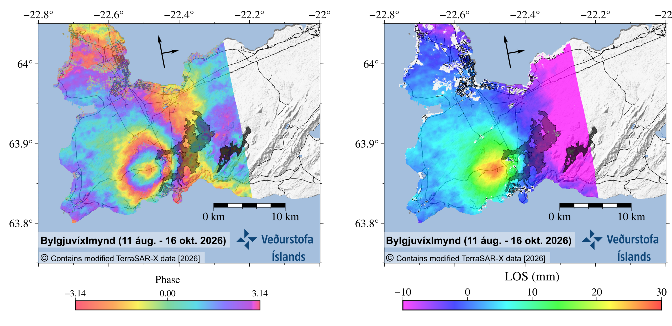
InSAR measurements from 11 August to 16 October 2026 show continued ground deformation at Svartsengi. The interferogram is shown on the left, while the image on the right shows the same measurements converted into ground displacement along the satellite’s line of sight (LOS).
Seismic activity remains low
Seismic activity remains low within the magma dike. However, some activity has been recorded near Víkur, west of Grindavík. A magnitude 2.5 earthquake occurred there on 14 October, the largest recorded in the area since June.
The seismic activity near Víkur is thought to be associated with increased stress in the Earth’s crust around Grindavík due to ground uplift at Svartsengi. This additional stress leads to increased stress release in the form of earthquakes.
Magma intrusion remains the most likely scenario
As long as ground uplift continues at Svartsengi, the most likely scenario remains that magma will move from the accumulation zone into the Sundhnúkur crater row. Such a magma intrusion could lead to an eruption.
It is not possible to predict when the next event will occur. As more time passes since the last magma intrusion, uncertainty regarding the timing of the next event increases. A short warning period remains possible, as was the case before previous magma intrusions and eruptions along the Sundhnúkur crater row.
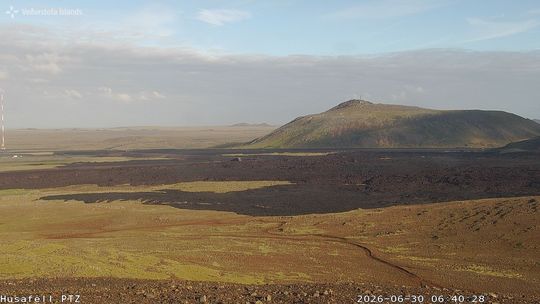
A view of the eruption site from Húsafell, looking toward Þorbjörn
Ground uplift may continue for an extended period
There is no indication in the monitoring data that the ongoing series of eruptions along the Sundhnúkur crater row is coming to an end. The Reykjanes–Svartsengi volcanic system remains at alert level 2, « Considerable increase in activity » (orange).
To conclude that the eruptive episode has ended, monitoring data would need to show clear signs of declining activity over an extended period.
Even when considerable time passes without magma intrusions or eruptions, magma accumulation may continue or resume after a pause. Eruptive episodes on the Reykjanes Peninsula can continue for extended periods, with intervals of varying lengths between events. A long period without activity is therefore not, in itself, an indication that the eruptive episode has ended.
Source et photo : IMO.
New Zealand , White Island :
Minor eruptive activity continues at Whakaari/White Island characterised by low altitude ash and gas plumes that are dispersed downwind. More explosive eruptions could occur suddenly and be a threat to life on the crater floor and the area immediately offshore, south-east of the island. There are no threats to the mainland, but residents may notice a sulphur smell or light ash fall during favourable wind conditions.
Whakaari/White Island continues to generate weakly-loaded volcanic ash and gas plumes that blow downwind. This activity has been continuing since our last Volcanic Activity Bulletin on Wednesday 21 October (WI-2026/13), and is occasionally punctuated by short-lived, more visibly energetic plumes that may rise up to 1-1.5 km above sea level. Satellite data indicates the plume contains fine volcanic ash and sulphur dioxide (SO2) gas, a common volcanic gas. During northerly winds over the weekend, minor amounts of gas and fine ash particles were blown towards the Bay of Plenty coastline; coastal residents may have noticed this as sulphur odours and/or a fine dusting on their property. The Volcanic Alert Level remains at 3 and the Aviation Colour Code remains orange.
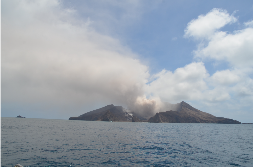
While the current activity is relatively passive and low energy, volcanic activity could still escalate with little or no warning. Sudden, more explosive events can throw rocks and ash and gas surges across the main crater floor and immediately offshore to the south-east of the island, presenting a major threat to life in these areas. Explosive activity could also cause ash fallout downwind in the immediate vicinity of Whakaari/White Island and be an inconvenience to aircraft or vessels in the area. Any significant impact on the mainland remains very unlikely; the level of volcanic activity would have to escalate significantly for this likelihood to increase.
Any potential impacts on aviation continue to be assessed and communicated by MetService’s Volcanic Ash Advisory Centre (VAAC).
Our ability to monitor Whakaari/White Island in near-real time remains very limited due to the lack of functioning instrumentation on the island. Earth Sciences New Zealand’s Volcano Monitoring Group and the National Geohazards Monitoring Centre will continue to monitor the volcano to the best of our ability with remote observations from the mainland and satellites, and occasional flights near the island. These observations are supported by additional information supplied by MetService. We will provide further updates when information becomes available or the status changes.
Source : Geonet / Oliver Lamb / Duty Volcanologist
Photo : Brad Scott, GNS Science.
Costa Rica , Rincon de la Vieja :
Current activity level: Caution.
Over the past week, 18 eruptions were recorded; none exceeded an acoustic magnitude of 4 (moderate). Most of these eruptions were of low magnitude. The eruption on October 21 at 03:11 had the highest acoustic magnitude of the week; it did not trigger any lahars. Frequent acoustic pulses, associated with emissions of water vapor and volcanic gases (small eruptions), continue to be observed. There were 17 very low-magnitude acoustic pulses recorded; this activity has been declining—in both amplitude and frequency—since September 22. Background tremor is dominated by « banded » tremor sequences; at times, it appears continuous, with variable amplitude. These sequences show variations in amplitude, tremor duration, and the intervals between episodes. A slight increase in the frequency of long-period (LP) and « tornillo »-type seismic signals has been noted. However, the frequency of « tornillo »-type signals has decreased over the last two weeks.
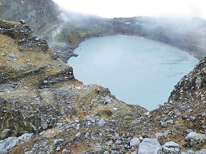
During this week, 3 volcano-tectonic earthquakes located near the crater and 4 earthquakes located further away were recorded. In general, eruptions tend to occur when a significant drop in the amplitude of low-frequency tremor is observed; this suggests the formation of a plug that traps volatile compounds, the rupture of which ultimately triggers an eruption. No significant deformation was recorded. The rapid uplift of the summit, detected in September, as well as its subsequent contraction, have ceased. The MultiGAS station recorded a CO2/SO2 ratio of 3.8 ± 1.8, a value comparable to that of the previous week, when a figure of 3.7 ± 1.73 was noted. The average SO2 flux for this week is 371 ± 131 tonnes per day (t/d), with a maximum value of 2,175 t/d. These figures suggest an apparent increase compared to the previous week, during which the average flux was 264 ± 106 t/d, with a maximum value of 1,417 t/d. The most recent detection of atmospheric SO2 by the SENTINEL satellite dates back to October 1, 2026, with a mass of 68 tonnes.
Source : Ovsicori
Photo : Ovsicori