October 2 , 2026.
Hawaii , Kilauea :
HAWAIIAN VOLCANO OBSERVATORY STATUS REPORT ,U.S. Geological Survey
Wednesday, September 30, 2026, 11:01 PM HST (Thursday, October 1, 2026, 09:01 UTC)
19°25’16 » N 155°17’13 » W,
Summit Elevation 4091 ft (1247 m)
Current Volcano Alert Level: WATCH
Current Aviation Color Code: ORANGE
Summary:
A shallow intrusion of magma is occurring within the summit region near the existing eruption location in Hawai’i Volcanoes National Park.
Activity Summary:
Earthquake activity has increased in the summit region of Kīlauea beneath Halemaʻumaʻu crater and the south caldera region. Ground deformation patterns recorded by summit tiltmeters suggest that magma is intruding beneath the ground in this area, in an east-west orientation, near the western or southern part of Halemaʻumaʻu crater.
Increased earthquake activity began this afternoon, September 30, 2026, at approximately 2 p.m. HST, underneath Halemaʻumaʻu. Since then, about 40 earthquakes have been detected and activity is still on-going. The largest event, so far, a magnitude 3.4 earthquake, occurred at 9:52 p.m. HST, 1.4 km (0.9 miles) beneath the surface in the northeast part of Halemaʻumaʻu. Starting around 8 p.m. HST., summit tiltmeters began to show extremely rapid changes consistent with crack growth in an east-west orientation possible near the current vent area, suggesting that magma is intruding in this region.
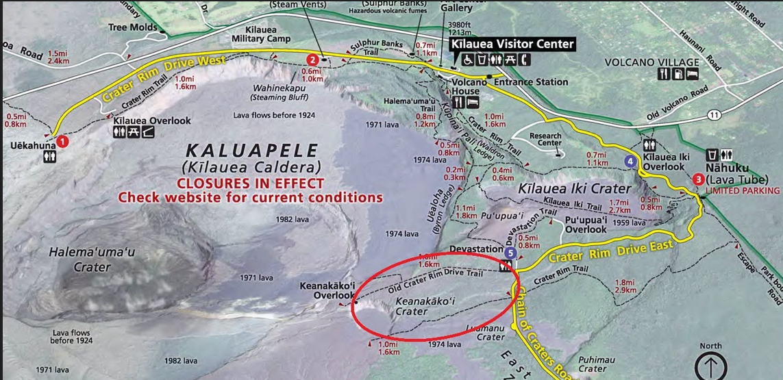
Historically, east-west trending fissures have erupted in the southeastern part of Halemaʻumaʻu and extending through the Keanakākoʻi crater area all the way to Chain of Craters Road near Lua Manu. The last east-west fissure in this area erupted in September 2023 and extended from the middle of Halemaʻumaʻu to the eastern wall just beneath the Keanakākoʻi overlook. An event of this type is also possible under current conditions.
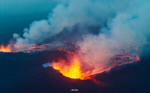
Currently, there are no signs of a change at the surface as the existing eruptive vent complex in Halemaʻumaʻu, including the north and south vents, continue to intermittently spatter with strong glow and flames; however, conditions could change quickly. It is possible that this event ends without reaching the surface or it produces a fissure eruption in a new location within the summit caldera region.
Current activity is restricted to the summit region of Kīlauea. No anomalous activity has been detected in the East Rift Zone or Southwest Rift Zone.
The USGS Hawaiian Volcano Observatory is monitoring the situation closely and will issue additional messages as needed.
Thursday, October 1, 2026, 9:05 AM HST (Thursday, October 1, 2026, 19:05 UTC).
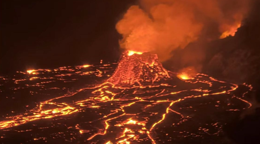
the north vent remained dominant until the evening of September 28, when south vent started having short, rapid cycles of overflows and lava drainback that continued through yesterday afternoon. These south vent overflows lasted about 2–5 minutes, with most pauses between each cycle lasting about 5–7 minutes; there were over 100 such overflows. Since September 29, the frequency of overflow activity has greatly decreased, although intermittent overflows continue at both north and south vents. Since yesterday September 30, north vent has had several overflows with minor dome fountaining. Eruptions from the north and south vents stopped during the early stages of dike emplaced yesterday afternoon, but the north vent resumed later during continued intrusive activity. The south vent had at least one overflow this morning after intrusive activity quieted down. In total, there were at least 10 overflows during and after the main intrusive event. Both north and south vents also spattered overnight and had persistent strong glow, and west vent had occasional glow. No other areas of incandescence were observed across the summit region last night.
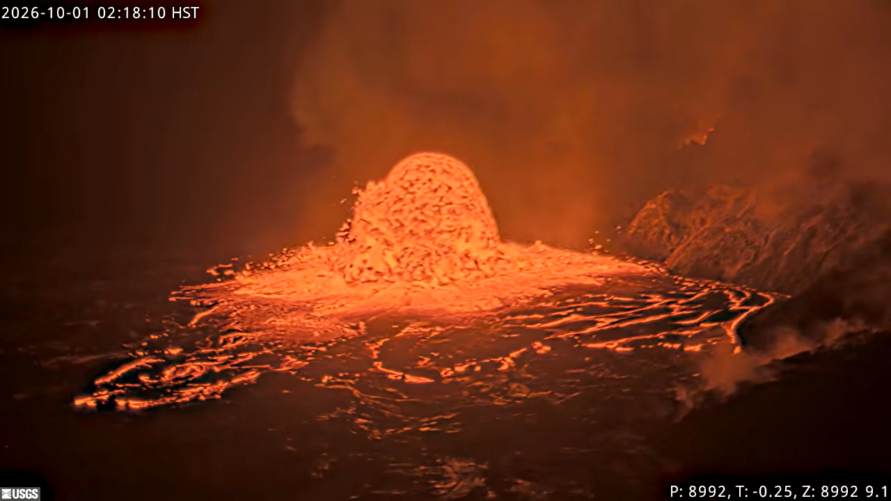
Increased earthquake activity began yesterday, September 30, 2026, at approximately 2 p.m. HST, underneath Halemaʻumaʻu. In the past 24 hours, there were 98 shallow earthquakes located across the summit region, primarily underneath Halemaʻumaʻu, the largest of which was a magnitude (M) 3.4 earthquake at 9:52 p.m. H.S.T. Starting around 8 p.m. HST., summit tiltmeters began to show extremely rapid changes consistent with crack growth in an east-west orientation near the current vent area, suggesting that magma was intruding in this region. Most of the seismicity was confined to the western part of Halemaʻumaʻu and the northwestern part of Kaluapele, the summit caldera. Between 8 p.m. H.S.T. last night and 3 a.m. this morning, Uēkahuna tiltmeter (UWD) recorded approximately 38.5 microradians of inflation (this value has been corrected for a spike in the signal caused by the M3.4 earthquake). Since 3 a.m. H.S.T. this morning, summit inflation has flattened out and earthquake activity has decreased. A comparison of webcam imagery before and after the intrusion does not show any new ground cracking or eruption of lava in a new location.
Source : HVO.
Photos : USGS , Hawaii Volcanoes National Park , USGS.
Italy , Stromboli :
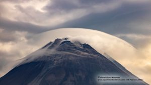
Statement on Stromboli activity, October 1, 2026, 09:55 (07:55 UTC).
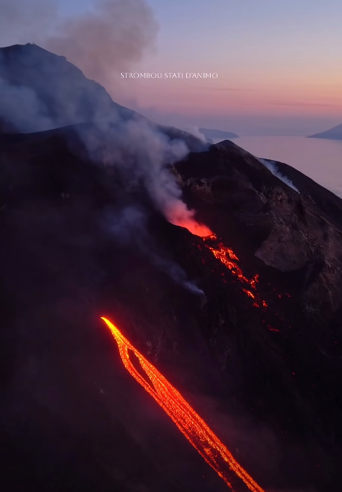
The National Institute of Geophysics and Volcanology (Osservatorio Etneo) reports that, based on an analysis of images from the surveillance camera network, a lava overflow began this morning (Oct. 1) from the North crater area; this activity is generating a modest lava flow that is splitting into two branches on the upper part of the Sciara del Fuoco. Ordinary Strombolian activity continues in both crater areas (North and Central-South), as does « spattering » (lava projections) in the North crater area, with varying intensity.
Seismically, the temporal evolution of the average volcanic tremor amplitude shows no significant variations; values remain within the average range, subject to minor fluctuations. A slight increase in the occurrence rate of explosion quakes has been noted.
No significant changes have been detected in the time series from ground deformation monitoring stations.
Further updates will be provided in due course.
Source : INGV.
Photo : Stromboli stati d’animo / Sebastiano Cannavo
Alaska , Gareloi :
AVO/USGS Volcanic Activity Notice
Current Volcano Alert Level: ADVISORY
Previous Volcano Alert Level: NORMAL
Current Aviation Color Code: YELLOW
Previous Aviation Color Code: GREEN
Issued: Thursday, October 1, 2026, 8:42 AM AKDT
Source: Alaska Volcano Observatory
Notice Number: 2026/A749
Location: N 51 deg 47 min W 178 deg 47 min
Elevation: 5161 ft (1573 m)
Area: Aleutians
Summary:
A single brief explosion was detected in geophysical data at 07:27 AM AKDT (15:27 UTC). Aviation Color Code/ Volcano Alert Level was changed to YELLOW/ADVISORY. It is unknown if an ash cloud was produced due to cloud cover at the volcano.
Volcanic Activity:
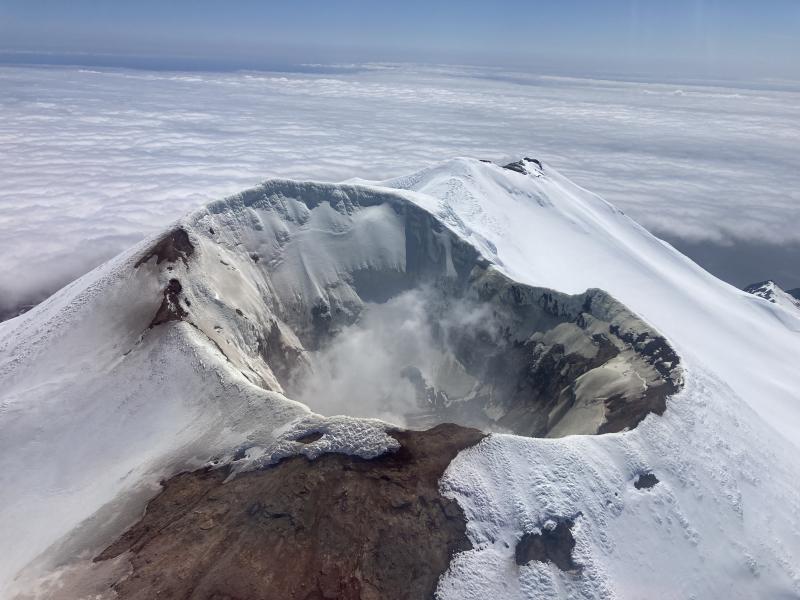
A single brief explosion was detected in geophysical data at 07:27 AM AKDT (15:27 UTC). As a result, AVO is raising the Aviation Color Code to YELLOW and the Volcano Alert Level to ADVISORY. It is unknown if a volcanic ash cloud was produced as cloud cover up to about 20,000 feet above sea level is obscuring the volcano. If an ash cloud were produced, the amount of ash would be minor due to the short duration (less than 1 min) of the explosion. Infrasound data indicates the explosion likely occurred from the south crater of Mount Gareloi.
Mount Gareloi is monitored by a local seismic and infrasound network, satellite data, and regional infrasound and lightning-detection networks.
Remarks:
Mount Gareloi, which makes up all of Gareloi Island, is a stratovolcano located in the Delarof Islands group of the Aleutian Islands, about 2,000 km (1,242 mi) west-southwest of Anchorage and about 150 km (93 mi) west of Adak, the westernmost community in Alaska. This small volcano is 10 × 8 km (6.2 × 5.0 mi) in diameter at its base with two summits, separated by a narrow saddle. The northern, slightly higher peak contains crater about 300 m (1,000 ft) across. The southern summit has a crater open to the south and a persistent degassing vent (fumarole) on its western rim. Gareloi has been one of the most active in the Aleutians since the 1740s, with 16 reports of eruptive activity at Gareloi since 1760. In 1929, its largest historical eruption produced sixteen small south- to southeast-trending craters that extend from the southern summit to the coast, as well as lava flows and pyroclastic deposits on the southeastern flank of the volcano. Eruptions of Gareloi commonly produce ash clouds and lava flows, and the primary hazard is airborne clouds of ash that could affect aircraft. Since seismic instruments were installed in 2003, they have detected small but consistent seismic signals from beneath Mount Gareloi’s edifice.
Source : AVO.
Photo : Mann, Doerte / AVO / EarthScope Consortium.
Vanuatu , Ambrym :
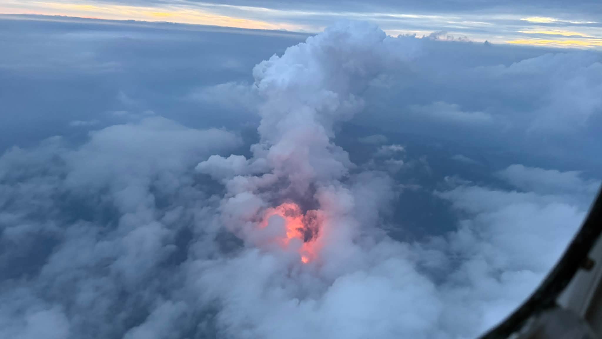
The Vanuatu Meteorology and Geo-Hazards Department (VMGD) reported that the eruption at Ambrym continued during 21-29 September. A thermal anomaly continued to be identified in satellite images, though it was gradually decreasing in intensity. During an overflight on 28 September observers saw an intense glow through weather clouds and from within the volcanic plume in Marum Crater. Closer observations revealed explosive activity ejecting incandescent material high above a vent. The Alert Level remained at 2 (on a scale of 0-5). VMGD warned the public to stay outside of Permanent Danger Zone A, defined as a 1-km radius around Benbow Crater and a 2-km radius around Marum Crater (including Maben-Mbwelesu, Niri-Mbwelesu, and Mbwelesu craters).
Ambrym is a large basaltic volcano with a 12-km-wide caldera formed during a major Plinian eruption with dacitic pyroclastic flows about 1,900 years ago. A thick, almost exclusively pyroclastic sequence, initially dacitic then basaltic, overlies lava flows of a pre-caldera shield volcano. Post-caldera eruptions, primarily from Marum and Benbow cones, have partially filled the caldera floor and produced lava flows that ponded on the floor or overflowed through gaps in the caldera rim. Post-caldera eruptions have also formed a series of scoria cones and maars along a fissure system oriented ENE-WSW. Eruptions have been frequently reported since 1774, though mostly limited to extra-caldera eruptions that would have affected local populations. Since 1950 observations of eruptive activity from cones within the caldera or from flank vents have occurred almost yearly.
Sources: Vanuatu Meteorology and Geohazards Department (VMGD), Unity Airlines Vanuatu , GVP.
Photo : Unity Airlines Vanuatu
Indonesia , Marapi :
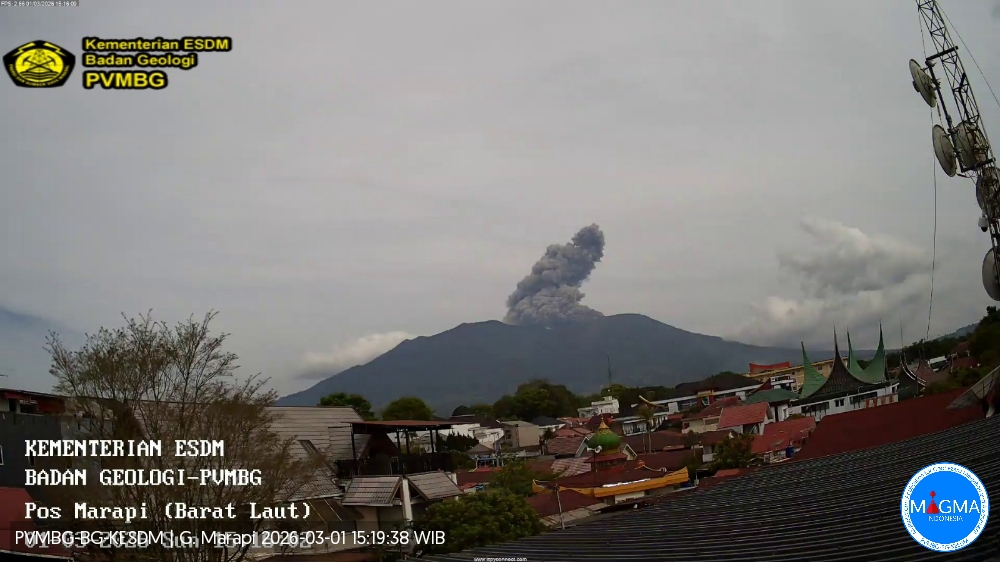
The Pusat Vulkanologi dan Mitigasi Bencana Geologi (PVMBG) reported that an eruptive event at Marapi (on Sumatra) was recorded at 21h40 on 26 September. Webcam views were obscured by weather conditions. According to news reports the event was accompanied by loud booms and rumbling sounds, generated an ash plume that rose 1 km above the summit, and ejected incandescent material onto the upper flanks based on video and eye-witness accounts posted on social media by residents. Ashfall was reported in Bukittinggi City; a resident posted a video of ashfall at 22h57 on attendees at an outdoor concert. An eruptive event recorded at 17h35 on 29 September was not visually confirmed due to weather conditions. The Alert Level remained at 2 (on a scale of 1-4) and the public was warned to stay 3 km away from the active crater.
Seismic observations
1 eruption earthquake with an amplitude of 19.5 mm and a duration of 27 seconds.
10 emission earthquakes with amplitudes between 2.8 and 3.4 mm and durations ranging from 20 to 34 seconds.
14 harmonic tremors with amplitudes between 2.8 and 5.5 mm and durations ranging from 62 to 1,209 seconds.
2 low-frequency earthquakes with amplitudes between 2.8 and 3.1 mm and durations ranging from 17 to 20 seconds.
1 shallow volcanic earthquake with an amplitude of 3.4 mm and a duration of 9 seconds.
1 local tectonic earthquake with an amplitude of 3.1 mm and a duration of 15 seconds.
3 distant tectonic earthquakes with amplitudes between 2.9 and 3 mm and durations ranging from 62 to 97 seconds.
Recommendations
1. Communities living near Mount Marapi, as well as climbers, visitors, and tourists, are advised not to enter or conduct activities within a 3 km radius of the eruption center (Verbeek crater) of Mount Marapi.
2. Communities residing near valleys, watercourses, or riverbanks originating from the summit of Mount Marapi must remain vigilant regarding the potential threat of *lahars* (volcanic mudflows), which may occur particularly during the rainy season.
Sources: Pusat Vulkanologi dan Mitigasi Bencana Geologi (PVMBG, also known as CVGHM), Berita Satu, Pikiran Rakyat, GVP
Photo : PVMBG ( archive)