September 15 , 2026.
Italy / Sicily , Etna :
VOLCANO OBSERVATORY NOTICE FOR AVIATION (VONA)
Issued: 14/09/2026 at 04:43 UTC
Volcano: Etna (211060)
Current color code: RED
Previous color code: Orange
Source: Etna Volcano Observatory
Notice number: 2026/0111/07E06
Volcano location: 37°44′ N 15°00′ E
Area: Italy
Summit elevation: 3300 m
Volcanic activity summary:
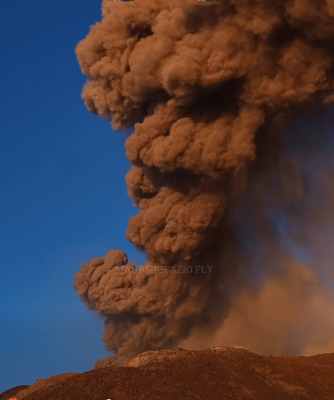
ONGOING ASH EMISSION
Volcanic plume height:
Estimated volcanic plume height: approximately 4,000 m above the summit (data from surveillance cameras)
Additional information on the volcanic plume:
The ash plume is drifting southward
Remarks:
The phenomenon is being observed via visible-light and thermal surveillance cameras
Next notice:
A new VONA notice will be issued in the event of a significant change in conditions or an alteration to the color code.
Catania-Fontanarossa Airport has closed airspace sector C1 to incoming flights. Flight operations have been severely restricted. Initially, arrivals were suspended until 16:00 local time, and numerous aircraft were diverted to other airports, such as Palermo.
Source : INGV. Vulkane.net.
Photo : Mauricio Fazio. ( capture d’écran)/ FB.
Indonesia , Anak Krakatau :
The Pusat Vulkanologi dan Mitigasi Bencana Geologi (PVMBG) reported ongoing Strombolian activity at Krakatau during 3-9 September, including an intense explosive and effusive phase that caused widespread ashfall and impacts. White, gray, and/or black ash plumes rose as high as 400 m above the summit and drifted W and NW during 3-4 September.
Webcam images at 04h19 and at 0428 on 4 September showed incandescent material being ejected above the crater, though webcam images later that day at 22h14, at 22h42, and at 22h53 showed what appeared to be lava fountaining and/or bright an intense ejections of lava. Continuous lava fountaining began at 23h07, with sounds of rumbling and roaring along with felt vibrations were reported at the Pasauran Anak Krakatau Volcano Observation Post (50 km ESE) in the Serang Regency. As the eruption intensified there were explosion, rumbling, and booming sounds reported by residents across a large area as far as 200 km E, in Banten (80 km SE), and Lampung (170 km N); a bang was heard and windows and doors vibrated possibly as far as 700 km away according to a news article. The Darwin Volcanic Ash Advisory Centre (VAAC) noted that by 23h30 ash plumes had risen to 13.7 km (45,000 ft) a.s.l. and drifted W, and 10 minutes later they had reached 14.6 km (48,000 ft) a.s.l.
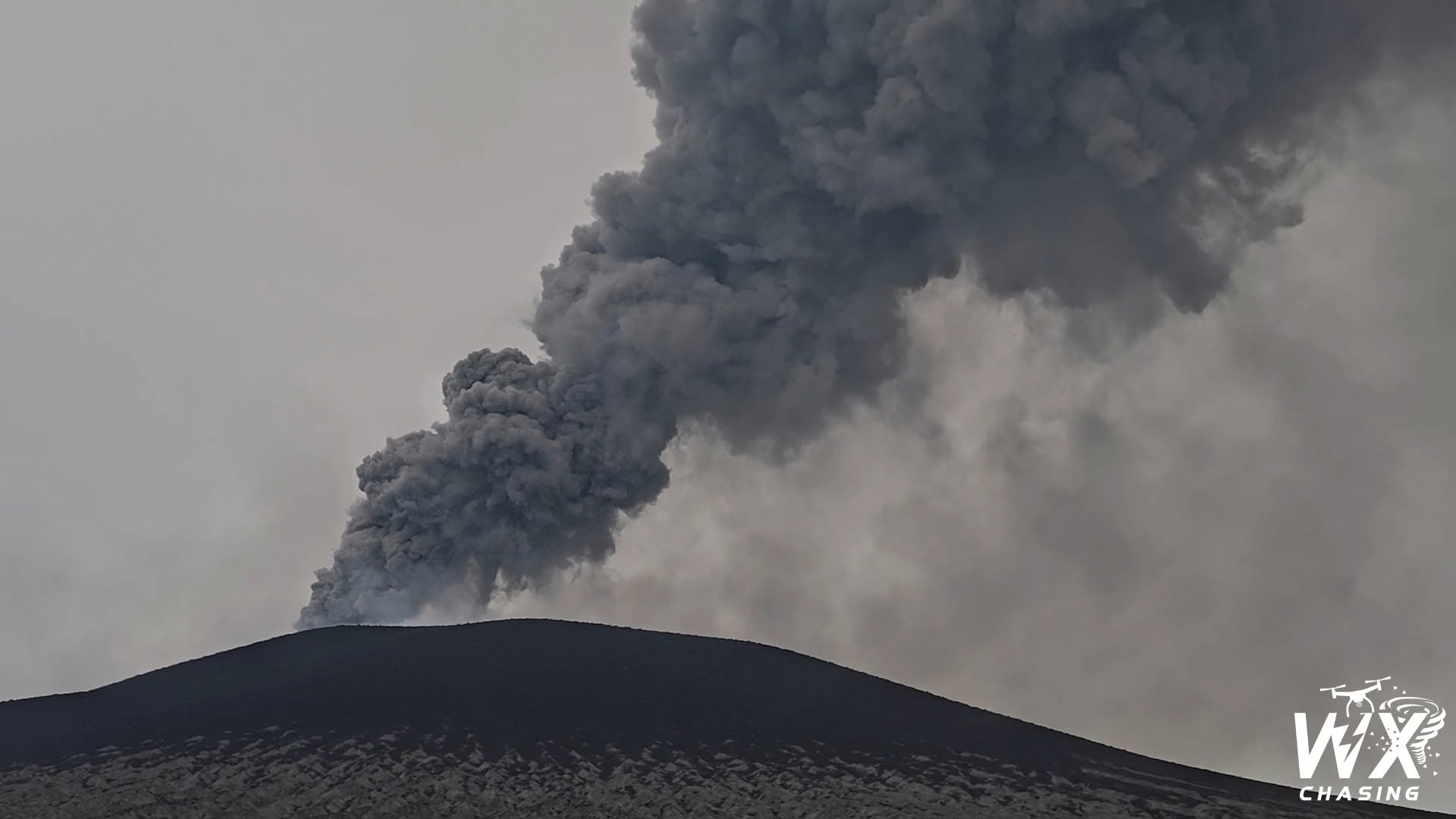
Webcams showed lava fountains rising 100-400 m above the vent and active lava flows, though ash-and-gas plumes, weather conditions, and darkness sometimes obscured webcam views. By 00h50 on 5 September ash plumes had risen to 15.2 km (50,000 ft) a.s.l. and were fanning out to the W. Fountaining was last confirmed at 01h00 on 5 September, before webcams were damaged by ejected volcanic material.
At 01:50 on September 5, the Darwin VAAC reported that ash was continuously rising to an altitude of 15.2 km and drifting westward, while ash at an altitude of 5.5 km (18,000 feet) was drifting southward. Within a few hours—by 04:50—the ash at 15.2 km was drifting westward, the ash at 6.1 km (20,000 feet) southward, and the ash at 5.5 km east-southeastward. Ash plumes rose to an altitude of 1.8 km (6,000 feet) and drifted southwestward. Between September 4 and 8, ash and gas plumes dispersed in several directions: southeastward and southward, crossing parts of Banten Province and West Java (including the capital, Jakarta, located 160 km to the east). Nearly 3,000 flights were disrupted (rerouted, delayed, or cancelled) at several airports in the region; operations were suspended for varying periods at eight domestic and international airports. These airports reopened on September 8.
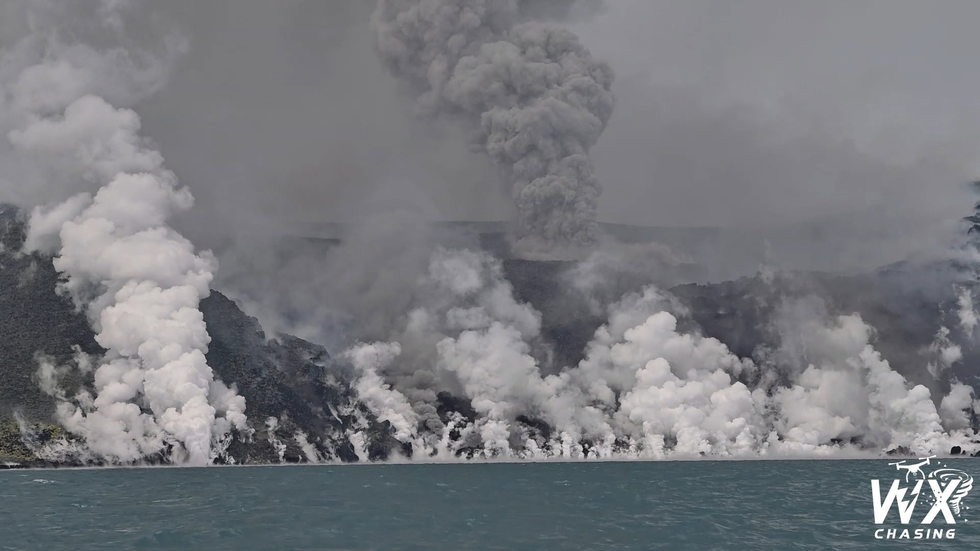
Five eruptive episodes were recorded on September 8 (at 05:08, 05:34, 07:49, 11:34, and 17:56) and another on September 9 (at 12:47), though none were directly observed visually. The Darwin VAAC reported that ash plumes rose between 1.5 and 2.1 km (5,000 to 7,000 feet) above sea level and drifted west and southwest over the course of these two days. According to a news report, a group of five journalists and three crew members remained missing on September 10 after setting out in a speedboat on September 7 to cover the eruption. The alert level remained at 3 (on a scale of 1 to 4), and the public was advised to stay at least 3 km away from the summit.
Sources : Pusat Vulkanologi et Mitigasi Bencana Geologi (PVMBG, également connu sous le nom de CVGHM), Badan Nacional Penanggulangan Bencana (BNPB), Antara News, Centre consultatif de cendres volcaniques de Darwin (VAAC).
Photos : WXChasing /FB.
Japan , Tokachidake :
Mount Tokachi (Hokkaido) volcanic alert level raised to 3
Saturday, September 12, 12:57 PM
Japanese meteorological authorities have raised the volcanic alert level for Mount Tokachi, located in Hokkaido Prefecture (in the country’s far north), to Level 3 (on a scale of 5), thereby restricting access to the mountain.
The Sapporo regional office of the Japan Meteorological Agency reports that seismographs installed on the mountain have detected high-amplitude volcanic earthquakes since August 17. The strongest tremor in this recent series was recorded on Saturday at approximately 8:20 AM. This earthquake brought the total number of high-amplitude volcanic tremors recorded since August to five, meeting the criteria required to raise the alert level. The shift to Level 3 took effect at 9:30 AM on Saturday.
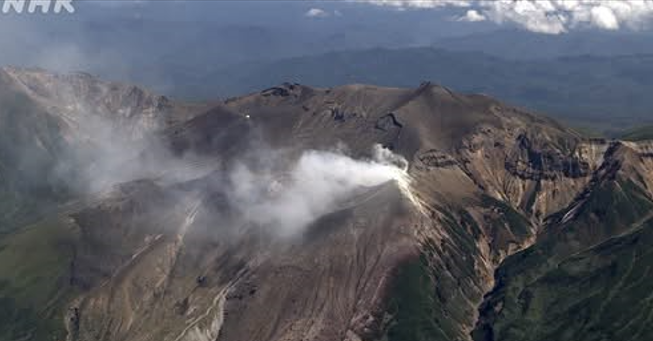
Authorities are urging the public to remain vigilant regarding the risk of large volcanic rock fragments being ejected within a radius of approximately 3 kilometers around the « 62-2 » crater. They also warn that volcanic ash and small rock fragments could be carried by the wind over long distances and fall in downwind areas.
Volcanic activity at Mount Tokachi has intensified this year, notably with an increase in volcanic gas emissions. Authorities raised the alert level to 2 in June, and a minor eruption occurred in July. At a press conference, an official from the Meteorological Agency advised the public to check information issued by the Agency and local municipalities, and to stay away from hazardous areas. He explained that the high-amplitude earthquakes are likely caused by the accumulation of magmatic material underground. He added that no major events had been observed since the alert level was raised.
Source et photo : 3 nhk org.
Colombia , Puracé – Los Coconucos volcanic chain :
Popayán, September 14, 2026, 3:00 PM
Based on monitoring of activity in the Los Coconucos volcanic chain, the Colombian Geological Service (SGC)—an agency attached to the Ministry of Mines and Energy—reports the following:
Since the last bulletin, the recording of seismic signals associated with fluid dynamics within the volcanic conduits has continued, specifically long-period (LP) events and tremor (TR) pulses located beneath the Puracé volcano crater at depths of less than 1 km. Persistent seismicity linked to rock fracturing (volcano-tectonic, VT) is also observed, primarily located between 13 and 18 km northeast of the Puracé volcano, at depths ranging from 6 to 12 km. The maximum
recorded magnitude was 1.9 ML.
Slow ground deformation continues in the area between the Puracé, Piocollo, and Curiquinga volcanoes. Regarding gas monitoring, sulfur dioxide (SO2) emissions remain steady, while an upward trend in soil carbon dioxide (CO2) concentrations has been noted.
Since the last bulletin, two ash emissions have been recorded; these dispersed toward the northwest of the volcanic edifice, following the wind direction. Observation
conditions were difficult due to heavy cloud cover over the upper part of the volcano. According to information published on satellite observation platforms, no thermal anomalies have been identified at the bottom of the crater.
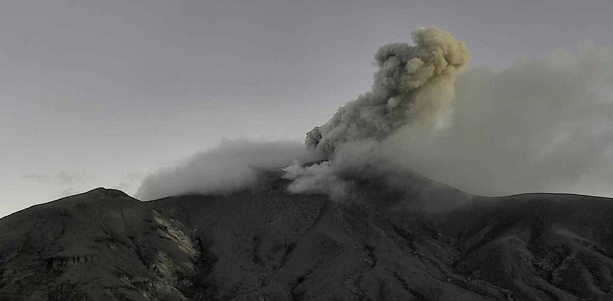
Overall, across the various volcanic monitoring methods, readings recorded by instruments on the volcano over the past few weeks have remained above baseline levels; these indicate a significant change in the volcano’s dynamics, which is why it remains at an orange alert level.
The public is advised to stay away from the crater areas of the Puracé, Piocollo, and Curiquinga volcanoes, as well as the headwaters of the rivers originating there, due to the risk of sudden gas and ash emissions accompanied by the ejection of rock fragments. Furthermore, the accumulation of ash and erupted material could trigger localized mudflows.
The volcanic activity alert level remains at Orange: indicating a volcano showing significant changes in monitored parameters.
Source et photo : SGC.
Costa Rica , Rincón de la Vieja :
The OVSICORI-UNA volcanic monitoring group is maintaining the activity level of the Rincón de la Vieja volcano at 3 (Caution).
This decision is based on the following observations:
● Fifty-seven eruptions were recorded this week; only three of them reached an acoustic magnitude greater than 4 (moderate). The highest number of eruptions was recorded on September 4. Most of these eruptions are of low magnitude, and an increase in acoustic energy relative to seismic energy has been observed; this could indicate a drop in the lake level and/or increased permeability resulting from the recurring eruptions over the past two months. The eruption on September 6 at 10:32 a.m. exhibited the highest acoustic magnitude of the week and triggered a syn-eruptive lahar (caused by the eruption). Secondary lahars were also recorded on September 5 and 6 following heavy rainfall.
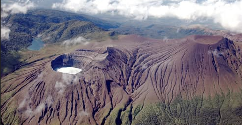
● Since July 2, 212 phreatic eruptions have been recorded. Eight of these generated lahars that surged down the rivers on the volcano’s northern flank; the eruption on August 31 was the most powerful of the year.
● Background tremor shows a downward trend, while an increase in the number of long-period (LP) events is being recorded.
● GNSS stations are detecting summit contraction.
● This week, the volcano emitted an average of 300 tonnes of SO₂ per day, a figure very close to that of the previous week.
These levels remain above the baseline value.
Eruptive activity continues. SO₂ emissions remain above the baseline value. Conditions suggest that further eruptions could occur, including eruptions of intensity equal to or greater than those observed so far. Consequently, the activity level for Rincón de la Vieja volcano remains at 3 (Caution).
OVSICORI-UNA continues to monitor activity at Rincón de la Vieja volcano using seismic, acoustic, geodetic, and gas-monitoring stations, as well as surveillance cameras and field observations; the institute will report any significant developments.
Source et photo : Ovsicori .