August 30 , 2026.
Alaska , Katmai :
AVO/USGS Volcanic Activity Notice
Current Volcano Alert Level: NORMAL
Current Aviation Color Code: GREEN
Issued: Saturday, August 29, 2026, 6:52 PM AKDT
Source: Alaska Volcano Observatory
Notice Number: 2026/A150
Location: N 58 deg 16 min W 154 deg 57 min
Elevation: 6716 ft (2047 m)
Area: Alaska Peninsula
Summary:
Resuspended ash observed from 1912 eruption. Aviation color code and alert level remain at GREEN/NORMAL.
Volcanic Activity:
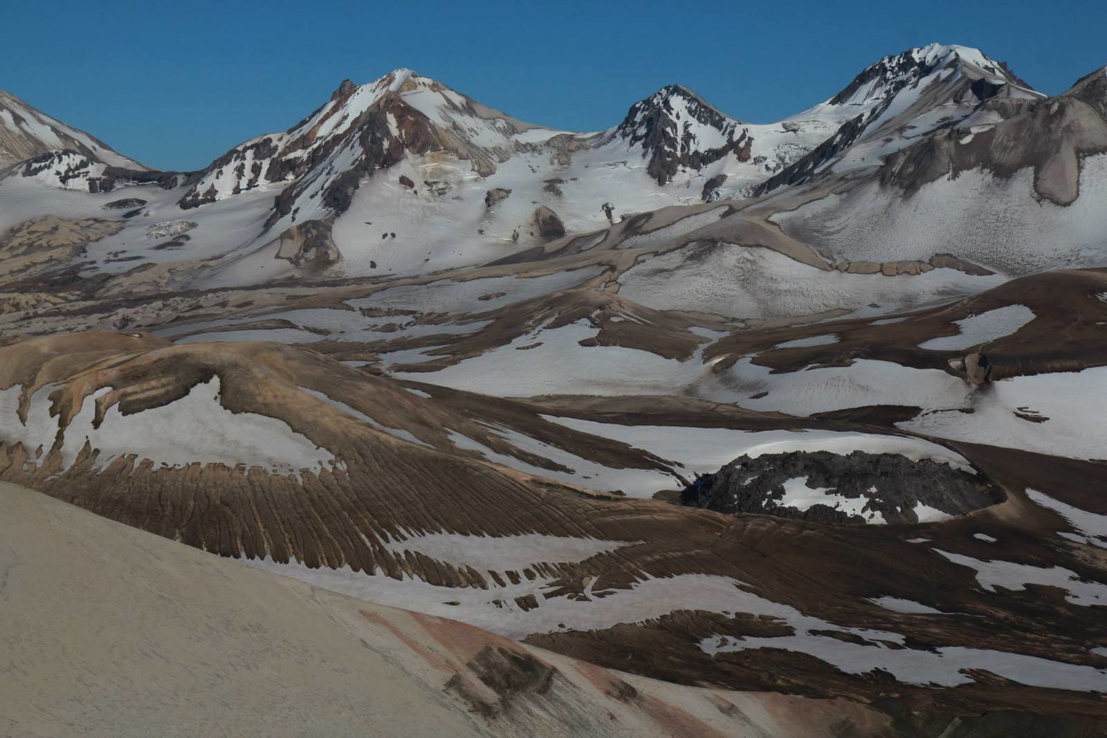
Strong northwesterly winds in the vicinity of Katmai and the Valley of Ten Thousand Smokes have picked up loose volcanic ash erupted during the 1912 Novarupta-Katmai eruption and are carrying it to the southeast. The National Weather Service has issued a SIGMET for this low-level event and suggests that the maximum cloud height is X,XXX ft (XX km) above sea level.
This phenomenon is not the result of recent volcanic activity and occurs during times of high winds and dry snow-free conditions in the Katmai area and other young volcanic areas of Alaska. No eruption is in progress. All of the volcanoes of the Katmai area (Griggs, Katmai, Novarupta, Mageik, Martin, Snowy and Trident) remain at Aviation Color Code GREEN and Alert Level NORMAL. Resuspended volcanic ash should be considered hazardous and could be damaging to aircraft and health.
Source et photo : AVO.
Kamchatka , Klyuchevskoy :
KVERT VOLCANIC ACTIVITY NOTICE (VAN)
Issued: August 30 , 2026
Volcano: Klyuchevskoy (CAVW #300260)
Current aviation colour code: ORANGE
Previous aviation colour code: orange
Source: KVERT
Notice Number: 2026-97
Volcano Location: N 56 deg 03 min E 160 deg 39 min
Area: Kamchatka, Russia
Summit Elevation: 4750 m (15580 ft)
Volcanic Activity Summary:
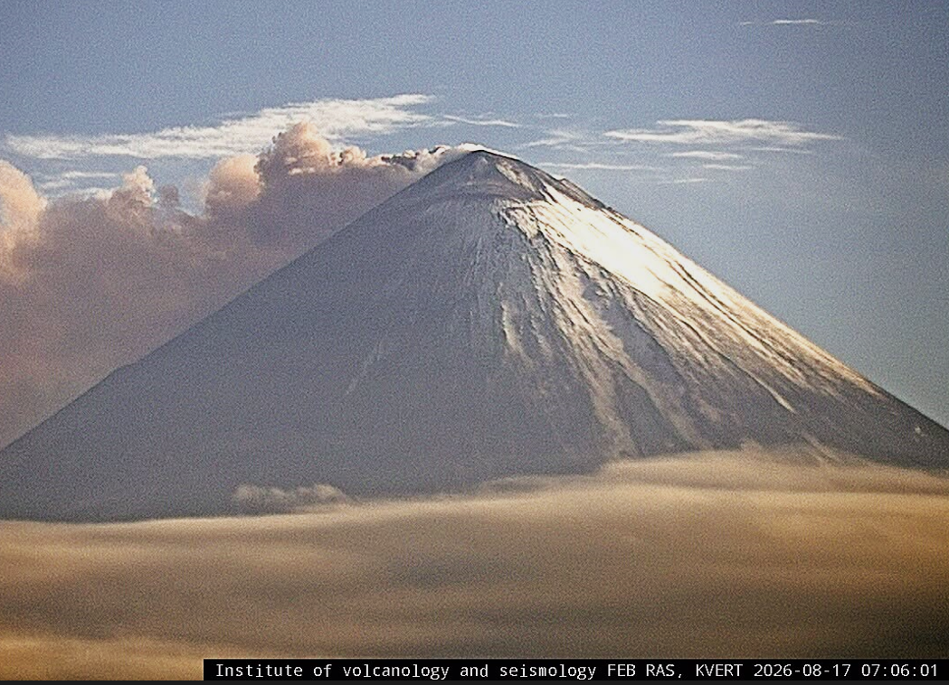
An explosive eruption of the volcano continues. According to video data, an ash rose up to 6.5-7.0 km a.s.l., and an ash plume is extending 50 km to the north-east of the volcano.
A moderate explosive eruption of the volcano continues. Ongoing activity could affect low-flying aircraft.
Volcanic cloud height:
6500-7000 m (21320-22960 ft) AMSL Time and method of ash plume/cloud height determination: 20260829/2330Z – Video data
Other volcanic cloud information:
Distance of ash plume/cloud of the volcano: 50 km (31 mi)
Direction of drift of ash plume/cloud of the volcano: ENE / azimuth 63 deg
Time and method of ash plume/cloud determination: 20260829/2350Z – Himawari-9 14m15
Source et photo : Kvert
Indonesia , Lewotobi Laki-laki :
An eruption of Mount Lewotobi Laki-laki occurred on Friday, August 28, 2026, at 07:35 WITA; an ash column rising approximately 1,000 meters above the summit (or about 2,584 meters above sea level) was observed. This dense, gray column drifted toward the southwest and west. The eruption was recorded by a seismograph, showing a maximum amplitude of 14.8 mm and a duration of 364 seconds.
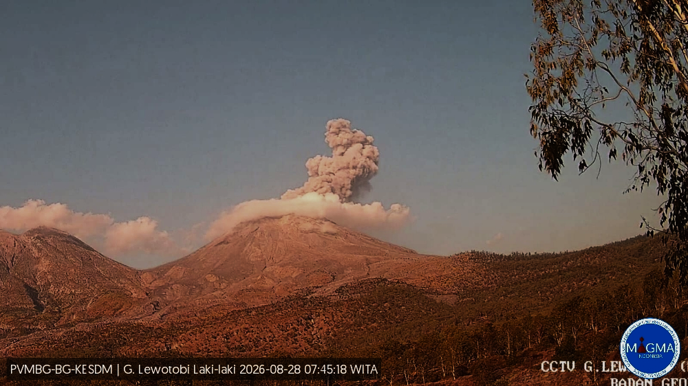
Seismic observations
7 emission earthquakes with amplitudes of 4.4–8.8 mm and durations of 32–34 seconds.
2 episodes of non-harmonic tremor with amplitudes of 3.7–5.9 mm and durations of 85–92 seconds.
18 low-frequency earthquakes with amplitudes of 2.2–7.4 mm and durations of 21–30 seconds.
18 distant tectonic earthquakes with amplitudes of 4.4–47.3 mm and durations of 40–141 seconds.
Recommendations
1. Communities located near Mount Lewotobi Laki-laki, as well as visitors and tourists, must not conduct any activities within a 5 km radius of the Mount Lewotobi Laki-laki eruption center.
2. The public is advised to remain calm, follow instructions from local authorities, and disregard information from unverified sources.
Source et photo : PVMBG.
Costa Rica , Poas :
OVSICORI-UNA Weekly Volcanic Monitoring Bulletin, August 28, 2026
Latitude: 10.20°N;
Longitude: 84.23°W;
Elevation: 2,687 m above sea level.
Current activity level: Alert
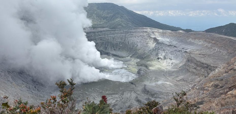
Two eruptions were recorded this week: one on the 26th at 10:36 and the other on the 27th at 02:35.
They had acoustic magnitudes of 3.8 and 4.6, respectively. The second event reached the highest acoustic magnitude observed in recent years (at least since 2020). However, this does not mean it produced the highest eruption plume of that period; that record belongs to the eruption of April 21, 2025. On August 20, tremor amplitude increased significantly and remained high until the morning of the 25th, when it dropped to moderate levels. The amplitude remained stable for approximately 24 hours until the eruption on the 26th, at which point it increased again. It subsequently decreased, particularly during the half-hour preceding the eruption on the 27th.
Five volcano-tectonic earthquakes were recorded this week, all clustered just south of the national park near the locality of Altura. They were all of low magnitude (< 2) and located approximately 1 km below sea level. Four of these events occurred in the hours leading up to the eruption on the 26th (between 03:30 and 06:30). The number of long-period events had been trending downward since late July; however, they increased slightly before the eruption on the 26th and, more notably, after the eruption on the 27th.
The geodetic network shows no significant deformation, aside from a gradual trend of uplift around the crater. Multi-GAS stations recorded an average SO2/CO2 ratio of 1.5 ± 0.6, a value similar to that of the previous week (1.5 ± 0.4). The H2S/SO2 ratio remains below 0.1. NOVAC stations recorded a daily SO2 flux of 188 ± 69 tonnes, comparable to the previous week (203 ± 78 t/d). The last detection of atmospheric SO2 by the Sentinel satellite was on August 19, with a value of 13 tonnes.
The level of the hyperacidic lake stabilized this week. The lake exhibits a milky-gray color; on August 20, an acidity of pH 0.17 and a temperature of 74°C were measured.
Source et photo : Ovsicori.
Ecuateur , El Reventador :
DAILY STATUS REPORT FOR REVENTADOR VOLCANO, Saturday, August 29, 2026.
Information from the Geophysical Institute – EPN.
Surface activity level: High; Surface trend: Unchanged
Internal activity level: Moderate; Internal trend: Unchanged
From August 28, 2026, 11:00 AM to August 29, 2026, 11:00 AM:
Seismicity:
Explosion (EXP): 75
Long-period (LP): 6
Emission tremor (TREMI): 7
Harmonic tremor (TRARM): 3
Precipitation / Lahars:
No precipitation has been recorded in the area. **Heavy rains could remobilize accumulated materials and generate debris-laden mudflows (lahars) capable of descending the volcano’s flanks and flowing into adjacent rivers.**
Ash emissions/plumes:
Since yesterday afternoon, the surveillance camera system has recorded several gas and ash emissions drifting west and southwest, reaching altitudes of 300 to 900 meters above the crater rim. In connection with this activity, the Washington VAAC issued a report noting an ash plume rising 700 meters above the crater rim and drifting west.
Other monitoring parameters:
The MIROVA-MODIS satellite system detected one thermal anomaly, while the FIRMS system detected ten over the past 24 hours.
Observations:
Overnight and early this morning, the surveillance camera network recorded several episodes of incandescent material descending the volcano’s flanks, reaching up to 1,000 meters below the crater rim. At the time this report was finalized, the volcano remained obscured by cloud cover.
Alert Level – SGR: Orange
Source et photo : IGEPN.