August 29 , 2026.
Guatemala , Fuego :
Weather conditions: Clear skies
Wind: Easterly
Precipitation: 0.8 mm
Activity
Low- to moderate-intensity degassing was recorded overnight and in the early morning; fumarolic plumes reached approximately 300 meters above the crater and dispersed towards the west. Explosive activity ranged from 6 to 9 explosions (of low, moderate, and high intensity) per hour, generating ash plumes that rose between 4,500 and 4,800 meters above sea level and drifted towards the west and southwest.
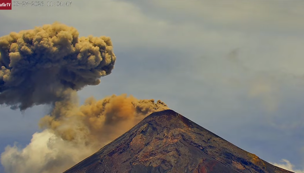
Some explosions were accompanied by rumbling and shockwaves that caused the roofs of nearby houses to vibrate. Incandescent material was observed being ejected up to 300 meters above the crater, accompanied by small avalanches. Additionally, incandescent material fell around the crater and was channeled into the Ceniza, Taniluyá, Seca, Santa Teresa, Trinidad, and Las Lajas ravines, sometimes descending as far as the vegetation line.
Source : Insivumeh .
Photo : Afar TV
Alaska , Kupreanof :
Mount Kupreanof continues to exhibit low-level unrest, with occasional local earthquakes and steam emissions observed in web camera images. Seismic activity remained low throughout the week, and no sulfur dioxide emissions have been detected since August 21.
A new temporary monitoring station was installed near Mount Kupreanof in July 2026 and is intermittently providing seismic data, infrasound data, gas measurements, and web camera images.
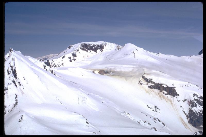
Intermittent data transmission is by design to conserve battery power, but the frequency of data acquisition can be increased if activity warrants. The closest functioning seismometers that provide continuous data are approximately 10 miles (16 km) to the northeast of the volcano as part of the Mount Veniaminof network. Mount Kupreanof is also monitored by satellite data, remote infrasound and lightning networks, and visual observations from pilots and mariners passing by the volcano
Source : AVO
Photo : Miller, T. P. Alaska Volcano Observatory / Geophysical Institute
Canaries Islands , Tenerife :
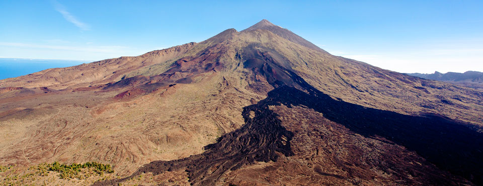
Identification of the main deep magma accumulation zone beneath Tenerife
A new study has produced the first three-dimensional image of the deep crustal and upper mantle structure beneath Tenerife, revealing several zones of low seismic velocity likely linked to magma accumulations at the base of the ancient oceanic crust.
Reconstructing the island’s deep structure was made possible by analyzing over 785 teleseismic events—high-magnitude earthquakes occurring across the globe and recorded between 2017 and 2024 by the Canary Islands seismic network on Tenerife. Researchers employed the « receiver function » technique, which allows for the analysis of how seismic waves transform as they pass through discontinuities and media with varying physical properties within the Earth. This data enables the reconstruction of the subsurface structure and the detection of variations in seismic wave propagation velocity with depth.
One of the study’s key findings is the identification of a relatively rigid oceanic crustal layer, approximately 10 kilometers thick, characterized by relatively high seismic velocities.
Beneath this layer lies a much more heterogeneous structure, within which four major low-seismic-velocity anomalies have been identified. These structures are distributed across various sectors of Tenerife and span a depth range of approximately 10 to 30 kilometers. The observed low seismic velocities are interpreted as indicating zones of high temperatures and/or variations in rock composition and physical properties, potentially linked to the presence and accumulation of magma originating from the upper mantle.
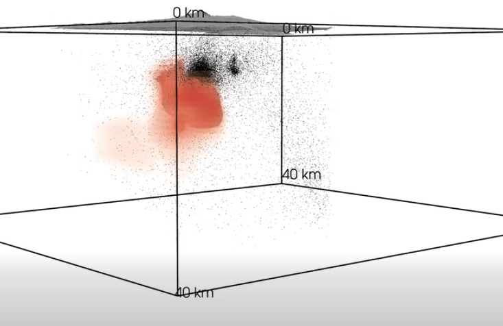
The study’s most significant finding concerns the western sector of Tenerife, where exceptionally low S-wave velocities were identified.
Combining these results with thermodynamic modeling suggests that this anomaly could contain a substantial proportion of molten material—specifically, magma. The correlation between low seismic velocities and high melt fractions indicates the presence of a magma-rich zone within the upper mantle.
This accumulation is likely linked to processes of basal magmatic accretion (underplating), whereby magma rising from the mantle gradually accumulates at the base of the oceanic crust. Throughout Tenerife’s geological evolution, these processes have likely significantly altered the physical and chemical characteristics of the crust-mantle boundary and the upper mantle.
These findings thus shed new light on the formation and evolution of Tenerife’s volcanic edifice, starting from its deepest levels.
Source : Instituto Volcanológico de Canarias
Photo : webtenerifefr.com
Colombia , Nevado del Ruiz :
Manizales, August 25, 2026, 2:30 PM.
Based on monitoring of the Nevado del Ruiz volcano’s activity, the Colombian Geological Service (SGC)—an agency affiliated with the Ministry of Mines and Energy—reports the following:
During the week of August 18 to 24, 2026, the volcano continued to exhibit unstable behavior.
Compared to the previous week, the main variations in monitored parameters were as follows:
– Seismic activity associated with rock-fracturing processes within the volcanic edifice showed a decrease in the number of recorded earthquakes but an increase in released seismic energy. The earthquakes were located primarily near the Arenas crater and on the volcano’s northwest, east-northeast, and north flanks, at distances of less than 10 km from the crater. Earthquake depths ranged from less than 1 km to 7 km below the volcano’s summit. The maximum magnitude was 1.6, corresponding to an earthquake that occurred on August 23 at 5:55 PM, located near the Arenas crater at a depth of 1 km.
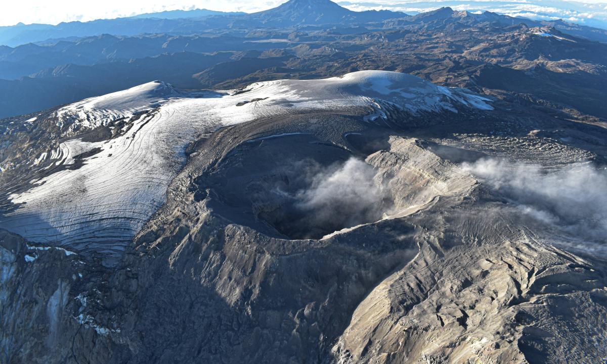
– Seismicity associated with fluid dynamics within the volcanic conduits remained at similar levels regarding both the number of events and the seismic energy released. This activity was characterized by short-duration, low-energy seismic signals. As in previous weeks, no long-duration seismic signals were recorded, and no pulsed ash emissions or changes in the apparent temperature of the gas column were confirmed.
Emissions of water vapor and volcanic gases—primarily sulfur dioxide (SO₂)—into the atmosphere continued from the Arenas crater. The estimated SO₂ flux associated with degassing processes decreased slightly compared to the previous week. Supplementary monitoring via satellite data platforms continued to show low levels of SO₂ emissions.
– The gas and water vapor column remained at a vertical height of less than 400 m above the volcano’s summit, with dispersion directed primarily toward the northwest, north-northwest, and west-northwest flanks. Strong winds in the volcanic area continued to remobilize previously deposited volcanic material, causing light ashfall over the city of Manizales (Caldas department). Monitoring of thermal anomalies at the base of the Arenas crater via satellite platforms was limited by persistent cloud cover in the area. Low-intensity thermal anomalies were recorded over the past week.
Source et photo : SGC.
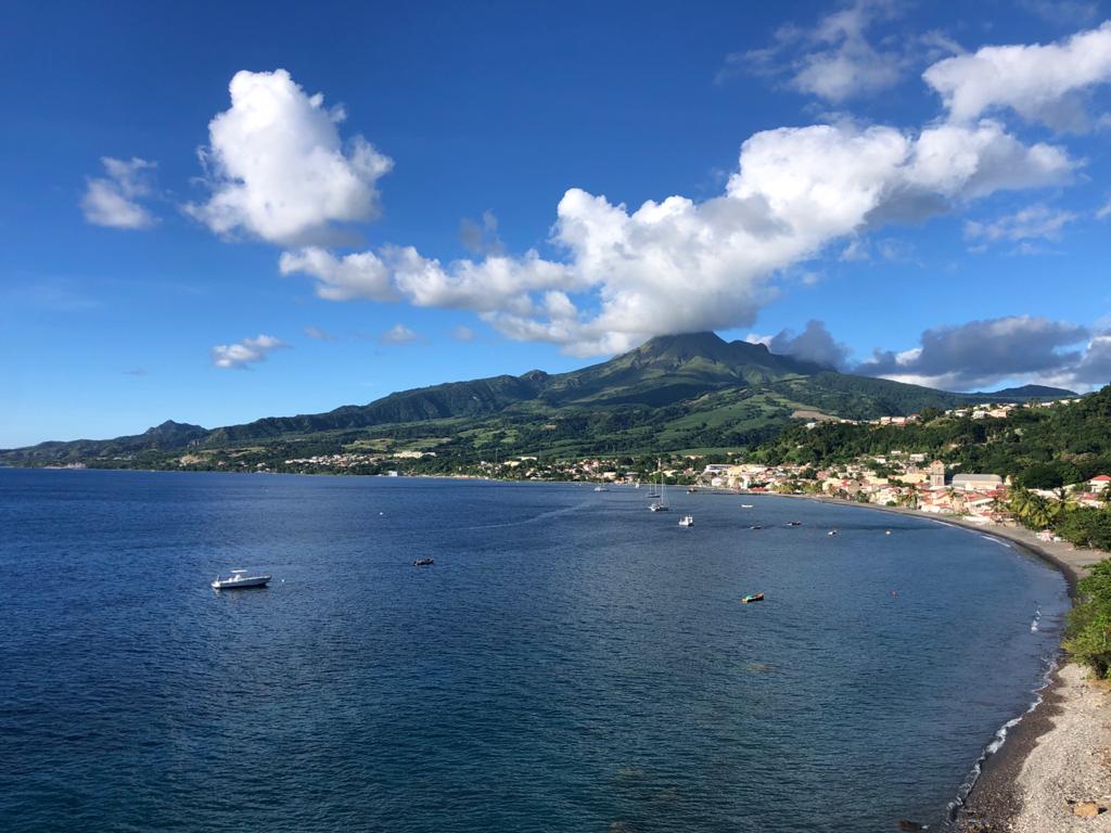
Martinique , Mount Pelée :
Weekly Report / Institut de physique du globe de Paris, Martinique Volcanological and Seismological Observatory (OVSM)
Saint-Pierre, August 28, 2026, at 3:00 PM local time (GMT-4)
Volcano-tectonic seismic activity
Between August 21, 2026, at 4:00 PM (UTC) and August 28, 2026, at 4:00 PM (UTC), the OVSM recorded 71 volcano-tectonic earthquakes:
• 71 volcano-tectonic earthquakes. None of the earthquakes exceeded a magnitude (local magnitude Mlv or duration magnitude Md) of 1. These earthquakes were located at depths ranging from 0.7 to 1.7 km beneath the volcano’s summit.
No earthquakes were reported felt by the population.
During the previous week, the OVSM had recorded 117 volcano-tectonic earthquakes. As of August 28, 2026, and over the past four weeks, the OVSM has thus observed a total of 351 volcanic earthquakes, representing an average of 87 to 88 earthquakes per week.
Deformations of Mount Pelée
Since May 2026, the OVSM has been recording ground displacements of several centimeters in the summit area of Mount Pelée. Over the past four weeks, maximum displacement rates have been around 1.1 cm per month, similar to the previous month. These displacements are consistent with deformation of the volcanic edifice caused by an inflating pressure source located at a depth of approximately 1 km beneath the summit.
The probability of short-term eruptive activity remains low. However, given the observations gathered over recent months and years, a change in the situation over the medium term (weeks to months) cannot be ruled out.
The volcanic alert level, in accordance with the measures established by the authorities, is currently YELLOW: vigilance.
Source : Direction de l’OVSM-IPGP.
Photo : RCI fm