
October 21 , 2026 .
New Zealand , White Island :
Observations now confirm weak, ongoing eruption from Whakaari/White Island. Volcanic Alert Level raised to 3; Aviation Colour Code is raised to Orange.
Wednesday October 21, 2026 – 12:45 PM
Whakaari/White Island volcano is now continuously passively erupting a small amount of volcanic ash. Consequently, the Volcanic Alert Level is raised to Level 3 (from 2) and the Aviation Colour Code to Orange (from Yellow). There are no threats to the mainland beyond a potentially noticeable sulphur smell and light ash fall. More explosive eruptions could occur suddenly and be a threat to life on the crater floor and the area immediately offshore, southeast from the island.
During an observation flight yesterday afternoon (Tuesday 20 October 2026), it was confirmed that Whakaari/White Island activity has moved from intermittent to passive eruption of a continuous steam and gas plume that includes some volcanic ash. A blanket of volcanic ash could be seen around the active vent in the Main Crater, and a small amount was being carried upwards in a column of steam and gas (Figures 1 and 2). The discharge was weak, with no evidence that any explosive eruption had occurred.
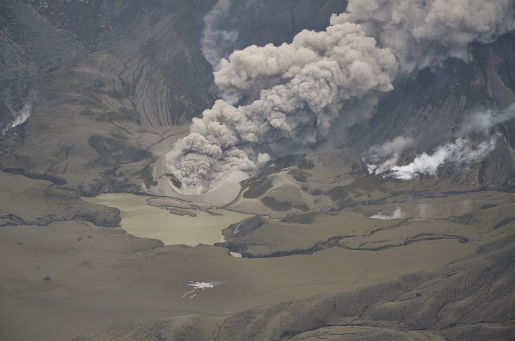
Figure 1: Image (from 20 October 2026 observation flight) of low-energy, continuous eruption of steam, gas and ash from the active vent of Whakaari/White Island. (Credit: Earth Sciences New Zealand).
The size and shape of the active vent is unchanged from our last observations on Monday 12 October, but some ash has accumulated close to the vent and is now thinly spread across the Main Crater floor and outer flanks of the island. The discharge temperature (measured by FLIR camera imaging) has increased from about 100°C to about 395°C since last week. Volcanic sulphur dioxide (SO2) gas from the volcano is being detected daily by TropOMI satellite imaging, and other visual imagery has clearly showed plumes downwind from the island.
Given the now continuous ash emission, increased vent temperature and, potentially, gas emission rate, the Volcanic Alert Level is raised to Level 3 (Minor volcanic eruption). The Aviation Colour Code is raised to Orange, signalling that minor amounts of ash are being carried away from the island in the continuous steam and gas plume. Minor ashfall is likely occurring on and near the island. There have been no reports of ash affecting the mainland, but people might smell the sulphur gases during onshore winds and potentially notice some ash particles. The current activity is typical of eruptive cycles seen at Whakaari/White Island. Based on past eruptive episodes over the past 30 years, this activity could continue for some time, maybe weeks.
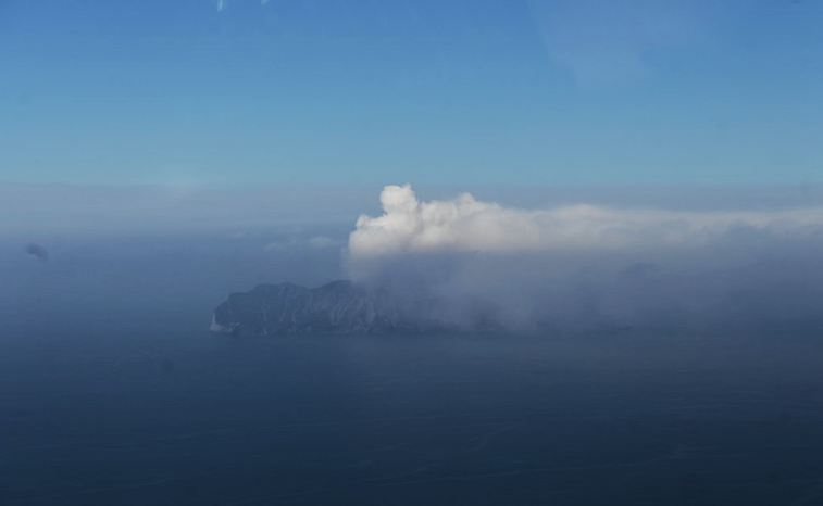
Figure 2: Image (from 20 October 2026 observation flight) of the white steam and gas plume from Whakaari/White Island, with a lower hazy plume carrying a small amount of volcanic ash. (Credit: Earth Sciences New Zealand).
While the current ash emission is quite passive and low energy, volcanic activity could escalate with little or no warning. Sudden, more explosive events can throw rocks across the Main Crater floor and produce ash and gas surges (pyroclastic flows), both of which can be a threat to life on the Main Crater floor and area immediately offshore on the SE of the island. Explosive activity could also cause ash fallout downwind in the immediate vicinity of Whakaari/White Island and be an inconvenience to aircraft or vessels in the area, with any significant impact to the mainland remaining very unlikely. The level of volcanic activity would have to escalate significantly for this likelihood to increase.
Any potential impacts on aviation continue to be assessed and communicated by MetService’s Volcanic Ash Advisory Centre (VAAC).
Our ability to monitor Whakaari / White Island in near-real time remains very limited due to the lack of functioning instrumentation on the island. Earth Sciences New Zealand’s Volcano Monitoring Group and the National Geohazards Monitoring Centre will continue to monitor the volcano to the best of our ability with remote observations from the mainland and satellites, and occasional flights near the island. These observations are supported by additional information supplied by MetService. We will provide further updates when information becomes available or the status changes.
Source : Geonet / Michael Rosenberg / Duty Volcanologist
Photos : Geonet / Earth Sciences New Zealand
Indonesia , Anak Krakatau :
Location: South Lampung Regency, Lampung
Date of event: Wednesday, October 21, 2026, 06:45:00 GMT+2
An eruption of Mount Anak Krakatau, in Lampung Province, occurred on Wednesday, October 21, 2026, at 11:45 WIB (Western Indonesian Time). An ash column was observed, reaching a height of approximately 500 m above the summit (± 657.0 m above sea level). The ash column, which was dense and black in color, drifted toward the northwest. The eruption was recorded on a seismogram with a maximum amplitude of 70.0 mm. The eruption was still ongoing at the time this report was written.
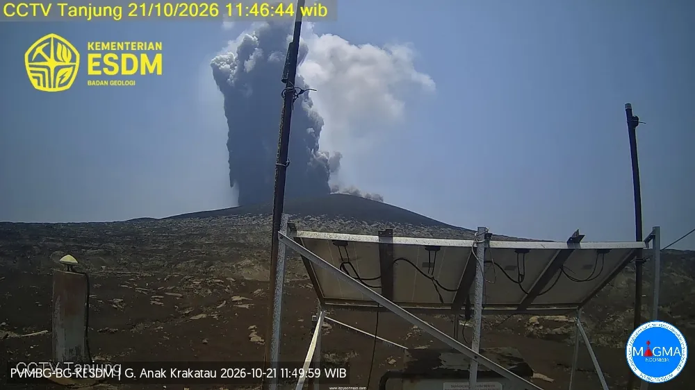
Seismic observations
7 hybrid/polyphase earthquakes, with amplitudes ranging from 18.0 to 53.5 mm and event durations varying from 7.0 to 15.0 seconds.
1 « continuous tremor » type earthquake, with an amplitude ranging from 2.0 to 20.0 mm (dominant amplitude: 5.0 mm).
2 shallow volcanic earthquakes, with amplitudes ranging from 42.5 to 47.0 mm and durations between 13.0 and 15.0 seconds.
Recommendations
1. Populations living near Mount Anak Krakatau, as well as visitors, tourists, and hikers, are prohibited from entering or conducting any activities within a 5 km radius of the Anak Krakatau eruptive center.
2. Populations living near Mount Anak Krakatau, as well as visitors and tourists, are prohibited from entering or conducting any activities within a 1 km radius of the new islands located in the northwest and southeast sectors of Mount Anak Krakatau.
Source et photo : PVMBG.
Italy / Sicily , Etna :
WEEKLY BULLETIN, October 12, 2026, to October 18, 2026. (Date of issue: October 20, 2026)
SUMMARY OF ACTIVITY STATUS
Based on monitoring data, the following is noted:
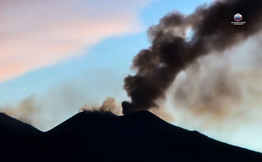
1) VOLCANOLOGICAL OBSERVATIONS: Variable degassing activity at the summit craters, along with intermittent ash emissions from « Bocca Nuova » and the Northeast Crater.
2) SEISMOLOGY: Moderate seismic activity related to fracturing; the average tremor amplitude shows fluctuations between medium and low levels.
3) INFRASOUND: Low infrasonic activity.
4) GROUND DEFORMATION: Time series from ground deformation monitoring stations show no significant variations.
5) GEOCHEMISTRY: SO2 flux at a medium level.
CO2 flux from the ground (Etnagas): average values.
Partial pressure of CO2 dissolved in groundwater (EtnaAcque network): no update available.
Helium (He) isotope ratio at peripheral sites: the latest data, from September 22, 2026, confirm high values.
6) SATELLITE OBSERVATIONS: Thermal activity in the summit area, as observed by satellite, has remained at a generally low level.
VOLCANOLOGICAL OBSERVATIONS
Monitoring of volcanic activity at Mount Etna during the week in question was carried out through the analysis of images from the surveillance camera network of the INGV’s Etna Observatory (INGV-OE), as well as through field missions conducted by INGV-OE personnel.
Activity at Etna’s summit craters remained unchanged from the previous week; it was characterized by sporadic, scattered ash emissions, originating primarily from the Bocca Nuova and the Northeast (NE) crater. In general, the summit craters were mainly the site of degassing of varying intensity.
Source : INGV
Photo : Salvatore Lo Giudice
Italy , Stromboli :
WEEKLY BULLETIN, October 12, 2026, to October 18, 2026. (Date of issue: October 20, 2026)
SUMMARY OF ACTIVITY STATUS
Based on monitoring data, the following observations are noted:
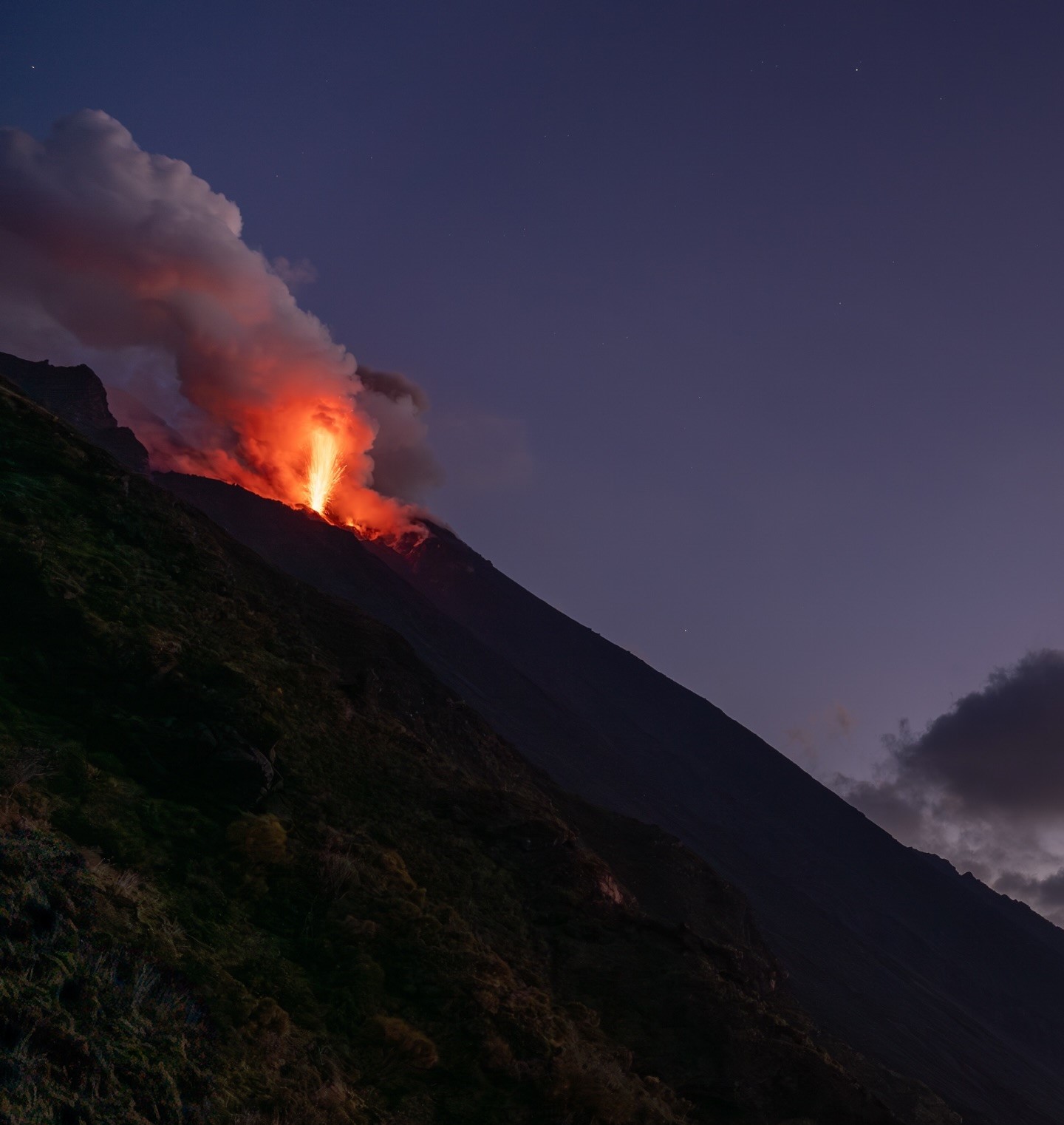
1) VOLCANOLOGICAL OBSERVATIONS: Typical Strombolian eruptive activity occurred in both crater zones; an effusive event resulting from a crater overflow took place on October 12, and a landslide occurred along the Sciara del Fuoco on October 18. The overall frequency of explosive activity—across both the North and Central-South crater zones—remained at a moderate level, with low-intensity explosions in both areas.
2) SEISMOLOGY: Monitored seismic parameters show no significant variations.
3) GROUND DEFORMATION: The SELI inclinometer recorded a variation during the lava overflow on October 12.
4) GEOCHEMISTRY: SO2 flux at a moderate level.
Soil CO2 flux (Pizzo zone – STR02): preliminary data (due to technical issues).
C/S ratio in the plume: no data available.
Helium isotopic ratio (R/Ra): no data available.
Soil CO2 flux in the San Bartolo area: moderate values.
Soil CO2 flux in the Scari area: no data available.
5) SATELLITE OBSERVATIONS: Thermal activity in the summit area, as observed by satellite, ranged from low to moderate.
VOLCANOLOGICAL OBSERVATIONS
Observations of explosive activity captured by surveillance cameras
During the observation week, Stromboli’s eruptive activity was characterized through the analysis of images recorded by INGV-OE surveillance cameras, located at an altitude of 190 m above sea level and at Punta dei Corvi (designated SCT-SCV and SPCT, respectively). Explosions in the North crater zone (Zone N) primarily produced coarse material (bombs and lapilli), while explosions in the Central-South crater zone (Zone CS) generated predominantly fine material, mixed with some coarse material. The mean frequency of explosions in Zone N was at an average level, while the intensity remained generally low. In Zone CS, the mean explosion frequency remained low, and the intensity of the explosive activity stayed, overall, at a low level. The total daily mean hourly frequency of explosions (Zone N + Zone CS) was at an average level.
Effusive activity via lava overflow (times in GMT)
During the observation week, on October 12 at approximately 18:05, an episode of lava emission via overflow occurred from the North crater zone. This episode, which began with a sudden initial phase, gradually concluded around 20:00.
Rockfall phenomena along the Sciara del Fuoco (times in GMT)
On October 18, following the gradual accumulation of loose material, a partial collapse (rockfall) of the scoria cone located in the North crater zone occurred. The event involved a modest volume of hot material that channeled along the slope, cascading down and spreading across the Sciara del Fuoco.
Source : INGV
Photo : Stromboli stati d’animo / Sebastiano Cannavo
Colombia , Chiles – Cerro Negro :
San Juan de Pasto, October 20, 2026, 4:24 PM
As part of the monitoring of activity at the Chiles-Cerro Negro Volcanic Complex (CVCCN), the Colombian Geological Service (SGC)—an agency affiliated with the Ministry of Mines and Energy—
reports the following:
For the period from October 13 to October 19, 2026, the main variations in the monitored parameters, compared to the previous week, were as follows:
● Amidst fluctuating seismic activity, an increase in the number of events was observed, while the energy released showed a slight decrease. Seismicity associated with
rock fracturing remains predominant, followed by activity linked to fluid dynamics.
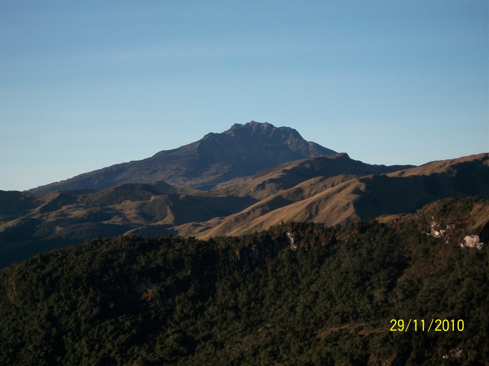
● Fracture-related earthquakes were located primarily to the west of the Chiles volcano, at a distance of less than 3.4 km and at depths ranging from 2.6 to 4.2 km below the volcano’s summit (4,700 m above sea level), with a maximum magnitude of 1.4.
None of the recorded earthquakes were felt by the local population.
● Analysis of data collected by satellite sensors and ground-based stations continued to reveal variations associated with deformation processes within the volcanic zone.
Based on the assessment and correlation of the monitored parameters, the SGC recommends closely following the evolution of the situation through weekly bulletins and other information released via our official channels. It is also advised to adhere to the instructions provided by local and departmental authorities, as well as those from the National Unit for Disaster Risk Management (UNGRD).
Volcanic activity remains at the yellow alert level: an active volcano exhibiting changes in the baseline behavior of monitored parameters, along with other manifestations.
Source et photo : SGC.
