October 23 , 2026.
Hawaii , Kilauea :
HAWAIIAN VOLCANO OBSERVATORY DAILY UPDATE , U.S. Geological Survey
Thursday, October 22, 2026, 10:00 AM HST (Thursday, October 22, 2026, 20:00 UTC)
19°25’16 » N 155°17’13 » W,
Summit Elevation 4091 ft (1247 m)
Current Volcano Alert Level: ADVISORY
Current Aviation Color Code: YELLOW
Summary:
The Halema’uma’u eruption of Kīlauea is currently paused after episode 55 fountaining ended on October 17. Summit reinflation continues today and the preliminary forecast for episode 56 fountaining is between October 29 and November 5, 2026.
Overview:
The summit eruption of Kīlauea in Halemaʻumaʻu is paused following lava fountaining in episode 55 on October 17, 2026. Summit tiltmeter data showed re-inflation began immediately following the end of episode 55 and steady, slow inflation is continuing. Assuming magma chamber inflation has returned to the pattern established in the past, the preliminary forecast for episode 56 fountaining to occur is between October 29 and November 5, 2026.
Summit Observations:
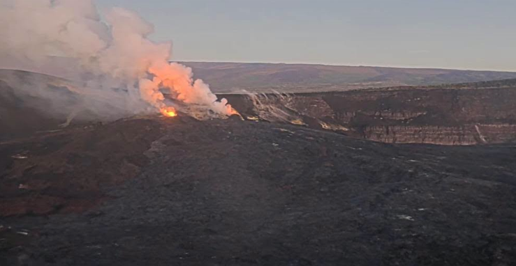
Glow was again observed overnight from both vents in Halema’uma’u with weak intermittent glow from the north vent and strong continuous glow from the west vent. No glow was visible from the south vent, which was covered in a layer of tephra during episode 55.
Continuous, low-level seismic tremor has been present over the past day, which is typical during inter-episode pauses. Two earthquakes were recorded in the summit area in the past 24 hours.
Steady inflationary tilt continued over the past 24 hours. The UWD tiltmeter has recovered at total of 10.8 microradians of inflationary tilt since the end of episode 55. Deflationary tilt measured at a summit tiltmeter at Uēkahuna (UWD) totaled 21 microradians during episode 55. Post-fountaining tilt patterns have been similar to those seen prior to episode 54.
During inter-episode pauses, the sulfur dioxide (SO2) emission rate from the summit typically varies between 1,000 to 5,000 tonnes per day. Winds are forecast from the northeast, which are pushing the gas plume to the southwest over the Kaʻū Desert this morning.
Rift Zone Observations:
Rates of seismicity and ground deformation remain low in the East Rift Zone and Southwest Rift Zone. SO2 emissions from the East Rift Zone remain below the detection limit. No significant ground deformation was recorded in either rift zone.
Source et photo : HVO
Indonesia , Karangetang :
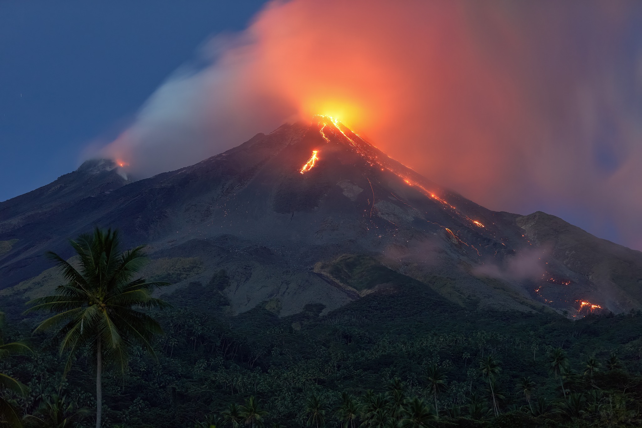
The Pusat Vulkanologi dan Mitigasi Bencana Geologi (PVMBG) reported that the eruption at Karangetang’s North Crater (Kawah Dua) continued during 15-21 October. White plumes rose as high as 1 km above the summit and drifted in various directions on most days. At 2047 on 21 October a white-and-gray ash plume rose around 800 m above the summit and drifted N and NE. Incandescence at the North Crater and from lava flows and/or incandescent avalanches on the flanks were visible in some webcam images throughout the week. Rumbling sounds were occasionally reported. The Alert Level remained at 2 (on a scale of 1-4) and the public was advised to stay 1.5 km away from both craters, with an extension to 2.5 km on the NW and SW flanks of North Crater.
Seismic Data
5 deep volcanic earthquakes, with amplitudes ranging from 7.0 to 42.0 mm, S-P intervals of 0.4 to 1.6 seconds, and durations of 5.0 to 17.0 seconds.
13 rockfall-related earthquakes, with amplitudes ranging from 2.0 to 15.0 mm and durations of 12.0 to 110.0 seconds.
26 non-harmonic tremors, with amplitudes ranging from 2.0 to 40.0 mm and durations of 33.0 to 147.0 seconds.
25 harmonic tremors, with amplitudes ranging from 2.0 to 50.0 mm and durations of 38.0 to 327.0 seconds.
134 emission-related earthquakes (gas releases), with amplitudes ranging from 3.0 to 50.0 mm and durations of 20.0 to 152.0 seconds.
7 distant tectonic earthquakes, with amplitudes ranging from 3.0 to 50.0 mm and durations of 43.0 to 200.0 seconds.
Recommendations
(1) The public, as well as visitors and tourists, are advised not to approach, hike in, or conduct any activities within the danger zone. This zone is defined as a 1.5 km radius around the summit of Kawah Dua (North crater) and the main crater (to the South), and also includes an extended sectoral zone reaching 2.5 km in the south-southwesterly direction.
Sources : Pusat Vulkanologi dan Mitigasi Bencana Geologi (PVMBG, également connu sous le nom de CVGHM) , GVP.
Photo : Andi volcanist. ( archive ).
Japan , Suwanosejima / Tokachidake :
Suwanosejima
The Japan Meteorological Agency (JMA) reported that eruptive activity at Suwanosejima’s Otake Crater continued during 9-16 October. Crater incandescence was observed at night with a high-sensitivity camera. Eruptive events on 12 and 15 October produced ash plumes that rose as high as 700 m above the crater rim. Ashfall and rumbling were confirmed in areas within 5 km according to the Suwanosejima Branch Office in Toshima village (3.5 km SSW). The Alert Level remained at 2 (the second level on a five-level scale) and the public was warned to be cautious within 1.5 km of the crater.
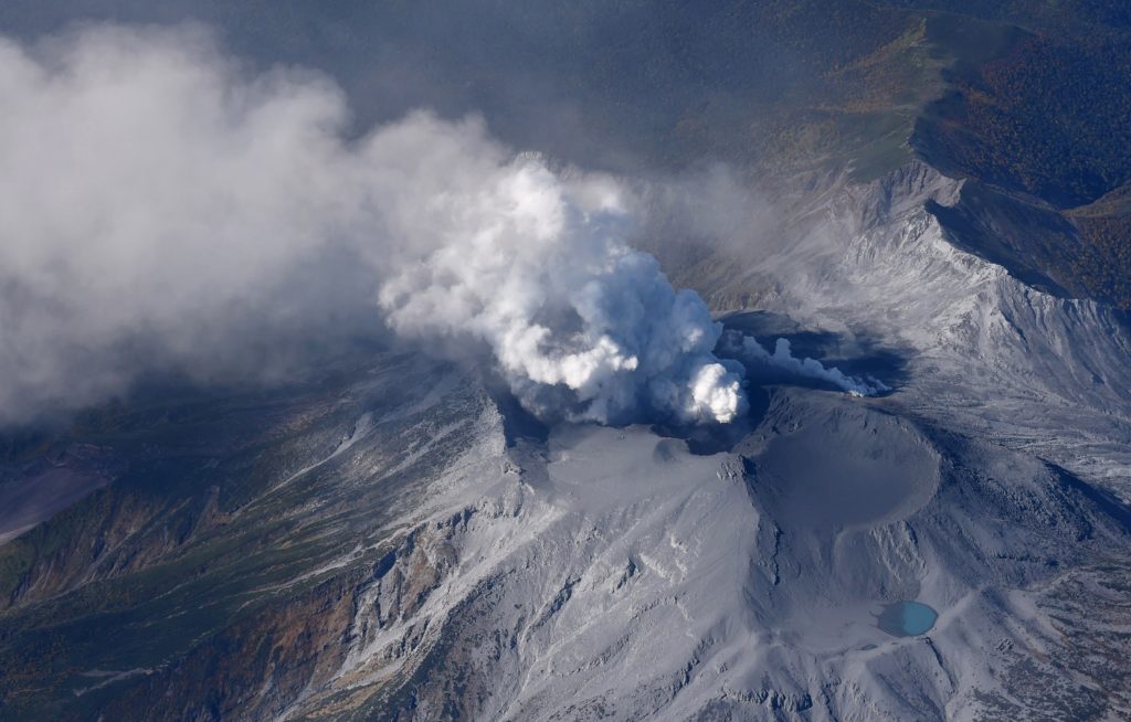
The 8-km-long island of Suwanosejima in the northern Ryukyu Islands consists of an andesitic stratovolcano with two active summit craters. The summit is truncated by a large breached crater extending to the sea on the E flank that was formed by edifice collapse. One of Japan’s most frequently active volcanoes, it was in a state of intermittent Strombolian activity from Otake, the NE summit crater, between 1949 and 1996, after which periods of inactivity lengthened. The largest recorded eruption took place in 1813-14, when thick scoria deposits covered residential areas, and the SW crater produced two lava flows that reached the western coast. At the end of the eruption the summit of Otake collapsed, forming a large debris avalanche and creating an open collapse scarp extending to the eastern coast. The island remained uninhabited for about 70 years after the 1813-1814 eruption. Lava flows reached the eastern coast of the island in 1884. Only about 50 people live on the island.
Tokachidake
The Japan Meteorological Agency (JMA) reported that volcanic activity at Tokachidake had decreased. There was a brief increase in large-amplitude volcanic earthquakes in the vicinity of 62-2 Crater from mid-August to mid-September, but seismicity declined afterward. The last eruption occurred on 6 August. At 1000 on 16 October the Alert Level was lowered to 2 (on a scale of 1-5) and the public was warned to be cautious around the crater.
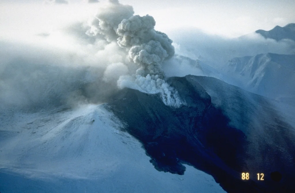
Tokachidake volcano consists of a group of dominantly andesitic stratovolcanoes and lava domes arranged on a NE-SW line above a plateau of welded Pleistocene tuffs in central Hokkaido. Numerous explosion craters and cinder cones are located on the upper flanks of the small stratovolcanoes, with the youngest Holocene centers located at the NW end of the chain. Frequent historical eruptions, consisting mostly of mild-to-moderate phreatic explosions, have been recorded since the mid-19th century. Two larger eruptions occurred in 1926 and 1962. Partial cone collapse of the western flank during the 1926 eruption produced a disastrous debris avalanche and mudflow.
Sources: Japan Meteorological Agency (JMA) , GVP.
Photos : ontake /Masanori Genko , GVP.
Chile / Argentina , Nevados de Chillan :
The Servicio Nacional de Geología y Minería (SERNAGEOMIN) and the Servicio Geológico Minero Argentino (SEGEMAR) reported that eruptive activity at Nevados de Chillán was ongoing during 15-21 October. SERNAGEOMIN scientists conducted a field visit during 15-16 October to observe the lava flow and collect ash samples. The lava flow on the SW flank was 514 m long by 15 October and continued to advance down the SW flank at an estimated rate of about 1 m per hour during the week. Detached blocks from the end of the lava flow descended the flank. Ash plumes rose as high as 860 m above the summit and drifted S and SW. A long-period earthquake indicating fluid movement at depth was detected at 05h27 on 16 October.
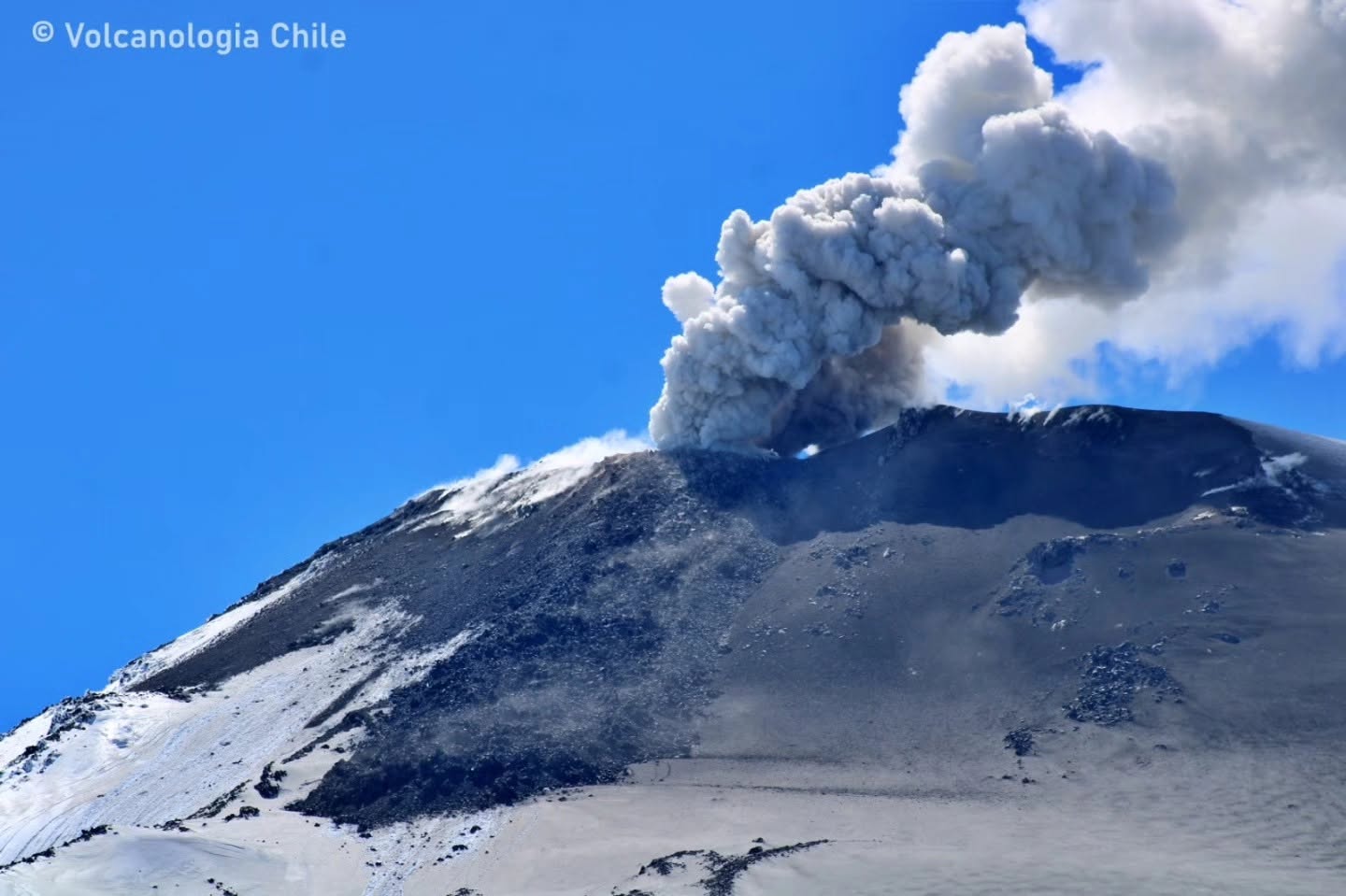
Incandescence at the vent was visible in a webcam image a few hours later at 08h27. The Alert Level remained at Yellow (the second lowest level on a four-color scale) and the public was warned that an eruption may impact areas within 2 km of the active crater. The Sistema y Servicio Nacional de Prevención y Repuesta Ante Desastres (SENAPRED) maintained an “Preventive Early Alert” for Pinto and Coihueco and warned the public to stay 2 km away from Emission Center 3 (EC3).
Sources : Servicio Nacional de Geología y Minería (SERNAGEOMIN), Sistema y Servicio Nacional de Prevención y Repuesta Ante Desastres (SENAPRED), Servicio Geológico Minero Argentino (SEGEMAR) , GVp..
Photo : Volcanologia Chile
Philippines , Mayon :
The Philippine Institute of Volcanology and Seismology (PHIVOLCS) reported ongoing eruptive activity at Mayon during 14-21 October. The seismic network recorded 4-14 daily volcanic earthquakes. Sulfur dioxide emissions generally averaged 935-2,153 tonnes per day. Daily emissions rose as high as 600 m above the crater and drifted WNW, WSW, and SW. At 1105 on 17 October a grayish ash plume rose 400 m above the crater rim and drifted W. The Alert Level remained at 2 (on a 0-5 scale) and the public was reminded to stay away from the 6-km-radius Permanent Danger Zone (PDZ). PHIVOLCS recommended that civil aviation authorities advise pilots to avoid flying close to the summit.
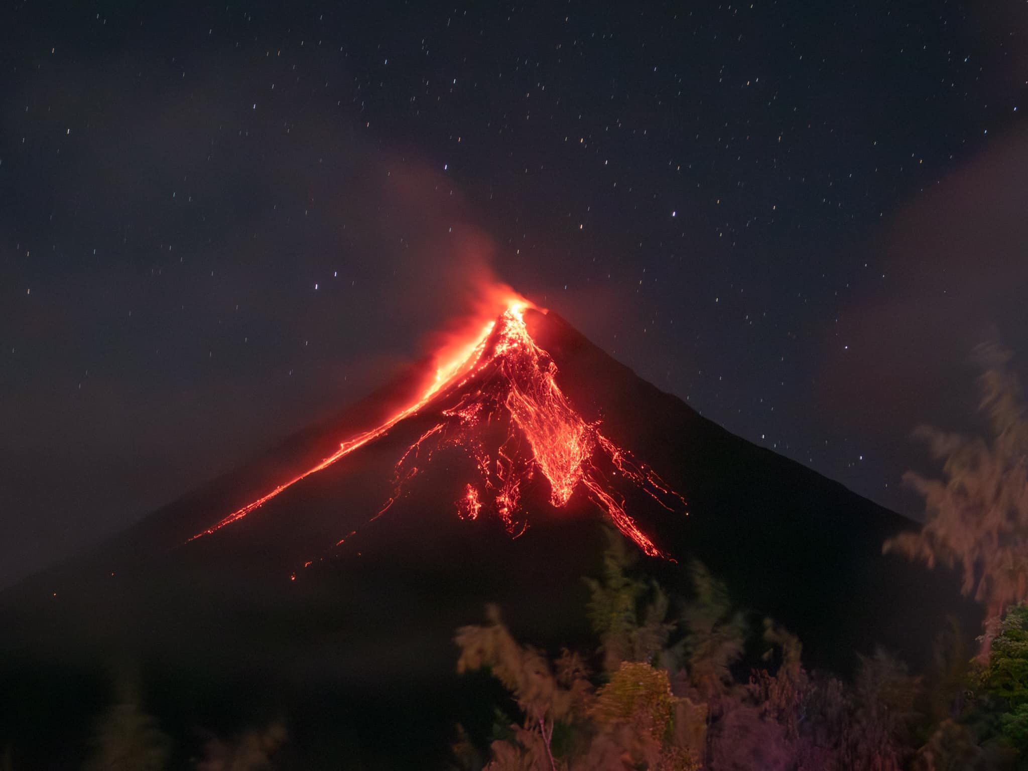
Seismicity:
3 volcanic earthquakes
Glow in the crater
Visible (to the naked eye)
Sulfur dioxide (SO2) flux
3,317 tonnes/day (October 22, 2026)
Ground deformation
Inflation of the volcanic edifice, accompanied by short-term deflation in the northeastern sector
Sources : Institut philippin de volcanologie et de sismologie (PHIVOLCS) , GVP.
Photo : Rick Estillomo ( archive).