August 20 , 2026.
Italy / Sicily , Etna :
Statement on Etna’s activity, August 18, 2026, 14:51 (12:51 UTC).
The National Institute of Geophysics and Volcanology (INGV), Etna Observatory (Osservatorio Etneo), reports that thermal measurements taken this morning by INGV-OE personnel indicate that the
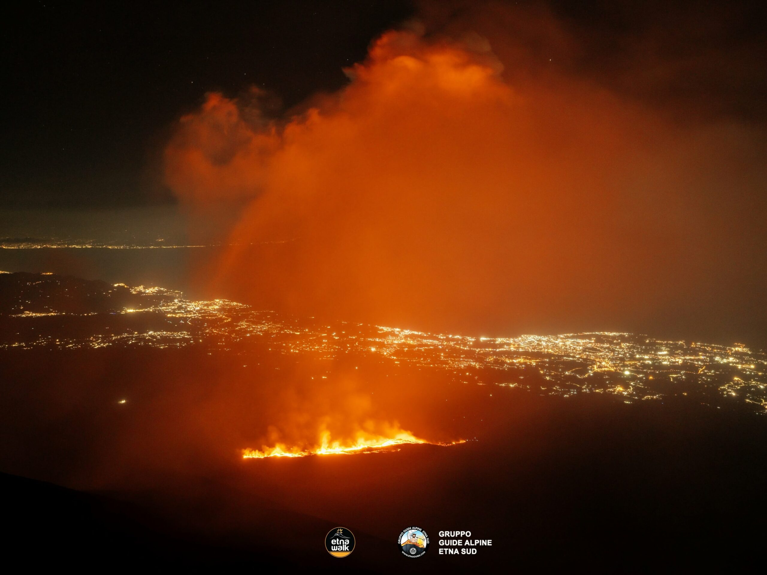
lava flow fed by the vent located at an elevation of 1,900 meters has reached an elevation of 1,330 meters at its front, in the Rocca Capra area (Valle del Bove). At dawn,
an additional eruptive vent opened at an elevation of approximately 3,100 m in the upper part of the Valle del Bove, producing a lava flow whose front is currently obscured by cloud cover.
Explosive activity at the Voragine crater ceased at 00:00 UTC, leaving only a weak ash plume confined to the summit.
Since approximately 23:30 UTC yesterday, a very rapid drop in the average amplitude of volcanic tremor has been recorded; values, initially high, fell to low levels within about half an hour and have remained there. The centroids of the tremor sources are located in the Voragine crater area, at elevations ranging from 1,900 to 2,500 m above sea level.
Infrasonic activity underwent a significant change around 00:00 UTC today, shifting from high event occurrence rates and amplitudes—all localized at the Voragine crater—to a state of near-total calm. Immediately afterward, and for only a few hours, infrasonic activity was produced by the Northeast Crater—consisting of a few medium-to-high amplitude events—while infrasonic activity has been absent since approximately 03:00 UTC.
Regarding ground deformation, the GNSS network shows no significant changes.
Following the oscillations noted in the previous bulletin, the Cratere del Piano (ECP) inclinometer recorded a cumulative variation of approximately 1 microradian, consistent with an ongoing deflation process. Since around 23:50 on August 17, the ECP signal has shown a trend reversal.
Statement on Etna activity, August 19, 2026, 05:50 (03:50 UTC).
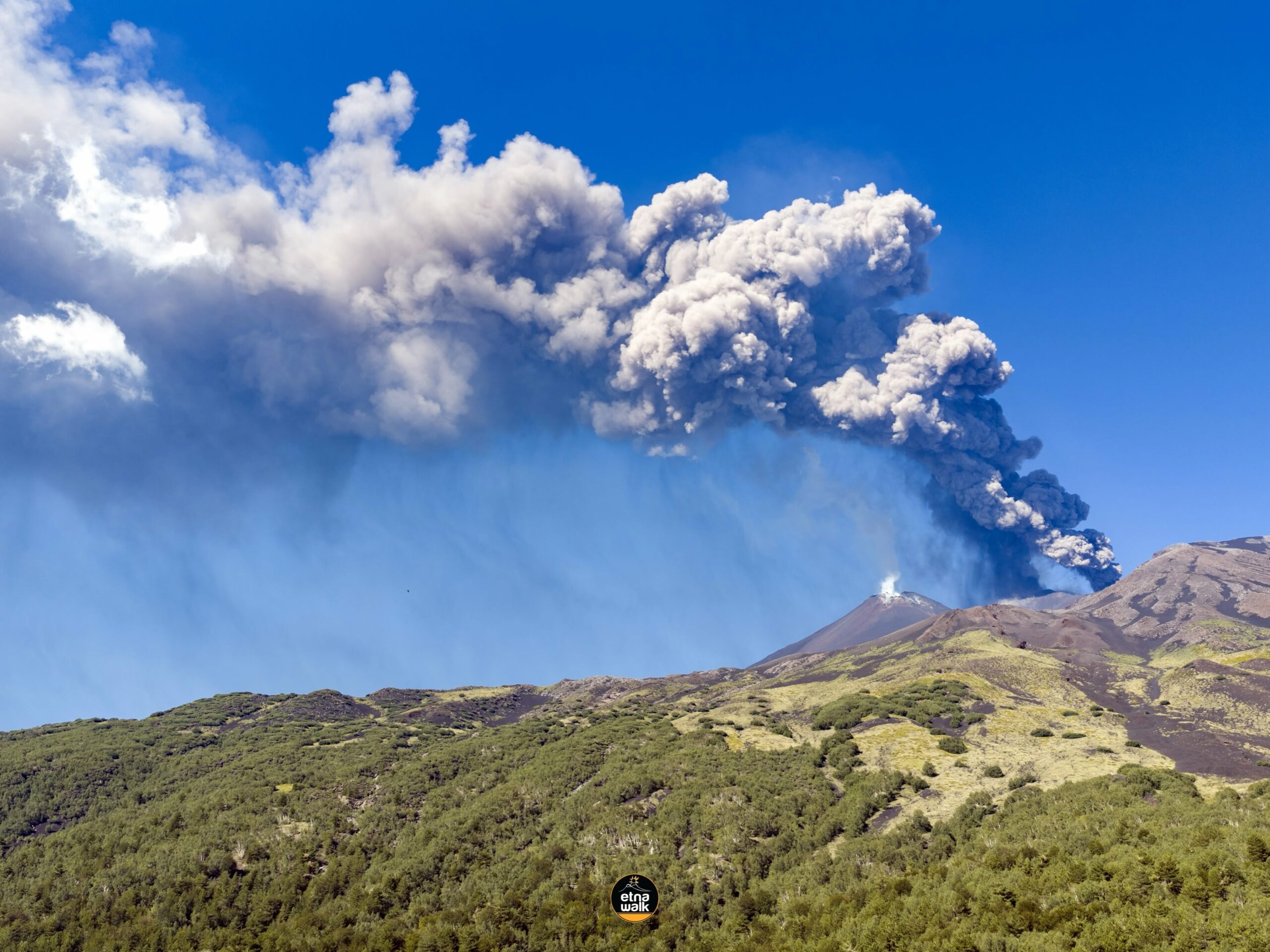
The National Institute of Geophysics and Volcanology (INGV), Etna Observatory, reports that a resumption of Strombolian activity was observed at the Voragine crater starting around 03:00 UTC, generating ash emissions that, according to forecast models, are dispersing toward the southern quadrant.
Seismically, the average amplitude of volcanic tremor has experienced a sudden increase since approximately 02:00 UTC; it currently falls within a high range. Tremor source centroids are located in the Northeast Crater area, at an elevation between 1,800 and 2,000 meters above sea level. Infrasonic activity has recorded a significant rise since 02:00 UTC today; Infrasonic events were localized primarily in the Northeast Crater area, with amplitudes reaching high values.
Regarding ground deformation, the GNSS network currently shows no significant changes. Since approximately 02:30 UTC, certain tiltmeter stations—specifically the three summit stations—have recorded changes in their trends. The « Cratere del Piano » summit station has registered a shift of a few tenths of a microradian, and the observed change is consistent with the onset of a deflation process.
Statement on Mount Etna activity, August 19, 2026, 16:56 (14:56 UTC).
The National Institute of Geophysics and Volcanology (INGV) – Etna Observatory reports that, based on observations and thermal measurements conducted this morning by INGV-OE personnel, the lava flow originating from the vent at an elevation of approximately 3,100 m in the upper Valle del Bove (see the statement from August 18, 2026) has traveled about 500 m and is currently stationary. The lava flow fed by the vent at an elevation of 1,900 m has advanced a few tens of meters since yesterday, reaching an elevation of approximately 1,315 m; it is currently stationary and cooling. An additional lava flow has formed through superposition; its active front is located at an elevation of approximately 1,550 m, near Rocca Musarra (Valle del Bove). Furthermore, during the field inspection, no explosive activity was observed at the Voragine crater; only sporadic emissions of dilute ash, dispersing within the summit area, were noted.
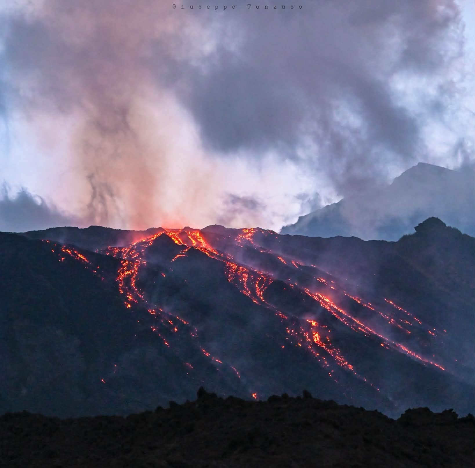
Seismically, the average amplitude of volcanic tremor—after peaking around 03:00 UTC today—showed slight fluctuations within a medium-to-high range; since approximately 13:50 UTC, the tremor has exhibited a clear downward trend and is currently within a medium range. Tremor source centroids are located in the Northeast Crater area, at an elevation of approximately 1,500 to 3,000 m above sea level. Infrasonic activity remains high, with events generally of medium-to-high amplitude localized in the Northeast Crater area. Regarding ground deformation, the GNSS network currently shows no significant variation. Since approximately 03:30 UTC, the « Cratere del Piano » tiltmeter station has indicated a trend consistent with a phase of slight inflation, with a cumulative change of less than 0.5 microradians.
Further updates will be provided as soon as possible.
Source : INGV.
Photos : Etna Walk / Giuseppe Distefano / Gruppo guide alpine Etna Sud , Etna Walk , Giuseppe Tonzuso .
Indonesia , Lewotobi Laki-laki :
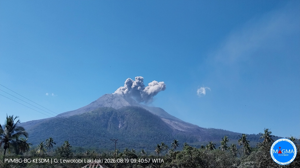
An eruption of Mount Lewotobi Laki-laki occurred on Wednesday, August 19, 2026, at 09:38 WITA; the observed ash column reached a height of approximately 400 m above the summit (or about 1,984 m above sea level). The dense, gray ash column drifted toward the southwest and west. The eruption was recorded by the seismograph with a maximum amplitude of 14.8 mm and a duration of 150 seconds.
Seismic observations
1 eruption earthquake, with an amplitude of 29.6 mm and a duration of 113 seconds.
1 emission earthquake (« gust earthquake »), with an amplitude of 47.3 mm and a duration of 55 seconds.
40 distant tectonic earthquakes, with amplitudes ranging from 7.4 to 47.3 mm and durations from 32 to 511 seconds.
Recommendations
1. Communities near Mount Lewotobi Laki-laki, as well as visitors and tourists, must not conduct any activities within a 5 km radius of the Mount Lewotobi Laki-laki eruption center.
2. The public is advised to remain calm, follow instructions from local authorities, and disregard rumors from unverified sources.
Source et photo : PVMBG
Colombia , Chiles / Cerro Negro :
San Juan de Pasto, August 18, 2026, 3:15 PM.
Based on monitoring of the Chiles-Cerro Negro volcanic complex (CVCCN), the Colombian Geological Service (SGC)—an agency affiliated with the Ministry of Mines and Energy—reports the following information:
For the period from August 11 to August 17, 2026, the main changes in monitored parameters compared to the previous week were as follows:
● Amidst the fluctuating behavior characteristic of this volcanic complex, seismic activity showed a significant decrease in both event frequency and energy. Seismicity associated with rock-fracturing processes remained predominant, followed by activity linked to fluid dynamics.
● During this period, seismic activity was distributed across various sectors—both in the immediate vicinity of and further away from the volcanic edifices—with a predominance of events located near the Chiles volcano’s collapse zone. The earthquake with the highest magnitude (1.3) was recorded approximately 10 km southeast of the Chiles volcano, at a depth of nearly 8 km below the summit (4,700 meters above sea level); other events occurred at distances ranging from 2 to 10 km from the volcano, at depths of less than 5 km.
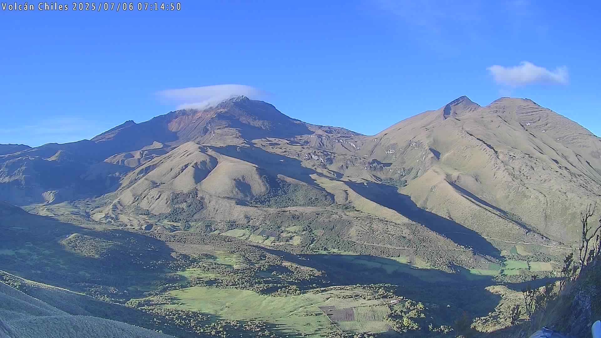
● Analysis of data collected by satellite sensors and ground stations has continued to reveal variations associated with deformation processes in the volcanic zone.
Based on the assessment and correlation of monitored parameters, the SGC recommends closely monitoring the situation’s evolution via weekly bulletins and other information released through our official channels, as well as adhering to instructions from local and departmental authorities and the National Unit for Disaster Risk Management (UNGRD).
Volcanic activity remains at the yellow alert level:
an active volcano showing changes in the baseline behavior of monitored parameters and other manifestations.
Source et photo : SGC.
Hawaii , Kilauea :
HAWAIIAN VOLCANO OBSERVATORY DAILY UPDATE , U.S. Geological Survey .
Wednesday, August 19, 2026, 9:20 AM HST (Wednesday, August 19, 2026, 19:20 UTC)
19°25’16 » N 155°17’13 » W,
Summit Elevation 4091 ft (1247 m)
Current Volcano Alert Level: ADVISORY
Current Aviation Color Code: YELLOW
Summary:
Kīlauea volcano is not erupting; the summit eruption in Halemaʻumaʻu is paused. Preliminary data indicate the onset of the next fountaining episode is likely between August 21 and August 27.
Overview:
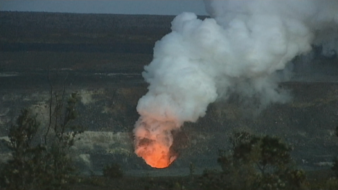
The summit eruption of Kīlauea in Halemaʻumaʻu is paused. Data from summit tiltmeters showed re-inflation began immediately following the end of episode 53. Glow was observed on webcams from the north and west vents overnight. Data suggest that another episode is likely between Friday August 21 and Thursday August 27.
No significant activity has been noted along Kīlauea’s East Rift Zone or Southwest Rift Zone.
USGS HVO continues to experience sporadic outages due to power and possible storm damage related to Hurricane Lala.
Summit Observations:
Moderate glow from the north vent was present most of the night. Faint to weak glow was intermittently present from the west vent on the V1 and V3 cameras. A few weak flashes of glow were also observed from the new west vent overnight, but the south vent remained dark.
Continuous low-level seismic tremor with occasional ragged tremor spikes occurred over most of the last 24 hours. Tremor oscilatted in magnitude and occassionally had clear drops in magnitude followed by prominent spikes that are usually correlated with gas pistoning in the vents. There was only one earthquake recorded in the summit area in the past 24 hours.
The Summer Camp (SMC) tiltmeter has recorded a total of 13.3 microradians of inflationary tilt since the end of episode 53 and increased by 1.2 microradians in the last 24 hours. Inflation leveled out on both the SMC and SDH (Sandhill) tiltmeters between 2:00 a.m. and 6:00 a.m. HST but inflation appears to have resumed at both sites. Deflationary tilt measured at the summit tiltmeter at SMC totaled 19.1 microradians during episode 53. There has been a data transfer problem with the UWD tiltmeter over the past 24 hours.
During inter-episode pauses, the sulfur dioxide (SO2) emission rate from the summit typically varies between 1,000 to 5,000 tonnes per day. Winds are coming from the northeast between 11 to 20 miles per hour (mph), with gusts as high as 28 mph. Gas coming from the vents is being blown to the southwest.
Rift Zone Observations:
Rates of seismicity and ground deformation remain low in the East Rift Zone and Southwest Rift Zone. SO2 emissions from the East Rift Zone remain below the detection limit.
Source : HVO.
Photo : David Corrigan
Costa Rica , Rincón de la Vieja :
ERUPTION REPORT – OVSICORI-UNA
Location: 10.83° N, 85.34° W
Massif elevation: 1,916 m (6,284 ft)
Date: 18/08/2026 Time: 14:00:30
Plume height (above crater): 1,000 m (3,280 ft)
Source of plume observation: Seismic and infrasound data.

Observed activity:
A short-lived eruption was reported; it was recorded for approximately 30 seconds by the seismic station closest to the crater, and low-amplitude signals were detected by infrasound sensors. An acoustic magnitude of 2.0 was estimated based on data from the VRBA station. Visual confirmation via webcam was not possible due to dense cloud cover affecting both available cameras.
Modulation of volcanic tremor and an increase in amplitude within the 5–20 Hz frequency band were observed approximately one hour prior to the event.
Activity level: Vigilance
Source : Ovsicori .
Photo : RSN.