July 29 , 2026.
Hawaii , Kilauea :
HVO/USGS Volcanic Activity Notice
Current Volcano Alert Level: WATCH
Previous Volcano Alert Level: ADVISORY
Current Aviation Color Code: ORANGE
Previous Aviation Color Code: YELLOW
Issued: Tuesday, July 28, 2026, 10:48 AM HST
Source: Hawaiian Volcano Observatory
Notice Number: 2026/H356
Location: N 19 deg 25 min W 155 deg 17 min
Elevation: 4091 ft (1247 m)
Area: Hawaii
Summary:
Precursory low-level eruptive activity before episode 52 of the ongoing Halemaʻumaʻu eruption began around 10:22 a.m. HST on July 28, 2026.
Volcanic Activity:
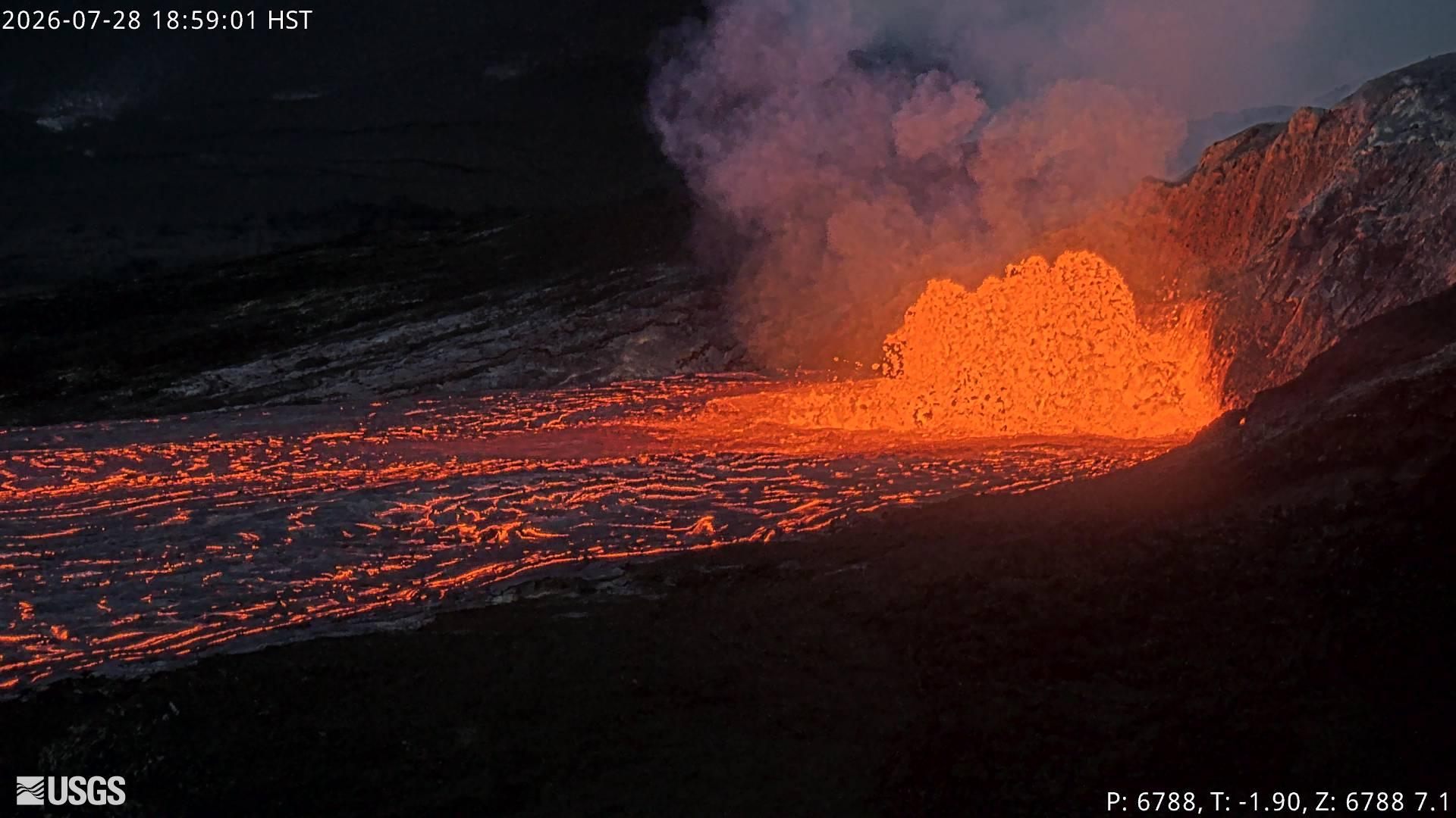
Precursory low-level activity for episode 52 of the ongoing Halemaʻumaʻu eruption at the summit of Kīlauea began around 10:22 a.m. HST on July 28 with an overflow from the north vent. Accordingly, HVO is raising the Alert Level for Kīlauea from ADVISORY to WATCH and the Aviation Color Code from YELLOW to ORANGE.
This low-level precursory activity can continue for hours to days before the lava fountaining episode beings. The forecast for episode 52 of lava fountaining to start is between today and July 30. Low level winds are out of the north to northeast at the summit today, with the possibility of tephra and ash being carried in the direction of Pāhala and Nāʻālehu. Higher level winds are variable from the north to northwest, with the possibility of tephra being dispersed into Hawaiʻi Volcanoes National Park. Another VAN will be published when lava fountaining episode 52 begins.
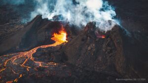
Source et photo : HVO
Italy / Sicily , Etna :
WEEKLY BULLETIN, July 20, 2026 – July 26, 2026 (Issue date: July 28, 2026)
ACTIVITY SUMMARY
Based on monitoring data, the following observations were noted:
1) VOLCANOLOGICAL OBSERVATIONS: Sporadic intra-crater explosive activity at the Northeast Crater and occasional impulsive explosive episodes at the Bocca Nuova crater, accompanied by ash emissions; degassing at the Voragine and Southeast craters.
2) SEISMOLOGY: Low-intensity seismic activity associated with fracturing; a single event reached the local magnitude (Ml) threshold of ≥ 2.0. The average amplitude of volcanic tremor showed a fluctuating trend, remaining primarily within a medium range.
3) INFRASOUND: Low-energy infrasonic activity with a low frequency of occurrence.
4) GROUND DEFORMATION: During the week in question, deformation monitoring networks detected no significant changes.
5) GEOCHEMISTRY: SO2 flux at a medium level.
Soil CO2 flux (Etnagas network): high values.
Partial pressure of dissolved CO2 in groundwater (EtnaAcque network): no update.
Helium (He) isotope ratio at peripheral sites: no update; the last recorded data indicated high values (July 9, 2026).
6) SATELLITE OBSERVATIONS: Over the past week, satellite-observed thermal activity in the summit area remained at a low level.
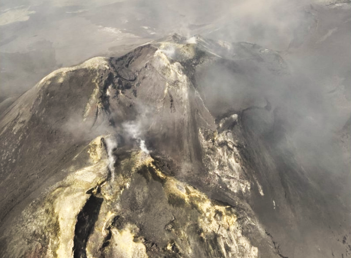
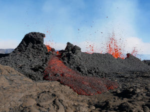
Aerial drone images from July 21 showing the fumarole systems of the Southeast Crater.
VOLCANOLOGICAL OBSERVATIONS
Monitoring of Etna’s volcanic activity during the week in question was conducted through the analysis of images from INGV – Osservatorio Etneo (INGV-OE) surveillance cameras and via a drone overflight carried out on July 21.
Overall, the activity status of the summit craters showed no significant changes compared to observations from the previous week (see report no. 30/2026). Specifically, the Northeast (NE) Crater exhibited intense, impulsive degassing from the vent at its base, as well as sporadic explosive activity within the crater, while the Bocca Nuova Crater experienced occasional impulsive explosive episodes from the western pit (BN-1); these generated dilute, grey-brown ash emissions that were rapidly dispersed by high-altitude winds over the summit area.
Finally, the Voragine and Southeast (SE) craters showed modest degassing associated with fumarole systems located along the crater rims.
Source et photo : INGV
Italy , Stromboli :
WEEKLY BULLETIN, July 20, 2026 – July 26, 2026 (Issue date: July 28, 2026)
ACTIVITY SUMMARY
Based on monitoring data, the following observations are noted:
1) VOLCANOLOGICAL OBSERVATIONS: Ordinary Strombolian eruptive activity across both crater zones, occasionally accompanied by lava spattering in the North Crater zone. The frequency of overall explosive activity—encompassing both the North Crater zone and the Central-South Crater zone—remained at a medium-high level; explosion intensity was high in the North Crater zone and medium-high in the Central-South zone.
2) SEISMOLOGY: Monitored seismic parameters show no significant variation.
3) GROUND DEFORMATION: Deformation data acquired by the GNSS network showed no significant variation during the week.
Tiltmeters at Punta Labronzo and Elipista (near Pizzo) recorded no significant variation.
4) GEOCHEMISTRY: SO2 flux: medium level.
Soil CO2 flux (Pizzo zone – STR02): high values.
Plume C/S ratio: medium values.
Helium isotope ratio (R/Ra): no update available.
Soil CO2 flux in the San Bartolo zone: high levels.
5) SATELLITE OBSERVATIONS: Satellite-observed thermal activity in the summit area was generally low, with a few isolated anomalies of moderate intensity.
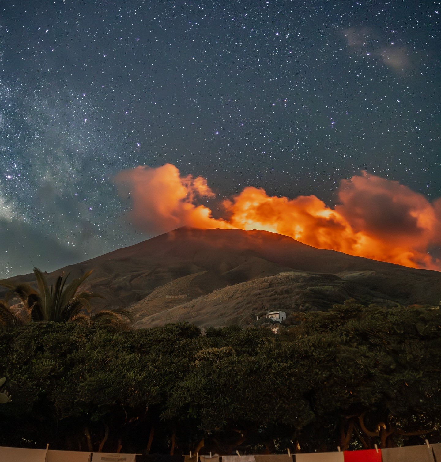
VOLCANOLOGICAL OBSERVATIONS
Observations of explosive activity captured by surveillance cameras
During the observation week, Stromboli’s eruptive activity was characterized through the analysis of images recorded by INGV-OE surveillance cameras located at an elevation of 190 m above sea level and at Punta dei Corvi (SCT-SCV and SPCT, respectively).
Explosions in the North crater area (Zone N) primarily produced coarse material (bombs and lapilli); in the Central-South crater area (Zone CS), explosions produced mostly fine material mixed with coarse material. The average explosion frequency for Zone N fell within the usual range, and intensity remained at a predominantly high level. In Zone CS, the average explosion frequency was at a low-to-moderate level, and the intensity of explosive activity was generally low-to-moderate. The total average hourly explosion frequency (Zone N + Zone CS) was at a moderate-to-high level.
Source : INGV
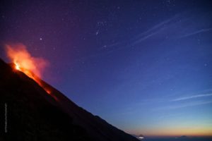
Photo : Stromboli stati d’animo / Sebastiano Cannavo.
Indonesia , Lewotobi Laki-laki :
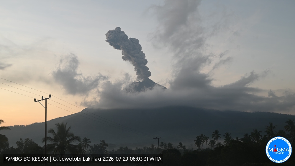
An eruption of Mount Lewotobi Laki-laki occurred on Wednesday, July 29, 2026, at 05:58 WITA, with an ash column reaching a height of approximately 1,200 m above the summit (or about 2,784 m above sea level). The observed ash column was gray and dense, drifting towards the north and northeast. The eruption was recorded by the seismograph with a maximum amplitude of 44.4 mm and a duration of 55 seconds.
Seismic observations
1 eruption earthquake, with an amplitude of 14.8 mm and a duration of 196 seconds.
2 emission earthquakes, with amplitudes ranging from 2.9 to 7.4 mm and durations of 31 to 33 seconds.
6 episodes of non-harmonic tremor, with amplitudes ranging from 2.9 to 7.4 mm and durations of 71 to 91 seconds.
Recommendations
1. Communities living near Mount Lewotobi Laki-laki, as well as visitors and tourists, must not conduct any activities within a 5 km radius of the Mount Lewotobi Laki-laki eruption center.
2. The public is advised to remain calm, follow instructions from local authorities, and disregard information from unverified sources.
Source et photo : PVMBG.
Colombia , Puracé – Los Coconucos volcanic chain. :
Popayán, July 28, 2026, 3:30 PM
Based on monitoring of the Puracé volcano—part of the Los Coconucos volcanic chain (CVLC)—the Colombian Geological Service (SGC), an entity attached to the Ministry of Mines and Energy, reports the following information:
During the week of July 21 to 27, 2026, activity at the CVLC continued to intensify. Seismic activity linked to fluid movements (magmatic gases and liquids, their interaction with the hydrothermal system, and atmospheric ash emissions) showed an increase in both continuous tremor and episodes of pulsed tremor, as well as in released seismic energy. These events remained primarily localized beneath the Puracé volcano crater, at depths of less than 3 km. This activity was accompanied by an increase in the number of daily ash emissions and in plume height, reaching up to 3,500 meters above the volcano’s summit. Continuous degassing at the crater was also observed. Ash plumes dispersed mainly toward the northwest and west; reports were received regarding ashfall, noise, and ground vibrations in various areas of Puracé and Coconuco, as well as ashfall in Paletará and the city of Popayán. Due to this evolution in activity, a special bulletin was issued on July 23 to report on the observed changes in the volcano’s behavior.
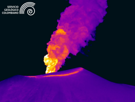
Ash emission at Puracé volcano on July 21, 2026, at 19:56. Recording from the Mina thermal camera, located 2.2 km northwest of Puracé volcano.
Seismic activity linked to rock fracturing (VT) remained at levels similar to those recorded the previous week in terms of the number of events, while a slight increase in released seismic energy was observed. These events were primarily located between the Puracé and Piocollo volcanoes, at depths ranging from 1 to 3 km, with magnitudes below 1.4.
Images captured by thermal cameras revealed an increase in the temperature of emissions and of the fumarole field located on the outer rim of the Puracé volcano crater. Satellite observations highlighted persistent thermal anomalies within the crater itself. Furthermore, a significant increase in atmospheric sulfur dioxide (SO₂) and carbon dioxide (CO₂) emissions was recorded, reaching the highest levels measured by instrumental and satellite monitoring systems since the eruptive episode of January 20, 2025.
Regarding geodetic monitoring, a slow deformation process continues to be observed in the area between the Puracé, Piocollo, and Curiquinga volcanoes.
In conclusion, the variations observed at Puracé volcano (CVLC) indicate that the system continues to show an increase in several monitored parameters; further ash emissions and fallout are possible, with their dispersion determined by the prevailing wind direction. Additionally, the possibility of further changes in volcanic activity—potentially leading to more energetic surface manifestations—cannot be ruled out. The public is advised not to visit high-altitude areas along the volcanic chain and to stay informed through official SGC reports; authorities are also recommended to review their risk management plans regarding volcanic activity.
The volcanic alert level remains at « Yellow »: an active volcano showing changes in the baseline behavior of monitored parameters and other manifestations.
Source et photo : SGC.