July 16 , 2026.
Hawaii , Kilauea :
HAWAIIAN VOLCANO OBSERVATORY STATUS REPORT, U.S. Geological Survey
Wednesday, July 15, 2026, 6:08 PM HST (Thursday, July 16, 2026, 04:08 UTC)
19°25’16 » N 155°17’13 » W,
Summit Elevation 4091 ft (1247 m)
Current Volcano Alert Level: ADVISORY
Current Aviation Color Code: YELLOW
Summary:
Episode 51 of the ongoing Halemaʻumaʻu eruption began at 8:30 a.m. HST and ended at 4:46 p.m. HST on July 15, 2026.
Activity Summary:
Episode 51 of the ongoing Halemaʻumaʻu eruption began around 8:30 a.m. HST on July 15 and ended abruptly at 4:46 p.m. HST on July 15, 2026.
The maximum lava fountain height was approximately 950 feet (290 meters) above ground level from the north vent. The south vent never fountained during this episode but did emit flames and gas jets.
The maximum plume height was approximately 18,000 (5,500 meters) above mean sea level.
Tephra fall was restricted mostly to the closed area of Hawaiʻi Volcanoes National Park to the southwest of the active Halemaʻumaʻu vents. A light fall of Peleʻs hair was reported at several sites in the national park outside the closed area, including Uēkahuna overlook and Kaʻu Desert trailhead on Highway 11.
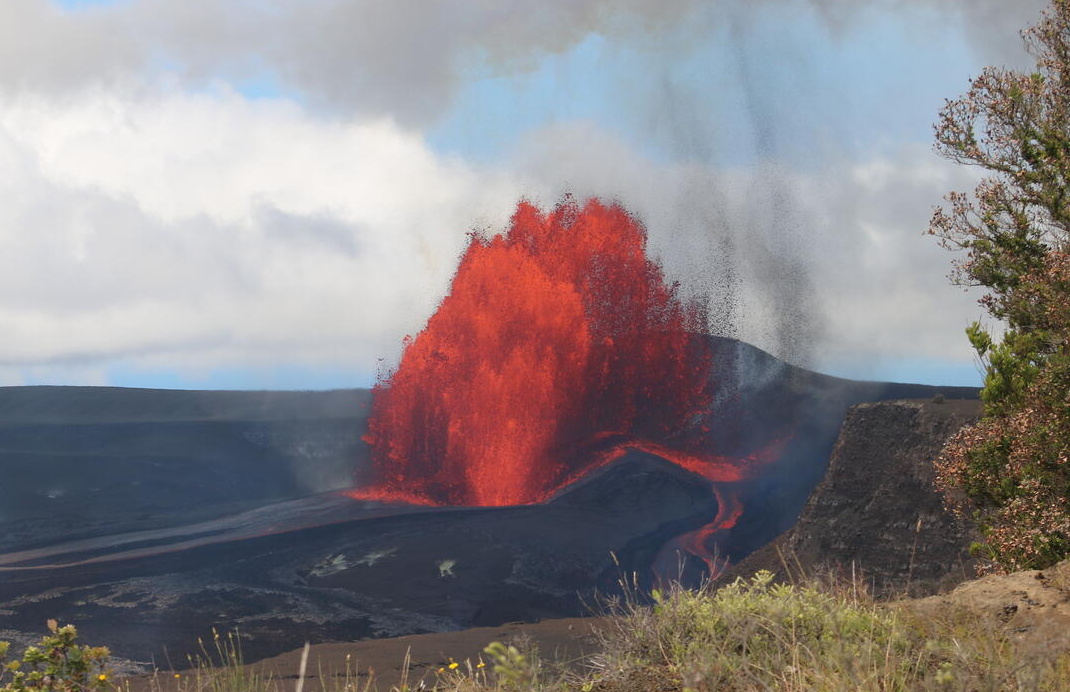
View of the lava fountain erupting from the North vent during episode 51 on July 15, 2026. Fountain heights reached approximately 290 meters (950 feet), and effusion rates peaked at about 300 cubic meters per second (400 cubic yards per second) at 10:30 a.m. HST on July 15. This photo was taken shortly thereafter, around 11:00 a.m. HST.
Episode 51 Chronology:
Lava fountaining episode 51 in Halemaʻumaʻu at the summit of Kīlauea began around 8:30 a.m. HST on July 15 and ended abruptly at 4:46 p.m. HST, after 8.3 hours of continuous fountaining from the north vent. The last 2-3 minutes were marked by gas jetting from the north vent. The south vent never fountained during this episode but did emit flames and gas jets. The instantaneous effusion rate peaked at about 370 cubic yards (280 cubic meters) per second at approximately 10:30 a.m. HST, with an average effusion rate of 200 cubic yards (150 cubic meters) per second for the entire fountaining episode. An estimated 6.6 million cubic yards (5.1 million cubic meters) of lava erupted and covered about 50% of the Halemaʻumaʻu crater floor. Seismicity followed the normal change in tremor patterns seen after most fountain episodes. There was one locatable earthquake associated with the eruption: a shallow magnitude-2 event at 14:52:59 HST located beneath the southeast corner of Halema’uma’u crater. The Uēkahuna tiltmeter (UWD) recorded about 14.7 microradians of deflationary tilt during episode 51.
Precursory activity began from the north vent on the afternoon of July 14 with 4 overflows between 3 and 4 p.m. HST, the longest lasting over 30 minutes. Activity then paused when inflation leveled off. Summit inflation resumed later in the evening. Overflows began from the south vent at 2:08 and 2:32 a.m. HST on July 15, and each lasted less than 5 minutes. After a brief pause, short overflows from the north vent occurred at 4:27 and 4:42 a.m. HST. These were immediately followed by the onset of a vigorous overflow fed by 10-30 foot (3-10 meter) high dome fountains from the north vent at 4:47 a.m. HST which continued until the onset of episode 51 fountaining around 8:30 a.m. HST. The transition was marked by increasing height of the dome fountain, greater eruptive volume, increased deflation and tremor.
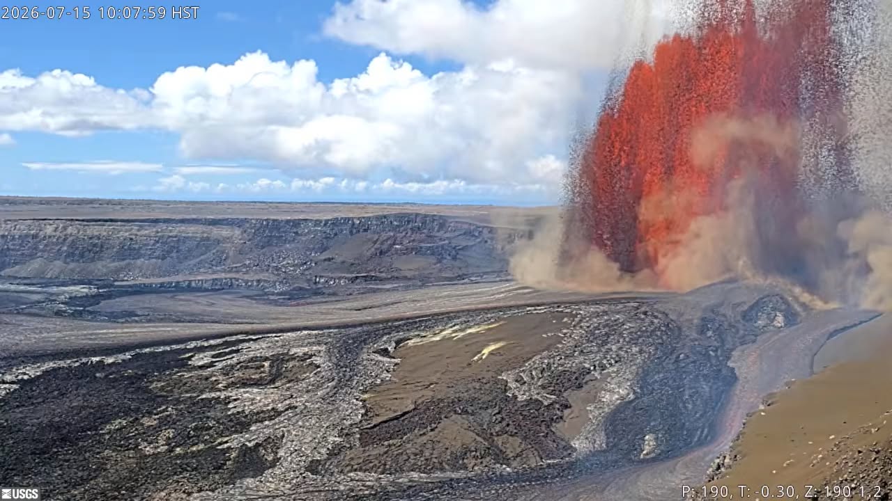
The north vent lava fountain reached a peak height of approximately 950 feet (290 meters) around 10:30 a.m. HST and produced significant heat and ash, feeding a plume cloud that reached a maximum height of about 18,000 feet (5,500 meters) above sea level based on radar data reported by the National Weather Service (NWS) and verified by HVO webcam images. Winds were out of the northeast during the initial hours of fountaining and caused the plume to move toward the southwest during the most energetic part of the episode. High level winds from the south blew the upper plume toward the northwest after 10:00 a.m. HST. The NWS issued an updated Special Weather Statement (SWS) at 10:26 a.m. HST indicating that varying levels of ash, Pele`s hair, and other lightweight tephra may fall downwind of the eruption. The plume track largely remained within Hawaiʻi Volcanoes National Park with most tephra falling in the closed area.
Fountain and plume heights gradually decreased in height to about 400 feet (120 meters) AGL and 10,000 feet (3,000 meters) AMSL, respectively, by 4:40 p.m. HST. Then the episode ended abruptly at 4:46 p.m. HST. No tephra was reported from any populated areas.
The abrupt switch from summit deflation to inflation at the end of episode 51 indicate that another lava fountaining episode is likely.
Source : HVO.
Photo : USGS / K. Mulliken.
United-States / Mariana Islands , Ahyi Seamount :
NMI/USGS Volcanic Activity Notice
Current Volcano Alert Level: ADVISORY
Previous Volcano Alert Level: UNASSIGNED
Current Aviation Color Code: YELLOW
Previous Aviation Color Code: UNASSIGNED
Issued: Thursday, July 16, 2026, 10:13 AM ChST
Source: U.S. Geological Survey
Notice Number: 2026/N41
Location: N 20 deg 26 min E 145 deg 1 min
Elevation: -180 ft (-55 m)
Area: Northern Mariana Islands
Summary:
Submarine plumes seen in satellite data reflecting volcanic unrest or undersea eruption. Change of Aviation Color Code to YELLOW and Volcano Alert Level to Advisory.
Volcanic Activity:
Signs of unrest at Ahyi Seamount have been observed in recent satellite images over the past few weeks. Small plumes of discolored water were observed drifting less than 0.3 miles (0.5 km) away from the volcano in satellite images on July 1, 7, and 11. Small plumes have been observed intermittently in clear satellite images over the last few months, but recent images show more discrete plume shapes suggesting more vigorous activity. No significant activity has been detected from the direction of Ahyi Seamount in hydroacoustic array data at Wake Island.
The plumes are likely the result of gas release into the water column, these could reflect vigorous hydrothermal degassing or be associated with an ongoing effusive eruption. In either case, the observations indicate increased volcanic unrest and potential for activity to breach the ocean surface.
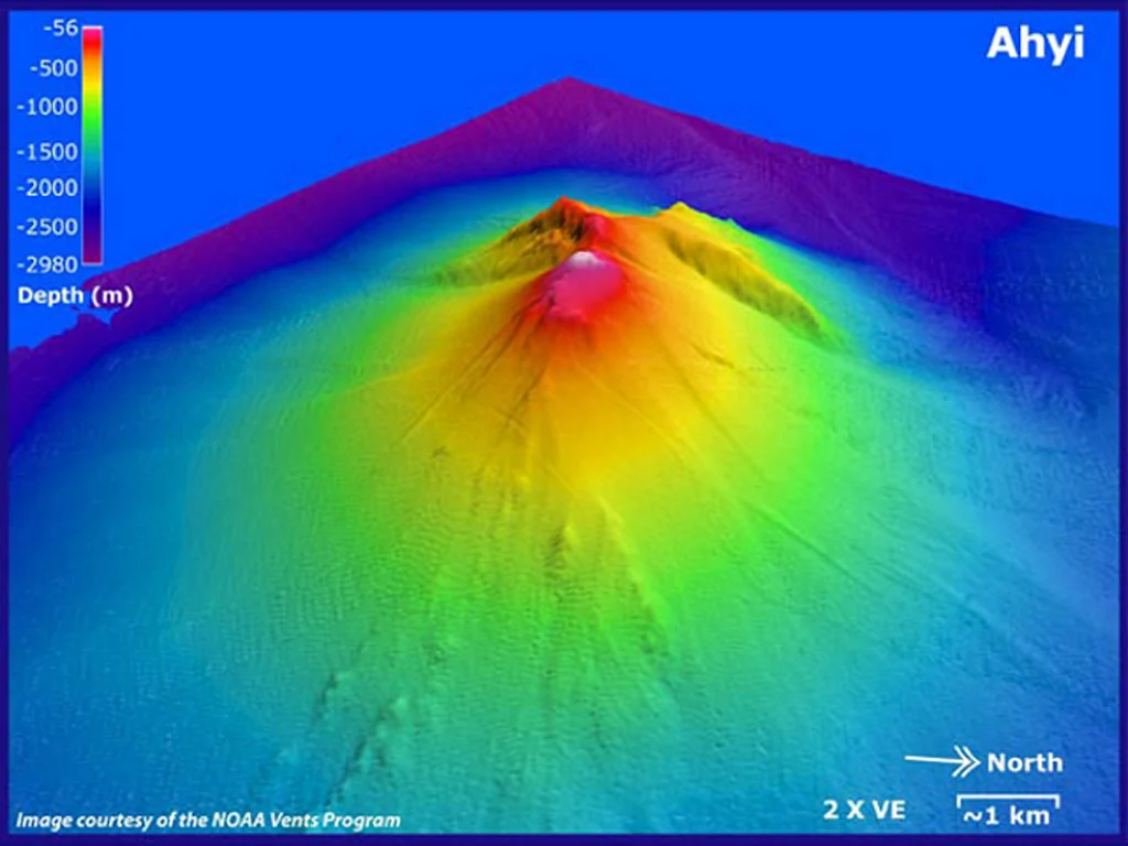
Eruptive activity at Ahyi Seamount may present a hazard to mariners in the water above and near the volcano. The summit has shallowed over the course of previous eruptions to 180 feet (55 m) below sea level, but the lack of local real-time data means we are unable to forecast or warn of impending eruptions. The Aviation Color Code and Volcano Alert Level are being raised to YELLOW and ADVISORY. We will continue to monitor satellite and distal hydroacoustic data for additional evidence for, or escalation of, volcanic activity.
Remarks:
Ahyi seamount is a large conical submarine volcano that rises to within 180 feet (55 m) of the sea surface about 11 miles (18 km) southeast of the island of Farallon de Pajaros (Uracas) in the Northern Mariana Islands. Water discoloration has been observed over the submarine volcano during previous periods of activity, and in 1979 the crew of a fishing boat felt shocks over the summit area followed by upwelling of sulfur-bearing water. From April 24 to 25, 2001, an explosive submarine eruption was detected seismically from a seismic station on Rangiroa Atoll, Tuamotu Archipelago. The event was well constrained (+/- 9 miles or 15 km) at a location near the southern base of Ahyi; the summit of the seamount lies within the location uncertainty. Another eruption was detected from April 24 to May 17, 2014, using data from seismometers located on subaerial volcanoes in the Northern Mariana Islands and hydrophone arrays at Wake Island. NOAA divers also reported hearing explosions while conducting coral reef research on nearby Farallon de Pajaros. The 2014 eruption of Ahyi formed a new crater near the summit of the volcano and a large landslide chute developed on its southeast flank. The most recent eruptive activity began in 2022.
Source : USGS / NMI.
Photo : GVP / Susan Merle (Oregon State University/NOAA Vents Program).
Kamchatka , Sheveluch :
KVERT VOLCANIC ACTIVITY NOTICE (VAN)
Issued: July 14 , 2026
Volcano: Sheveluch (CAVW #300270)
Current aviation colour code: RED
Previous aviation colour code: orange
Source: KVERT
Notice Number: 2026-73
Volcano Location: N 56 deg 38 min E 161 deg 19 min
Area: Kamchatka, Russia
Summit Elevation: 3283 m (10768.24 ft), the dome elevation ~2500 m (8200 ft)
Volcanic Activity Summary:
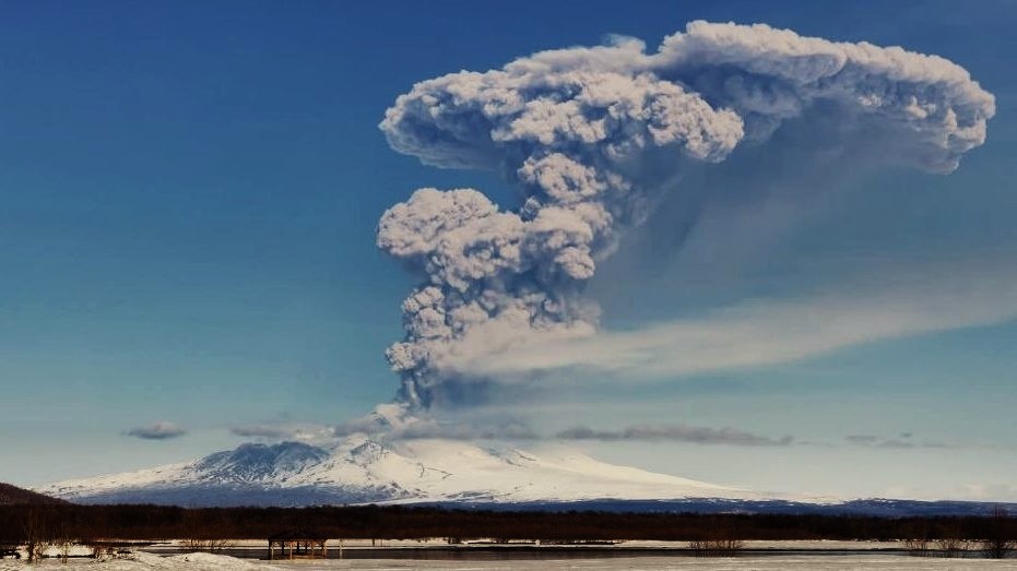
The explosive-extrusive eruption of the volcano continues, accompanied by powerful gas-steam activity; a new block of lava continues to grow in the northern part of the lava dome. Explosions sent ash up to 10.5 km a.s.l., and ash cloud move for 145 km to the east-southeast of the volcano.
The explosive-extrusive eruption of the volcano continues. Ash explosions up to 12 km (39,400 ft) a.s.l. could occur at any time. Ongoing activity could affect international and low-flying aircraft.
Volcanic cloud height:
10500 m (34440 ft) AMSL Time and method of ash plume/cloud height determination: 20260714/0530Z – Himawari-9 14m15
Other volcanic cloud information:
Distance of ash plume/cloud of the volcano: 145 km (90 mi)
Direction of drift of ash plume/cloud of the volcano: ESE / azimuth 109 deg
Time and method of ash plume/cloud determination: 20260714/0700Z – Himawari-9 14m15
Start time of explosion and how determined: 20260714/0525Z – Satellite data
Source : Kvert.
Photo : Jara Pokorny / Sopky světa FB via B. Duyck .
Indonesia , Lewotobi Laki-laki :
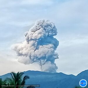
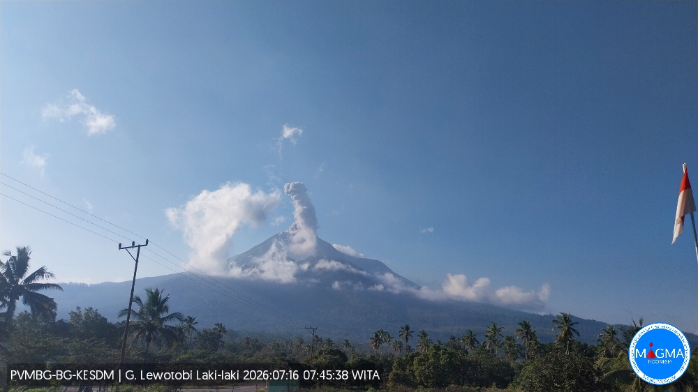
An eruption of Mount Lewotobi Laki-laki occurred on Thursday, July 16, 2026, at 07:42 WITA; the observed ash column reached a height of approximately 600 m above the summit (or about 2,184 m above sea level). The dense, gray ash column drifted towards the north and northeast. The eruption was recorded by a seismograph with a maximum amplitude of 22.2 mm and a duration of 295 seconds.
Seismic observations
2 eruption earthquakes with amplitudes of 14.8–22.2 mm and durations of 167–295 seconds.
1 emission earthquake with an amplitude of 7.4 mm and a duration of 33 seconds.
1 non-harmonic tremor with an amplitude of 5.9 mm and a duration of 84 seconds.
3 low-frequency earthquakes with amplitudes of 5.9–22.2 mm and durations of 28–30 seconds.
1 local tectonic earthquake with an amplitude of 47.3 mm and a duration of 33 seconds.
1 distant tectonic earthquake with an amplitude of 7.4 mm and a duration of 99 seconds.
Recommendations
1. Communities located near Mount Lewotobi Laki-laki, as well as visitors and tourists, must not conduct any activities within a 5 km radius of the Mount Lewotobi Laki-laki eruption center.
2. The public is advised to remain calm, follow instructions from local authorities, and disregard information from unverified sources.
Source et photo : PVMBG.
Colombia , Galeras :
San Juan de Pasto, July 14, 2026, 5:25 PM.
Based on the monitoring of activity at the Galeras volcano, the Colombian Geological Service (SGC)—an agency affiliated with the Ministry of Mines and Energy—reports the following:
During the week of July 7 to 13, 2026, the main variations in monitored parameters compared to the previous week were as follows:
● Amidst a period of low volcanic activity, a decrease in the frequency of seismic events was recorded, accompanied by a reduction in the total energy released. The majority of this seismicity remained associated with rock-fracturing processes within the volcanic edifice.
● Fracture-related events were mostly scattered across the volcanic edifice, primarily toward the southwest of the volcano. These events occurred at depths ranging from 1.5 to 15 km below the summit of the Galeras volcano (4,200 meters above sea level), with recorded magnitudes of less than 1.4.
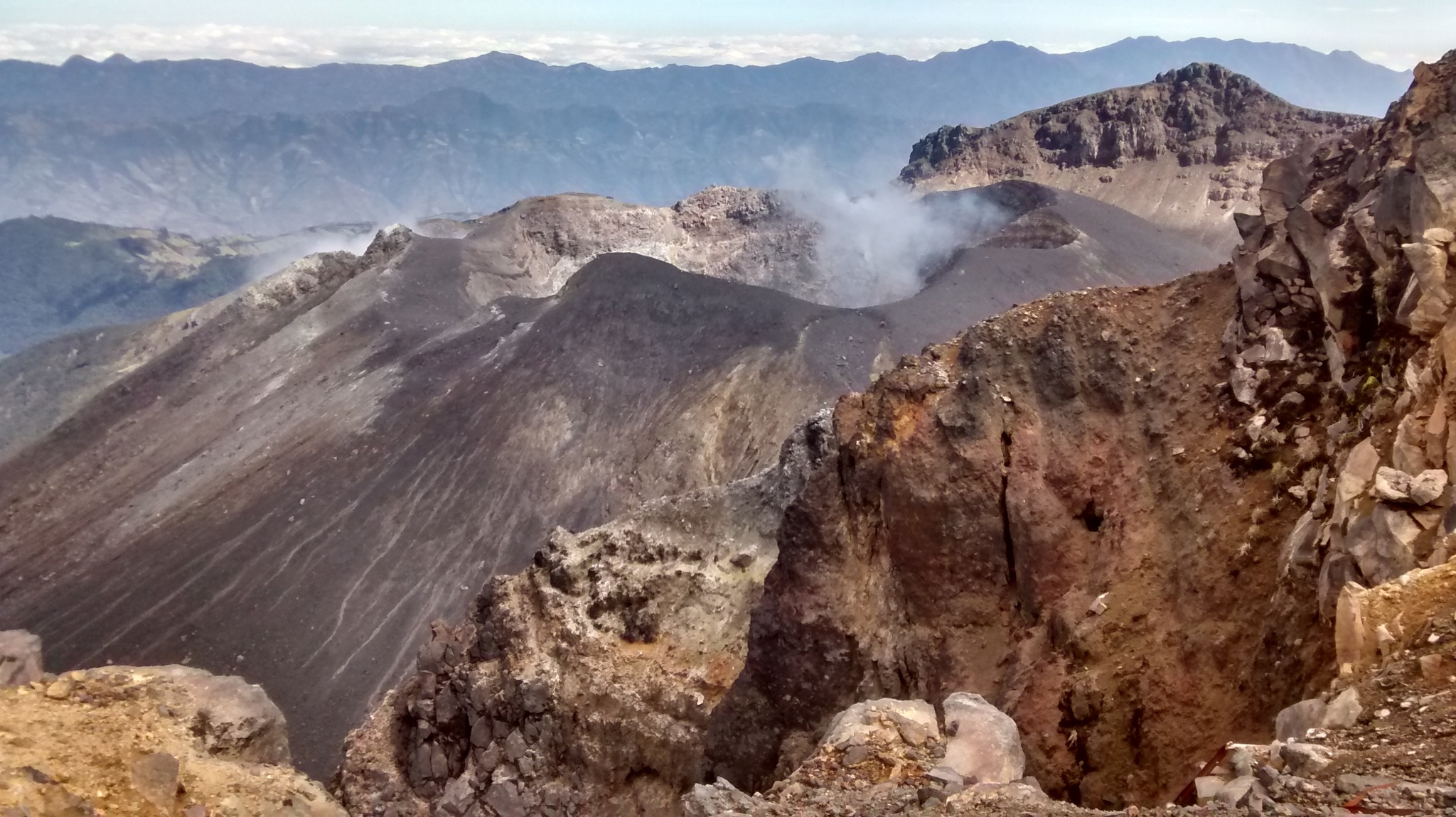
● Intermittent emissions of white gas were observed, characterized by low plume heights and dispersion directions that varied with the wind. These emissions
originated primarily from the fumarole fields of El Paisita (to the north) and Las Chavas (to the west), as well as from the main crater.
● Other volcanic monitoring parameters remained stable.
In light of the above, the SGC recommends closely monitoring the volcano’s activity via weekly bulletins and other information released through our official channels,
and adhering to the instructions issued by local and departmental authorities and the National Unit for Disaster Risk Management (UNGRD).
Volcanic activity remains at the yellow alert level: an active volcano showing changes in the baseline behavior of monitored parameters and other manifestations.
Source et photo : SGC.