June 5 , 2026.
Indonesia , Lewotobi Laki-laki :
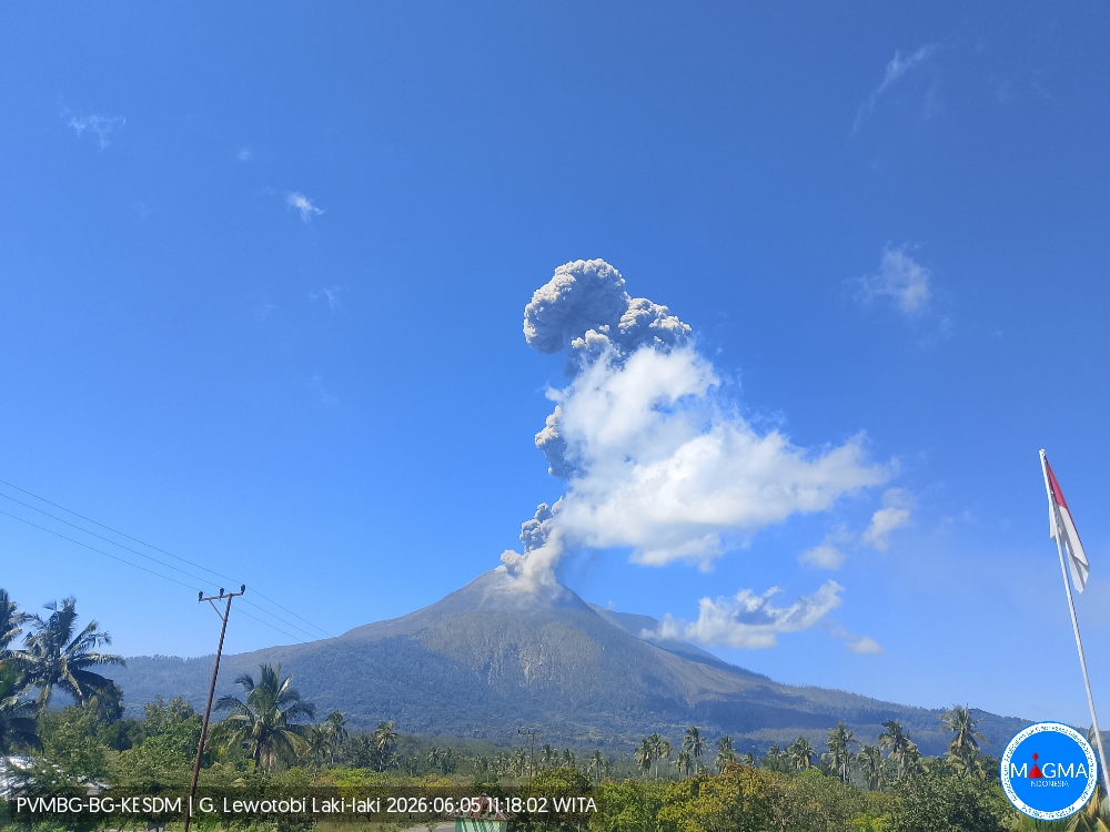
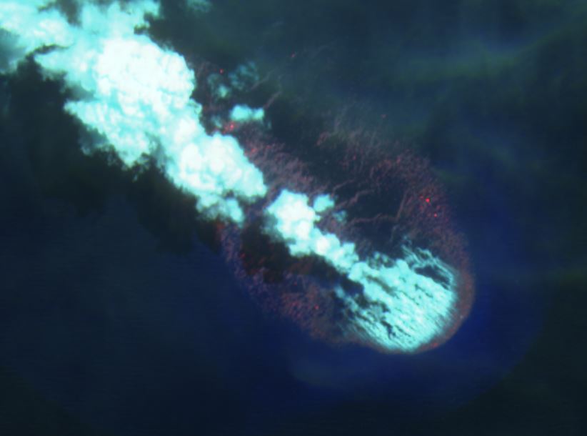
An eruption of Mount Lewotobi Laki-laki occurred on Friday, June 5, 2026, at 11:15 AM WITA. The observed ash column rose approximately 2,500 meters above the summit (about 4,084 meters above sea level). This ash column was gray and very dense, oriented to the west and northwest. The eruption was recorded by a seismograph, with a maximum amplitude of 29.6 mm and a duration of 137 seconds.
VOLCANO OBSERVATORY NOTICE FOR AVIATION – VONA
Issued : June 5 , 2026
Volcano : Lewotobi Laki-laki (264180)
Current Aviation Colour Code : ORANGE
Previous Aviation Colour Code : orange
Source : Lewotobi Laki-laki Volcano Observatory
Notice Number : 2026LWK048
Volcano Location : S 08 deg 32 min 20 sec E 122 deg 46 min 06 sec
Area : East Nusa Tenggara, Indonesia
Summit Elevation : 5069 FT (1584 M)
Volcanic Activity Summary :
Eruption with volcanic ash cloud at 03h15 UTC (111h5 local).
Volcanic Cloud Height :
Best estimate of ash-cloud top is around 13069 FT (4084 M) above sea level or 8000 FT (2500 M) above summit. May be higher than what can be observed clearly. Source of height data: ground observer.
Other Volcanic Cloud Information :
Ash cloud moving from west to northwest. Volcanic ash is observed to be gray. The intensity of volcanic ash is observed to be thick.
Remarks :
Eruption recorded on seismogram with maximum amplitude 29.6 mm and maximum duration 137 second.
Source et photo : PVMBG.
Bismarck sea , Titan Ridge :
The Rabaul Volcano Observatory (RVO) reported that the eruption at Titan Ridge continued during 28 May-4 June. After a decrease in activity over a couple of days the number of hydroacoustic signals significantly increased during 28-29 May, signifying the resumption of semi-continuous activity. Weather clouds prevented satellite observations of the vent areas. Activity was ongoing during 29 May-2 June based on satellite views and hydroacoustic data. By 1 June a steam plume was rising from part of the NE vent area and drifting E and SE; there were no plumes rising from the vent area to the SW. A shallow plume of discolored water drifted as far as 8 km SE from the NE vent.
Hot pumice associated with the plume of discolored water was seen floating within a few hundred meters of the vent area; resultant thermal anomalies were hotter than those previously detected. Pumice rafts from previous days were scattered around the Bismarck Sea. During 2-4 June the eruption plume rose as high as 5 km a.s.l. The steam-and-gas plume as well as a plume of discolored sea water drifted NW, N, E, and SE. The number of daily hydroacoustic signals declined on 3 June. Significant amounts of floating pumice, thick and extensive rafts, washed up on the shores of the Admiralty Islands.
Source: Rabaul Volcano Observatory (RVO), GVP.
Photo : Sentinelle
Japan , Tokachidake :
The Japan Meteorological Agency (JMA) reported increasing seismicity at Tokachidake. Fumarolic activity, including the volume of plumes and the rate of volcanic gas emissions at Crater 62-2, remained high. Seismicity began gradually increasing in April, with occasional temporary spikes in earthquake frequency; volcanic activity overall showed a slight upward trend. The number of volcanic earthquakes located at shallow depths beneath Crater 62-2 began to increase at around 0100 on 31 May and by 0900 on 1 June the network had recorded a preliminary total of 86 events. The Alert Level remained at 1 (on a 5-level scale).
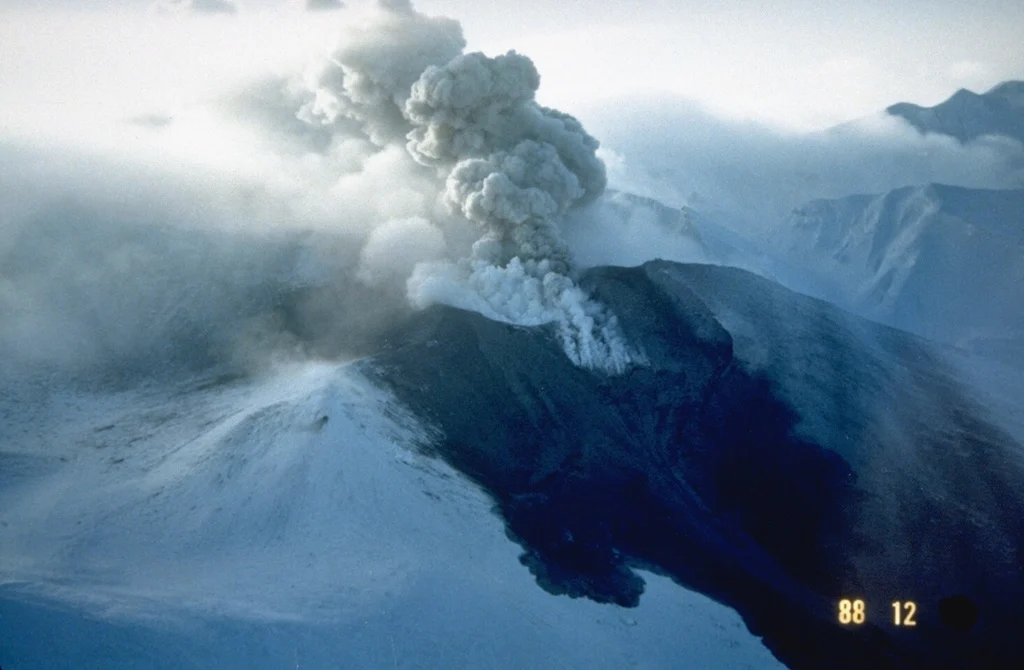
Snowpack on the western flank of Tokachi preserves individual layers of pyroclastic surge and pyroclastic flow deposits from the 1988-89 eruption. Because the eruptions took place during the winter, snowfall proved very useful to scientists in distinguishing the deposits of small-scale eruptions that lasted only a very short time
Tokachidake volcano consists of a group of dominantly andesitic stratovolcanoes and lava domes arranged on a NE-SW line above a plateau of welded Pleistocene tuffs in central Hokkaido. Numerous explosion craters and cinder cones are located on the upper flanks of the small stratovolcanoes, with the youngest Holocene centers located at the NW end of the chain. Frequent historical eruptions, consisting mostly of mild-to-moderate phreatic explosions, have been recorded since the mid-19th century. Two larger eruptions occurred in 1926 and 1962. Partial cone collapse of the western flank during the 1926 eruption produced a disastrous debris avalanche and mudflow.
Sources: Japan Meteorological Agency (JMA) , GVP.
Photo : Japan Meteorological Agency / GVP.
Philippines , Mayon :
The Philippine Institute of Volcanology and Seismology (PHIVOLCS) reported that the eruption at Mayon continued during 28 May-3 June, characterized by lava effusion, pyroclastic density currents (PDCs), incandescent rockfalls, ash-and-gas plumes, and occasional minor Strombolian activity. Emissions were visible daily rising as high as 1.5 km above the summit and drifting in various directions. Each day the seismic network recorded 223-364 rockfalls, 0-3 PDCs, and 7-35 volcanic earthquakes. The earthquake counts included 6-24 daily periods of volcanic tremor, each lasting between two minutes to two hours and 30 minutes. Daily measurements of sulfur dioxide emissions averaged 1,083-2,747 tonnes per day. The lava flows did not advance in the Mi-isi (S), Basud (E), and Bonga (SE) drainages, remaining 1.8, 3.8, and 3.2 km long, respectively.
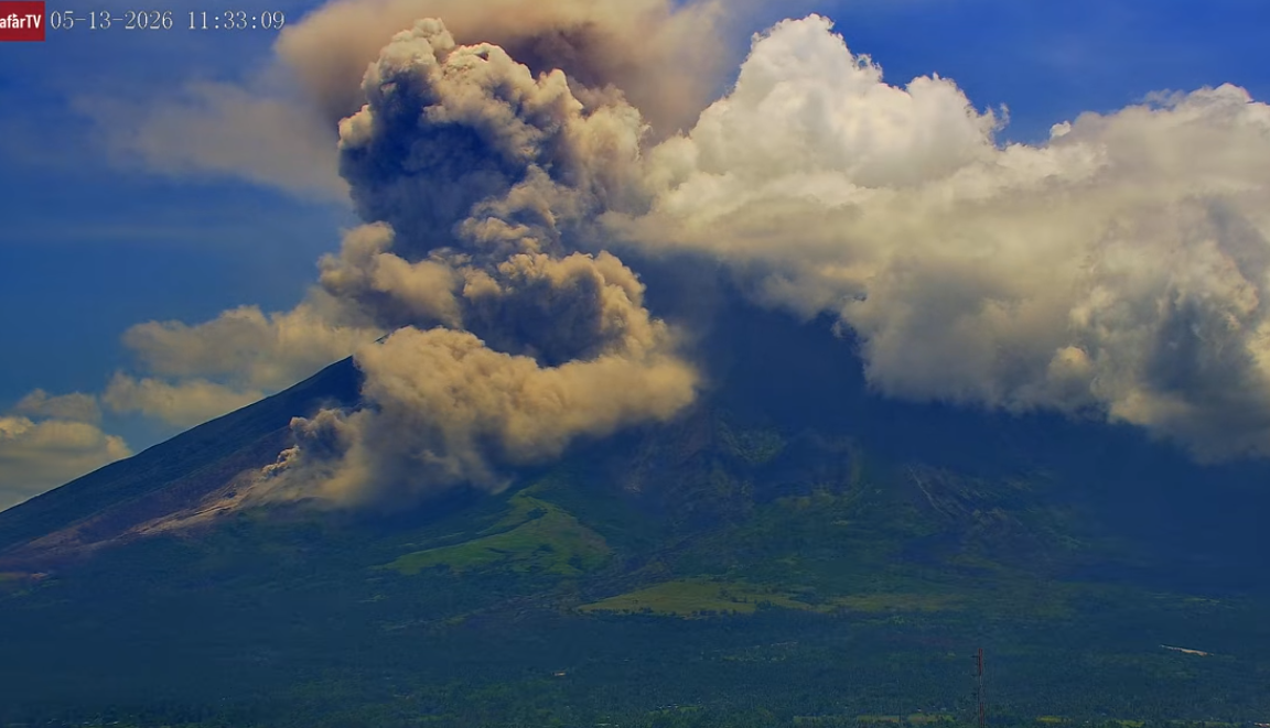
The number of evacuees was similar to the previous week; by 1800 on 1 June a total of 3,975 people (1,088 families) were staying in 12 evacuation shelters, and an additional 137 people (40 families) were staying with friends or relatives, according to the Disaster Response Operations Monitoring and Information Center (DROMIC). The Alert Level remained at 3 (on a 0-5 scale) and residents were reminded to stay away from the 6-km-radius Permanent Danger Zone (PDZ). PHIVOLCS recommended that civil aviation authorities advise pilots to avoid flying close to the summit.
Sources: Philippine Institute of Volcanology and Seismology (PHIVOLCS), Disaster Response Operations Monitoring and Information Center (DROMIC), GVP.
Photo : Afar tv.
Colombia , Galeras :
San Juan de Pasto, June 2, 2026, 5:20 PM
Regarding the monitoring of activity at the Galeras volcano, the Colombian Geological Survey (SGC), an agency under the Ministry of Mines and Energy, reports the following:
During the week of May 26 to June 1, 2026, the main variations in monitored parameters, compared to the previous week, were as follows:
● Volcanic activity remained low, with an increase in seismic activity and a decrease in energy released. Most of the seismicity remained related to rock fracturing processes within the volcanic edifice.
● Most fracturing events occurred near the main crater, and a few others toward the northeast sector of the volcanic edifice, at distances of less than 18 km. Depths were less than 16 km below the summit of the Galeras volcano (4,200 m altitude), with magnitudes less than 1.1.
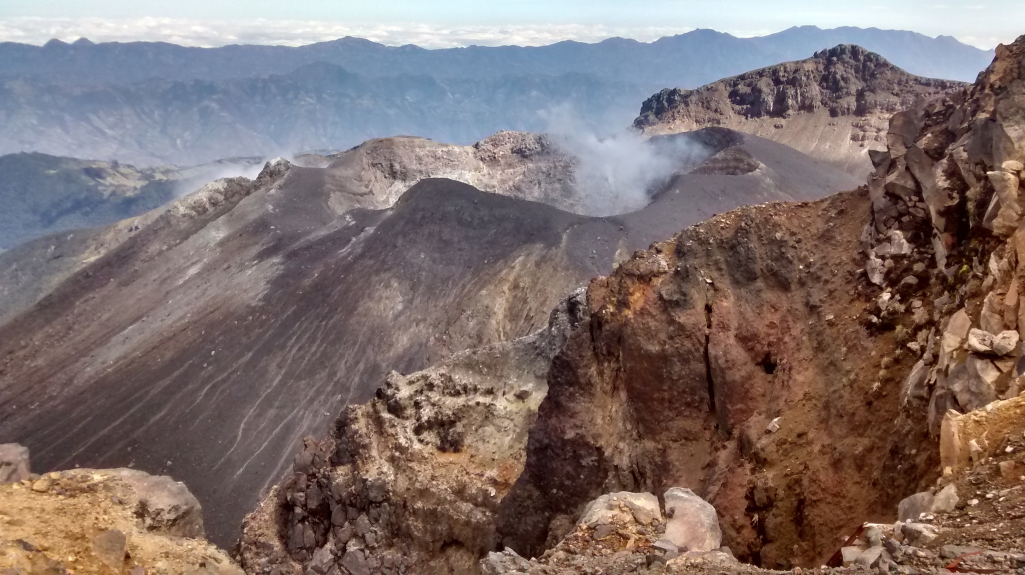
● Due to weather conditions, only a few gas plumes were observed on May 30. These plumes were white, low-altitude, and dispersed by variable winds. They originated primarily from the El Paisita fumarole field, north of the main crater.
● All other volcanic monitoring parameters remained stable.
In light of the above, the Geological Survey of Colombia (SGC) recommends closely monitoring the situation by consulting the weekly bulletins and other information published through its official channels, as well as following the instructions of local and departmental authorities and the National Unit for Disaster Risk Management (UNGRD).
● Volcanic activity remains at the yellow alert level: Active volcano with changes in the baseline behavior of monitored parameters and other manifestations.
Source et photo : SGC.