May 28 , 2026.
Indonesia , Ibu :
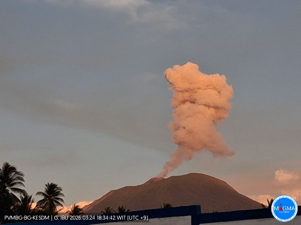
An eruption of Mount Ibu occurred on Tuesday, May 26, 2026, at 9:41 PM WIT, with an observed ash column height of approximately 400 m above the summit (approximately 1725 m above sea level). This gray ash column of moderate intensity was moving eastward. The eruption was recorded by a seismograph with a maximum amplitude of 28 mm and a duration of 54 seconds.
Seismic Observations
121 eruption earthquakes with amplitudes between 15 and 28 mm and durations between 33 and 97 seconds.
1 emission earthquake with an amplitude of 4 mm and a duration of 33 seconds.
9 harmonic tremors with amplitudes between 2 and 20 mm and durations between 54 and 138 seconds.
94 low-frequency earthquakes with amplitudes between 2 and 10 mm and durations between 17 and 29 seconds.
149 shallow volcanic earthquakes with amplitudes between 2 and 12 mm and durations between 7 and 21 seconds.
1 local tectonic earthquake with an amplitude of 15 mm and a duration of 34 seconds.
Fifteen distant tectonic earthquakes, ranging in magnitude from 4 to 28 mm and lasting from 39 to 144 seconds, were recorded.
Recommendations
1. Residents living around Mount Ibu and visitors/tourists are advised to refrain from all activities within a 2 km radius and a 3.5 km sector around the crater opening in the northern part of the active Mount Ibu crater.
2. In the event of ashfall, people engaging in outdoor activities are advised to wear a mask covering their nose, mouth, and eyes, as well as protective eyewear.
Source et photo : PVMBG.
Colombia , Puracé – Los Coconucos volcanic chain :
Popayán, May 26, 2026, 3:30 PM
Regarding the monitoring of activity at the Puracé volcano and the Los Coconucos volcanic chain, the Geological Survey of Colombia (SGC), an agency under the Ministry of Mines and Energy, reports the following:
During the week of May 19-25, 2026, variations in seismic activity were observed, linked to an increase in the energy of continuous tremor (TR) located beneath the craters of the Puracé and Piocollo volcanoes, at depths of less than 3 km. This seismicity was associated with fluid circulation processes, the release of volcanic gases, and ash emissions into the atmosphere from the Puracé volcano crater.
Due to this increased activity, ash emissions were recorded starting May 21, with plumes reaching nearly 3 km above the volcano’s summit, exceeding those observed in previous weeks. These emissions dispersed primarily to the west and northwest of the crater, following the prevailing wind direction, causing ashfall in various rural areas of the municipality of Puracé, including Campamento, Cristales, Cobaló, Anambío, Pisanrabo, and San Juan, as well as in the commune of Paletará, the urban area, and the capital of Coconuco. Reports were also received from the Piedra de León sector in the municipality of Sotará and from some neighborhoods in the city of Popayán.
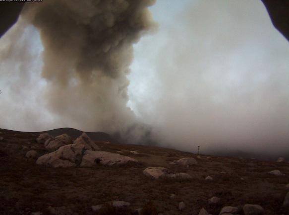
Recording from the Lavas Rojas camera, located 2.4 km northwest of the Puracé volcano, showing the ash emission of May 23, 2026, at 5:59 PM.
Fracture seismicity remained stable compared to the previous week, both in terms of the number of earthquakes and the seismic energy released. It was mainly located between the Puracé and Piocollo volcanoes, at depths between 1 and 3 km, with magnitudes less than 1. Images captured by satellite sensors and visible and infrared webcams continued to reveal thermal anomalies inside the Puracé volcano crater and in the fumarolic field located on its outer rim, as well as degassing phenomena in the craters of the Puracé and Curiquinga volcanoes. Concurrently, sulfur dioxide (SO₂) emissions were recorded through instrumental measurements in the field and via satellite, with notable increases in emission rates for the period studied. Furthermore, the slow deformation process persists between the Puracé, Piocollo, and Curiquinga volcanoes, a process detected after the eruptive episode of Curiquinga on January 20, 2025.
In conclusion, the variations observed in the Puracé-Los Coconucos volcanic chain indicate that the system continues to evolve and that further emissions and ashfall are possible, dispersed according to the prevailing wind direction. The public is advised to refrain from climbing to the top of the volcanic chain and to remain attentive to official bulletins from the Geological Survey of Colombia (SGC).
The alert level for volcanic activity remains at Yellow Alert: Active volcano with changes in the basic behavior of monitored parameters and other manifestations.
Source et photo: SGC.
Chile , Nevado de Longaví :
SPECIAL REPORT ON VOLCANIC ACTIVITY, May 23, 2026
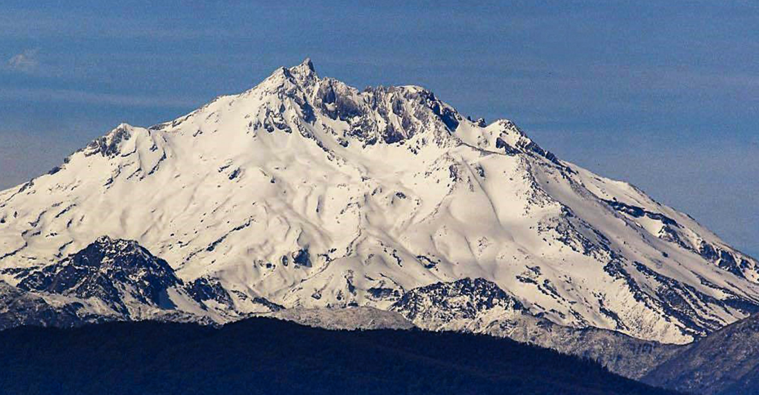
The Argentine Geological and Mining Service (SEGEMAR), through its Argentine Volcanological Monitoring Observatory (OAVV) and in collaboration with the Southern Andes Volcanological Observatory (OVDAS) of Chile, reports that, since Wednesday, May 20, 2026, at 1:49 a.m. local time (4:49 a.m. UTC), the volcanological monitoring stations located near the Nevado de Longaví volcano, belonging to OVDAS, have begun recording an increase in the volcano’s seismic activity, characterized by volcano-tectonic (VT) events associated with rock fracturing within the volcano.
This increase in seismicity represents a significant change in the volcano’s internal activity, notably the emergence of a new seismic source located approximately 4 to 5 km southwest of the crater, at a depth of about 3 km. Given the number of recorded events, their magnitude, and the energy released, this episode corresponds to the most intense seismic activity observed at the Nevado de Longaví volcano since instrumental monitoring began, demonstrating an increase in its internal activity above its baseline level. Consequently, as a precautionary measure, the Chilean Volcanological Observatory (OVDAS) has raised the technical alert level for the Nevado de Longaví volcano to YELLOW, while the Argentine Volcanological Observatory (OAVV) will remain in constant contact with OVDAS, reporting any changes in volcanic activity and any potential impacts on Argentine territory.
OBSERVATIONS:
According to information provided in the Special Volcanic Activity Bulletins (REAVs) published in recent days, more than 400 VT (volcano-tectonic) earthquakes have been recorded. Among this activity, four events with a local magnitude greater than 3.0 stand out, considered to be of moderate to high energy. The largest event occurred on May 20 at 8:34 a.m. local time, with a local magnitude of ML 4.3, according to the REAV. This is the largest local magnitude earthquake recorded to date on this volcanic system since the establishment of the OVDAS monitoring network.
It is also worth noting the recording of several events attributed to fluid dynamics, corresponding to five long-period earthquakes and one tremor. All these events exhibit low energy, with displacements of less than 1 cm².
At the time of writing, the volcano continues to experience volcano-tectonic (VT) seismicity, although at a lower rate than in previous days. Furthermore, the monitoring camera installed near the volcano has not recorded any significant changes in surface activity.
CONCLUSIONS:
The technical alert level has been raised, and monitoring and cooperation with the Southern Andes Volcanological Observatory (OVDAS) of Chile will continue, as will collaboration with local and provincial authorities. Ongoing coordination with the Federal Emergency Management Agency (AFE) will also continue, within the framework of our National Integrated Risk Management System (SINAGIR). Any changes will be reported.
Source et photo : Segemar.
Costa Rica , Rincon de la Vieja :
Latitude: 10.83°N;
Longitude: 85.34°W;
Altitude: 1916 m.
Current Activity Level: Alert.
Two small eruptions were recorded this week. Acoustic amplitude is lower than last week. No lahars were observed. Background tremor remains very weak and the overall trend is downward. Short tremors of varying amplitude and duration were also recorded, with a lower frequency (1-3 Hz) than the background tremor. There has been a slight increase in the number of long-period and spiral-type events. The occurrence of spiral-type events of stable amplitude continues. The dominant frequency of spirals continues to decrease this week.
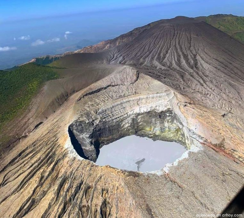
Two volcano-tectonic earthquakes distal to the crater were recorded this week. The geodetic network is not detecting any significant deformation. The MultiGAS station continues to record low SO₂ concentrations. This week, the NOVAC stations recorded 195 ± 192 tonnes of SO₂ per day, a higher rate than the previous week (114 ± 81 t/d). The last detection of SO₂ in the atmosphere by the SENTINEL satellite, emitted by the Rincón de la Vieja volcano, dates back to September 7, 2025.
Source : Ovsicori.
Photo : Crhoy.
Hawaii , Mauna Loa :
HAWAIIAN VOLCANO OBSERVATORY MONTHLY UPDATE , U.S. Geological Survey
Thursday, May 7, 2026, 9:50 AM HST (Thursday, May 7, 2026, 19:50 UTC)
19°28’30 » N 155°36’29 » W,
Summit Elevation 13681 ft (4170 m)
Current Volcano Alert Level: NORMAL
Current Aviation Color Code: GREEN
Summary:
Mauna Loa earthquake counts slightly increased in March, and inflationary ground deformation continued.
Mauna Loa had a slight increase in seismic activity compared to the previous month, with clustering of events under Mokuʻāweoweo and the upper Southwest Rift Zone still present. A total of 132 earthquakes were detected beneath Mauna Loa’s summit region in the April reporting period, while March had 86 earthquakes. Data from Global Positioning System (GPS) instruments on Mauna Loa show variable rates of inflation at the summit over the past six months.

This is associated with refilling of the summit reservoir system following the 2022 eruption.
Gas and temperature data from a station on Mauna Loa’s Southwest Rift Zone indicate these values are at background levels, with little change relative to previous months.
HVO continues to closely monitor Mauna Loa and will issue another update in one month, or earlier, should conditions change significantly.
Source et photo : HVO.