May 27 , 2026.
Italy , Stromboli :
Stromboli Activity Update, May 26, 2026, 10:28 (08:28 UTC).
The National Institute of Geophysics and Volcanology, Etna Observatory, reports that monitoring cameras observed effusive activity at 07:32 UTC, caused by a lava overflow in the North Crater area. This activity is producing a lava flow that is developing along the Sciara del Fuoco.
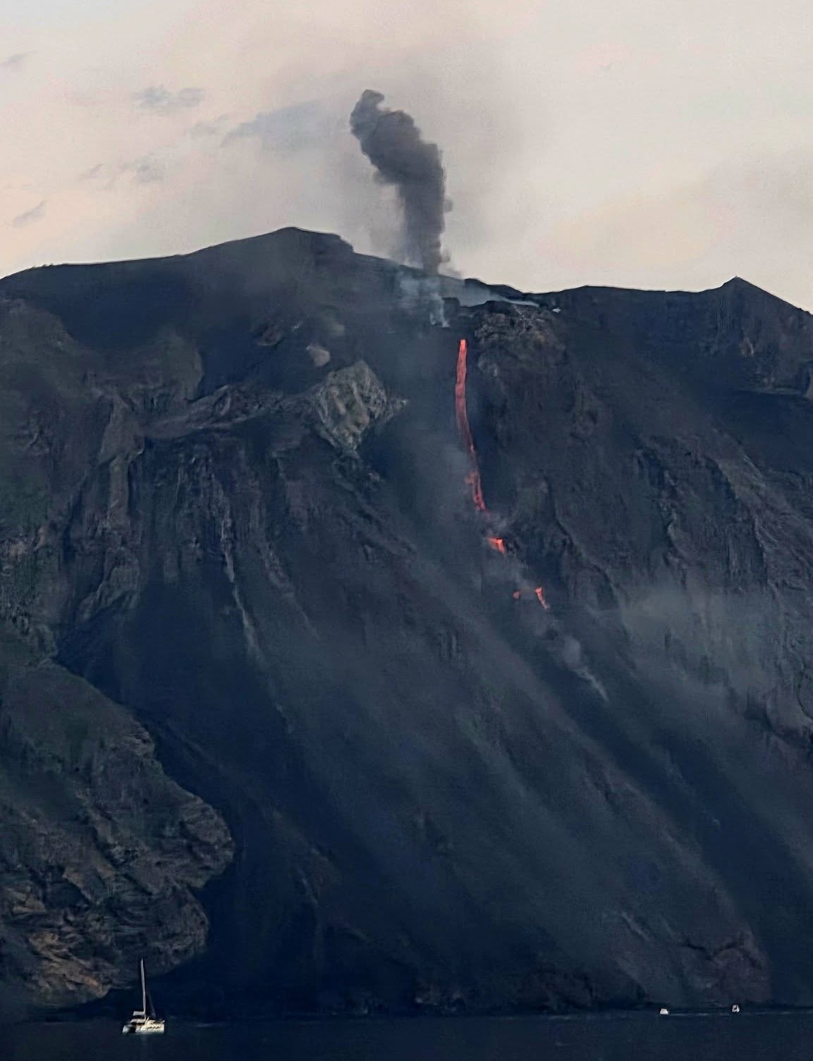
From a seismic perspective, since approximately 02:00 UTC today, the average amplitude of volcanic tremor has increased from moderate to high.
No significant changes have been reported in the frequency and amplitude of explosion earthquakes. Analysis of high-frequency GNSS network signals reveals no significant ground deformation.
Further information will be released soon.
Source : INGV.
Photo : Katarina Schulz / FB.
Iceland , Reykjanes Peninsula :
Ground uplift and magma accumulation continue beneath Svartsengi
Updated 26 May 2026
Uplift at Svartsengi continues at a steady rate
Approximately 26.6 million cubic metres of magma have accumulated since 16 July 2025
Seismic activity remains low
The hazard assessment is unchanged and remains valid until 30 June

Deformation
Land uplift at Svartsengi remains steady, with deformation continuing at a similar rate as in recent weeks. The latest model calculations indicate that approximately 26.6 million cubic metres of magma have accumulated beneath Svartsengi since the start of the most recent eruption on 16 July 2025. The average rate of magma accumulation over the past four weeks has been similar as in the past weeks.
Seismic activity
Seismic activity along the Sundhnúkur crater row and in the vicinity of Grindavík remains low. No significant changes in seismicity have been observed since the previous update.
Hazard assessment
The Icelandic Meteorological Office hazard assessment remains unchanged and is valid until 30 June unless activity levels change. The IMO’s 24/7 monitoring team continues to closely observe developments in the area.
Source : IMO.
Photo : Bar Harel. Wikimedia.
Hawaii , Kilauea :
HAWAIIAN VOLCANO OBSERVATORY DAILY UPDATE , U.S. Geological Survey
Tuesday, May 26, 2026, 9:19 AM HST (Tuesday, May 26, 2026, 19:19 UTC)
19°25’16 » N 155°17’13 » W,
Summit Elevation 4091 ft (1247 m)
Current Volcano Alert Level: ADVISORY
Current Aviation Color Code: YELLOW
Summary:
The Halemaʻumaʻu eruption of Kīlauea is paused. Glow was visible from both vents overnight. Summit has switched to deflation, and forecast window for episode 48 fountains is now pushed to between Wednesday-Friday (May 27-29).
Overview:
The Halemaʻumaʻu eruption of Kīlauea is paused. Glow was visible from both eruptive vents overnight. The summit switched to deflation yesterday afternoon, which pushes the forecast for episode 48 fountaining out to between Wednesday and Friday (May 27-29).
No significant activity has been noted along Kīlauea’s East Rift Zone or Southwest Rift Zone.
Summit Observations:
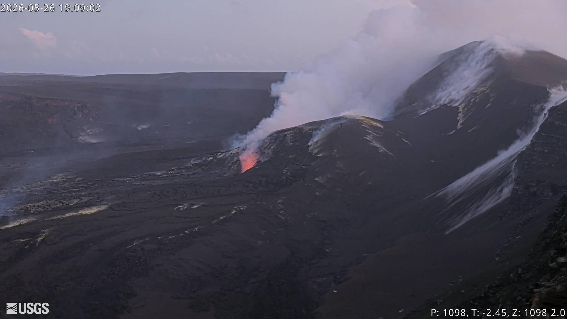
Bright glow was visible from both Halemaʻumaʻu eruptive vents overnight.
Low-level seismic tremor continues during the current pause, and has fluctuated over the past day. Earthquake activity beneath Kīlauea summit is low at this time.
Kilauea summit inflation abruptly switched to deflation yesterday at 4 p.m., and deflationary tilt continues this morning. Since the end of lava fountaining episode 47 on May 15, the Uēkahuna tiltmeter (UWD) has tracked about 13.3 microradians of inflationary tilt (a small tilt offset was due to the M6.0 earthquake on the west side of the island on Friday evening). This instrument recorded 15.6 microradians of deflationary tilt during episode 47.
With the eruption now paused, the sulfur dioxide (SO2) emission rate from the summit is likely now varying within a typical range of 1,000 to 5,000 tonnes per day. Measurements on Friday, May 22, indicated emission rates of about 2,000 tonnes per day. Surface winds are steady out of the northeast at the summit this morning.
Rift Zone Observations:
Rates of seismicity and ground deformation remain low in the East Rift Zone and Southwest Rift Zone. SO2 emissions from the East Rift Zone remain below the detection limit.
Source et photo : HVO.
Colombia , Chiles / Cerro Negro :
San Juan de Pasto, May 26, 2026, 6:10 PM
Regarding the monitoring of activity at the Chiles-Cerro Negro Volcanic Complex (CVCCN), the Colombian Geological Survey (SGC), an agency under the Ministry of Mines and Energy, reports the following:
For the period of May 19-25, 2026, the main variations in monitored parameters, compared to the previous week, were as follows:
● The downward trend in the number of earthquakes continues, accompanied by a slight increase in seismic energy released. Events associated with rock fracturing predominated, located primarily in the collapse zone of Chiles Volcano and to its southeast, at depths between 2 and 9 km below the summit of Chiles Volcano (4,700 m above sea level). The most significant fracturing event was recorded on May 20 at 2:22 PM, with a magnitude of 1.8, a depth of 8.8 km, and a location 7 km south of the summit. Seismicity related to fluid movement continues to be recorded.
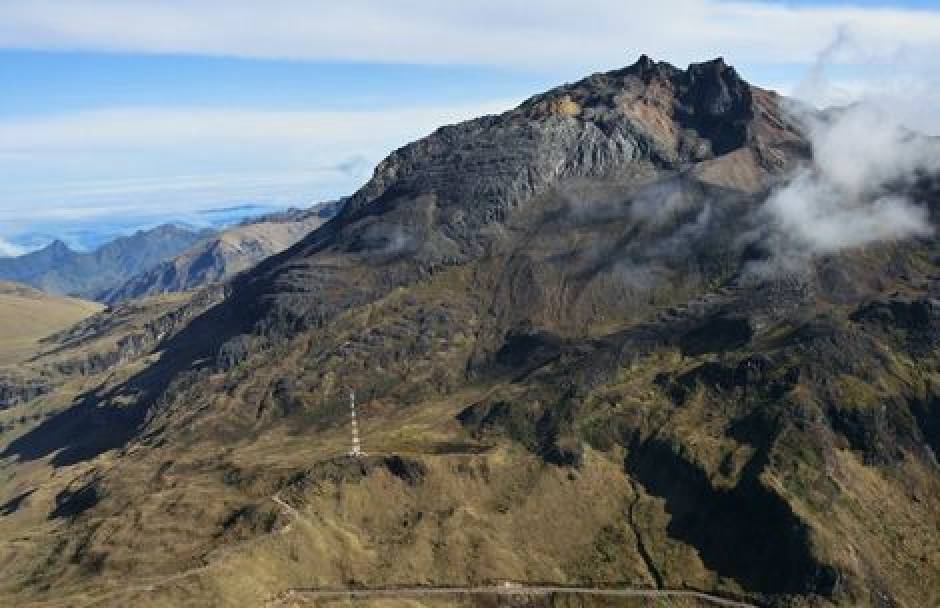
● Variations in volcanic surface deformation are being recorded and detected by satellite sensors and ground stations installed in the area of influence. Based on the assessment and correlation of monitored parameters, the Geological Survey of Colombia (SGC) recommends closely monitoring developments through weekly bulletins and other information published via its official channels, as well as following instructions from local and departmental authorities and the National Disaster Risk Management Unit (UNGRD).
Volcanic activity remains at the yellow alert level: active volcano with changes in the baseline behavior of monitored parameters and other manifestations.
Source et photo : SGC.
Guatemala , Santiaguito :
Weather conditions: Clear
Wind: North
Rainfall: 48.5 mm
Activity:
The Santiaguito volcano continues its activity with blocky lava extrusions, triggering avalanches from the southwest flank of the crater. These avalanches occasionally generate small pyroclastic flows that reach the base of the dome, resulting in a continuous scree slope of volcanic material. Ash remains suspended in the central part of the volcanic complex, mainly on the west and southwest flanks. Low- to medium-intensity explosions have been observed, ejecting ash columns up to an altitude of 3,200 meters.
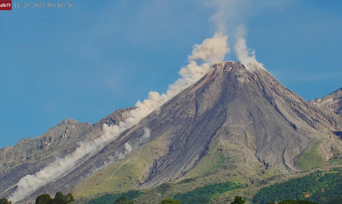
The ash dispersed approximately 20 km to the south-southwest, affecting Aldea Calaguache, Las Marías, El Viejo Palmar, and other nearby communities. Incandescence was observed in the crater overnight and into the early morning, indicating ongoing surface activity within the volcanic dome. Given the current conditions, larger pyroclastic flows, similar to those recorded on April 28, are possible. Therefore, approaching the volcanic domes and remaining in or near the ravines of the complex is strongly discouraged due to the risks associated with sudden falls of incandescent volcanic material and pyroclastic flows.
Source : SGC.
Photo : Afar TV.