May 26 , 2026.
Indonesia , Ili Lewotolok :
Increased Volcanic Seismicity at Ili Lewotolok Volcano, May 26, 2026.
Ili Lewotolok Volcano, located in Lembata Regency, East Nusa Tenggara Province, has been on Level II alert since February 24, 2026. Following an increase in seismicity in April 2026, a new wave of earthquakes occurred on May 25, 2026. Beginning at 7:00 PM WITA, a series of hybrid/multi-phase seismic tremors, similar to drumbeats, were recorded. These tremors exhibited relatively similar waveforms and intervals. This drumbeat lasted for over an hour, then gradually expanded before dissipating.
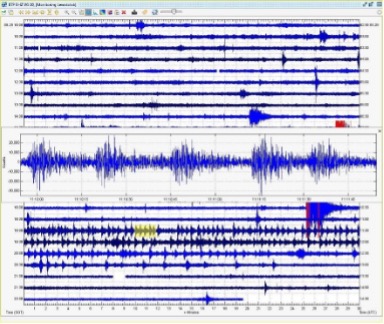
From May 1 to 24, 2026, seismic observations recorded 179 eruption earthquakes, 972 emission earthquakes, 17 avalanche earthquakes, 3 harmonic tremors, 9 non-harmonic tremors, 5 hybrid earthquakes, 14 shallow volcanic earthquakes, 69 deep volcanic earthquakes, 44 local tectonic earthquakes, and 50 distant tectonic earthquakes. On May 25, 2026, four eruption earthquakes, 56 emission earthquakes, 91 hybrid/multiphase earthquakes, 7 deep volcanic earthquakes, two local tectonic earthquakes, and five distant tectonic earthquakes were recorded.
Seismic energy estimated using the RSAM (Real-Time Seismic Amplitude Measurements) method showed a sharp increase in seismic energy values during the repetitive shaking phase characteristic of hybrid earthquakes.
Visual observations from the Ili Lewotolok PGA station revealed no anomalies at the summit of Mount Ili Lewotolok during the recording of the hybrid/multiphase seismic signal. The volcano was clearly visible until it became shrouded in fog. White and gray plumes of varying intensity rose from the crater to between 5 and 200 meters above the summit. The eruptive column, white to gray in color, extended from 50 to 300 meters above the summit. Avalanches occurred, but their distance and direction could not be visually observed.
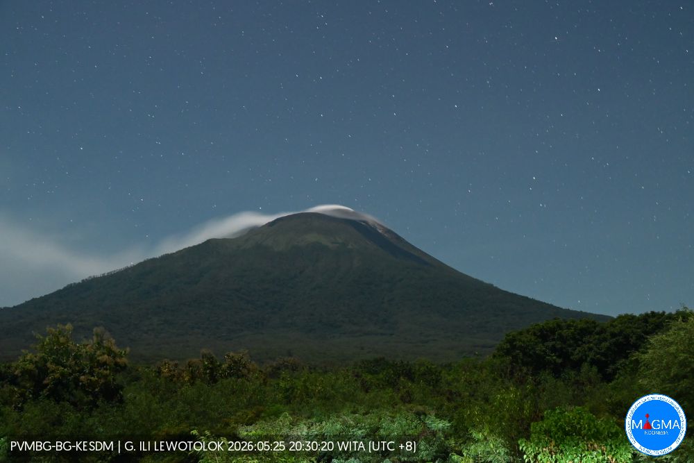
Based on visual and instrumental monitoring data, Mount Ili Lewotolok has exhibited increased seismicity, including hybrid volcanic earthquakes. The activity level of Mount Ili Lewotolok remains at Level II (WASPADA) with the following recommendations:
Residents living near Mount Ili Lewotolok, as well as visitors, climbers, and tourists, are advised to refrain from all activities within a 2-kilometer radius of the Mount Ili Lewotolok activity center. They should be aware of the risk of lava avalanches and pyroclastic flows in the south, southeast, west, and northeast sectors of Mount Ili Lewotolok. Residents are advised to wear masks and other eye and skin protection to prevent acute respiratory infections and other health problems, and to cover drinking water containers in case of exposure to volcanic ash.
Source et photos : PVMBG.
Colombia , Nevado del Ruiz :
Manizales, May 19, 2026, 9:15 PM
Regarding the monitoring of activity at the Nevado del Ruiz volcano, the Colombian Geological Survey (SGC), an agency under the Ministry of Mines and Energy, reports the following:
During the week of May 12-18, 2026, the volcano continued to exhibit unstable behavior. Compared to the previous week, the main variations in monitored parameters were as follows:
– Seismicity associated with fluid dynamics in the volcanic conduits increased slightly in the number of recorded earthquakes and decreased in the seismic energy released. These seismic signals corresponded to short-duration, low-energy events. As in previous weeks, no pulsatile ash emissions or variations in the apparent temperature of the gas column, associated with this type of seismic signal, were observed.
– Seismic activity associated with rock fracturing processes within the volcanic edifice has decreased in the number of recorded earthquakes, but increased in seismic energy released.

The earthquakes were primarily located within the Arenas crater and, more sporadically, on various flanks of the volcano, within 10 km of the crater. Relative to the reference level, their depth ranged from less than 1 km to 2 km in the crater area, and from 2 km to 9 km on the flanks.
The maximum recorded magnitude was 1.2, corresponding to the earthquake that occurred on May 13 at 4:52 a.m., 9 km east-southeast of the Arenas crater and at a depth of 4 km.
The volcano continued to emit water vapor and volcanic gases, primarily sulfur dioxide (SO₂), into the atmosphere from the Arenas crater. The estimated SO₂ flux, associated with degassing processes, remained variable, with low values, and increased compared to the previous week. Satellite data platforms have shown low levels of SO₂ emissions.
The height of the gas and water vapor column remained below 500 m above the volcano’s summit, with the highest values around 300 m. The dispersion direction of this column was variable, tending towards the west, southwest, northwest, and north-northwest flanks of the volcano.
Monitoring of thermal anomalies at the bottom of the Arenas crater, using satellite platforms, has shown that their energy levels remain low. It should be noted that their detection remains limited by the thick cloud cover in the region.
Source et photo : SGC.
Ecuador , Sangay :
DAILY REPORT ON THE STATE OF SANGAY VOLCANO, Monday, May 25, 2026.
Geophysical Information Institute – EPN.
Surface Activity Level: High, Surface Trend: No Change
Internal Activity Level: Moderate, Internal Trend: No Change
Seismicity: From May 24, 2026, 11:00 AM to May 25, 2026, 11:00 AM:
Seismicity:
Explosion (EXP): 305
Rain/Lahars:
Last night, light rain fell in the volcano area, but no mudflows or debris flows were detected.
Heavy rain could remobilize accumulated material, generating mudflows and debris flows that could cascade down the volcano’s flanks and reach nearby rivers.
Emissions/Ash:
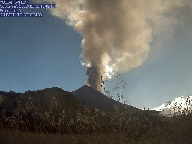
Due to cloud cover in the volcano area, it was not possible to observe gas and/or ash emissions using surveillance cameras. However, from yesterday afternoon until early this morning, several plumes of gas and ash were detected by the GOES-19 satellite system, drifting south and southwest at an altitude of less than 800 meters above the crater. In parallel with this activity, the Washington VAAC issued three reports of ash clouds drifting south and west-southwest, reaching an altitude of 900 meters above sea level.
Other monitoring parameters:
The MIROVA-VIIRS 750 satellite system detected two thermal anomalies, the MIROVALANDSAT system one thermal anomaly, and the FIRMS and MIROVA-VIIRS 375 satellite systems each detected three in the past 24 hours.
Observation:
From yesterday afternoon until the time of writing, the area around the volcano has remained completely cloudy.
Alert level: Yellow
Source : IGEPN
Photo : IGEPN ( archive).
La Martinique , Mount Pelée :
Weekly Report, Paris Institute of Earth Physics, Martinique Volcanological and Seismological Observatory
Saint-Pierre, May 22, 2026, 3:00 PM local time (GMT-4)
Between May 15, 2026, 4:00 PM UTC and May 22, 2026, 4:00 PM UTC, the Martinique Volcanological and Seismological Observatory recorded:
• 61 volcano-tectonic earthquakes. Among them, 6 had a magnitude (local magnitude Mlv or duration magnitude Md) greater than 0.5. The largest had a magnitude Mlv of 0.8. The others were of lower energy. These earthquakes originated from the well-known seismically active zones of Mount Pelée, located between 1.0 and 1.4 km below the summit of the volcano. Volcano-tectonic seismicity is associated with microfracturing in the volcanic edifice, linked to the overall reactivation of the volcano observed since 2019.
No earthquakes have been felt by the population.
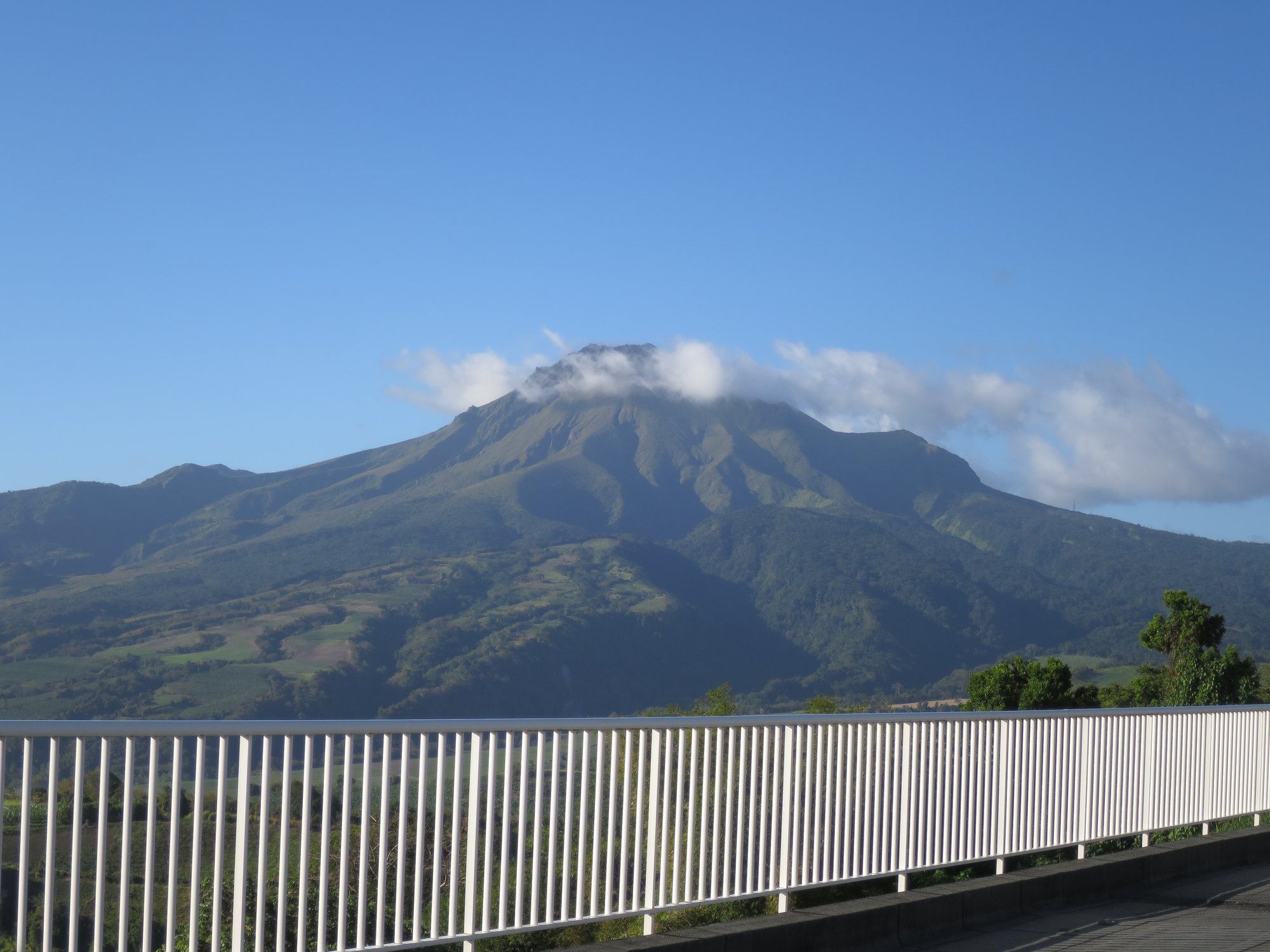
The previous week, the OVSM (Mountain Seismological Observatory) recorded 80 volcanic earthquakes. As of May 22, 2026, and over the past four weeks, the OVSM has observed a total of 971 volcanic earthquakes, an average of 242 to 243 earthquakes per week.
During phases of volcanic reactivation of volcanoes similar to Mount Pelée, seismic activity of varying intensity and frequency is common. The probability of an eruptive activity in the short term remains low. However, based on observations accumulated in recent years, and particularly in recent months, a change in the situation in the medium term (weeks to months) cannot be ruled out.
For more details on observations and interpretations of volcanic activity over the longer term, please refer to the OVSM’s monthly bulletins. The volcanic alert level, in accordance with the measures implemented by the authorities, is currently YELLOW: vigilance.
Source et photo : Direction de l’OVSM-IPG.
Costa Rica , Poas :
Latitude: 10.20°N
Longitude: 84.23°W
Altitude: 2,687 m
Current Activity Level: Alert
No eruptions were recorded this week. The amplitude of tremors and the number of long-period events remain stable. No volcano-tectonic seismicity was recorded this week. The geodetic network indicates that the previously observed vertical uplift has ceased.
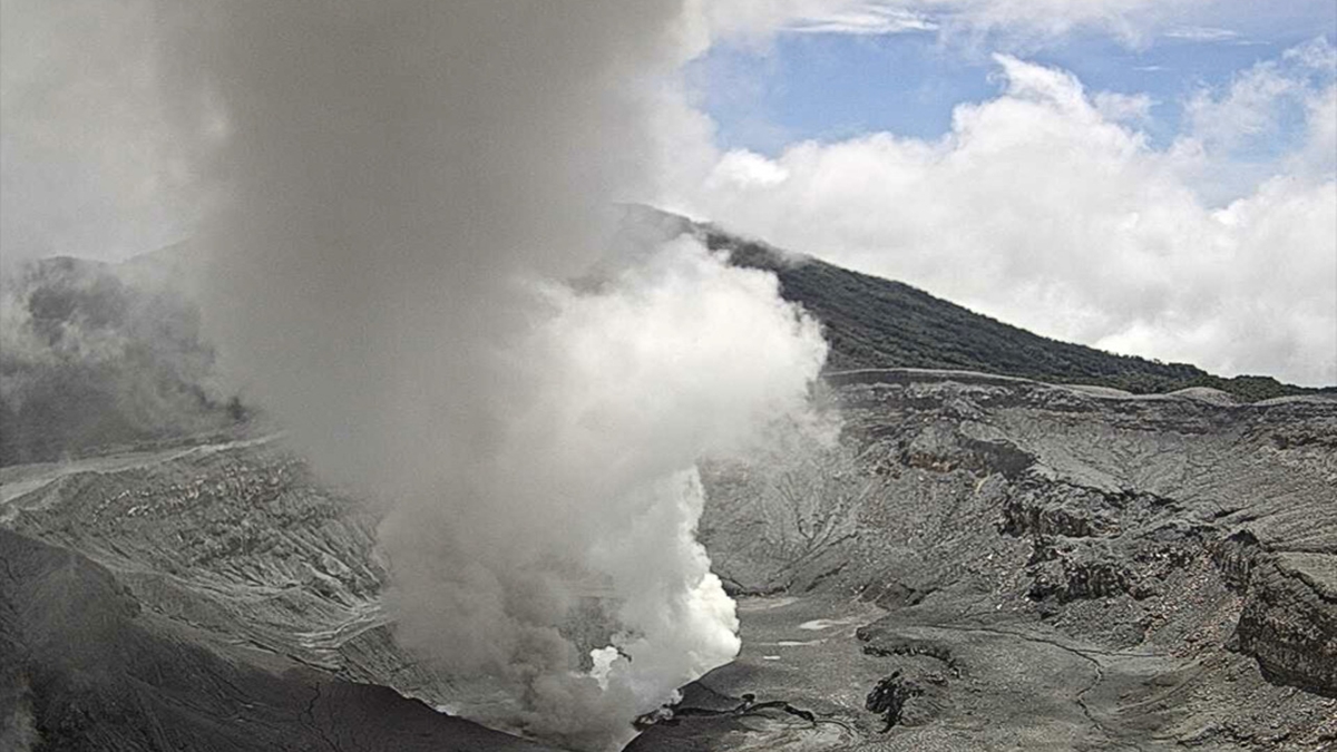
However, the contraction trend of the volcanic edifice detected in recent months continues. The SO₂/CO₂ ratio shows stable average values close to 1.8, and the H₂S/SO₂ ratio is below 0.1. This week, NOVAC stations recorded 127 ± 27 tonnes of SO₂ per day, a rate similar to that of the previous week (138 ± 41 t/d). The SENTINEL satellite detected the SO₂ plume several days a week, reaching a peak of 91 tonnes of SO₂ in the atmosphere on May 7. The level of the hyperacidic lake remains generally stable.
Source et photo : Ovsicori .