November 06 , 2024 .
Italy , Stromboli :
WEEKLY BULLETIN, from October 28, 2024 to November 03, 2024. (issue date November 05, 2024)
SUMMARY STATUS OF ACTIVITY
In light of the monitoring data, it emerges:
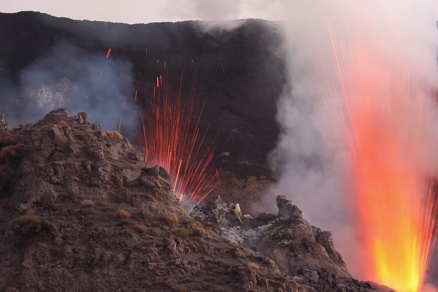
1) VOLCANOLOGICAL OBSERVATIONS: During this period, intense eruptive activity was observed with splashes coming from the northern area of the crater and an explosive sequence of energy higher than ordinary activity followed by a lava flow from the overflow of the crater on November 2.
The total hourly frequency was established at average values (8-15 events/h). The intensity of the explosions was low in the northern crater area and medium to high in the central-southern area.
2) SEISMOLOGY: The monitored seismological parameters do not show significant variations, with the exception of the sequence of explosive events of higher than normal intensity recorded on November 2.
3) GROUND DEFORMATIONS: The ground deformation monitoring networks recorded an inclinometric variation of 0.5 microradians at 14:20 UTC on the 2nd in correspondence with the explosion sequence.
4) GEOCHEMISTRY: SO2 flux at medium level
Soil CO2 flux in the summit area STR02 on high values.
CO2/SO2 ratio in the plume: between high and very high values.
Helium isotope ratio in the thermal aquifer: there are no updates. Latest data from 24/10/2024 on average values
CO2 flow at Mofeta in the San Bartolo area: in average values.
CO2 flow at Scari: stable values around 160 g/m2/day.
5) SATELLITE OBSERVATIONS: The thermal activity observed by satellite in the summit area was generally low to moderate in correspondence with the eruptive activity in the North Crater area.
VOLCANOLOGICAL OBSERVATIONS
During the observed period, the eruptive activity of Stromboli was characterized by analyzing the images recorded by the INGV-OE surveillance cameras located at an altitude of 190 m (SCT-SCV) and at Punta dei Corvi (SPCT). The explosive activity was mainly produced by 4 eruptive vents located in the northern area of the crater and by 3 vents located in the central southern area. On November 2, an explosive sequence of higher energy than ordinary explosive activity affected both areas of the crater (North and Central Southern).
Observations of the explosive activity captured by the surveillance cameras
In the area of the northern crater (N), four active vents were observed that produced explosive activity of low intensity (less than 80 m in height) and sometimes of medium intensity (less than 150 m in height). In addition, sometimes intense splashes were observed on November 3. The products emitted in eruption were mainly coarse materials (bombs and lapilli). The average frequency of explosions varied between 4 and 11 events/h.
In the Centre-Sud (CS) zone, the explosive activity was produced by at least three chimneys, the explosions varied in intensity from medium (less than 150 m in height) to high (more than 250 m in height) emitting fine materials mixed with coarse materials. The average frequency of explosions varied between 1 and 5 events/h.
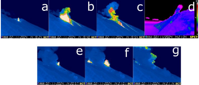
Images of the first phase of the explosive sequence seen from the SCT camera (a-b-c) and from the SPCT camera (d);
Images of the second phase seen from the SCT camera (e-f-g)
Explosive sequence and effusive activity of 2 November 2024
Active vents of the crater terrace on 2 November produced an explosive sequence of higher energy than usual, followed by effusive activity from the lava overflow from the northern crater area.
The explosive sequence developed in two phases, below the chronology with UTC times.
At 14:19:24, the sequence started with the first phase, which lasted about 30 seconds, consisting of two strong explosions in the northern crater area. The products exceeded 200 m in height, their fallout was abundant along the Sciara del Fuoco and some blocks reached the coastline.
At 14:20:55, the second phase began, lasting about 2.5 minutes, which involved at least three vents in the South Central area and at least one in the North area of the crater. The vents in the South Central area emitted a cloud of ash mixed with coarse materials that exceeded 350 m in height and headed towards the North-East. The explosion in the North area emitted coarse materials that reached about 150 m in height.
At 14:22, following the explosive sequence, an effusive activity begins with the production of lava flows at variable speed that propagate along the ravine formed on the Scaria del Fuoco, following the eruptive activity of July, the fronts remaining confined to the upper part of the Sciara, not reaching the coast. The activity ends around 18:15.
Source : INGV
Photos : Stromboli stati d’animo / Sebastiano Cannavo , INGV.
La Réunion , Piton de la Fournaise :
Seismicity
In October 2024, the OVPF-IPGP recorded in the Piton de la Fournaise massif in total:
• 22 superficial volcano-tectonic earthquakes (0 to 2.5 km above sea level) under the summit craters;
• 20 deep earthquakes (below sea level);
• 18 long-period earthquakes;
• 99 landslides.
The month of October 2024 was marked by low seismicity under the Piton de la Fournaise with only 22 superficial volcano-tectonic earthquakes and 20 deep earthquakes recorded.
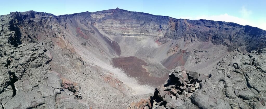
Only 5 superficial volcano-tectonic earthquakes and 1 deep earthquake could be located respectively under the Dolomieu crater and under the Bory crater. The others – of lower magnitudes – could not be located.
Numerous (99) landslides in the Dolomieu Crater, at the level of the ramparts of the Enclos Fouqué and at the Cassé de la Rivière de l’Est were also recorded.
Gas geochemistry:
Following the cyclonic event of 15 January 2024, a rapid increase in soil CO2 fluxes was observed from 19 January onwards both in the near and distal field on the western flank of Piton de la Fournaise. This increase lasted until May and reached unusually high values at the proximal GITN site. Fluid isotopic compositions do not show an increase in the magmatic component in the fluids .
A decrease in CO2 fluxes at all sites has been recorded since mid-May 2024.
Composition of summit fumaroles by MultiGas method
– Since the installation of the new MultiGaS station at the summit in June 2024, SO2 and H2S concentrations at the summit of the volcano remain below detection levels .
Phenomenology
No eruptive activity during October 2024.
Summary
Since April 2024, magma replenishment and pressurization of the superficial reservoir have ceased.
In October 2024, seismicity remained low – with only 22 shallow and 20 deep volcano-tectonic earthquakes recorded beneath the summit craters.
Source : OVPF ( https://www.ipgp.fr/communiques-et-bulletins-de-lobservatoire/?categorie=&domaine=&date=&observatoire-associe=391&motcle= )
Photo : OVPF
Italy / Sicily , Etna :
WEEKLY BULLETIN, from October 28, 2024 to November 03, 2024. (issue date November 05, 2024)
SUMMARY STATUS OF ACTIVITY
In light of the monitoring data, it emerges:
1) VOLCANOLOGICAL OBSERVATIONS: Degassing activity at the summit craters accompanied by a low emission of ash from the Southeast crater.
2) SEISMOLOGY: Absence of seismic fracturing activity with Ml>=2.0. Average amplitude of volcanic tremor in the middle and low levels.
3) INFRASOUND: Low infrasound activity.
4) GROUND DEFORMATIONS: The ground deformation monitoring networks did not record any significant variations.
5) GEOCHEMISTRY: SO2 flux at medium level
The soil CO2 flux is at medium values.
The partial pressure of dissolved CO2 in groundwater has values within seasonal variability.
The Helium isotope ratio in peripheral sites is at high values (last updated on 14/10/2024)
6) SATELLITE OBSERVATIONS: The thermal activity observed by satellite in the summit area was generally low with some isolated thermal anomalies of moderate level.
VOLCANOLOGICAL OBSERVATIONS
During the week, the monitoring of the volcanic activity of Etna was carried out through the analysis of images acquired from the surveillance camera network of the National Institute of Geophysics and Volcanology, Osservatorio Etneo (INGV-OE) and via a drone study carried out on November 5.
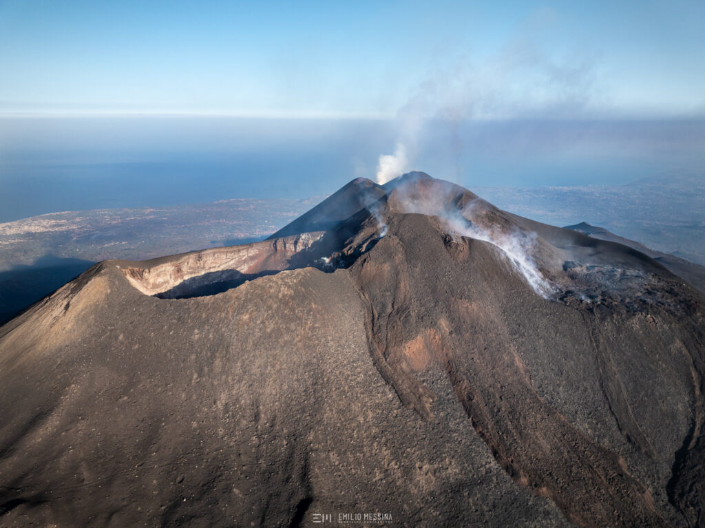
Overall, during the period in question, the summit craters were affected by a degassing activity that varied according to the craters. In particular, the North-East crater is affected by an intense impulsive degassing generated by a vent located at the bottom. The Voragine and Bocca Nuova craters present an intense and extensive degassing, especially along the western edge of the Bocca Nuova.
Finally, the degassing activity of the Southeast Crater was accompanied by occasional and light emissions of very diluted red-brown ash from the eastern vent.
SEISMOLOGY
Seismicity: During the week in question, no seismic event of magnitude equal to or greater than 2 was recorded.
Volcanic tremor: During the week in question, the average amplitude of the volcanic tremor did not show significant variations compared to what was observed the previous week, remaining between the medium and low level. The locations of the centroids of the sources of the volcanic tremor concerned the areas of the Northeast Crater and the Voragine Crater, in a depth range mainly between 2700 and 3000 m above mean sea level.
Source : INGV
Photo : Emilio Messina Photography by FB ( 16/08/2024 )
Indonesia , Lya :
Mount Iya Activity Level Increased from Level II (WASPADA) to Level III (SIAGA) on November 5, 2024 at 18:00 WITA
The volcano (G.) Iya is administratively located in Ende Regency, East Nusa Tenggara Province and geographically, its summit is located at 8,897° S. Latitude, 121,645° E. Longitude and has a height of 637 m above sea level.
The latest developments in the activity of G. Iya until November 5, 2024 are as follows:
From October 1, 2024 to November 4, 2024, the volcano was clearly visible until it was covered by fog. Visually, the smoke from the crater was observed to be white and gray with light to moderate intensity and a height of approximately 10 to 300 meters from the summit. Based on visual data taken using a drone over the crater on November 5, 2024, a thin gray smoke from the crater was observed approximately 50 m high above the summit.
Seismicity recorded between October 1, 2024 and November 4, 2024:
28 harmonic tremors,
77 non-harmonic tremors,
2 « Tornillo » earthquakes,
3 low-frequency earthquakes,
2 shallow volcanic earthquakes,
173 deep volcanic earthquakes,
63 local tectonic earthquakes,
56 distant tectonic earthquakes,
Continuous tremor, Amplitude 1 to 1.8 mm, dominant value 1.5 mm.
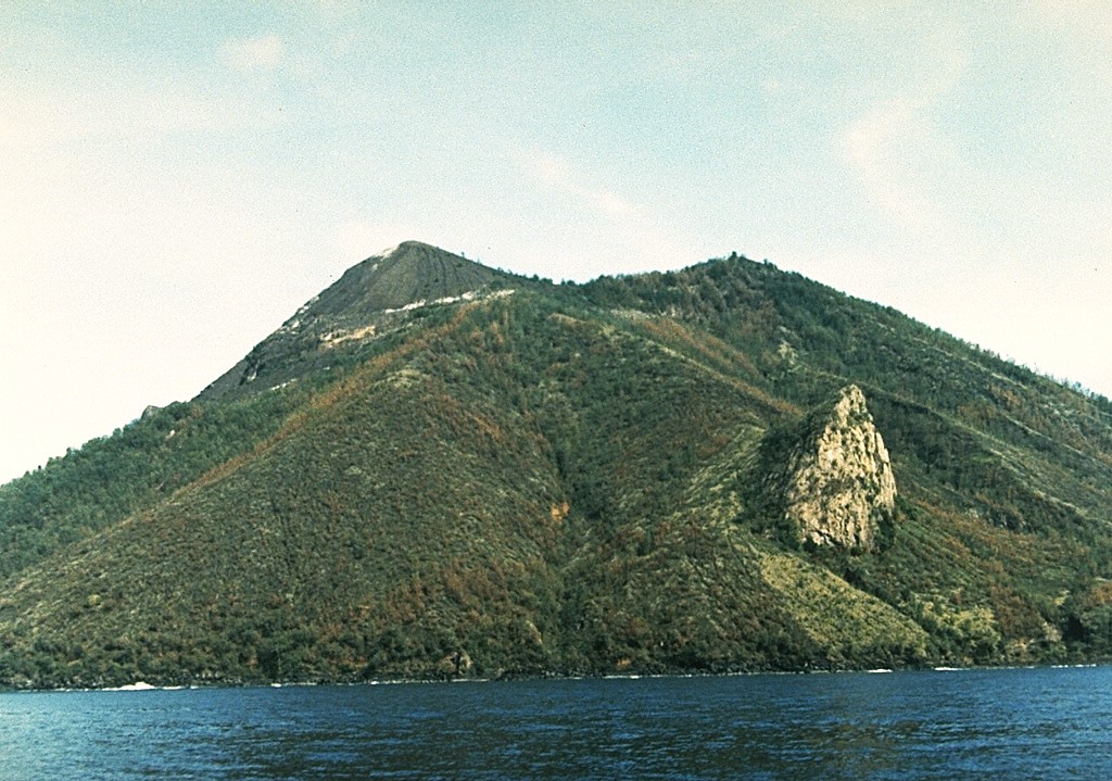
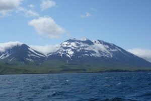
An ancient lava dome forms the light-coloured feature on the right on the southeastern flank of Gunung Iya. It is part of a southernmost cone chain forming a peninsula on the south-central coast of Flores Island.
The seismicity of G. Iya during this period is dominated by harmonic tremor, non-harmonic tremor, continuous tremor and volcanic earthquakes.
The increase in seismicity of G. Iya is marked by an increase in deep volcanic earthquakes since August 2024. This significant increase in seismicity indicates an increase in pressure within the body of G. Iya due to increased magmatic activity, or migration of magma from deep to shallower levels. This triggers shallow earthquakes that can cause eruptions.
Shallow earthquakes on G. Iya, namely seismic tremors, began to be recorded on October 16, 2024, which indicates a movement or increase in magma pressure towards the surface.
Caution should be exercised if a large-magnitude tectonic earthquake is recorded around G. Iya, as it can potentially affect volcanic activity.
Based on the results of visual and instrumental monitoring, G. Iya shows an increase in activity and potential hazard threats. Therefore, the activity level of G. Iya has been increased from level II (WASPADA) to level III (SIAGA), starting from November 5, 2024 at 18:00 WITA with recommendations tailored to the latest potential hazard threats.
Source : PVMBG
Photo : Ruska Hadian, 1985 (Volcanological Survey of Indonesia).
Colombia , Chiles / Cerro Negro :
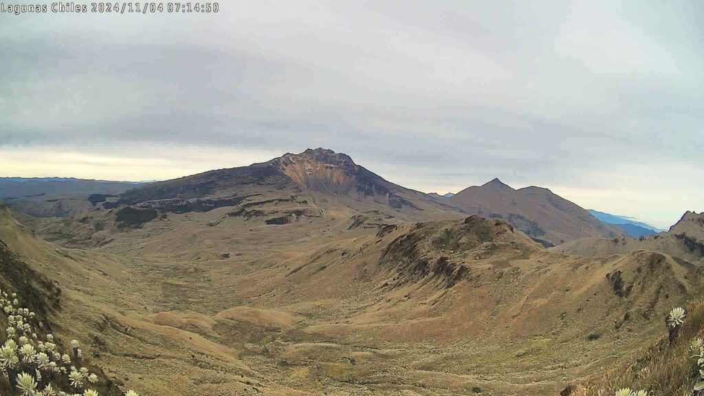
From the monitoring of the activity of the Chiles and Cerro Negro volcanoes, the Colombian Geological Survey (SGC), an entity attached to the Ministry of Mines and Energy, reports that:
For the week between October 29 and November 4, 2024, the seismic activity was similar to that recorded the previous week, the dominant seismicity continues to be that related to the fracture of the rock within the volcano. However, the recording of earthquakes related to the movement of fluids is still present.
The fracture seismicity was mainly located near the Chiles volcano in a North-South corridor that extends for approximately 3.5 km, with depths reaching 5 km from its summit (4,700 m). The magnitude value of the most energetic earthquake was 1.5 and no felt earthquakes were reported during the week evaluated.
Instruments that record volcanic deformation and remote satellite sensors continue to show changes related to an inflationary process in the volcanic area.
Based on the above, the SGC recommends closely monitoring the evolution through the weekly bulletins and other information published through our official channels, as well as the instructions of local and departmental authorities and the National Disaster Risk Management Unit (UNGRD).
Volcanic activity remains in yellow alert status: active volcano with changes in the behavior of the base level of the monitored parameters and other manifestations.
Source et photo : SGC.

