November 11 , 2022.
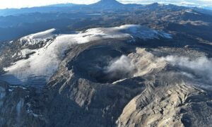
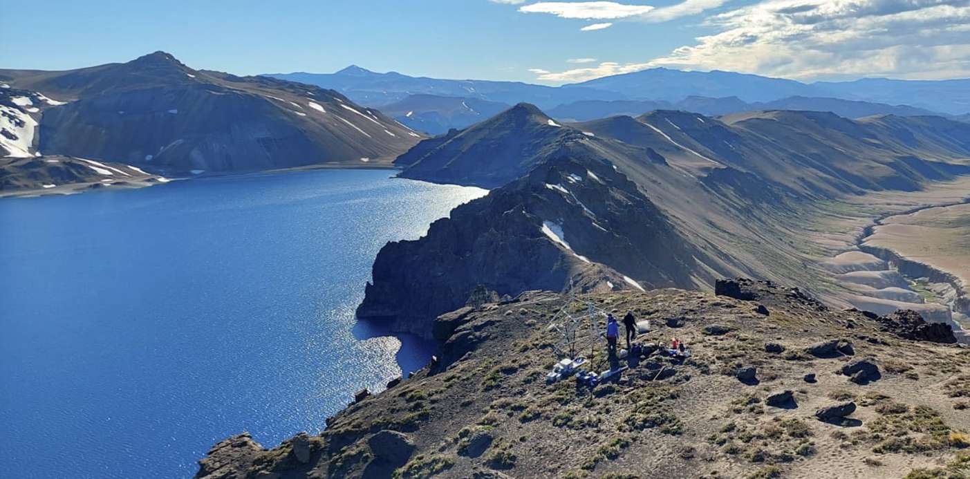
Chile , Laguna del Maule :
Seismology
The seismological activity of the period was characterized by the recording of:
1649 VT type seismic events, associated with rock fracturing (Volcano-Tectonics). The most energetic earthquake presented a value of local magnitude (ML) equal to 2.1, located 13.8 km south-south-east of the volcanic edifice, with a depth of 1.0 km per relative to the crater.
27 LP-type seismic events, associated with fluid dynamics within the volcanic system (Long Period). The size of the largest earthquake estimated from the reduced displacement parameter (RD) was equal to 2 cm2.
2 TR-type seismic events, associated with sustained dynamics over time of the fluids inside the volcanic system (TRemor).
2 HB-type seismic events, associated with both rock fracturing and fluid dynamics within the volcanic system (HyBrid). The most energetic earthquake presented a reduced displacement value (RD) of 532 cm2 and a local magnitude value (ML) equal to 3.1, located 16.7 km south-southeast of the volcanic edifice, with a depth of 7.3 km in reference to the crater.
Fluid Geochemistry
No anomalies were reported in the emissions of sulfur dioxide (SO2) into the atmosphere in the area near the volcanic complex, according to data published by the Tropospheric Monitoring Instrument (TROPOMI) and the Ozone Monitoring Instrument (OMI) Sulfur Dioxide Group.
Satellite thermal anomalies
During the period, no thermal alert was recorded in the area associated with the volcanic complex, according to the analytical processing of Sentinel 2-L2A satellite images, in combination with false color bands.
Geodesy
According to the data provided by 4 GNSS stations and 2 inclinometer stations, which make it possible to measure the deformation of the complex, it is observed that the historically recorded inflationary process is maintained, but with a slight decrease in the deformation rates. The maximum uplift rate continues to be recorded at the GNSS MAU2 station, at the center of the geodetic network and to the southwest of the lagoon, estimating displacements with a maximum amplitude of 1.5 cm/month in the vertical component.
Based on the above, it is concluded that the Laguna del Maule volcanic complex continues the inflationary process recorded since 2012, with slight changes in the acceleration and deceleration of deformation rates, but with a sustained upward trend. .
Activity remained at levels considered low, suggesting stability of the volcanic system. The volcanic technical alert is maintained at:
GREEN TECHNICAL ALERT: Active volcano with stable behavior – There is no immediate risk.
Source : Sernageomin.
Photo : Neuqueninforma.gob.ar
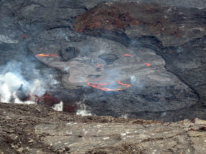
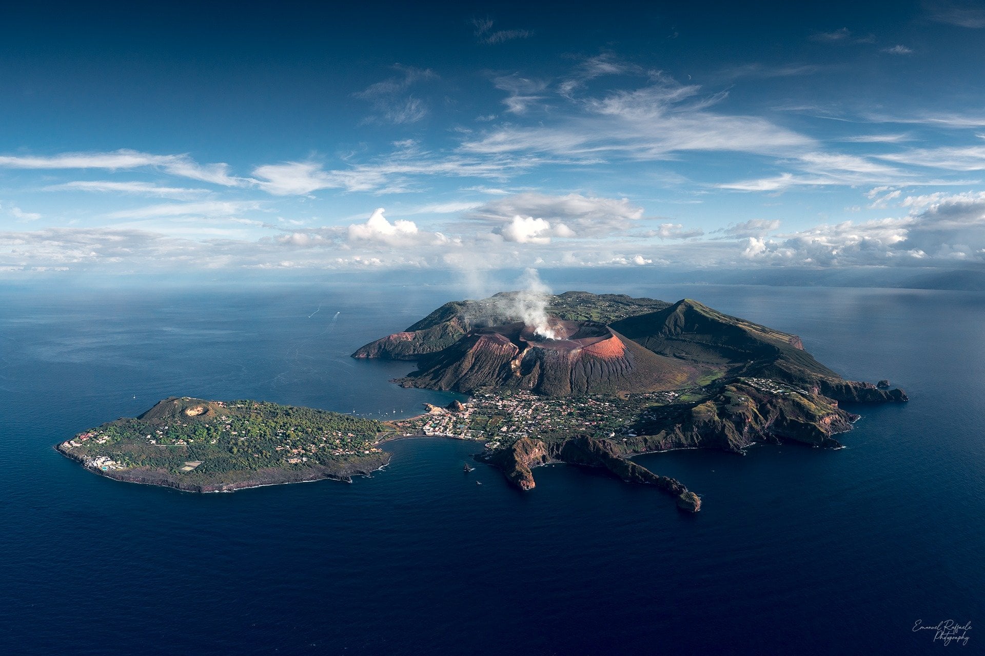
Italy , Vulcano :
WEEKLY BULLETIN, from October 31, 2022 to November 06, 2022. (issue date November 08, 2022)
ACTIVITY STATUS SUMMARY
In the light of the surveillance data, it is highlighted:
1) Temperature of the crater fumaroles: Along the upper edge the maximum emission temperature persists with stable and high values, around 373°C.
2) CO2 flux in the crater area: The CO2 flux in the crater area remains at medium-high values.
3) SO2 flux in the crater area: stable at a moderately medium-high level
4) Geochemistry of fumarolic gases: There are no updates.
5) CO2 fluxes at the base of the La Fossa cone and in the Vulcano Porto area: The CO2 fluxes recorded in the Rimessa, C. Sicilia sites always show values above background levels. A slight increase is observed on the site of C. Sicilia. The P4max site displays average values, while at the Faraglione site there are values close to the background level.
6) Geochemistry of thermal aquifers: In the Camping Sicilia well, still high temperature values and conductivity values at medium-low levels are recorded.
There are no updates on the level and conductivity values measured in the waters of the Bambara well.
7) Local seismicity: Low occurrence rate of local micro-seismicity.
8) Regional seismicity: No regional seismic activity
9) Deformations – GNSS: The data from the GNSS network does not show any significant variations.
10) Deformations – Inclinometry: The network of inclination sensors does not show any significant variations.
11) Gravimetry: There are no significant variations.
12) Other Notes: Mobile GNSS. The GNSS mobile network acquires and transmits movements in real time at a frequency of 1 Hz. The historical series acquired so far do not show significant variations around the Porto di Levante area.
CO2 FLOW IN THE CRATER AREA
The CO2 flux values on the ground in the upper zone of the VSCS station remain high around 8000 g m-2 d-1. No significant change is observed compared to the previous week, and the values remain anomalous compared to the background values evaluated during the last decade of measurements.
CO2 FLOW AT THE BASE OF LA FOSSA CONE AND IN THE VULCANO PORTO AREA
CO2 fluxes at the base of the crater at the Rimessa site show stable values compared to last week, but still higher than those of the background level. In the sites of C. Sicilia and Palizzi (P4max) during the last week, the flow shows a tendency to increase slightly always on average values; in the Faraglione site, there are values close to the background level.
Source : INGV.
Photo : Emanuel Raffaele Photography
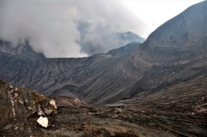
Colombia , Purace / Los Coconucos Volcanic Range :
Weekly bulletin of the activity of the Puracé volcano – Los Coconucos volcanic chain
The activity level of the volcano continues at the yellow Activity Level or (III): changes in the behavior of volcanic activity.
From the analysis and evaluation of the information obtained through the monitoring network of the Puracé volcano – Los Coconucos volcanic chain, during the week of November 1 to 7, 2022, the COLOMBIAN GEOLOGICAL SERVICE – Volcanological and Seismological Observatory of Popayan reports that:
With regard to the seismic activity recorded, there were no notable variations in terms of the number of events and the energy released. During the week, 840 seismic events were recorded, of which 74 were associated with rock fracturing processes (VT type) and 766 with fluid dynamics in volcanic conduits.
The geodetic network of GNSS (Global Navigation Satellite System) stations monitoring ground deformation continues to record a process related to inflation.
By monitoring the surface activity with the images obtained during the week thanks to the Mina, Lavas Rojas, Cerro Sombrero and Curiquinga web cameras, a degassing of the volcanic system was highlighted, with a white column oriented preferentially towards the North -West.
Regarding the monitoring of volcanic gases, sulfur dioxide (SO2) measurements continue to show changes, with a maximum flow of 622 t / day for the week evaluated. The other instruments measuring the concentration of carbon dioxide (CO2) and radon gas (222Rn) in the volcanic influence zone recorded increases for the period evaluated, which is normal in active volcanic systems.
Sensors monitoring electromagnetic fields and infrasonic waves did not record variations associated with changes in volcanic activity.
It is concluded from the above that variations in volcanic activity continue to be recorded, consistent with the behavior expected at activity level III (yellow level), which could evolve towards states of greater activity.
Source : Ingeominas.
Photo : colparques.net
Indonesia , Anak Krakatau :
Mount Anak Krakatau erupted on Friday, November 11, 2022 at 10:47 a.m. WIB with an ash column height observed at ± 200 m above the peak (± 357 m above sea level). It is observed that the ash column is gray to black with a thick intensity, oriented towards the North-East. This eruption was recorded on a seismograph with a maximum amplitude of 49 mm and a duration of 96 seconds.

SEISMICITY OBSERVATION
1 earthquake eruption/explosion with an amplitude of 49 mm, and a duration of 96 seconds.
1 low frequency earthquake with an amplitude of 16 mm and a duration of 5 seconds.
Continuous tremor with an amplitude of 1-2 mm, dominant value 1 mm.
RECOMMENDATION
Communities/visitors/tourists/climbers should not approach Mount Anak Krakatau or engage in activities within 5 km of the active crater.
Source et photo : Magma Indonésie .
Hawaii , Mauna Loa :
19°28’30 » N 155°36’29 » W,
Summit Elevation 13681 ft (4170 m)
Current Volcano Alert Level: ADVISORY
Current Aviation Color Code: YELLOW
Activity Summary:
Mauna Loa is not erupting and there are no signs of an imminent eruption at this time. Monitoring data show no significant changes within the past 24 hours. Mauna Loa continues to be in a state of heightened unrest as indicated by increased earthquake activity and inflation of the summit. The current unrest is most likely being driven by renewed input of magma 2–5 miles (3–8 km) beneath Mauna Loa’s summit.
Observations:
During the past 24 hours, HVO detected 44 small-magnitude (below M3.0) earthquakes 2–3 miles (2–5 km) below Mokuʻāweoweo caldera and 4–5 miles (6–8 km) beneath the upper-elevation northwest flank of Mauna Loa. Both of these regions have historically been seismically active during periods of unrest on Mauna Loa. A M3.6 earthquake also occurred northwest of the summit yesterday at 6:21 p.m.
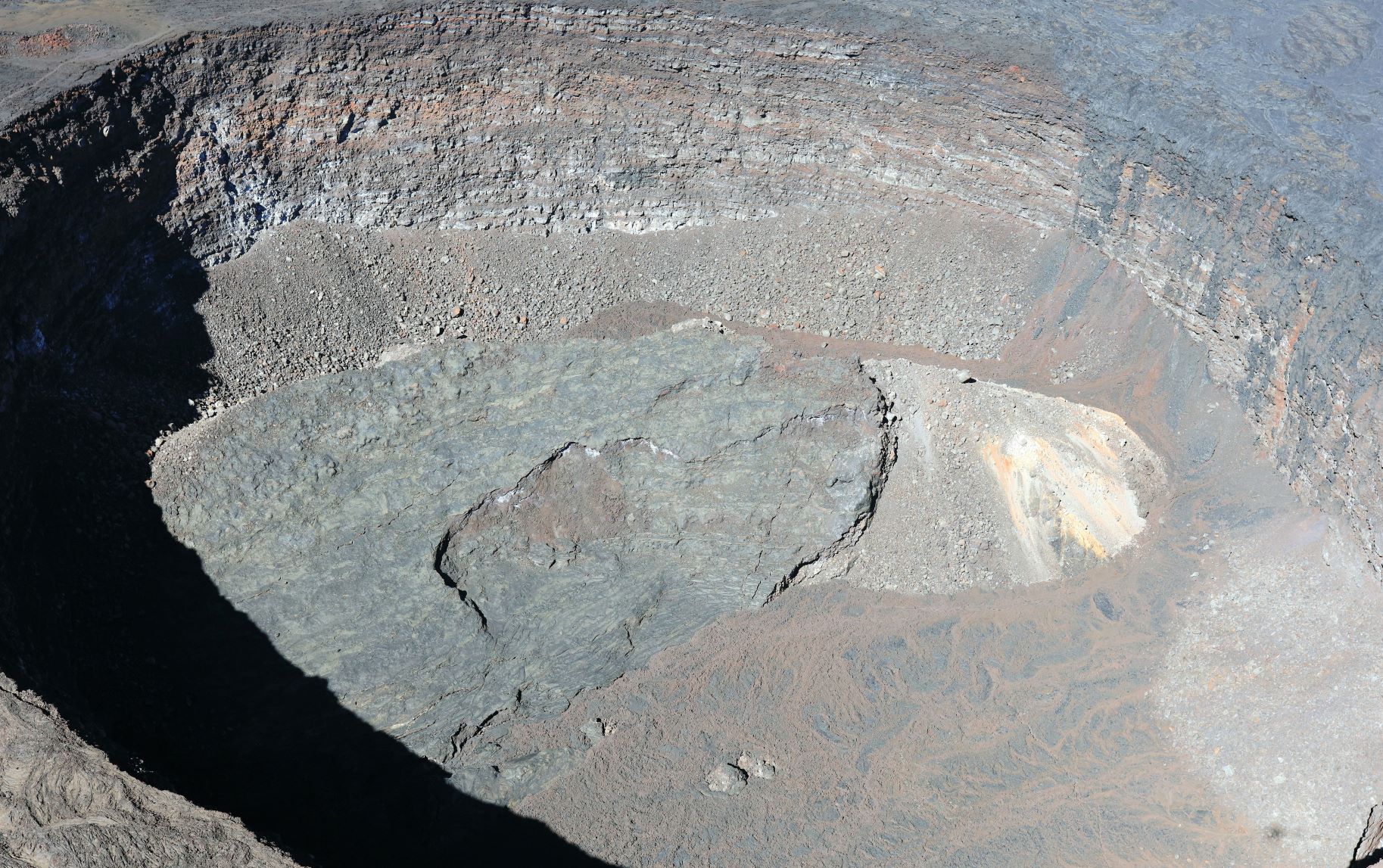
![]()
Lua Poholo, a pit crater located on the northern side of Moku‘āweoweo, Mauna Loa’s summit caldera, near where the Northeast Rift Zone meets the summit caldera. Part of the pre-collapse floor of the pit crater remained intact as the pit crater formed, and is visible as the slanted slab at the base. Younger lava flows that draped over the edge of the pit crater are visible on the right side of the image, and older fissure vents are visible in the upper left part of the image.
Global Positioning System (GPS) instruments at the summit and on the flanks of Mauna Loa continue to measure inflation at rates elevated since mid-September. However, tiltmeters at the summit are not showing significant surface deformation over the past week.
Concentrations of sulfur dioxide (SO2), hydrogen sulfide (H2S), and carbon dioxide (CO2), as well as fumarole temperatures, remain stable at the summit and at Sulphur Cone on the upper Southwest Rift Zone. Webcam and thermal camera views have shown no changes to the volcanic landscape on Mauna Loa over the past week.
Source : HVO.
Photo : USGS / K. Mulliken.