November 19 , 2021.
Spain / La Palma : Cumbre Vieja
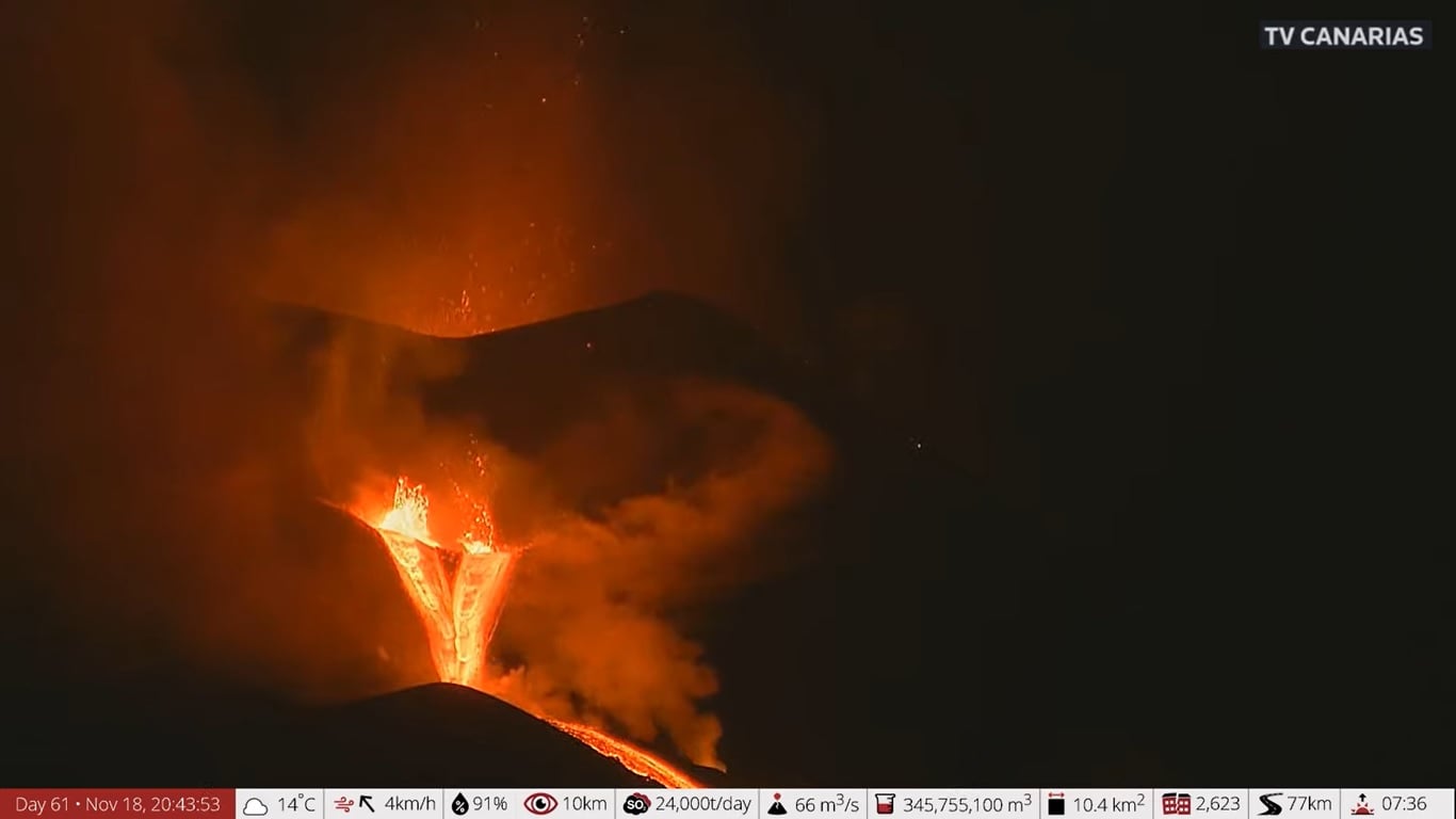
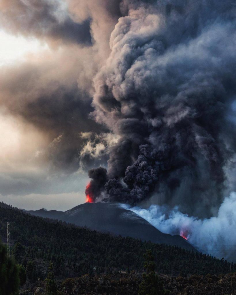
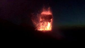
November 18, 2021 11:00 UTC. Eruptive activity continues on La Palma.
Since the last declaration, 230 earthquakes have been located in the area affected by the volcanic reactivation on the island of La Palma, 22 of which were felt by the population. This is the maximum number of localized daily earthquakes since the start of the eruption.
The seismicity is located in the same areas as the previous days under the central area of Cumbre Vieja and divided into two groups depending on the depth, a first group at a depth of 10-15 km and a second group with depths greater than 30 km.
The biggest earthquakes of this period were two earthquakes of 4.7 and 4.8 mbLg at 12:33 UTC yesterday recorded with a difference of a few seconds between them, both located at depths greater than 35 km. The maximum intensity associated with these earthquakes was IV (EMS).
The volcanic tremor signal, which had increased since November 16, dropped sharply around 6:00 p.m., coinciding with the reestablishment of summit emission activity.
The island’s network of permanent GNSS stations shows a gradual slowing of the deformation towards the south at station LP03, which is closest to the eruptive centers.
In the rest of the stations, the slight deflation possibly linked to the deep seismicity has stabilized.
In view of the image calibrated at 09:02 UTC, a column height of 3,500 m is estimated, and an ash cloud of 3,000 m in a southwest direction.
The height of the cone is measured by obtaining a value of 1,129 m at sea level.
Today at 10:45 UTC, due to the increase in the height of the eruptive column, IGN issued a new VONA (Volcano Observatory Notice for Aviation) message informing that the maximum height of the eruptive column is 3500 m above sea level.
Experts from the Canary Islands Volcanic Emergency Plan (Pevolca) predict that this Friday the intensity of precipitation in La Palma will decrease. The most relevant data they provided in their declaration:
– The volcanic tremor has started to descend again in the Cumbre Vieja region – it is at a low level – and follows the downward trend in sulfur dioxide emission, with estimated values between 16,000 and 32,000 tonnes per day, which are combined with explosive Strombolian « episodes », with the emission of a large quantity of pyroclasts, especially yesterday afternoon.
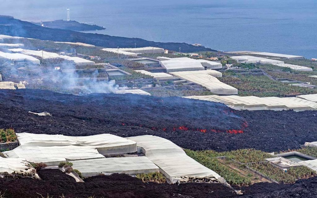
– The latest data available on the affected area is estimated at 1,040.54 hectares, or 3.37 more than in the previous update. The lava delta reaches 42.87 hectares.
– Experts detect a slight downward trend in seismicity.
– Weather forecasts indicate that the winds will shift to the west for the next few hours, so the concentration of ash could affect the operation of La Palma airport.
Sources : IGN es , El Pais .
Photos : gsantosphoto, Volcanes y Ciencia Hoy , TV Canarias .
Italy , Vulcano :
This article is based on information provided by the Monitoring Center of the Aeolian Islands and the INGV sections of Palermo and Catania-Osservatorio Etneo.
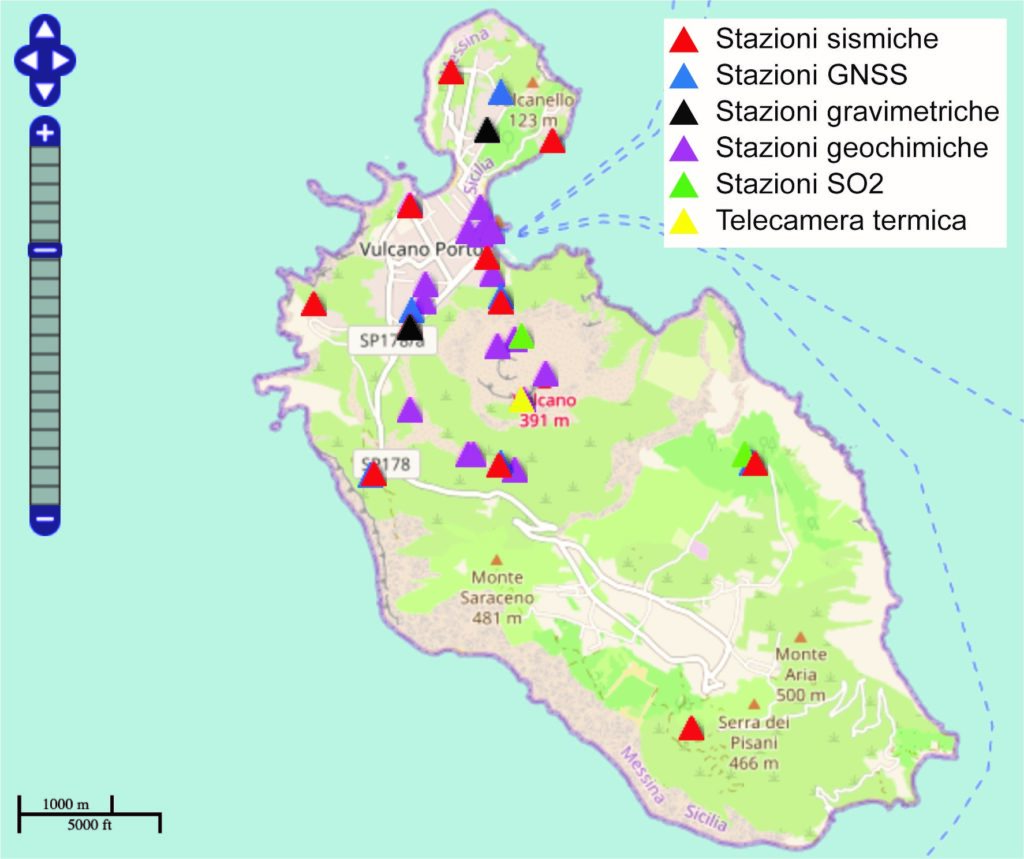
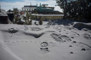
Over the past summer, particularly from September 2021, INGV monitoring systems have measured significant variations in certain geophysical and geochemical signals on Vulcano (Aeolian Islands). Following these changes, from October 1, 2021, the Department of Civil Protection ordered the alert level to change from green to yellow for the island.
The yellow alert level provides for, in addition to a series of civil protection actions, the strengthening of monitoring and surveillance activities.
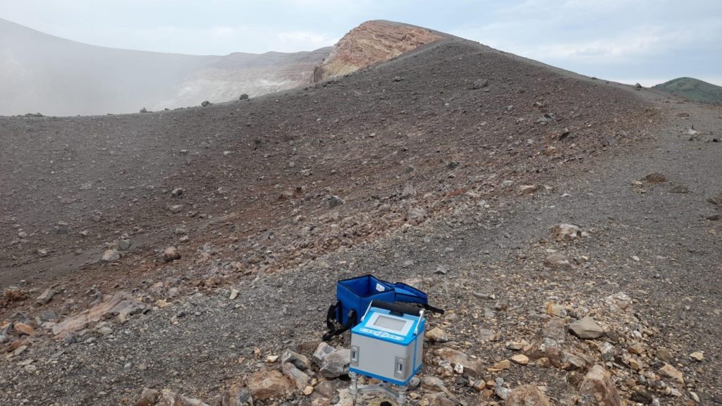
The INGV, with the contribution of several coordinated sections of the Monitoring Center of the Aeolian Islands, therefore created new networks and developed the existing networks, installing new stations for continuous measurement of various parameters and increasing detection activities on field. He also increased the number, frequency and extent of geochemical sampling and conducted other permanent surveys of other parameters.
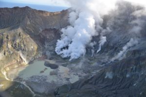
During the month of October, a campaign of thermal surveys and by LIDAR drones was carried out in collaboration with the University La « Sapienza » of Rome, for the study of the morphological and thermal variations of the summit area and the slopes of the northeast sector of the Cone of La Fossa. A measurement campaign was also carried out on the geodesic cornerstones of the GNSS network on the islands of Lipari and Vulcano, with high details on the crater of La Fossa and on the area of the fumaroles above the Forge Vecchia. Also in October, researchers from INGV-Osservatorio Vesuviano carried out a magnetotelluric prospecting campaign on the island.
INGV staff will set up new mobile GNSS stations, at the same sites where gravimeters have already been positioned, in order to integrate gravity data and gain more detail in the deformation observation near the crater.
Source and photos : INGV Vulcani.
Iceland , Fagradalsfjall :
Activity status of Fagradalsfjall, November 17, 2021.
From September 18 to today, no lava flows in Fagrdalsfjall crater have been seen. The gas is still measured, but in very small amounts.
Accompanying the eruption, the land around the volcano was sagging, possibly due to the magma flowing from the magma reservoir. At the end of August, we saw on the GPS counters that the sag was starting to reverse, and from mid-September the sag started to turn into inflation. The lift is very small, only about 2 cm where it is greatest. The latest satellite data show that the swelling of the land reaches the north of Keilir, south of the eruptions. The model’s calculations indicate that its source is at great depths and the most likely explanation is considered to be the accumulation of magma.
It is not unlikely that the powerful earthquake swarm that began in late September at the southern end of Keilir and lasted for about a month, was linked to inflation, although no deformation of the surface has occurred. was observed in connection with the eruption, which would have been a sign that the magma had approached the surface.
It is not uncommon for magma to accumulate under volcanic systems as a result of eruptions. This current inflation should not be an indication that magma will reach the surface in the near future, and it is entirely possible that this is a scenario that will take years or decades, but it is difficult to predict. predict its progress at this point.
Developments in Fagradalsfjall will continue to be closely monitored.
Source : Vedur is
Chile , Nevados de Chillan :
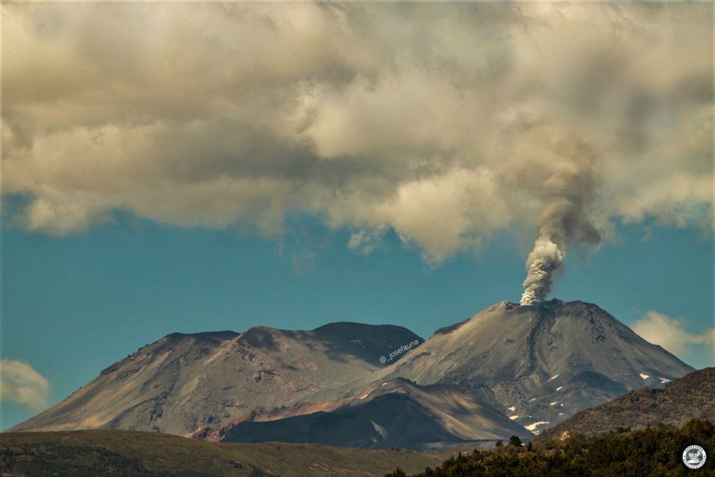
Special Report on Volcanic Activity (REAV), Ñuble region, Nevados de Chillán volcanic complex, November 17, 2021, 10:20 a.m. local time (Continental Chile).
The National Service of Geology and Mines of Chile (Sernageomin) publishes the following PRELIMINARY information, obtained thanks to the monitoring equipment of the National Volcanic Monitoring Network (RNVV), processed and analyzed at the Volcanological Observatory of the Southern Andes ( Ovdas):
On Wednesday November 17, 2021, at 9:56 a.m. local time (12:56 p.m. UTC), the monitoring stations installed near the Nevados de Chillán volcanic complex recorded a particular signal (occurrence of seismicity in a short period of time associated with the fracturing of rocks (volcano-tectonic type VT) in the volcanic system.
The characteristics of earthquakes after their analysis are as follows:
TIME OF ORIGIN: 09:56 a.m. local time (12:56 a.m. UTC)
LATITUDE: 36.843 ° S
LONGITUDE: 71.387 ° W
DEPTH: 3.6 km
LOCAL MAGNITUDE: 3.3 (Ml)
OBSERVATIONS:
At the time of this report, no surface activity associated with this event has been observed. Approximately 64 events of similar characteristics were recorded with lower energy.
The volcanic technical alert remains at the Yellow level.
Source : Sernageomin.
Photo : Josefauna.
Hawaii , Kilauea :
19°25’16 » N 155°17’13 » W,
Summit Elevation 4091 ft (1247 m)
Current Volcano Alert Level: WATCH
Current Aviation Color Code: ORANGE
Activity Summary:
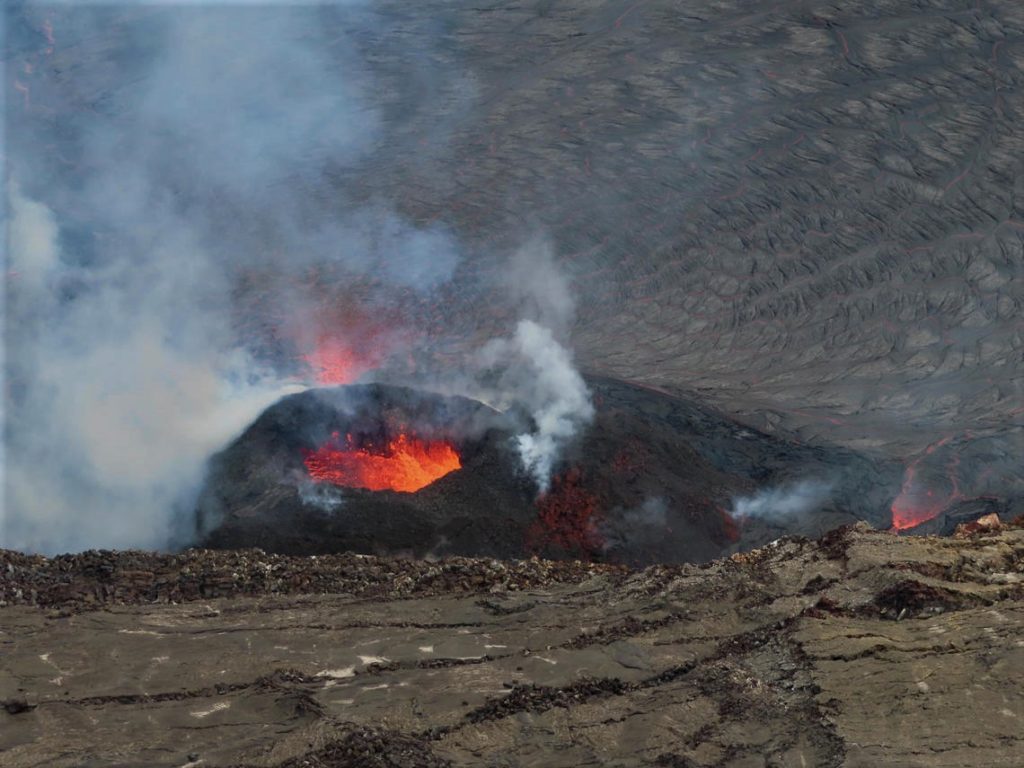
Kīlauea volcano is erupting from a single vent in the western wall of Halemaʻumaʻu crater. As of this morning, November 18, 2021, lava is erupting at the summit. All lava activity is confined within Halemaʻumaʻu crater in Hawai‘i Volcanoes National Park. Seismic activity and volcanic gas emission rates remain elevated.
Summit Observations:
Sulfur dioxide (SO2) emission rates remain elevated, with an emission rate for November 9, 2021, of approximately 2600 tonnes per day. Summit tiltmeters overall recorded neutral tilt over the past day. Seismicity remains stable. Earthquake activity remains below background and volcanic tremor remains elevated since the beginning of the eruption.
A view of the active west vent within Halema‘uma‘u crater, at the summit of Kīlauea, on November 15, 2021. A new flow has developed on the south side of the west vent cone (right side of photo), with lava moving from a source near the base of the cone toward the lava lake. Photo taken at 12:55 p.m. HST from the western rim of the crater.
Halemaʻumaʻu Lava Lake Observations:
Lava continues to erupt from a single vent in the western wall of Halemaʻumaʻu crater, while the eastern edge of the lake continues to advance onto the lowest of the exposed down-dropped caldera floor blocks. The western end of the lake showed a maximum elevation of approximately 803.5 meters (2637 ft) above sea level by HVO’s permanent laser rangefinder this morning, and a total increase of about 60 meters (197 ft) since lava emerged on September 29. Webcams show spatter and ponded lava within the west vent, an area of active lava at the surface of the lava lake, and sporadic oozes of lava along the cooler outer lake margins. The total erupted volume since the beginning of the eruption was estimated to be about 30 million cubic meters (7.8 billion gallons) on November 16.
Source : HVO.
Photo : USGS / J.M. Chang.

