September 4 , 2026.
Vanuatu , Ambae :
The Vanuatu Meteorology and Geohazards Department (VMGD) reported that the eruption at Ambae continued during 21-26 August, with explosive activity producing tall ash plumes on 25 August. Continuous plumes of gas, steam, and ash were visible in satellite and webcam images drifting NW during 21-24 August and drifting NE on 25 August. Sulfur dioxide gas emissions were at moderate to high levels, and seismicity indicated high levels of activity. Thermal anomalies were identified in satellite data. The Wellington Volcanic Ash Advisory Center (VAAC) reported that ash plumes were significantly higher during 25-26 August. The eruption escalated at 20h40 on 25 August, and by 21h24 an ash plume had risen to 16.5 km (54,000 ft) a.s.l. and was drifting E based on satellite images.
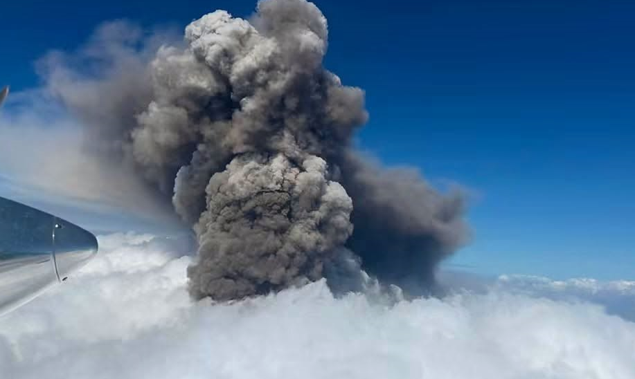
The ash plume altitude decreased to 15.2 km (50,000 ft) a.s.l. by 2153 and to 12.8 km (42,000 ft) a.s.l. by 0013 on 26 August. A strong sulfur dioxide signal was also detected. Ash plumes continued to be detected during the rest of the day on 26 August rising 3-4.6 km (10,000-15,000 ft) a.s.l. The Alert Level remained at 3 (on a scale of 0-5), and the public was warned to stay outside of Danger Zone B, defined as a 3-km radius around the active vents in Lake Voui, and to stay away from drainages during heavy rains.
Sources: Vanuatu Meteorology and Geohazards Department (VMGD), Wellington Volcanic Ash Advisory Center (VAAC) , GVP.
Photo : via Vulcaniya
Indonesia , Anak Krakatau :
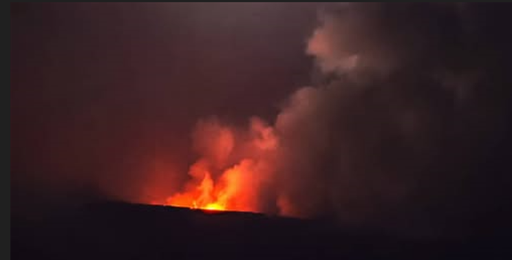
The Pusat Vulkanologi dan Mitigasi Bencana Geologi (PVMBG) reported ongoing eruptive activity at Krakatau during 20-26 August. Daily ash-and-gas plumes that were a mixture of white, gray, and black colors rose 100-400 m above the summit and drifted mainly NW, W, and SW. Several webcam images showed incandescent material being ejected above the crater. The Alert Level remained at 3 (on a scale of 1-4) and the public was advised to stay 3 km away from summit.
Seismic Observations
19 gust earthquakes with amplitudes ranging from 21 to 77 mm and durations from 21 to 50 seconds.
34 harmonic earthquakes with amplitudes ranging from 17 to 84 mm and durations from 12 to 119 seconds.
14 low-frequency earthquakes with amplitudes ranging from 12 to 38 mm and durations from 6 to 35 seconds.
36 hybrid/multiphase earthquakes with amplitudes ranging from 12 to 88 mm and durations from 7 to 27 seconds.
1 continuous tremor event with an amplitude of 1 to 20 mm (dominant amplitude of 1 mm).
Recommendations
The public, visitors, tourists, and hikers should not approach Mount Anak Krakatau or engage in any activities within a 3 km radius of the crater.
Sources : Pusat Vulkanologi dan Mitigasi Bencana Geologi (PVMBG, également connu sous le nom de CVGHM), GVP.
Photo : via vulkane.net
Philippines , Kanlaon :
The Philippine Institute of Volcanology and Seismology (PHIVOLCS) reported continuing eruptive activity at Kanlaon during 19-26 August. The seismic network recorded 0-8 daily volcanic earthquakes; the counts included three periods of tremor during 24-25 August, lasting 21 minutes to five hours and 42 minutes. Sulfur dioxide emissions ranged from 1,244 to 2,092 tonnes per day. Volcanic emissions rose as high as 300 m above the summit and drifted NNE, ENE, and E on most days; observations were obscured on 19 August.
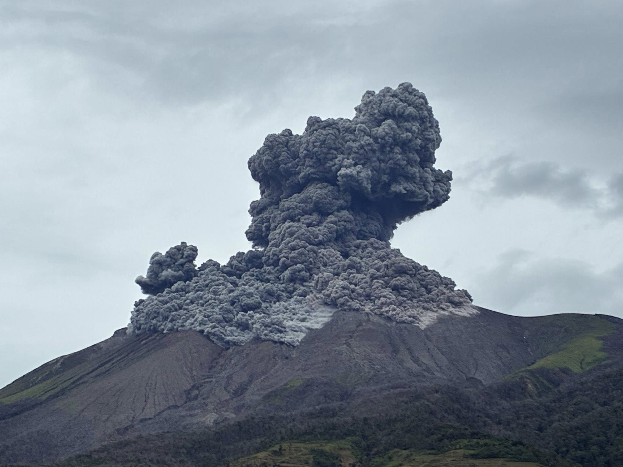
Ash emissions were periodically recorded during the week. At 05h24 on 20 August a grayish ash emission rose 200 m above the crater rim and drifted E. A total of five ash emissions were recorded on 22 August, each lasting 17 minutes to nearly five hours. At least two of the plumes, at 11h23 and 15h11, were voluminous, rose 150 m above the crater rim, and drifted SE. The webcam recorded hot emissions during 23h05-23h59. Two grayish ash emissions on 23 August lasted 33 minutes and nearly two hours, rose 150 m above the crater rim, and drifted SE. On 24 August there were three ash emissions, each lasting 23 minutes to six hours. One of the ash plumes rose 200 m above the crater rim and drifted E at 05h51. A grayish ash emission lasted for 30 seconds and drifted ENE on 25 August. The Alert Level remained at 2 (on a scale of 0-5); the public was warned to stay out of the 4-km-radius Permanent Danger Zone (PDZ) and pilots were advised to avoid flying close to the summit.
Sources: Philippine Institute of Volcanology and Seismology (PHIVOLCS) , GVP.
Photo : Leah Pahayahay Martinez , (Archive )
Japan , Sakurajima :
The Japan Meteorological Agency (JMA) reported ongoing eruptive activity at Minamidake Crater (Aira Caldera’s Sakurajima volcano) during 17-24 August. Crater incandescence was visible in nighttime webcam images. An eruptive event at 20h29 on 17 August generated an ash plume that rose as high as 1.9 km above the summit. An ash plume from an explosion at 05h38 on 19 August rose as high as 1.3 km above the summit and drifted NW. Very small eruptive events were recorded during 21-24 August. The Alert Level remained at 3 (on a 5-level scale), and the public was warned to be cautious within 1 km of both the Minimadake and Showa craters.
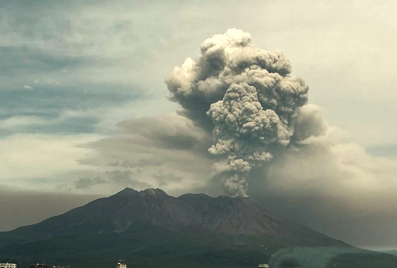
The Aira caldera in the northern half of Kagoshima Bay contains the post-caldera Sakurajima volcano, one of Japan’s most active. Eruption of the voluminous Ito pyroclastic flow accompanied formation of the 17 x 23 km caldera about 22,000 years ago. The smaller Wakamiko caldera was formed during the early Holocene in the NE corner of the caldera, along with several post-caldera cones. The construction of Sakurajima began about 13,000 years ago on the southern rim and built an island that was joined to the Osumi Peninsula during the major explosive and effusive eruption of 1914. Activity at the Kitadake summit cone ended about 4,850 years ago, after which eruptions took place at Minamidake. Frequent eruptions since the 8th century have deposited ash on the city of Kagoshima, located across Kagoshima Bay only 8 km from the summit. The largest recorded eruption took place during 1471-76.
Sources: Japan Meteorological Agency (JMA) , GVP.
Photo : Alex Tor
Chile , Villarica :
The Servicio Nacional de Geología y Minería (SERNAGEOMIN) reported that several episodes of minor explosive activity in Villarrica’s summit crater were observed beginning at 02h39 on 21 August when a plume rose 40 m above the crater rim. Incandescence from the lava lake was visible overnight during 21-22 August. SERNAGEOMIN and Servicio Geológico Minero Argentino (SEGEMAR) noted that at 12h32 on 22 August a small ash plume rose 60 m above the crater rim and drifted NE, based on webcam images. The Volcanic Alert Level remained at Green (the lowest level on a four-level scale).
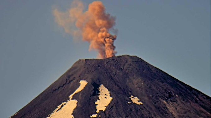
The glacier-covered Villarrica stratovolcano, in the northern Lakes District of central Chile, is ~15 km south of the city of Pucon. A 2-km-wide caldera that formed about 3,500 years ago is located at the base of the presently active, dominantly basaltic to basaltic andesite cone at the NW margin of a 6-km-wide Pleistocene caldera. More than 30 scoria cones and fissure vents are present on the flanks. Plinian eruptions and pyroclastic flows that have extended up to 20 km from the volcano were produced during the Holocene. Lava flows up to 18 km long have issued from summit and flank vents. Eruptions documented since 1558 CE have consisted largely of mild-to-moderate explosive activity with occasional lava effusion. Glaciers cover 40 km2 of the volcano, and lahars have damaged towns on its flanks.
Sources: Servicio Nacional de Geología y Minería (SERNAGEOMIN), Servicio Geológico Minero Argentino (SEGEMAR), GVP.
Photo : Sernageomin ( archive).