September 24 , 2026.
Hawaii , Kilauea :
HAWAIIAN VOLCANO OBSERVATORY DAILY UPDATE , U.S. Geological Survey
Wednesday, September 23, 2026, 8:23 AM HST (Wednesday, September 23, 2026, 18:23 UTC)
19°25’16 » N 155°17’13 » W,
Summit Elevation 4091 ft (1247 m)
Current Volcano Alert Level: WATCH
Current Aviation Color Code: ORANGE
Summary:
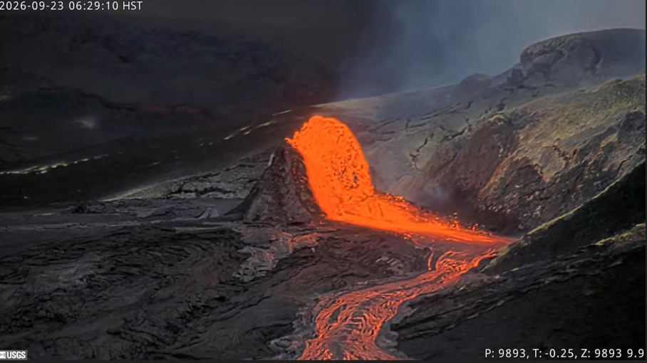
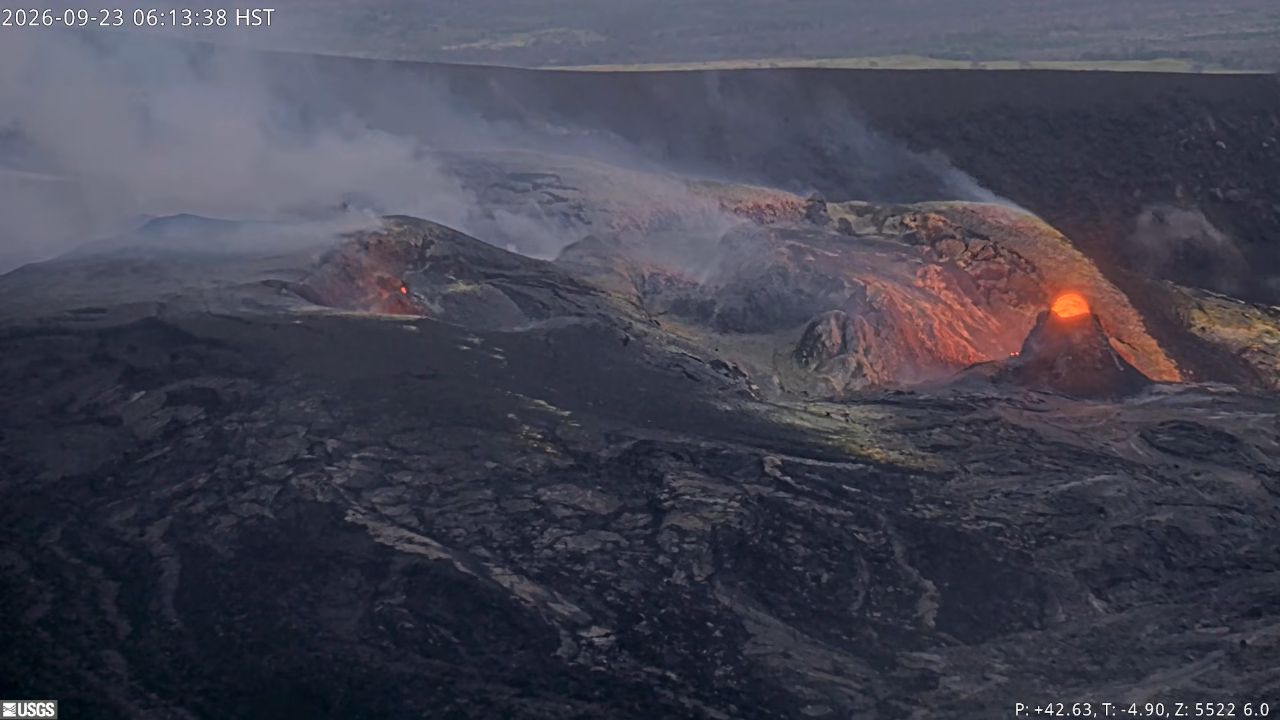
Precursory overflows from the north vent resumed last night. Strong glow from all vents continued with intermittent spatter from the north and south vents. There is no anomalous activity outside of the summit.
Overview:
Precursory overflows from the north vent resumed overnight. Glow and flames continued from the north-south-west vent complex throughout the night, with intermittent spatter bursts from the north and south vents. There are currently no signs of activity at the recent vents 1-6. Summit tilt has been relatively flat over the past 24 hours, with slight deflation starting early this morning. Over the past 24 hours continuous tremor remains the dominant seismic signal across the summit. No anomalous seismic activity or deformation has occurred outside of the summit region.
HVO is maintaining the Alert Level for Kīlauea at WATCH and the Aviation Color Code at ORANGE.
Summit Observations:
Precursory overflows from the north vent resumed last night, September 22, beginning at 10:10 p.m. HST. Additional overflows began at 11:44 p.m. HST on September 22, and 2:46 a.m., 6:10 a.m., and 7:04 a.m. HST on September 23. Each overflow lasted about 30 minutes and produced lava flows that traveled a few hundred meters (yards) from the vent. The were all fed by vigorous fountains from the small 30-50 foot (10-15 meter)The north, south, and west vents continued to glow and emit flames. Intermittent spatter bursts were also observed from the north and south vents last night. No other areas of incandescence were observed across the summit region last night.
Strong continuous tremor is the dominant seismic signal across the summit. There were nine small earthquakes located across the summit region in the past day, but they did not form clusters in time or location.
Summit tilt has been relatively flat over the past day, with about 0.3 microradians of deflation recorded since about 3:00 a.m. HST this morning. The current total inflation since the end of episode 54 is about 15.7 microradians, slightly less than the maximum of 16 microradians reached on September 16 and more than two microradians greater than was lost during episode 54 fountaining.
During inter-episode pauses, the sulfur dioxide (SO2) emission rate from the summit typically varies between 1,000 and 5,000 tonnes per day.
Rift Zone Observations:
Rates of seismicity and ground deformation remain low in the East Rift Zone and Southwest Rift Zone. SO2 emissions from the East Rift Zone remain below the detection limit. No significant ground deformation was recorded in either rift zone.
Source et photo : HVO.
Indonesia , Ili Lewotolok :
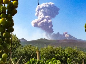
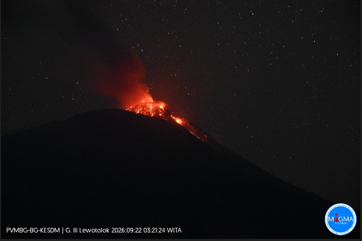
An eruption of Mount Ili Lewotolok occurred on Tuesday, September 22, 2026, at 03:20 WITA, producing an ash column estimated to reach a height of approximately 500 m above the summit (or about 1,923 m above sea level). The observed ash column was gray and dense, drifting towards the west and northwest. The eruption was recorded by the seismograph with a maximum amplitude of 40 mm and a duration of 29 seconds.
Seismic observations
89 eruption earthquakes, with amplitudes of 29.2–40 mm and durations of 20–60 seconds.
2 avalanche earthquakes, with amplitudes of 3.9–7.8 mm and durations of 27–62 seconds.
301 emission earthquakes, with amplitudes of 5.8–19.5 mm and durations of 21–60 seconds.
1 harmonic tremor event, with an amplitude of 5.8 mm and a duration of 155 seconds.
1 non-harmonic tremor event, with an amplitude of 7.8 mm and a duration of 176 seconds.
1 deep volcanic earthquake, with an amplitude of 40 mm and a duration of 14 seconds.
1 local tectonic earthquake, with an amplitude of 7.8 mm and a duration of 55 seconds.
Recommendations
1. Communities living near Mount Ili Lewotolok, as well as visitors, hikers, and tourists, are advised not to enter or conduct activities within a 2 km radius—and a 3 km radius in the southern and southeastern sectors—of the Mount Ili Lewotolok activity center.
2. Remain vigilant regarding potential hazards associated with lava avalanches and pyroclastic flows in the southern, southeastern, western, and northeastern sectors of Mount Ili Lewotolok.
Source et photo : PVMBG.
Chile / Argentina , Villarica :
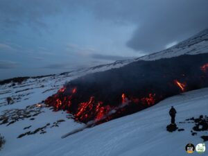
During the reporting period, volcano-tectonic (VT) seismic activity—associated with rock fracturing within the volcano—continued, albeit with a significantly lower number of events compared to the previous period.
The dominant seismic activity was linked to fluid movement within the volcano, manifesting as « long-period » (LP) and « tremor » (TR) events. LP events were the most frequent, showing lower energy release levels than in the previous period.
The maximum reduced displacement (RD) reached 15 cm². Tremor (TR) seismicity was recorded to a lesser extent than long-period (LP) seismicity. Some of these tremor episodes reached reduced displacements (RD) of up to 26 cm².
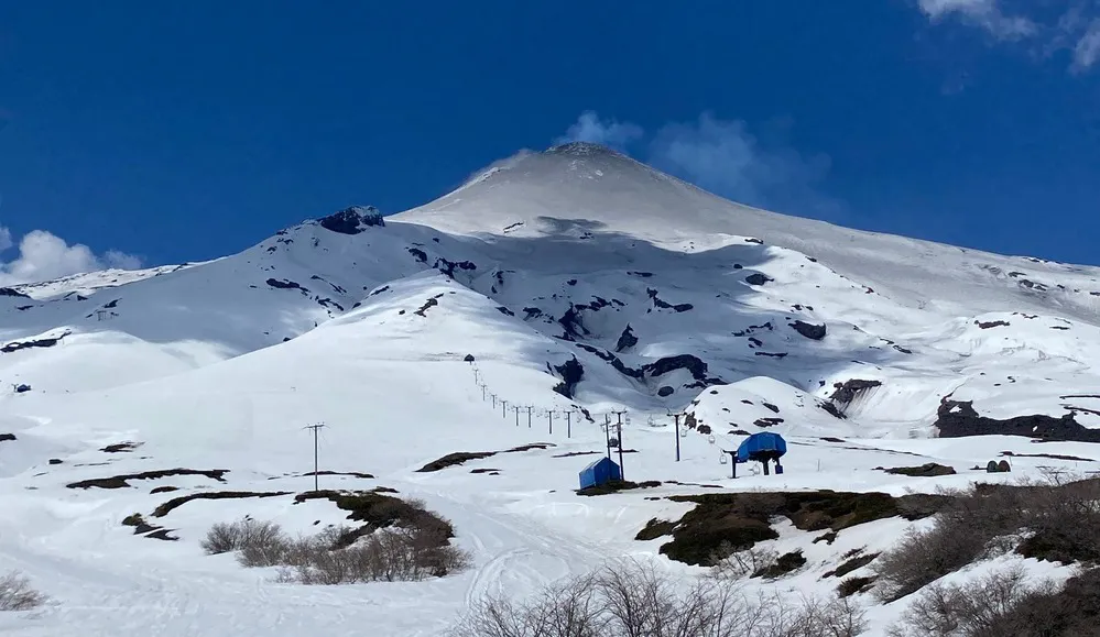
Analysis of images from OVDAS surveillance cameras—when weather conditions permitted—revealed degassing plumes reaching a maximum height of 180 m above the crater rim on September 15.
Additionally, incandescence was observed on September 3, 14, and 15. A specific event was noted on September 4, involving the emission of ballistic material that reached a height of 30 m but remained confined within the active crater, with no impact outside it.
During the analyzed period, satellite image processing detected one (1) very low-magnitude thermal anomaly via VIIRS375 and one (1) low-magnitude anomaly via MODIS. Furthermore, processing of Sentinel-2 L2A imagery revealed a thermal radiance anomaly at the crater.
Analysis of high-resolution satellite imagery (specifically PlanetScope and Sentinel-2 L2A) identified deposits of fine ash and pyroclasts on the snow, primarily in the southern sector of the volcanic edifice. The distribution of these materials aligns with the ballistic emission events recorded during the period. No significant morphological changes or impacts beyond the crater were observed.
Source : Segemar .
Photo : auracaniadiario
Colombia , Galeras :
San Juan de Pasto, September 22, 2026, 5:10 PM.
As part of the monitoring of Galeras volcano’s activity, the Colombian Geological Service (SGC)—an agency under the Ministry of Mines and Energy—reports the following:
During the week of September 15 to 21, 2026, the main variations in monitored parameters compared to the previous week were as follows:
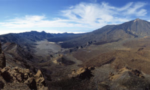
● Amidst a period of low activity and fluctuating behavior at Galeras volcano, seismic activity decreased in terms of both frequency and energy release compared to the previous week, while remaining primarily associated with rock fracturing. The localized events had magnitudes below 1.5; they were located in the vicinity of the Galeras volcano crater—within 2.5 km—and at depths of less than 7 km below the summit (4,270 m above sea level).
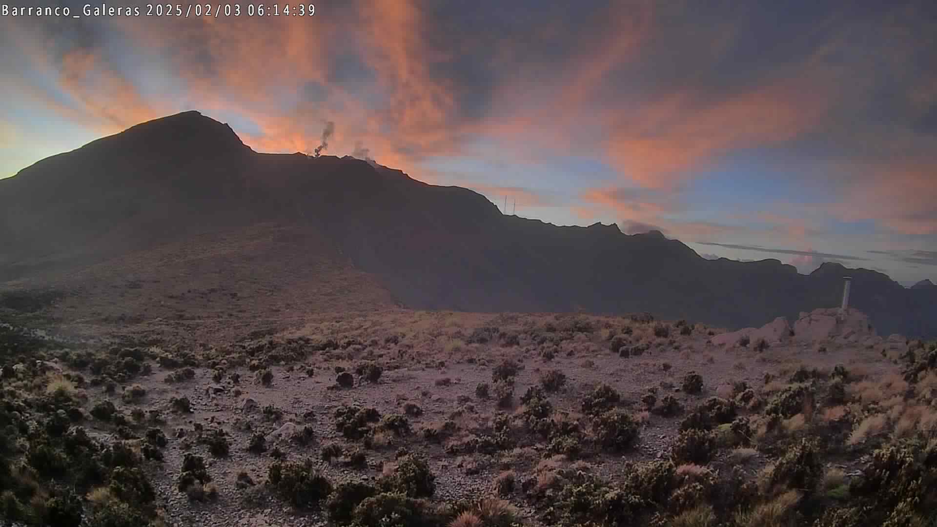
● Low-level emissions of white gas were recorded and dispersed according to wind direction. These emissions originated primarily from fumarole fields within the main crater and the Las Chavas area to the west.
● Other volcanic monitoring parameters remained stable.
In light of the above, the SGC recommends closely monitoring the situation via weekly bulletins and other information released through our official channels, and adhering to the instructions of local and departmental authorities as well as the National Unit for Disaster Risk Management (UNGRD).
Volcanic activity remains at the « Yellow » alert level: an active volcano showing changes in the baseline behavior of monitored parameters and other manifestations.
Source et photo : SGC.
Costa Rica , Rincon de la Vieja / Poas :
Daily volcano status report. OVSICORI-UNA, Date: 23/09/2026. Updated at: 07:26:00.
Volcano: Rincón de la Vieja
Latitude: 10.83
Longitude: -85.324
Elevation: 1,916 m above sea level
Observed activity:
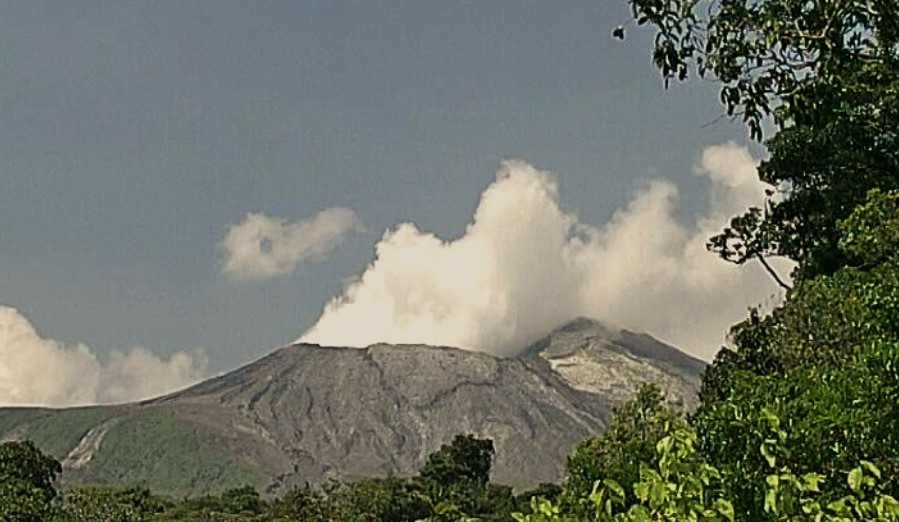
At 00:44 (local time), a moderate eruption was recorded, with an acoustic magnitude of 3.9. The plume reached approximately 1,000 to 2,000 m above the crater; the event was detected via seismic and acoustic signals as well as by webcam. No associated lahar was recorded. Frequent exhalations and sporadic eruptions of low to moderate intensity continue to be observed. The seismic signal shows low-frequency tremor, ranging between 0.8 and 2 Hz. The geodetic network is recording extension at the base of the volcano and subsidence in the summit area.
Environmental conditions:
Winds are light and blowing towards the northwest.
Activity level: Caution (3)
Volcano: Poás
Latitude: 10.200
Longitude: -84.233
Elevation: 2,687 m above sea level
Observed activity:
Convection is observed in the crater lake, above vent A. Low-level tremor persists, with dominant frequencies between 3 and 6 Hz. Between 10:00 PM yesterday and 3:00 AM today, infrasonic tremor was recorded with frequencies between 4 and 5 Hz. Gas ratios remain within the ranges observed in recent days. A peak in SO₂ concentration was recorded around 1:00 AM.
Environmental conditions:
Winds are light and blowing towards the northwest.
Activity level: Advisory (2)
Source et photo : Ovsicori .