September 22 , 2026.
Hawaii , Kilauea :
HAWAIIAN VOLCANO OBSERVATORY DAILY UPDATE, U.S. Geological Survey
Monday, September 21, 2026, 9:28 AM HST (Monday, September 21, 2026, 19:28 UTC)
19°25’16 » N 155°17’13 » W,
Summit Elevation 4091 ft (1247 m)
Current Volcano Alert Level: WATCH
Current Aviation Color Code: ORANGE
Summary:
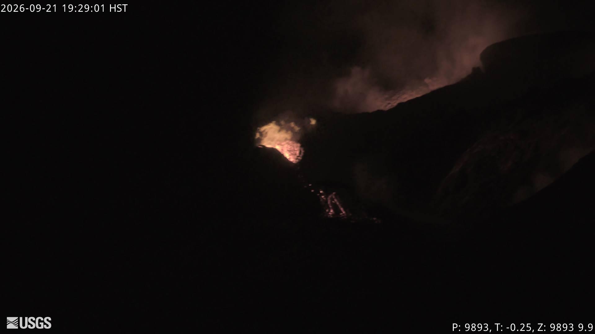
The north, south, and west vents continue to glow with minor intermittent spatter from the north vent. Minor summit inflation occurred overnight. There is no anomalous activity outside of the summit.
Overview:
Glow and flames continued from the north-south-west vent complex throughout the night, with minor intermittent spatter from the north vent. Slow inflation continues at the summit, gaining approximately 0.6 microradians over the past day. Over the past 24 hours strong tremor has become continuous and continues to be the dominant seismic signal across the summit. No anomalous seismic activity or deformation has occurred outside of the summit region.
The system is within 1-2 days at the current rate of inflation of reaching the maximum inflation of 16 microradians of tilt recovered since episode 54 fountaining ended. When this peak pressurization is reached, it is possible that activity will resume at the north-south-west vent complex, or reactivate the vent 1-6 system, or intrude another weak area in the summit region. None of these events are likely to produce a strong seismic precursor, so the alert levels remain at ORANGE/WATCH as the volcano continues to « exhibit heightened unrest with an increased potential for eruption ».
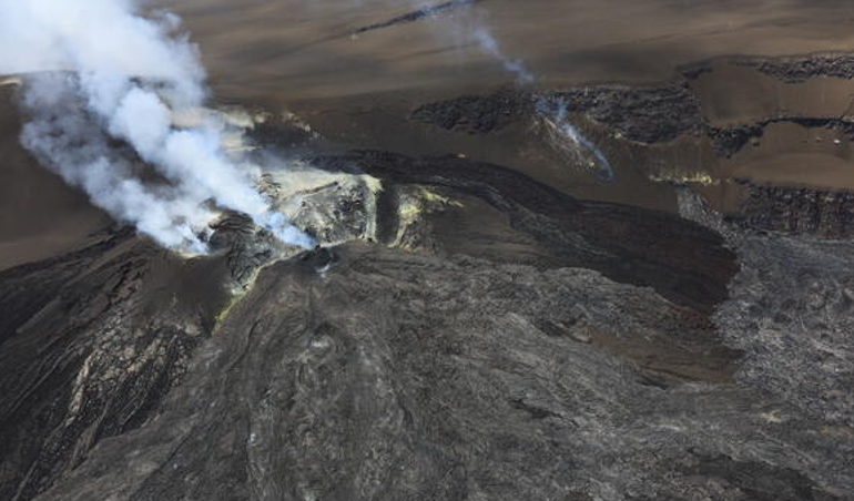
During a USGS Hawaiian Volcano Observatory monitoring overflight of Kīlauea summit the afternoon of September 18, 2026, geologists captured this view showing several of the vents degassing. In the left side of the image, the main vent complex in Halemaʻumaʻu (the north/south/west vents) that has been erupting episodically since December 2024 makes up a shield-shaped structure within the crater. The degassing feature in the right side of the photo is one of the vents that recently erupted between September 14-16, and another of these recently active vents is visible just below and to the right of it but not degassing.
Summit Observations:
The north, south, and west vents continued to glow and sporadically emit flames, with minor intermittent spatter from the north vent last night.
Strong continuous tremor is the dominant seismic signal across the summit. There were three small earthquakes located across the summit region in the past day, but they did not form clusters in time or location.
Summit inflation continues this morning, recording an increase of about 0.6 microradians over the past day. The total inflation since the end of episode 54 is currently about 15.6 microradians, more than two microradians greater than was lost during episode 54 fountaining.
During inter-episode pauses, the sulfur dioxide (SO2) emission rate from the summit typically varies between 1,000 and 5,000 tonnes per day.
Rift Zone Observations:
Rates of seismicity and ground deformation remain low in the East Rift Zone and Southwest Rift Zone. SO2 emissions from the East Rift Zone remain below the detection limit. No significant ground deformation was recorded in either rift zone.
Source : HVO.
Photos : USGS , USGS /K. Lynn .
Kamchatka , Chikurachki :
KVERT VOLCANIC ACTIVITY NOTICE (VAN)
Issued: September 21 , 2026
Volcano: Chikurachki (CAVW #290360)
Current aviation colour code: ORANGE
Previous aviation colour code: green
Source: KVERT
Notice Number: 2026-100
Volcano Location: N 50 deg 19 min E 155 deg 28 min
Area: Northern Kuriles, Russia
Summit Elevation: 1816 m (5956.48 ft)

Volcanic Activity Summary:
According to data by Tokyo VAAC and KVERT, the explosive eruption of Chicurachki volcano began plobably on 18:30 UTC on 20 September, 2026. The explosions sent ash up to 3 km a.s.l., and ash plume extended for 140 km to the north-east and east of the volcano. The explosive eruption of the volcano continues intermittently. KVERT continues to monitor Chikurachki volcano.
An eruptive activity of the volcano is observing. Ash explosions up to 6 km (19,700 ft) a.s.l. could occur at any time. Ongoing activity could affect low-flying aircraft.
Volcanic cloud height:
NO ASH CLOUD PRODUCED
Other volcanic cloud information:
NO ASH CLOUD PRODUCED
Source : Kvert.
Photo : Məmməd Ramin ( archive)
Indonesia , Anak Krakatau :
Reduction of the activity level of the Anak Krakatau volcano (Lampung Province) from Level III (SIAGA) to Level II (WASPADA) on September 21, 2026, at 18:30 WIB.
Anak Krakatau is a Type A active volcano located in the waters of the Sunda Strait. However, monitoring of Anak Krakatau is conducted from two observation posts: the Anak Krakatau volcano observation post in Kalianda (South Lampung Regency, Lampung Province) and the one in Pasauran (Serang Regency, Banten Province). Due to signs of increased volcanic seismicity and deformation, the volcano’s alert level had been raised to *Siaga* (Level III) effective July 2, 2026, at 16:30 WIB.
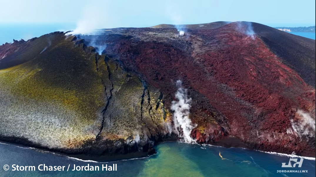
Alongside this intensification of activity, Anak Krakatau experienced 224 eruptions up to September 3, 2026. A continuous eruption lasting 25 hours occurred between 23:07 WIB on September 4, 2026, and 00:04 WIB on September 6, 2026. Satellite imagery analysis indicates that this continuous eruption generated lava flows spreading northwest, west, and southwest from the eruptive center. Although seven Strombolian-type eruptions took place after the continuous eruption ended, Anak Krakatau’s overall activity declined leading up to 00:00 WIB on September 20, 2026. This downward trend in activity was confirmed by deformation data indicating deflation. Seismic records for Anak Krakatau on September 20, 2026, revealed a low-frequency earthquake as well as continuous tremor activity with an average amplitude of 2 mm.
Based on the results of a thorough analysis and assessment, the activity level of the Anak Krakatau volcano was lowered from Level III (Alert/*Siaga*) to Level II (Vigilance/*Waspada*) effective 18:30 WIB on September 21, 2026.
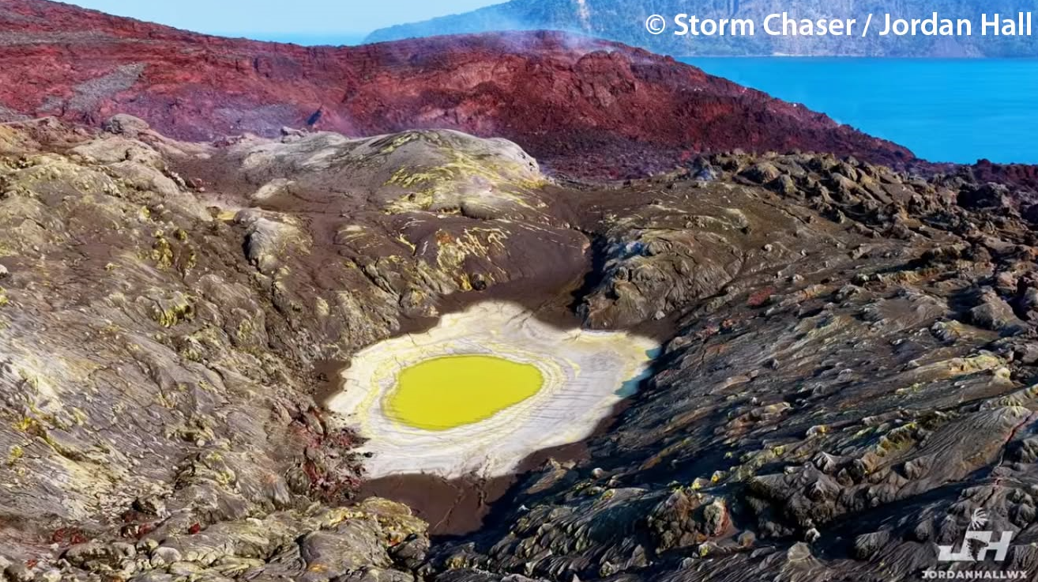
The recommendations for Level II (Vigilance) are as follows:
Communities living near the Anak Krakatau volcano, as well as visitors, tourists, and hikers, are prohibited from entering or engaging in activities within a 2-kilometer radius of the volcano’s active center; these individuals must also remain vigilant regarding the risk of incandescent rock ejections and heavy ashfall. Residents of coastal areas in the Banten and Lampung provinces are advised to remain calm, disregard rumors that an eruption of Mount Anak Krakatau would trigger a tsunami, and continue their daily activities while adhering to the guidelines of the Regional Disaster Management Agency (BPBD).
Source : PVMNG.
Photo : Storm Chaser / Jordan Hall.
Guatemala , Santiaguito :
Weather conditions: Clear skies
Wind: Northeast
Precipitation: 68.8 mm
Activity
Activity is being recorded at the « Caliente » dome of the Santa María-Santiaguito volcanic complex, characterized by weak white degassing plumes rising 500 meters above the crater, as well as explosions (weak to moderate) occurring at a rate of 0 to 2 per hour. These explosions propel gas and ash columns up to 3,400 meters above sea level (11,155 feet), which drift westward and southwestward with the wind.
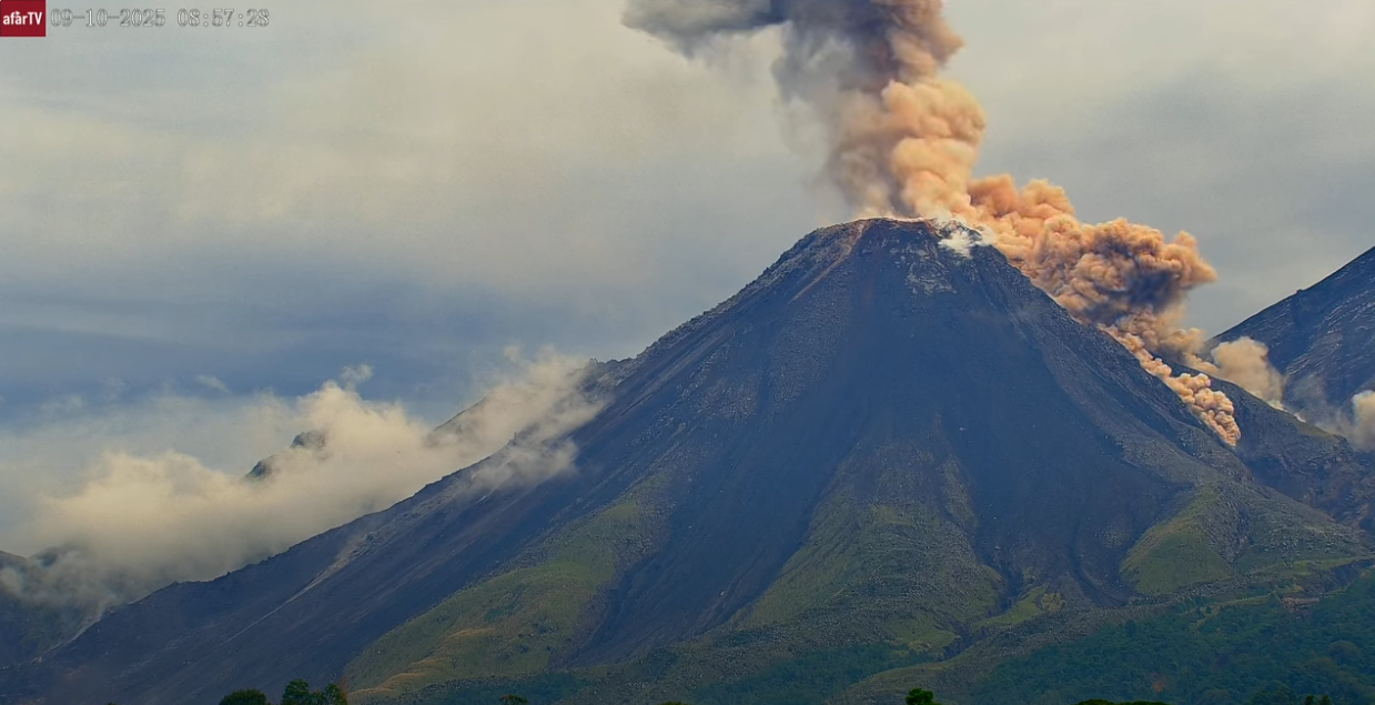
Blocks of incandescent rock can also be seen breaking off and traveling short distances down the flanks. Due to wind direction, light ashfall has been reported in the Monteclaro area and its surroundings. Given the significant accumulation of rock material on the « Caliente » dome and on the promontory overlooking the lava flow on its southwest flank, the formation of long-range pyroclastic density currents in any direction cannot be ruled out; it is therefore recommended to follow the instructions in special bulletin BESAN-002-2026.
Source : Insivumeh.
Photo : Afar TV.
Philippines , Taal :
The main crater of Taal Volcano in Batangas produced a “moderate emission” of steam-laden plumes that rose 1,100 meters above Taal Volcano Island (TVI) over the past 24 hours, the Philippine Institute of Volcanology and Seismology (Phivolcs) reported on Sunday, Sept. 20.
In its morning bulletin, Phivolcs said Taal has been emitting an average of 183 metric tons of sulfur dioxide (SO₂) daily since Sept. 17.
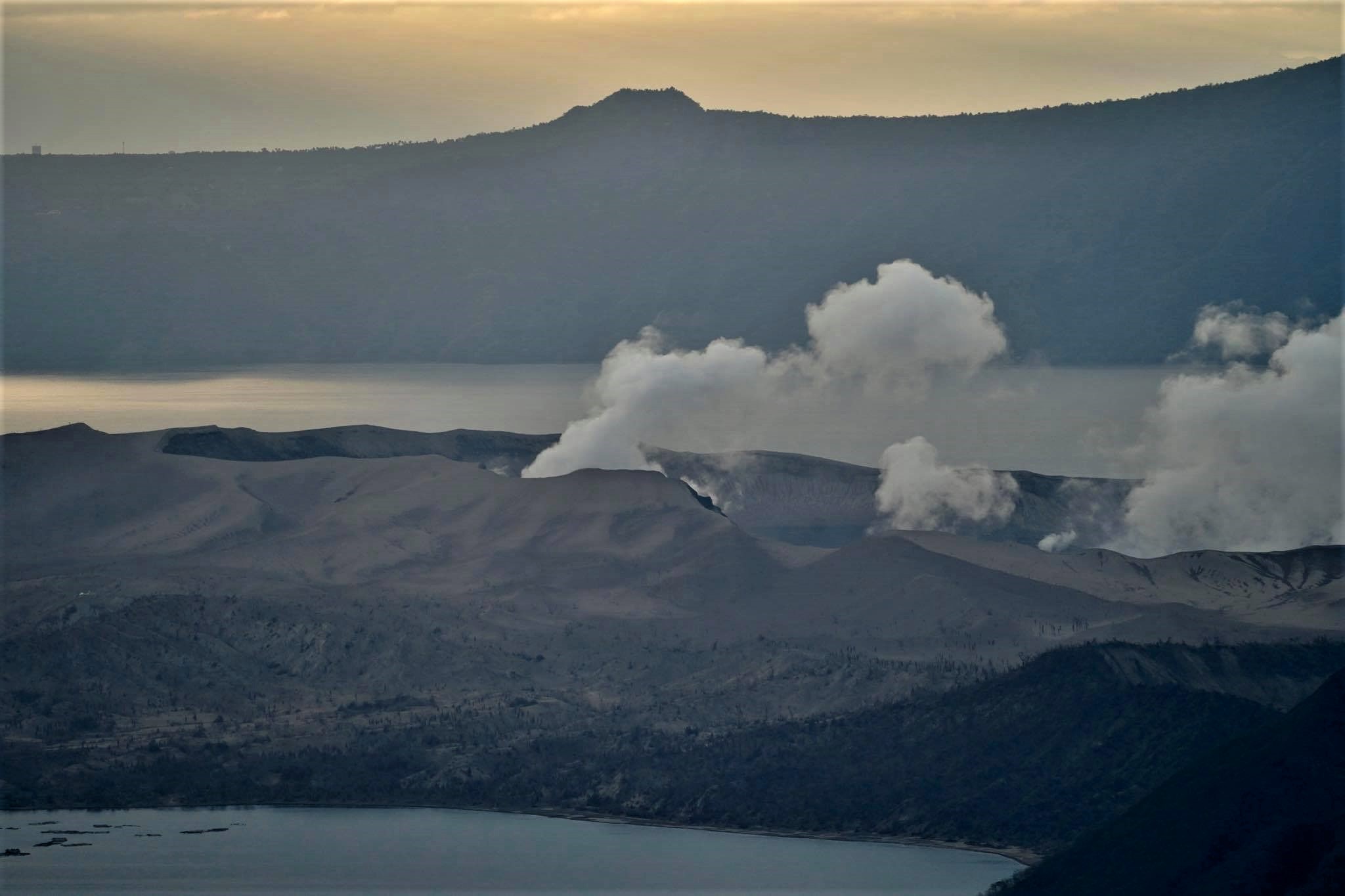
The plumes drifted southwest.
The plume height has increased over the past three days, from 600 meters on Thursday to 700 meters on both Friday and Saturday, before reaching 1,100 meters on Sunday.
Phivolcs recorded two volcanic earthquakes during the latest monitoring period.
From Sept. 1 to 20, Taal had a total of 89 volcanic earthquakes and four tremor episodes, Phivolcs said.
Sources : Phivolcs , newsinfo . inquirer.
Photo : Raffy Tima ( archive)