October 9 , 2026.
Japan , Hokkaido-Komagatake :
The Japan Meteorological Agency (JMA) reported increased unrest at Hokkaido-Komagatake starting in late September. A slight increase in the number of volcanic earthquakes located about 1 km below sea level beneath the summit crater was detected during 23-24 September. The number of earthquakes at shallow depths increased on 26 September and seismicity continued to intensify. At 13h00 that same day tiltmeters recorded uplift around the crater floor. A relatively large earthquake (M 1.4) was recorded at 20h30 on 28 September. No surficial changes were observed. At 07h30 on 2 October the Alert Level was raised to 2 (the second lowest level on a 5-level scale) and the public was warned that ballistics could be ejected as far as 4 km. Inflation slightly accelerated on 2 October and there was an increase in small-amplitude volcanic earthquakes mainly originating at shallow depths beneath the summit crater floor. Both seismicity and inflation slowed later that day. No earthquakes were recorded during 4-7 October, though inflation continued.
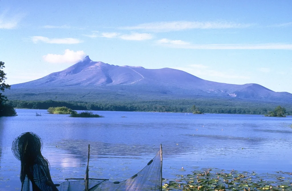
Komagatake on the Oshima Peninsula of southern Hokkaido rises to the N above Lake Onuma and is one of the most active volcanoes of Japan’s northernmost island. The summit formed as a result of edifice collapse and hummocky debris avalanche deposits were responsible for the formation of Lake Onuma. A period of more frequent explosive activity began with a major explosive eruption in 1640.
Much of the truncated Hokkaido-Komagatake andesitic volcano on the Oshima Peninsula of southern Hokkaido is Pleistocene in age. The sharp-topped summit lies at the western side of a large breached crater that formed as a result of edifice collapse in 1640 CE. Hummocky debris avalanche material occurs at the base of the volcano on three sides. Two late-Pleistocene and two Holocene Plinian eruptions occurred prior to the first historical eruption in 1640, which began a period of more frequent explosive activity. The 1640 eruption, one of the largest in Japan during historical time, deposited ash as far away as central Honshu and produced a debris avalanche that reached the sea. The resulting tsunami caused 700 fatalities. Three Plinian eruptions have occurred since 1640; in 1694, 1856, and 1929.
Sources: Japan Meteorological Agency (JMA) , GVP.
Photo : Ichio Moriya (Kanazawa University).
Indonésie , Anak Krakatau :
An eruption of Mount Anak Krakatau occurred on Thursday, October 8, 2026, at 18:28 (WIB). The eruption was not visually observed. At the time of writing this report, the eruption was still ongoing.
Seismic observations:
1 eruption earthquake with an amplitude of 46 mm and a duration of 494 seconds.
2 emission earthquakes with amplitudes of 19–29 mm and durations of 21–23 seconds.
20 hybrid/multiphase earthquakes with amplitudes of 8–49.5 mm and durations of 3–16 seconds.
18 shallow volcanic earthquakes with amplitudes of 7–45 mm and durations of 5–13 seconds.
2 deep volcanic earthquakes with amplitudes of 52–54 mm and durations of 15–26 seconds.
1 distant tectonic earthquake with an amplitude of 3 mm and a duration of 77 seconds.
1 continuous tremor event with an amplitude of 0.5–26 mm (dominant amplitude of 5 mm).
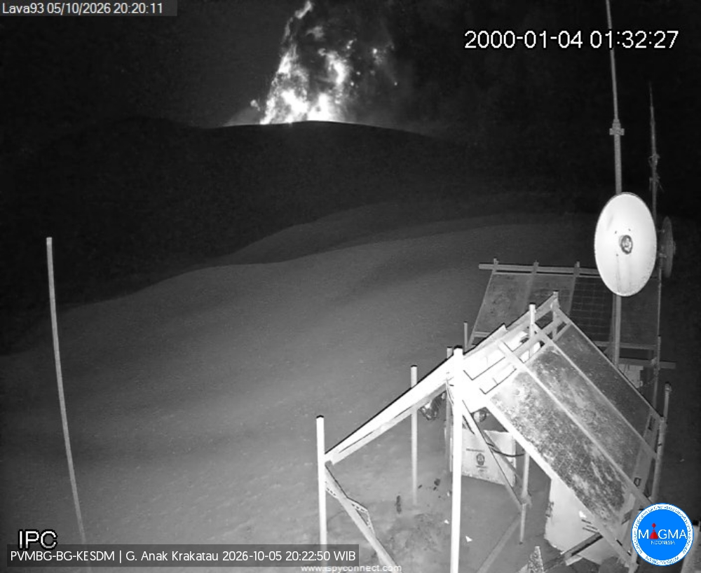
The Pusat Vulkanologi dan Mitigasi Bencana Geologi (PVMBG) reported continuing eruptive activity at Krakatau during 1-7 October. White plumes were visible during 1-4 October rising as high as 50 m above the summit. The seismic network detected four eruptive events on 5 October. No eruption plumes were observed, possibly due to weather conditions or darkness, though incandescent material being ejected above the summit was visible in webcam images at 20h22 and 20h37. The Alert Level remained at 2 (on a scale of 1-4) and the public was advised to stay 2 km away from summit.
Sources: Pusat Vulkanologi dan Mitigasi Bencana Geologi (PVMBG, also known as CVGHM) , GVP
Hawaii , Kilauea :
HAWAIIAN VOLCANO OBSERVATORY DAILY UPDATE , U.S. Geological Survey
Thursday, October 8, 2026, 8:25 AM HST (Thursday, October 8, 2026, 18:25 UTC)
19°25’16 » N 155°17’13 » W,
Summit Elevation 4091 ft (1247 m)
Current Volcano Alert Level: WATCH
Current Aviation Color Code: ORANGE
Summary:
Kīlauea summit north vent erupted minor spatter overnight. Kīlauea summit is at a high level of pressurization. Fountaining, intrusions, or an eruption in a new location within the summit region could occur.
Summit Observations:
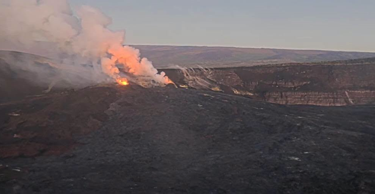
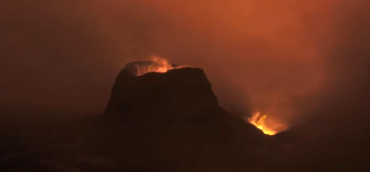
Both the north and south vents in Halemaʻumaʻu showed strong glow and flames in overnight webcam imagery, with minor amounts of spatter erupted by the north vent. Robust plumes of volcanic gas emanate from both vents in day-time webcam views.
In the past 24 hours, there were 6 shallow earthquakes located across the summit region of Kīlauea. The Uēkahuna tiltmeter (UWD) recorded approximately 1 microradian of inflation between 8 a.m. and 4 p.m. yesterday, October 7. Since then, UWD has shown slow deflation totaling about a microradian, resulting in no net change in tilt over the past day.
During inter-episode pauses, the sulfur dioxide (SO2) emission rate from the summit typically varies between 1,000 and 5,000 tonnes per day. Winds are currently forecast from the south/southwest, which could result in voggy conditions in the communities around Kīlauea summit.
Rift Zone Observations:
Rates of seismicity and ground deformation remain low in the East Rift Zone and Southwest Rift Zone. SO2 emissions from the East Rift Zone remain below the detection limit. No significant ground deformation was recorded in either rift zone.
Analysis:
Kīlauea had been erupting episodically between December 23, 2024, and August 25, 2026, from two vents (north and south) in Halema‘uma‘u at the summit. Lava fountaining episodes generally lasted for less than 12 hours and were separated by pauses of two or more weeks. Irregular patterns in inflation and deflation at Kīlauea summit since the most recent lava fountaining episode, number 54 on August 25, 2026, prevent forecast modeling for when the next fountaining episode can occur. It is possible that another fountaining episode from the north-south vent complex could occur; however, intrusive activity underneath Kaluapele is also possible, or magma could exploit existing weak crack systems in the summit region to erupt passively (with little or no seismicity or deformation).
Source : HVO.
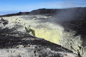
Photos : Hawaii Volcanoes National Park
Chile / Argentina , Nevados de Chillan :
Special Report on Volcanic Activity (REAV) – Ñuble Region, Nevados de Chillán Volcanic Complex
Issued on October 8, 2026, at 12:13 PM (local time, continental Chile)
Chile’s National Geology and Mining Service (Sernageomin) releases the following PRELIMINARY information, obtained via monitoring equipment from the National Volcanic Monitoring Network (RNVV) and processed/analyzed by the Southern Andes Volcanological Observatory (Ovdas):
On Thursday, October 8, at 12:11 PM (local time), monitoring stations installed near the Nevados de Chillán volcanic complex recorded an earthquake associated with internal fluid dynamics.
The earthquake’s characteristics are as follows:
ORIGIN TIME: 12:11 PM (local time) / 15:11 (UTC)
LOCATION: No location data
REDUCED DISPLACEMENT: 451.5 cm²
Additional observations
At the time this report was issued, no other notable activity was recorded.
The Servicio Nacional de Geología y Minería (SERNAGEOMIN) and the Servicio Geológico Minero Argentino (SEGEMAR) reported that a new lava flow at Nevados de Chillán was first visible on 29 September. Seismicity intensified on 27 September. Thermal anomalies coinciding with the area where explosive activity has been reported just SW of Nicanor Crater were identified in satellite images in recent days but intensified on 29 September. A lava flow on the W flank of the summit crater complex was visible in webcam images that same day. During the early hours on 1 October there was persistent incandescence at the vent along with several explosive events producing ash plumes that rose as high as 500 m above the summit and drifted NE and SE.
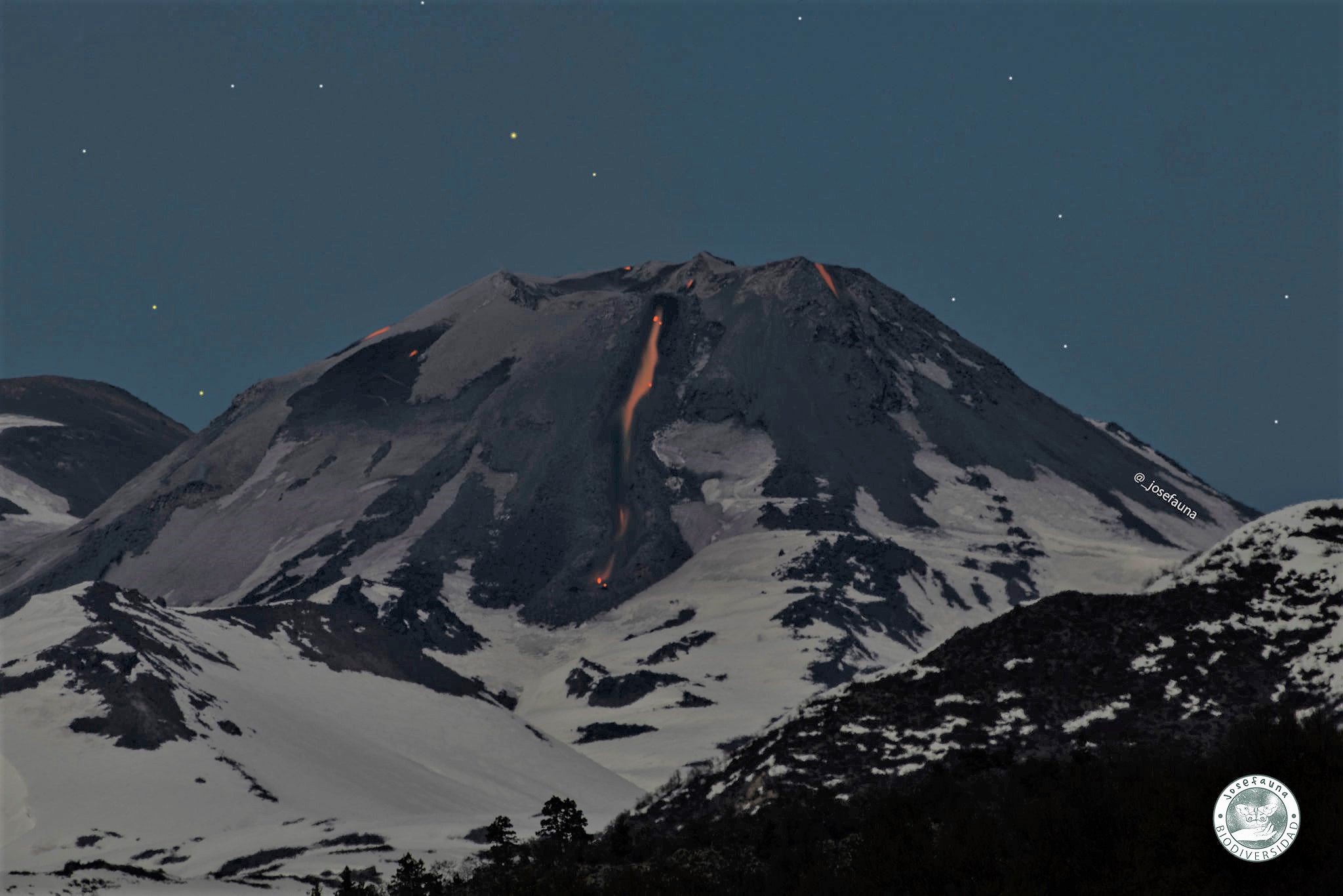
Increased surface temperatures were identified in satellite data on 4 October. Explosive activity increased during the early hours of 5 October, characterized by persistent incandescence in the area of the active craters and ejection of ballistics to greater distances than previously recorded. The Alert Level remained at Yellow (the second lowest level on a four-color scale) and the public was warned that an eruption may impact areas within 2 km of the active crater. The Sistema y Servicio Nacional de Prevención y Repuesta Ante Desastres (SENAPRED) maintained an “Preventive Early Alert” for Pinto and Coihueco and warned the public to stay 2 km away from Emission Center 3 (EC3).
Sources: Servicio Nacional de Geología y Minería (SERNAGEOMIN), Sistema y Servicio Nacional de Prevención y Repuesta Ante Desastres (SENAPRED), Servicio Geológico Minero Argentino (SEGEMAR), GVP.
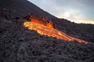
Photo : Josefauna. ( archive).
Nicaragua , Telica :
The Washington Volcanic Ash Advisory Center (VAAC) reported that an ash plume at Telica was identified in webcam images on 30 September rising to 1.2 km (4,000 ft) a.s.l. and drifting SW and NE. On 1 October frequent ash emissions visible in both satellite and webcam images rose as high as 1.5 km (5,000 ft) a.s.l. and drifted NW and NE. A diffuse ash plume was seen in webcam images on 3 October rising to 1.5 km a.s.l. and drifting NW.
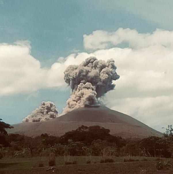
Telica, one of Nicaragua’s most active volcanoes, has erupted frequently since the beginning of the Spanish era. This volcano group consists of several interlocking cones and vents with a general NW alignment. Sixteenth-century eruptions were reported at symmetrical Santa Clara volcano at the SW end of the group. However, its eroded and breached crater has been covered by forests throughout historical time, and these eruptions may have originated from Telica, whose upper slopes in contrast are unvegetated. The steep-sided cone of Telica is truncated by a 700-m-wide double crater; the southern crater, the source of recent eruptions, is 120 m deep. El Liston, immediately E, has several nested craters. The fumaroles and boiling mudpots of Hervideros de San Jacinto, SE of Telica, form a prominent geothermal area frequented by tourists, and geothermal exploration has occurred nearby.
Sources: Washington Volcanic Ash Advisory Center (VAAC) , GVP.
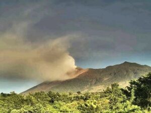
Photo : Archive Ineter