October 17 , 2026.
Hawaii , Kilauea :
HAWAIIAN VOLCANO OBSERVATORY DAILY UPDATE , U.S. Geological Survey
Friday, October 16, 2026, 9:54 AM HST (Friday, October 16, 2026, 19:54 UTC)
19°25’16 » N 155°17’13 » W,
Summit Elevation 4091 ft (1247 m)
Current Volcano Alert Level: WATCH
Current Aviation Color Code: ORANGE
Summary:
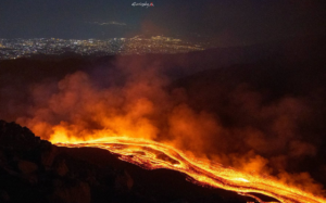
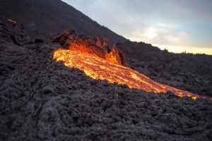
Overflows from the south vent overnight became continuous near dawn this morning. Kīlauea’s summit remains at a high level of pressurization with changes in eruptive activity or location within the summit region possible.
Summit Observations:
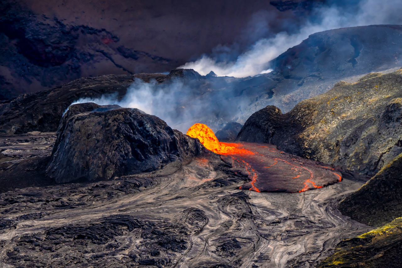
Multiple overflows from the south vent were observed through the night starting at 10:16 PM HST. There were 15 overflows that lasted less than 5 minutes and were small, advancing less than 100 feet (30 m) from the vent. Then at 5:10 a.m. HST, a high-volume overflow coated the entire area within 300 feet (100 m) of the vent with pahoehoe in 10 minutes. This was followed by the current south vent overflows which began and 5:56 a.m. HST and continue at this time. A small dome fountain within the vent has been feeding multiple channels of pahoehoe that cover the near vent area and extend near a half a mile (about a kilometer) from the vent. The volume of lava and the size of the dome fountain appear to wax and wane over time, but continues to feed vigorous overflow channels. Spatter from all three vents (north, south, and west) was also observed overnight, as well consistent glow and occasional flames.
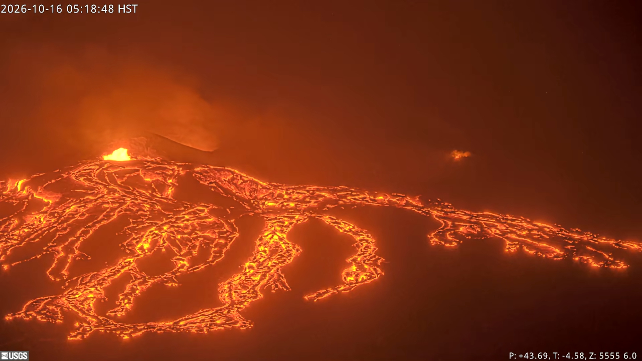
Irregular tremor bursts gave way to more continuous tremor around 6 a.m. HST, about the same time the south vent became continuously active and drainback events stopped. Twenty-one earthquakes were recorded over the past day, mostly in the southern and eastern regions of the summit region of Kīlauea.
Summit tiltmeters have shown minor changes in tilt, with an overall slight inflationary trend since Wednesday. GPS stations on opposite sides of Halemaʻumaʻu (CRIM and UWEV) show a small increase in length since the end of September suggesting longer-term inflation of the summit magma reservoir.
During inter-episode pauses, the sulfur dioxide (SO2) emission rate from the summit typically varies between 1,000 and 5,000 tonnes per day. Plumes of volcanic gas are visible from the vents in day-time webcam views. Winds are currently forecast from the north-northeast through today.
Rift Zone Observations:
Rates of seismicity and ground deformation remain low in the East Rift Zone and Southwest Rift Zone. SO2 emissions from the East Rift Zone remain below the detection limit. No significant ground deformation was recorded in either rift zone.
Source et photos : HVO
Indonesia , Anak Krakatau :
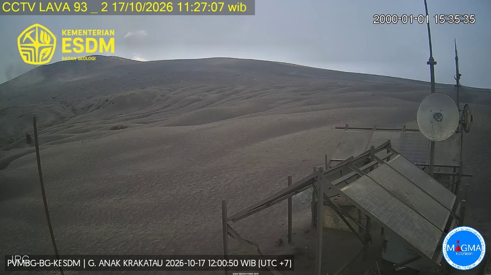
An eruption of Mount Anak Krakatau occurred on Saturday, October 17, 2026, at 01:47 WIB (Western Indonesian Time). The eruption was not observed visually; it was recorded by a seismograph, with a maximum amplitude of 55 mm and a duration of 29 seconds.
Seismic observations:
5 eruptive earthquakes, with an amplitude of 40–55.5 mm and a duration of 22–147 seconds.
1 low-frequency earthquake, with an amplitude of 28 mm and a duration of 15 seconds.
6 hybrid/polyphase earthquakes, with an amplitude of 13–49 mm and a duration of 8–16 seconds.
4 shallow volcanic earthquakes, with an amplitude of 14–43 mm and a duration of 8–12 seconds.
1 deep volcanic earthquake, with an amplitude of 52.5 mm and a duration of 16 seconds.
1 continuous tremor, with an amplitude of 2–20 mm (predominantly 5 mm).
Recommendations
1. Populations living near Mount Anak Krakatau, as well as visitors, tourists, and hikers, are prohibited from entering or conducting any activities within a 5 km radius of the eruptive center of Anak Krakatau.
2. Populations living near Mount Anak Krakatau, as well as visitors and tourists, are prohibited from entering or conducting any activities within a 1 km radius of the new islands located in the northwest and southeast sectors of Mount Anak Krakatau.
Source et photo : PVMBG.
Chile , Nevados de Chillan :
Special Report on Volcanic Activity (REAV), Ñuble Region, Nevados de Chillán Volcanic Complex
Issued on October 16, 2026, at 05:52 local time (continental Chile)
The National Geology and Mining Service of Chile (Sernageomin) provides the following PRELIMINARY information, obtained via monitoring equipment from the National Volcanic Monitoring Network (RNVV) and subsequently processed and analyzed by the Southern Andes Volcanological Observatory (Ovdas):
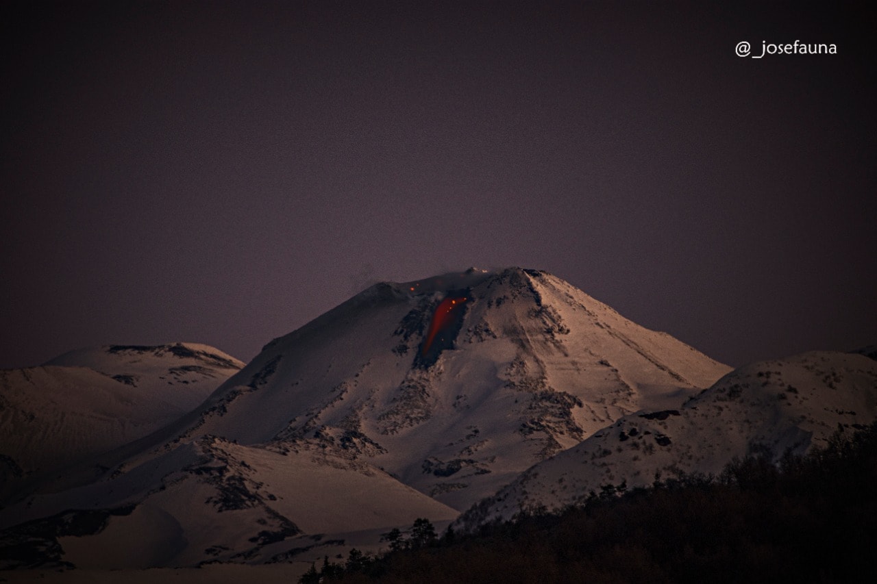
On Friday, October 16, at 05:27 local time, monitoring stations installed in the vicinity of the Nevados de Chillán volcanic complex recorded an earthquake associated with the internal dynamics of fluids.
The characteristics of the seismic event are as follows:
ORIGIN TIME: 05:27 local time (08:27 UTC)
REDUCED DISPLACEMENT: 400 cm²
ACOUSTIC SIGNAL: 0.9 Pa (reduced to 1 km)
Additional observations
The occurrence of further similar events cannot be ruled out.
The volcanic technical alert level remains at: YELLOW technical alert.
Sernageomin maintains real-time monitoring and provides timely updates regarding any potential changes in volcanic activity in the country.
Source : Sernageomin
Photo : Josefauna ( archive).
Colombia , Nevado del Ruiz :
Manizales, October 13, 2026, 6:00 PM
As part of the ongoing monitoring of the Nevado del Ruiz volcano, the Colombian Geological Service (SGC)—an agency affiliated with the Ministry of Mines and Energy—reports the following information:
During the week of October 6 to 13, 2026, the volcano continued to exhibit unstable behavior. Compared to the previous week, the main variations in the monitored parameters were as follows:
– Seismic activity associated with rock-fracturing processes within the volcanic edifice increased—both in terms of the number of recorded earthquakes and the total seismic energy released—relative to the previous week. The earthquakes were primarily located near the Arenas crater, as well as along the south-southwest, north-northeast, and south-southeast flanks, all within 11 km of the crater. The depths of these events ranged from less than 1 km to 8 km below the volcano’s summit. The strongest earthquake of the week was recorded today at 6:03 AM (local time); it had a magnitude of 1.9 and was located 11 km northeast of the crater, at a depth of 4 km below the summit.
– Seismicity associated with fluid dynamics within the volcanic conduits remained stable, in terms of both the number of earthquakes and the seismic energy released. This seismic activity was characterized by short-duration signals, associated with low energy levels. As in previous weeks, no long-duration seismic signals were recorded; furthermore, no ash emissions or changes in the apparent temperature of the gas column were confirmed.
– The emission of water vapor and volcanic gases—primarily sulfur dioxide (SO2)—into the atmosphere continued from the Arenas crater. The estimated SO2 flux, linked to degassing processes, decreased compared to the previous week. This decline is attributed, in part, to wind direction, which shifted toward flanks of the volcano where there is less coverage by monitoring stations. Supplementary monitoring, conducted using satellite data, also indicated low levels of SO2 emissions.
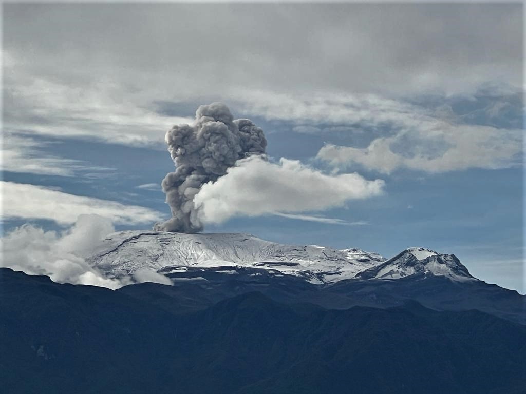
– The vertical height of the gas and water vapor column reached a maximum of 1,200 m above the volcano’s summit, though it generally remained below 800 m. The dispersion direction of the column was highly variable, with a slight tendency toward the north-northwest flank.
– Monitoring of thermal anomalies at the bottom of the Arenas crater, carried out via satellite platforms, was limited by cloud cover in the area. Nevertheless, a few low-energy anomalies were recorded.
Source et photo : SGC.
Costa Rica , Rincón de la Vieja :
OVSICORI-UNA Weekly Volcanic Monitoring Bulletin, October 16, 2026
Latitude: 10.83° N;
Longitude: 85.34° W;
Elevation: 1,916 m above sea level.
Current activity level: Caution.
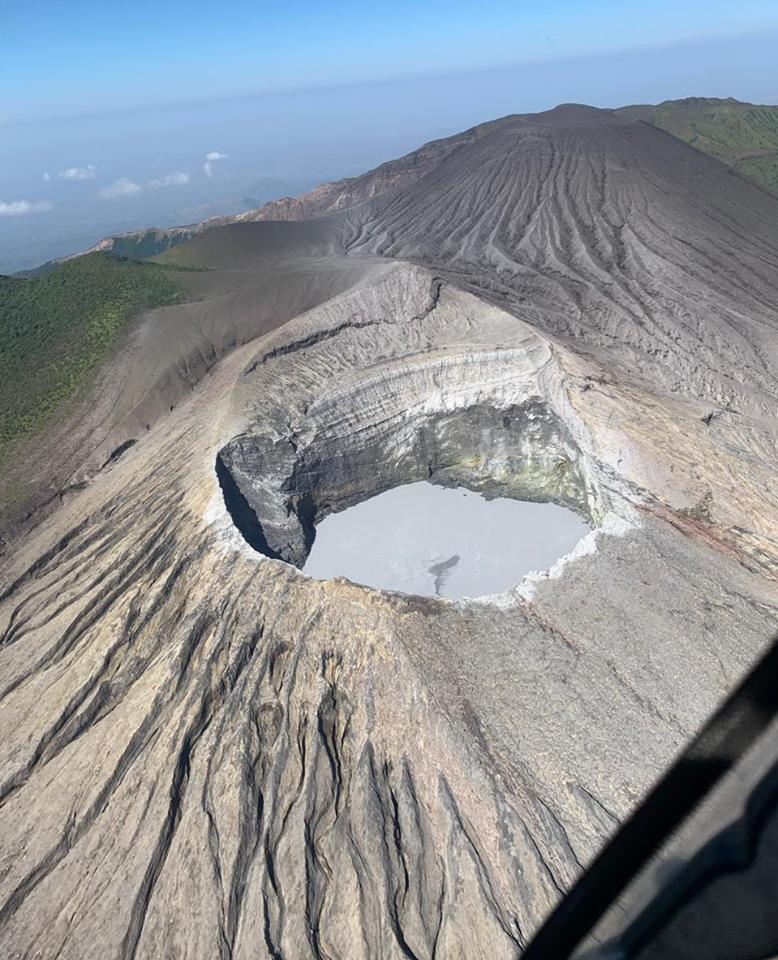
During this week, 13 eruptions were recorded; none exceeded an acoustic magnitude of 4 (moderate). Most of these eruptions were of low magnitude. The eruption on October 12 at 02:35 had the highest acoustic magnitude of the week; it did not result in the formation of lahars. Frequent acoustic pulses associated with emissions of water vapor and volcanic gases (small eruptions) continued to be observed this week. 65 very low-magnitude acoustic pulses were recorded; this activity has been decreasing—in both amplitude and frequency—since September 22.
Background tremor is dominated by « banded » tremor sequences; it sometimes appears continuous and exhibits variable amplitude. These banded tremor sequences show variations in amplitude, duration, and the intervals between episodes. The frequency of long-period (LP) seismic signals and « tornillo » (screw-shaped) signals remains stable. However, the frequency of « tornillo »-type signals has decreased this week. An increase in volcano-tectonic seismicity—both proximal and distal—was observed this week, following the 7.6 Mw magnitude earthquake that occurred in Panama on October 9. In total, 19 proximal volcano-tectonic earthquakes and 51 distal earthquakes (relative to the crater) were recorded during the week. The proximal volcano-tectonic earthquakes are located at depths ranging from 1.5 to 3 km.
Eruptions generally tend to occur when a significant decrease in the amplitude of low-frequency tremor is observed; this suggests the formation of a « plug » that traps volatile compounds, eventually leading to the rupture of this plug and the triggering of an eruption. No significant deformation has been recorded. The rapid summit uplift detected in September, as well as the subsequent contraction, have ceased.
The MultiGAS station recorded a CO2/SO2 ratio of 3.7 ± 1.73, which represents an increase compared to the previous week, when a value of 2.6 was measured. The average SO2 flux this week is 264 ± 106 tonnes per day, with a maximum value of 1,417 tonnes per day. These figures are higher than those from the previous week, when the average flux was 133 ± 77 t/d, with a maximum value of 1694 t/d. Wind conditions this week are more favorable than they were the previous week, which could account for this apparent increase. The values for this week remain above the baseline level for this volcano.
The most recent detection of atmospheric SO2 by the SENTINEL satellite dates back to October 1, 2026, with a mass of 68 tonnes.
Source : Ovsicori .
Photo : RSN.