October 10 , 2025.
Indonesia , Karangetang :
Increased seismicity at Mount Karangetang, North Sulawesi, October 9, 2025.
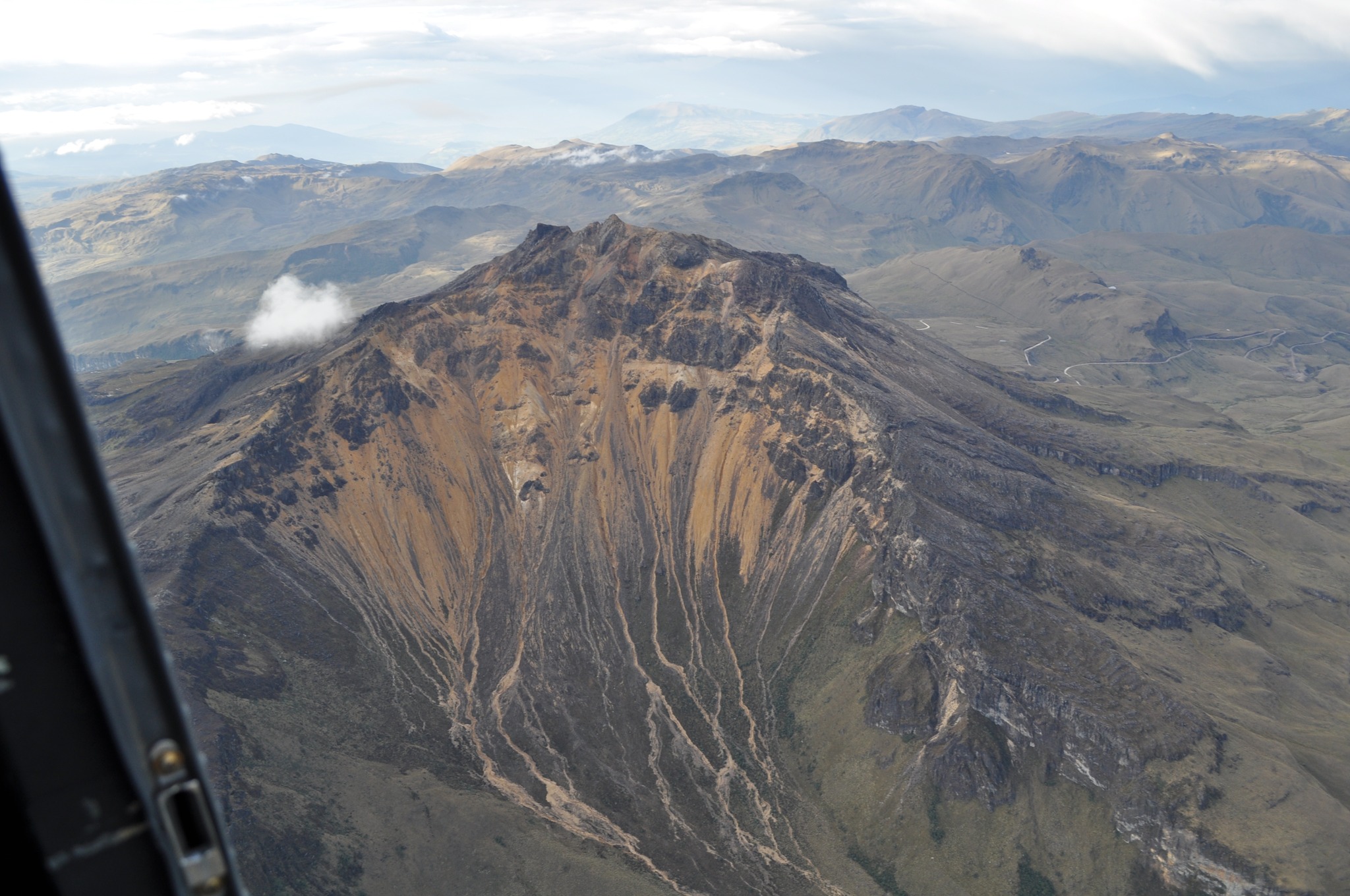
Karangetang Volcano is a stratovolcano rising to an altitude of 1,784 meters. It is located on Siau Island, North Sulawesi Province. Eruptions at Mount Karangetang are characterized by strombolian eruptions, lava dome formation, incandescent lava avalanches, lava flows, and pyroclastic flows. Eruptive activity can originate from both the North Crater and the South Crater (Main Crater). The last eruption occurred on September 5, 2023, when eruptive material in the form of lava avalanches flowed into the Batuawang River, approximately 1,000 meters from the summit of Mount Karangetang. Volcanic activity has been at Level II (Waspada) since January 11, 2025, at 6:00 PM (local time).
Seismic monitoring on August 17, 2025, showed an increase in seismic activity, particularly in the form of emission earthquakes. This activity, which began on August 5, 2025, reached 40 per day. On August 17, 2025, emission earthquakes increased significantly to 96 per day, followed by 13 harmonic tremors. This activity continued until October 8, 2025, with 83 emission earthquakes and 12 harmonic tremors recorded per day.
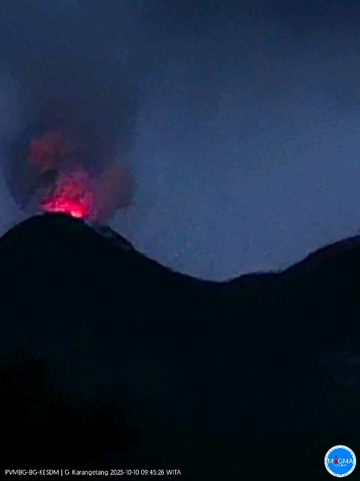
On October 9, 2025, at 6:30 p.m. (local time), incandescent lava avalanches were visually observed from the North Crater toward the South Crater, approximately 700 meters away. The increased seismicity and incandescent lava flows require increased vigilance, given the potential hazards of Mount Karangetang, including magmatic eruptions and hot ash plumes sliding down valleys from the eruption centers of the North and South Craters. The risk of effusive eruptions from Mount Karangetang is characterized by lava domes erupting and sliding down valleys.
Given the increased seismicity and incandescent lava flows, and the continued activity level at Level II (Waspada), the public is advised to avoid entering and carrying out activities within a 1.5 km radius of the North and South Craters, as well as within a 2.5 km radius southwest and south of the South Crater. The public is advised to remain calm and comply with the recommendations issued by the Geological Agency, through the Center for Volcanology and Geological Risk Reduction, and not to be influenced by false and irresponsible information regarding the volcanic activity of Karangetang.
The activity level of Mount Karangetang will be reassessed periodically or in the event of a significant change in activity.
Source et photo : PVMBG.
Chile , Planchón Peteroa :
Special Volcanic Activity Report (REAV)
October 9, 2025, 3:53 p.m. local time (Continental Chile)
The National Geology and Mining Service of Chile (Sernageomin) publishes the following preliminary information, obtained using the monitoring equipment of the National Volcanic Monitoring Network (RNVV), processed and analyzed at the Southern Andean Volcanological Observatory (OVDAS):
On Thursday, October 9, using images from surveillance cameras installed near the Planchón Peteroa volcanic complex, a column of gas and pyroclasts was observed at 6:28 p.m. UTC. It reached 840 meters above the crater, dispersing southeastward.
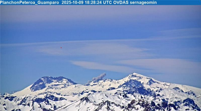
Image from the Guamparo surveillance camera, dated October 9, 2025, at 3:28 PM HL (6:28 PM UTC).
According to the latest volcanic activity reports published by SERNAGEOMIN for this system, and taking into account the above, the occurrence of new episodes of explosions of similar or greater energy, of low to moderate magnitude, likely to affect the immediate surroundings of active craters, cannot be ruled out.
OBSERVATIONS:
As of the publication date of this report, seismic activity has not shown any other significant changes.
The technical volcanic alert remains in effect at: YELLOW Technical Alert.
Source et photo : Sernageomin.
Colombia , Chiles / Cerro Negro :
San Juan de Pasto, October 7, 2025, 3:43 p.m.
Regarding the monitoring of the activity of the Chiles-Cerro Negro Volcanic Complex (CVCCN), the Colombian Geological Survey (SGC), an entity affiliated with the Ministry of Mines and Energy,
reports that:
From September 30 to October 6, 2025, the main variations in the monitored parameters compared to the previous week
were:
● Seismic activity and energy release increased compared to the previous week.
The predominance of seismicity associated with rock fracturing within the volcanic edifice continued, followed by seismicity related to fluid dynamics.
● Regarding seismic activity, the majority of earthquakes were concentrated primarily at the summit of Chiles Volcano, in the collapse zone, located within a radius of 1.0 km, at depths between 2.0 and 5.0 km from its summit (4,700 m above sea level). Ten seismic events with a magnitude greater than 2.0 were recorded; the strongest (2.8) occurred on October 6, 2025, at 7:34 a.m., and was located on the southwest flank of the summit, at a depth of 4.1 km. The remaining seismic activity was scattered throughout the CVCCN’s area of influence, at depths less than 4.5 km.
● Analysis of information obtained from satellite sensors and ground stations continues to indicate variations related to deformation processes in the volcanic area.
Based on the assessment and correlation of monitored parameters, the SGC recommends closely monitoring their developments through weekly bulletins and other information published through our official channels, as well as instructions from local and departmental authorities and the National Disaster Risk Management Unit (UNGRD).
Volcanic activity remains on yellow alert. The volcano is active, with changes in the baseline behavior of monitored parameters and other manifestations.
Source et photo : SGC.
Hawaii , Kilauea :
HAWAIIAN VOLCANO OBSERVATORY DAILY UPDATE , U.S. Geological Survey
Thursday, October 9, 2025, 8:04 AM HST (Thursday, October 9, 2025, 18:04 UTC)
19°25’16 » N 155°17’13 » W,
Summit Elevation 4091 ft (1247 m)
Current Volcano Alert Level: WATCH
Current Aviation Color Code: ORANGE
During the lapse in appropriations, the USGS Hawaiian Volcano Observatory (HVO) continues to maintain monitoring networks and issue updates and notifications of volcanic activity via the Hazard Notification Service. Volcano monitoring data will continue to be available on the HVO website. Static website content will not be updated until further notice and information may become outdated over time.
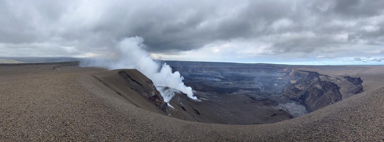
Activity Summary:
Episode 34 lava fountaining ended October 1 at 7:03 a.m. HST after approximately 6 hours of continuous activity. Variable weak to moderate incandescence was visible from both cones last night and the rhythmic pattern of seismic tremor indicates gas piston events in both vents. Kīlauea’s summit region resumed inflation following the end of episode 34, indicating that the next fountaining episode is likely to start between October 17 and 21.
Summit Observations:
The caldera this morning has been quiet with a passively outgassing plume rising from the vents after the end of episode 34. Last night, both the north and south vents showed weak to moderate glow. The variable nature of the glow correlates with rhythmic spikes in seismic tremor 10–15 minutes apart, which are indicative of gas piston activity within both vents. The UWD tiltmeter shows that inflationary tilt has resumed since the end of episode 34 and has recovered approximately 14.7 microradians so far. There were no summit earthquakes in the past 24 hours.
Source : HVO.
Photo : USGS /N. Deligne.
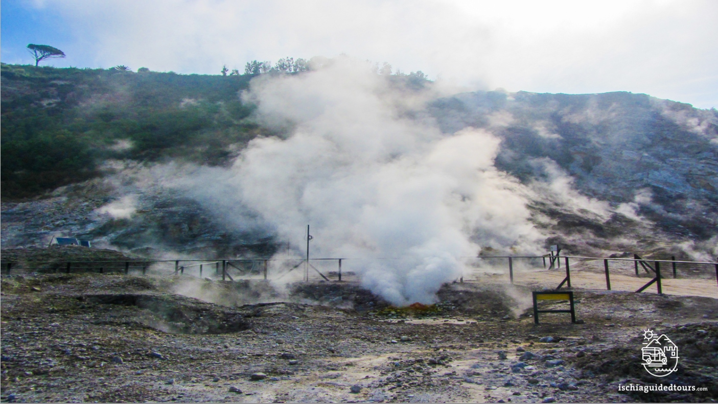
Italy , Campi Flegrei :
Weekly Bulletin from September 29, 2025 to October 5, 2025 (Publication Date: October 7, 2025)
ACTIVITY SUMMARY
Monitoring data highlights the following:
1) SEISMOLOGY: From September 29 to October 5, 2025, in the Phlegraean Fields region, 125 earthquakes with a magnitude Md ≥ 0.0 (Mdmax = 3.3 ± 0.3) were detected.
2) DEFORMATION: Since the beginning of April 2025, ground uplift has continued to be recorded, with a monthly average value of approximately 15 ± 3 mm/month. 3) GEOCHEMISTRY: During the reporting week, the geochemical parameters monitored confirmed the long-term trend of warming of the hydrothermal system and increased flow rates already known.
Sixty-five earthquakes were recorded during two seismic swarms:
1. Since 2:38 PM UTC on October 2, 2025, 53 earthquakes with magnitudes 0.0 ≤ Md ≤ 2.7 (± 0.3) have occurred in the Pozzuoli-Solfatare-Pisciarelli region;
2. Since 5:59 PM UTC on October 4, 2025, 12 earthquakes with magnitudes 0.0 ≤ Md ≤ 3.3 (± 0.3) have occurred in the Solfatara region.
GROUND DEFORMATIONS
Data collected following the earthquake swarm from February 15 to 19, 2025, showed an increase in the rate of ground uplift, with a monthly average value of approximately 30 ± 5 mm/month, until the end of March. Since the beginning of April, ground uplift has continued to be recorded, with a monthly average value of approximately 15 ± 3 mm/month.
The total uplift recorded at the RITE GNSS station has been approximately 34 cm since January 2024.
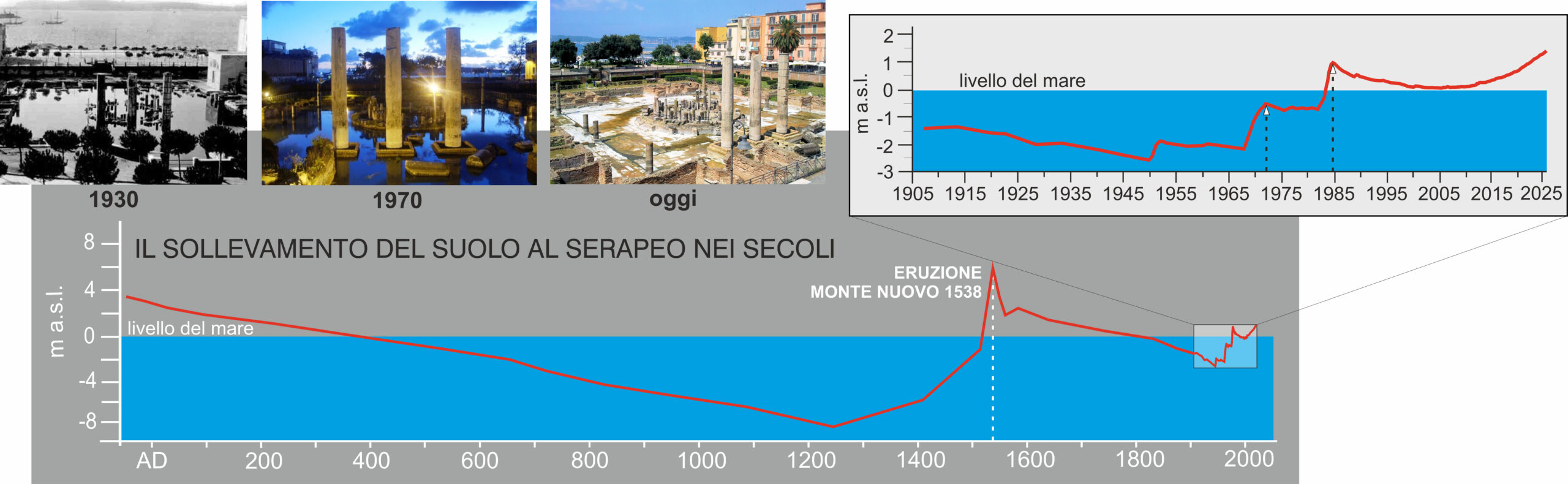
In the 1970s and 1980s, the Phlegraean Fields area, and the town of Pozzuoli in particular, were hit by a sudden uplift of the ground, which raised the general level by about 3.5 m and caused numerous earthquakes, with serious damage to buildings.
Source : INGV Vulcani.
Photos : Ischia guide tours , ingv.