November 16 , 2026.
Indonesia , Karangetang :
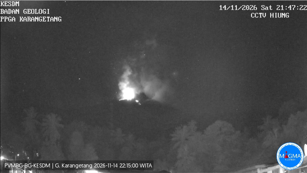
An eruption of Mount Karangetang occurred on Saturday, November 14, 2026, at 9:47 PM WITA (Central Indonesian Time). The eruption could not be observed visually. At the time this report was published, the eruption was still ongoing.
Seismic Observations
43 earthquakes linked to rockfalls, with amplitudes ranging from 2 to 22 mm and durations from 16 to 114 seconds.
369 emission-related earthquakes, with amplitudes ranging from 8 to 50 mm and durations from 12 to 101 seconds.
26 harmonic earthquakes, with amplitudes ranging from 5 to 50 mm and durations from 36 to 215 seconds.
65 non-harmonic tremors, with amplitudes ranging from 9 to 50 mm and durations from 45 to 265 seconds.
1 shallow volcanic earthquake, with an amplitude of 48 mm and a duration of 14 seconds.
1 deep volcanic earthquake, with an amplitude of 15 mm and a duration of 13 seconds.
6 distant tectonic earthquakes, with amplitudes ranging from 5 to 50 mm and durations from 43 to 303 seconds.
Recommendations
(1) The public, as well as visitors and tourists, are advised not to approach, hike in, or conduct any activities within the designated danger zone: a 1.5 km radius around the summit of Kawah Dua (North crater) and the main crater (South crater), as well as a 2.5 km sectoral extension toward the south-southwest.
(2) It is essential to remain vigilant regarding lava avalanches and pyroclastic flows, which may occur at any time due to the instability of previously accumulated volcanic material—particularly in the southern, southeastern, western, and southwestern sectors—as these deposits remain prone to collapse.
Source et photo : PVMBG.
Costa Rica , Poas :
Latitude: 10.20° N;
Longitude: 84.23° W;
Elevation: 2,687 m above sea level.
Current activity level: Warning
No eruptions were recorded this week. Overall, the amplitude of the volcanic tremor remains moderate, with little variation. A volcano-tectonic earthquake was recorded nearby, two kilometers northwest of the crater. The number of long-period events remains stable. No significant deformation of the volcanic edifice has been observed. Multi-GAS stations recorded an average SO2/CO2 ratio of 1.2 ± 0.4, a value comparable to that of the previous week.
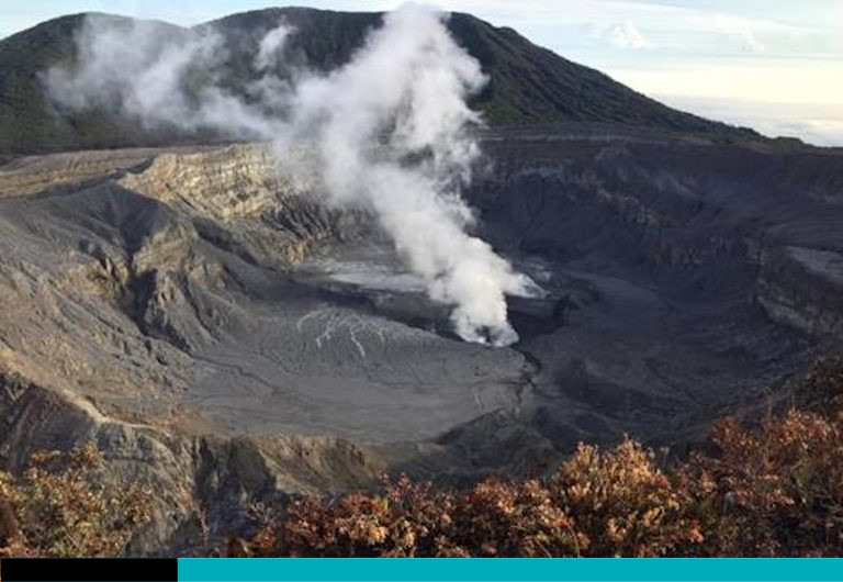
The average H2S/SO2 ratio for this week was less than 0.1. The NOVAC stations recorded 113 ± 66 tonnes of SO2 per day, with a maximum of 378 t/day. This average is comparable to that of the previous week (154 ± 39 tonnes of SO2 per day, with a maximum of 415 t/day). Today, November 13, the ExpoGAS sensor located at the visitor viewpoint detected 21 parts per million (ppm) of SO2 before 7:00 a.m. The SENTINEL satellite detected the SO2 plume several times this week, with a maximum value of 67 tonnes of SO2 in the atmosphere on November 9. The level of the hyperacidic lake continued to drop this week (-0.2 m).
Source et photo : Ovsicori
Ecuador , Sangay :
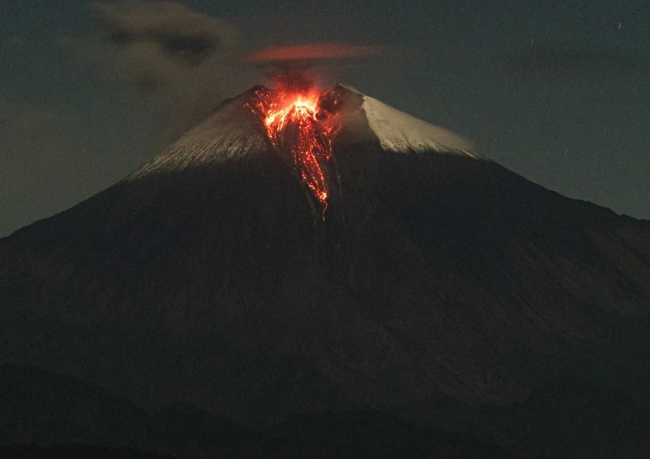
At the Sangay volcano, two small, active lava flows (less than 1.5 km long) were observed; both were channeled through the volcano’s southeastern ravine and remained confined to the summit area. Small, ash-poor gas explosions were also noted, occurring at intervals of approximately 10 minutes. Both the lava flows and the explosions were recorded by a thermal camera, which revealed maximum apparent temperatures below 500°C. While high, these temperatures are not unusual for volcanoes in an eruptive state, such as Sangay. Furthermore, measurements of volcanic gases—water (H2O), carbon dioxide (CO2), sulfur dioxide (SO2), and hydrogen sulfide (H2S)—were taken during the overflight using a MultiGAS (multi-component gas analysis system) connected to a sampling device mounted on one of the aircraft’s wings. To carry out these measurements, it is necessary to maintain a sufficient distance and target dispersed, ash-free plumes, typically found several kilometers southwest of the volcano.
DAILY STATUS REPORT FOR SANGAY VOLCANO, Sunday, November 15, 2026.
Information from the Geophysical Institute – EPN.
Surface activity level: Moderate; Surface trend: Unchanged.
Internal activity level: Low; Internal trend: Unchanged.
Seismicity: From November 14, 2026, 11:00 AM to November 15, 2026, 11:00 AM:
Seismicity:
The following is the count of seismic events recorded at the reference station:
Explosions (EXP): 31
Emission tremors (TREMI): 19
Harmonic tremors (TRARM): 3
Rainfall / Lahars:
No precipitation has been recorded in the vicinity of the volcano over the last 24 hours. **Heavy rainfall could remobilize accumulated materials, generating mud and debris flows that would descend the volcano’s flanks and reach adjacent watercourses.**
Emission plumes / Ash:
The surveillance camera system recorded several episodes of gas and ash emissions, reaching heights between 300 and 400 meters above the crater rim, moving toward the northwest and southeast. In connection with this activity, the Washington VAAC issued two reports indicating emissions reaching heights between 900 and 2,100 meters above the crater rim, moving toward the northwest.
Other monitoring parameters:
Over the last 24 hours, satellite systems have detected the following thermal anomalies:
1 via MIROVA MODIS, 1 via MIROVA VIIRS 750, 1 via MIROVA VIIRS 375, and 5 via FIRMS.
Observation:
During last night and early this morning, surveillance cameras recorded several instances of incandescent material descending the volcano’s flanks. At the time of writing this report, the volcano is obscured by clouds.
Sources : Instituto Geofísico-Escuela Politécnica Nacional (IG-EPN), Secretaría de Gestión de Riesgos (SGR) .
Photo : Cristopher Cárdenas , 12/06/2025.
Guatemala , Fuego :
Atmospheric conditions: Clear sky
Wind: From the west
Precipitation: 0.00 mm
Activity
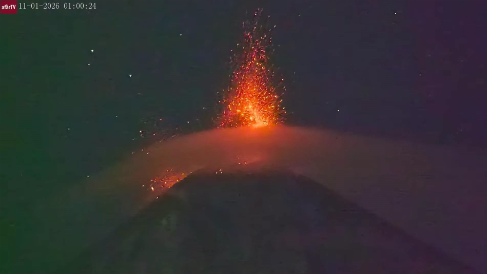
The Volcán de Fuego observatory reports conditions favorable for observing the crater. Between 3 and 6 explosions are being recorded per hour, ranging from low to moderate intensity and producing grayish gas plumes that rise to between 4,500 and 5,000 meters (14,764 to 16,404 feet) above sea level. Driven by the wind, these plumes are moving toward the east and northeast, reaching distances of 10 to 40 km. Some of these explosions eject incandescent material up to 200 meters above the crater rim. Others may produce rumbling sounds and weak shock waves. Light ashfall—consisting of fine particles—is expected in Alotenango, San Miguel Dueñas, and the surrounding areas.
Source : Insivumeh .
Photo : Afar tv
Colombia , Galeras :
San Juan de Pasto, November 10, 2026, 5:30 PM.
As part of the ongoing monitoring of the Galeras volcano, the Colombian Geological Service (SGC)—an agency affiliated with the Ministry of Mines and Energy—reports the following:
During the week of November 3 to 9, 2026, the primary variations in monitored parameters, compared to the previous week, were as follows:
● Seismic activity remained at low levels of occurrence, showing a decrease from the previous week; however, the seismic energy released increased—primarily due to seismicity linked to rock fracturing and, to a lesser extent, seismic processes associated with fluid dynamics.
● Fracturing-related earthquakes were scattered throughout the volcano’s area of influence, at depths ranging from 1.5 to 9.4 km below the summit (4,276 meters above sea level). The maximum magnitude recorded for these events was 2.1; there have been no reports of them being felt by the local population.
● The most notable earthquake occurred on November 9 at 3:50 a.m., approximately 3.7 km southeast of the volcano, at a depth of 4.1 km below the summit (4,270 m above sea level), with a magnitude of 2.1; there were no reports of it being felt.
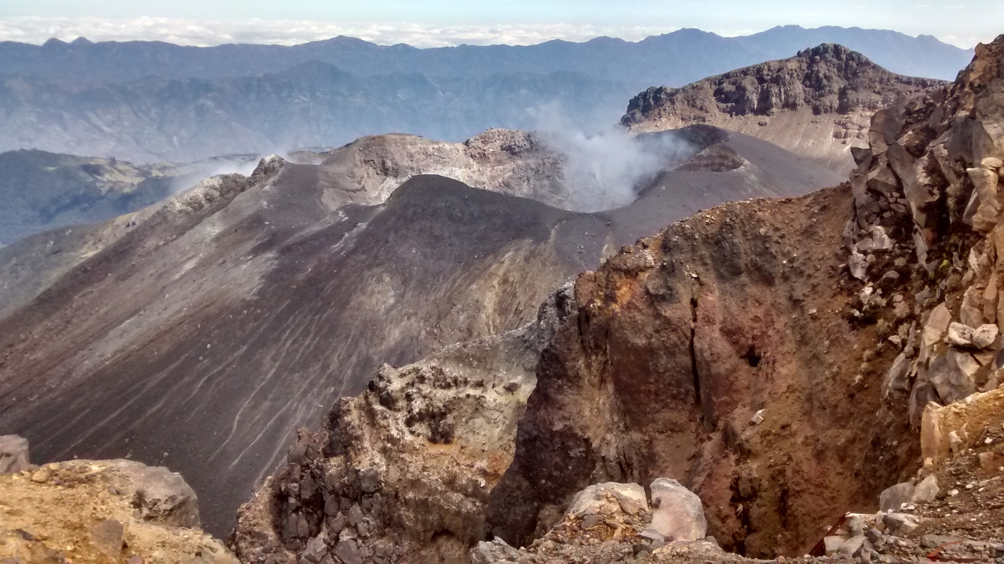
● For most of the week, the volcano’s summit remained clear, allowing for the observation of very faint, low-altitude white gas emissions, which dispersed according to wind direction. These emissions were primarily observed at the « El Paisita » fumarole fields to the north, at Las Chavas to the west, and from the main crater.
● Other volcanic monitoring parameters remained stable.
Based on the evaluation and correlation of the monitored parameters, the SGC recommends closely following their evolution through weekly bulletins and other information released via our official channels. It is also advised to adhere to the instructions provided by local and departmental authorities, as well as those from the National Unit for Disaster Risk Management (UNGRD).
Volcanic activity remains at the « Yellow » alert level: an active volcano exhibiting changes in the behavior of baseline monitored parameters, among other manifestations.
Source et photo : SGC.