March 3 , 2026.
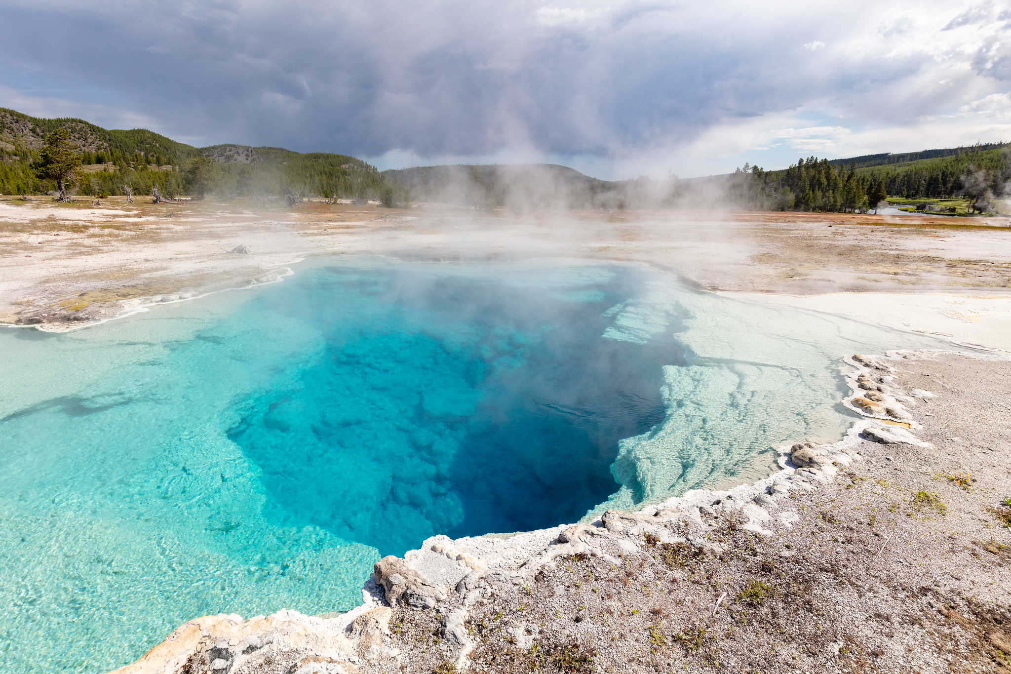
United States, Yellowstone :
YELLOWSTONE VOLCANO OBSERVATORY MONTHLY UPDATE , U.S. Geological Survey
Monday, March 2, 2026, 10:59 AM MST (Monday, March 2, 2026, 17:59 UTC)
44°25’48 » N 110°40’12 » W,
Summit Elevation 9203 ft (2805 m)
Current Volcano Alert Level: NORMAL
Current Aviation Color Code: GREEN
Summary
Yellowstone Caldera activity remains at background levels, with 74 located earthquakes in February (largest = M2.4). Deformation measurements indicate a pause in the uplift that had been occurring along the north caldera rim since July 2025. In Norris Geyser Basin, Steamboat Geyser erupted on February 27, and Echinus Geyser erupted about 40 times during the month—the first eruptions of the geyser since 2020.
Recent Work and News
Steamboat Geyser, in Norris Geyser Basin, erupted on February 27 at about 7:01 p.m. MST—its first eruption of 2026. Also in Norris Geyser Basin, Echinus Geyser erupted about 40 times between February 7 and February 24. The geyser’s most recent previous eruptions were in December 2020. No eruptions were detected at Black Diamond Pool in Biscuit Basin, site of a hydrothermal explosion in 2024.
Seismicity
During February 2026, the University of Utah Seismograph Stations, responsible for the operation and analysis of the Yellowstone Seismic Network, located 74 earthquakes in the Yellowstone National Park region. The largest event of the month was a microearthquake of magnitude 2.4 located about 12 miles north of Pahaska Tepee, Wyoming, on February 24 at 1:11 a.m. MST.
February seismicity in Yellowstone was marked by a swarm of 12 earthquakes that occurred approximately 6 miles north of West Yellowstone, Montana, during February 7–8. The largest earthquake in the sequence was a magnitude 2.2 event on February 7 at 1:07 a.m. MST.
Earthquake activity in Yellowstone is at background levels.
Ground Deformation
Continuous GPS stations indicate a pause in the uplift that had been occurring on the north caldera rim to the south of Norris Geyser Basin. The uplift started in July 2025 but ceased by mid-January 2026. In Yellowstone Caldera, continuous GPS data indicated subsidence, although results from the latter part of February are ambiguous due to the impacts of heavy snow and winter weather conditions that disrupted the GPS signal.
Source : YVO.
Photo : Sapphire pool National Park Service / Jacob W. Frank, July 20, 2020.
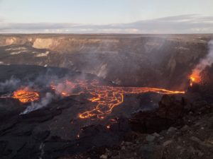
La Réunion Island , Piton de la Fournaise :
Press release from the Paris Institute of Earth Physics / Piton de la Fournaise Volcanological Observatory, March 3, 2026 – 11:10 a.m. local time – 7:10 a.m. UTC
Eruption in progress
The eruption that began on February 13, 2026, shortly after 10:00 a.m. (local time), at Piton de la Fournaise continues.
Only one eruptive site remains active on the south-southeast flank of the volcano, with fountains still visible from Piton de Bert. A cone is being built by the progressive accumulation of lava flows. It is now closed laterally.
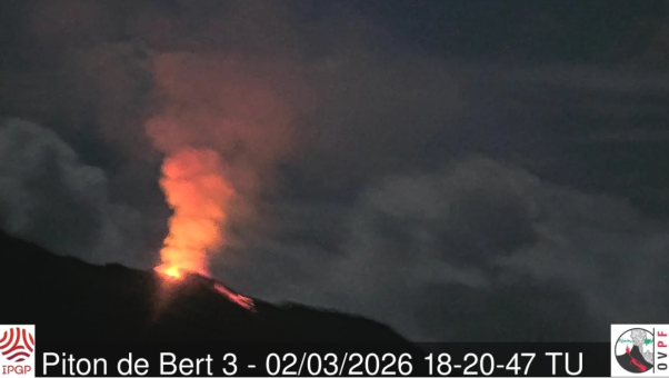
Image of the eruptive cone from the IRT/OVPF-IPGP webcam located at Piton Bert (UTC: local time – 4 hours) (©OVPF-IPGP).
With the lateral closure of the cone, significant lava tube activity is now established downstream. Lava flow resurgences and active above-water sections of the flow are concentrated downstream of the eruptive site and upstream of the Grandes Pentes fault, where the lava field widens and thickens. This distribution of lava flows is confirmed by the Sentinel-1 coherence maps of February 21 and 26, 2026, which show that the flows are developing primarily upstream of the Grandes Pentes fault, with new arms developing to the north and south of the initially emplaced flow. In the Grandes Pentes, the front of the lava flow remains frozen at ~2.6 km from the national road 2 and at an altitude of 660 m.
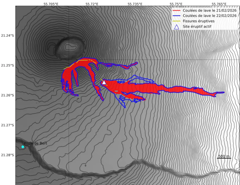
Outlines of lava flows on February 21, 2026 (in red) and February 26, 2026 (in blue) from coherence maps calculated respectively from the Sentinel-1 Stripmap Descending interferograms of February 9-21, 2026 and the Sentinel-1 Stripmap Ascending interferograms of February 8-26, 2026 (©OI2/ISDeform – OSUL)
As in previous days, seismic activity remains low. The resumption of inflation of the edifice, visible on the summit and base GNSS stations, appears to be confirmed, even though the data have fluctuated over the last few days. This inflation remains low for the time being and would indicate a slight repressurization of the magma supply system, possibly linked to magma recharge from the shallow reservoir.
Over the past 24 hours, eruptive tremor (an indicator of lava and gas emissions at the surface) has remained relatively stable and of low amplitude. In the long term, a gradual increase in tremor amplitude has been observed since February 21st, with small variations. Amplitude peaks are still being recorded and are likely linked to variations in degassing or morphological changes in the eruptive cone.
Surface flow rates, estimated from satellite data via the HOTVOLC platform (OPGC – Clermont Auvergne University), have indicated values between 1 and 14 m³/sec over the past 24 hours. It should be noted that these estimates can vary rapidly depending on cloud cover and become zero in the event of total cloud cover.
Source : OVPF/ IPGP.
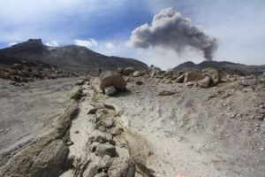
Alaska , Westdahl / Fisher :
ALASKA VOLCANO OBSERVATORY INFORMATION STATEMENT , U.S. Geological Survey
Monday, March 2, 2026, 2:20 PM AKST (Monday, March 2, 2026, 23:20 UTC)
WESTDAHL (VNUM #311340)
54°31’2″ N 164°38’51 » W, Summit Elevation 5118 ft (1560 m)
Current Volcano Alert Level: UNASSIGNED
Current Aviation Color Code: UNASSIGNED
A power failure in the City of Cold Bay has affected the Alaska Volcano Observatory (AVO) facility that receives seismic monitoring data from instruments around Westdahl volcano and relays it to AVO offices for analysis. Although some data from other stations on Unimak Island continue to flow in the AVO system, the remaining equipment does not provide enough information to confirm that the volcano is at normal background activity. Repairs are underway, and once power is restored to the AVO receive facility in Cold Bay, AVO’s instruments will resume functioning.
Because of the loss of adequate real-time seismic data, the Aviation Color Code and Volcano Alert Level for Westdahl volcano have been changed to UNASSIGNED/UNASSIGNED.
As with other volcanoes not currently monitored by on-site seismic networks, AVO will continue to rely on satellite observations, regional seismic and infrasound data, lightning-detection networks, and reports from pilots and local observers to identify signs of volcanic unrest.
FISHER (VNUM #311350)
54°40’9″ N 164°21’9″ W, Summit Elevation 3648 ft (1112 m)
Current Volcano Alert Level: UNASSIGNED
Current Aviation Color Code: UNASSIGNED
A power failure in the City of Cold Bay has affected the Alaska Volcano Observatory (AVO) facility that receives seismic monitoring data from instruments around Fisher volcano and relays it to AVO offices for analysis. Although some data from other stations on Unimak Island continue to flow in the AVO system, the remaining equipment does not provide enough information to confirm that the volcano is at normal background activity. Repairs are underway, and once power is restored to the AVO receive facility in Cold Bay, AVO’s instruments will resume functioning.
Because of the loss of adequate real-time seismic data, the Aviation Color Code and Volcano Alert Level for Fisher volcano have been changed to UNASSIGNED/UNASSIGNED.
As with other volcanoes not currently monitored by on-site seismic networks, AVO will continue to rely on satellite observations, regional seismic and infrasound data, lightning-detection networks, and reports from pilots and local observers to identify signs of volcanic unrest.
Source : AVO.
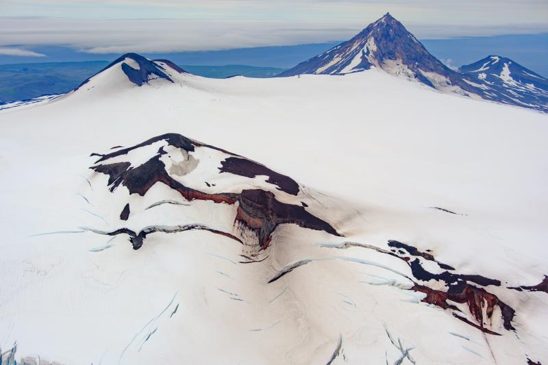
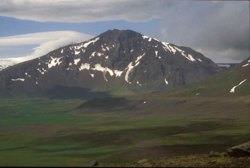
Photos : Loewen, Matt ,Stelling, P. L.
Indonesia , Lewotobi Laki-laki :
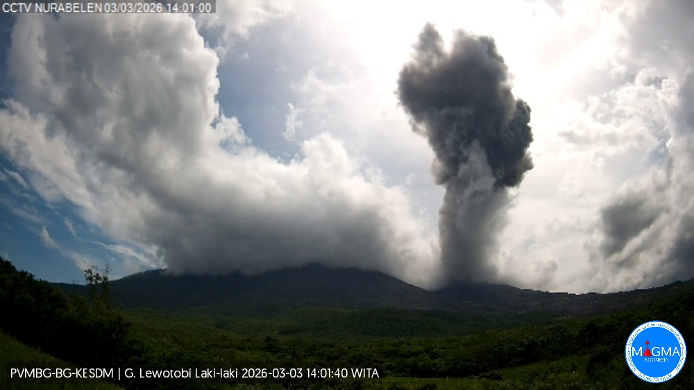
An eruption occurred on Mount Lewotobi Laki-laki on Tuesday, March 3, 2026, at 1:55 PM WITA. The observed ash column rose approximately 1,500 meters above the summit (about 3,084 meters above sea level). This column was gray and dense, oriented to the north and northwest. At the time of writing, the eruption was still ongoing.
VOLCANO OBSERVATORY NOTICE FOR AVIATION – VONA
Issued : March 3 , 2026 .
Volcano : Lewotobi Laki-laki (264180)
Current Aviation Colour Code : ORANGE
Previous Aviation Colour Code : orange
Source : Lewotobi Laki-laki Volcano Observatory
Notice Number : 2026LWK013
Volcano Location : S 08 deg 32 min 20 sec E 122 deg 46 min 06 sec
Area : East Nusa Tenggara, Indonesia
Summit Elevation : 5069 FT (1584 M)
Volcanic Activity Summary :
Eruption with volcanic ash cloud at 05h52 UTC (13h52 local).
Volcanic Cloud Height :
Best estimate of ash-cloud top is around 9869 FT (3084 M) above sea level or 4800 FT (1500 M) above summit. May be higher than what can be observed clearly. Source of height data: ground observer.
Other Volcanic Cloud Information :
Ash cloud moving from north to northeast. Volcanic ash is observed to be gray. The intensity of volcanic ash is observed to be thick.
Remarks :
Eruption and ash emission is continuing. Eruption recorded on seismogram with maximum amplitude 7.4 mm.
Source et photo : Magma Indonésie.
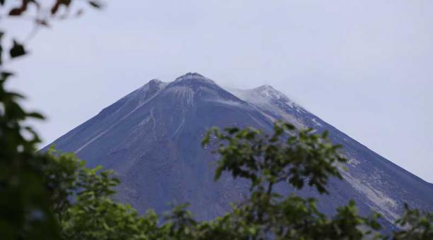
Ecuador , El Reventador :
REVENTADOR VOLCANO DAILY STATE REPORT, Monday, March 2, 2026.
Information Geophysical Institute – EPN.
Surface Activity Level: High, Surface Trend: No Change
Internal Activity Level: Moderate, Internal Trend: No Change
From March 1, 2026, 11:00 AM to March 2, 2026, 11:00 AM:
Seismicity:
Explosions (EXP) 75
Long Periods (LP) 6
Emission Tremors (TREMI) 4
Harmonic Tremors (TRARM) 6
Rainfall/Lahars:
No rainfall has been recorded in the volcano area. **Heavy rainfall could remobilize accumulated material, generating mudflows and debris flows that would cascade down the volcano’s flanks and into nearby rivers.**
Emissions/Ash:
Due to data transmission issues, ash emissions could not be observed via the monitoring camera system. However, several emissions were detected using GOES-19 satellite imagery, at altitudes between 700 and 1,200 meters above the crater rim, drifting northwest and southeast. In this regard, the Washington VAAC agency published four reports indicating emissions at altitudes of 700, 1,000, and 1,300 meters above the crater rim, drifting northwest and east.
Gas:
The Mounts satellite system detected 5.8 tons of SO₂ (sulfur dioxide), measured yesterday at 1:39 p.m. local time.
Other monitoring parameters:
The MIROVA-VIIRS 750 satellite system recorded two thermal anomalies, the MIROVA-VIIRS 375 system recorded one, the MIROVA-SENTINEL system recorded one, and the FIRMS system recorded four over the past 24 hours.
Observation:
According to satellite monitoring, from yesterday afternoon until the publication of this report, the volcano remained partly cloudy.
Alert Level – SGR: Orange
Source et photo : IGEPN.